


4,9 km | 6,6 km-effort
Bad Soden-Salmünster: Descubra las mejores excursiones: 46 a pie. Todos estos circuitos, recorridos, itinerarios y actividades al aire libre están disponibles en nuestras aplicaciones SityTrail para smartphone y tablet.
A pie


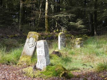
• Trail created by Naturpark Hessischer Spessart. Symbol: Blauer Strich und grüner Bogen über gelbem Rechteck auf hell...
A pie
• Trail created by Naturpark Hessischer Spessart. Symbol: Blauer Strich und grüner Bogen über gelbem Rechteck auf hell...
A pie
• Trail created by Naturpark Hessischer Spessart, Main Kinzig Kreis. Symbol: blauer Strich und grüner Bogen über gelbe...
A pie
• Symbol: Blauer Text 25 auf weißem Grund
A pie
• Trail created by Stadt Bad Soden-Salmünster. Symbol: Blauer Text 12 auf weißem Grund
A pie
• Trail created by Stadt Bad Soden-Salmünster. Symbol: Blauer Text 10 auf weißem Grund
A pie
• Trail created by Stadt Bad Soden-Salmünster. Symbol: Blauer Text 13 auf weißem Grund
A pie
• Trail created by Stadt Bad Soden-Salmünster. Symbol: Blauer Text 9 auf weißem Grund
A pie
• Trail created by Stadt Bad Soden-Salmünster. Symbol: Blaue Raute auf weißem Hintergrund Sitio web: http://www.bads...
A pie
• Trail created by Stadt Bad Soden-Salmünster. Symbol: Blauer Text 3 auf weißem Grund
A pie
• Trail created by Stadt Bad Soden-Salmünster. Symbol: Blauer Kreis auf weißem Hintergrund
A pie
• Trail created by Stadt Bad Soden-Salmünster. Symbol: Blaues Kreuz auf weißem Hintergrund
A pie
• Trail created by Stadt Bad Soden-Salmünster. Symbol: Blauer Text 4 auf weißem Grund
A pie
• Trail created by Stadt Bad Soden-Salmünster. Symbol: Blauer Text 5 auf weißem Grund
A pie
• Trail created by Stadt Bad Soden-Salmünster. Symbol: Blaues Quadrat auf weißem Hintergrund
A pie
• Trail created by Heimat- und Verkehrsverein Mernes. Symbol: Schwarzer Schmetterling auf weißem Hintergrund
A pie
• Trail created by Heimat- und Verkehrsverein Mernes. Symbol: Schwarzes Hirschgeweih auf weißem Hintergrund
A pie
• Trail created by Heimat- und Verkehrsverein Mernes. Symbol: Schwarze Fichte auf weißem Hintergrund
A pie
• Trail created by Heimat- und Verkehrsverein Mernes. Symbol: Schwarzes Ahornblatt auf weißem Hintergrund
A pie
• Trail created by Heimat- und Verkehrsverein Mernes. Symbol: Schwarzer Habicht auf weißem Hintergrund
20 excursiones mostradas en 46
Aplicación GPS de excursión GRATIS
 SityTrail
IGN / Institutos geográficos
SityTrail World
El mundo es suyo