![](/images/other/stat-length.png)
- Excursiones
- Outdoor
- Germany
- Hesse
- Schwalm-Eder-Kreis
- Oberaula
Oberaula, Schwalm-Eder-Kreis: Los mejores itinerarios de excursión, recorridos, paseos y sendas
Oberaula: Descubra las mejores excursiones: 7 a pie. Todos estos circuitos, recorridos, itinerarios y actividades al aire libre están disponibles en nuestras aplicaciones SityTrail para smartphone y tablet.
Los mejores recorridos (7)
![Excursión A pie Oberaula - Wanderweg Oberaula 5 - Photo](https://media.geolcdn.com/t/350/260/ext.jpg?maxdim=2&url=https%3A%2F%2Fmedia.geolcdn.com%2Ff%2F4a02d7ea-88e7-4266-a308-05ebc04b70f8.jpeg)
![A pie A pie](https://static1.geolcdn.com/sitytour/trail-icons/100.png)
Km
A pie
![](/images/other/stat-length.png)
![](https://static1.geolcdn.com/siteimages/upload/files/1508320355ic_sort_den_pos_24dp.png)
![](https://static1.geolcdn.com/siteimages/upload/files/1508320355ic_sort_den_neg_24dp.png)
![](https://static1.geolcdn.com/siteimages/upload/files/16400158638029165_repeat_loop_refresh_sync_direction_icon.png)
• Trail created by Gemeinde Oberaula. Symbol: gelber Text O5 auf grünem Grund
![Excursión A pie Oberaula - Wanderweg Oberaula 4 - Photo](https://media.geolcdn.com/t/350/260/ext.jpg?maxdim=2&url=https%3A%2F%2Fmedia.geolcdn.com%2Ff%2Fa4bb6858-ee6c-43f6-bea1-bb8ceda765aa.jpeg)
![A pie A pie](https://static1.geolcdn.com/sitytour/trail-icons/100.png)
Km
A pie
![](/images/other/stat-length.png)
![](https://static1.geolcdn.com/siteimages/upload/files/1508320355ic_sort_den_pos_24dp.png)
![](https://static1.geolcdn.com/siteimages/upload/files/1508320355ic_sort_den_neg_24dp.png)
![](https://static1.geolcdn.com/siteimages/upload/files/16400158638029165_repeat_loop_refresh_sync_direction_icon.png)
• Trail created by Gemeinde Oberaula. Symbol: gelber Text O4 auf grünem Grund
![Excursión A pie Oberaula - Wanderweg Oberaula 1 - Photo](https://media.geolcdn.com/t/350/260/ext.jpg?maxdim=2&url=https%3A%2F%2Fmedia.geolcdn.com%2Ff%2Fb40219dc-b713-4550-ad16-14a01ab90791.jpeg)
![A pie A pie](https://static1.geolcdn.com/sitytour/trail-icons/100.png)
Km
A pie
![](/images/other/stat-length.png)
![](https://static1.geolcdn.com/siteimages/upload/files/1508320355ic_sort_den_pos_24dp.png)
![](https://static1.geolcdn.com/siteimages/upload/files/1508320355ic_sort_den_neg_24dp.png)
![](https://static1.geolcdn.com/siteimages/upload/files/16400158638029165_repeat_loop_refresh_sync_direction_icon.png)
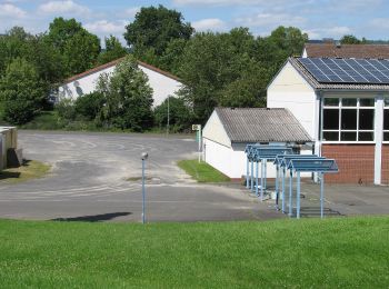
• Trail created by Gemeinde Oberaula. Symbol: gelber Text O1 auf grünem Grund
![Excursión A pie Oberaula - Wanderweg Oberaula 2 - Photo](https://media.geolcdn.com/t/350/260/ext.jpg?maxdim=2&url=https%3A%2F%2Fmedia.geolcdn.com%2Ff%2Fa4bb6858-ee6c-43f6-bea1-bb8ceda765aa.jpeg)
![A pie A pie](https://static1.geolcdn.com/sitytour/trail-icons/100.png)
Km
A pie
![](/images/other/stat-length.png)
![](https://static1.geolcdn.com/siteimages/upload/files/1508320355ic_sort_den_pos_24dp.png)
![](https://static1.geolcdn.com/siteimages/upload/files/1508320355ic_sort_den_neg_24dp.png)
![](https://static1.geolcdn.com/siteimages/upload/files/16400158638029165_repeat_loop_refresh_sync_direction_icon.png)
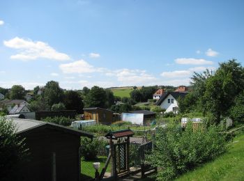
• Trail created by Gemeinde Oberaula. Symbol: gelber Text O2 auf grünem Grund
![Excursión A pie Oberaula - Wanderweg Oberaula 3 - Photo](https://media.geolcdn.com/t/350/260/ext.jpg?maxdim=2&url=https%3A%2F%2Fmedia.geolcdn.com%2Ff%2F1a4e660b-981f-4c81-bf82-4cd30268079e.jpeg)
![A pie A pie](https://static1.geolcdn.com/sitytour/trail-icons/100.png)
Km
A pie
![](/images/other/stat-length.png)
![](https://static1.geolcdn.com/siteimages/upload/files/1508320355ic_sort_den_pos_24dp.png)
![](https://static1.geolcdn.com/siteimages/upload/files/1508320355ic_sort_den_neg_24dp.png)
![](https://static1.geolcdn.com/siteimages/upload/files/16400158638029165_repeat_loop_refresh_sync_direction_icon.png)
• Trail created by Gemeinde Oberaula. Symbol: gelber Text O3 auf grünem Grund
![Excursión A pie Oberaula - Wanderweg Oberaula 9 - Photo](https://media.geolcdn.com/t/350/260/ext.jpg?maxdim=2&url=https%3A%2F%2Fstatic1.geolcdn.com%2Fsiteimages%2Fupload%2Ffiles%2F1545311037marcheuse_200dpi.jpg)
![A pie A pie](https://static1.geolcdn.com/sitytour/trail-icons/100.png)
Km
A pie
![](/images/other/stat-length.png)
![](https://static1.geolcdn.com/siteimages/upload/files/1508320355ic_sort_den_pos_24dp.png)
![](https://static1.geolcdn.com/siteimages/upload/files/1508320355ic_sort_den_neg_24dp.png)
![](https://static1.geolcdn.com/siteimages/upload/files/16400158638029165_repeat_loop_refresh_sync_direction_icon.png)
• Trail created by Gemeinde Oberaula. Symbol: gelber Text O9 auf grünem Grund
![Excursión A pie Oberaula - Wanderweg Oberaula 7 - Photo](https://media.geolcdn.com/t/350/260/ext.jpg?maxdim=2&url=https%3A%2F%2Fstatic1.geolcdn.com%2Fsiteimages%2Fupload%2Ffiles%2F1545311037marcheuse_200dpi.jpg)
![A pie A pie](https://static1.geolcdn.com/sitytour/trail-icons/100.png)
Km
A pie
![](/images/other/stat-length.png)
![](https://static1.geolcdn.com/siteimages/upload/files/1508320355ic_sort_den_pos_24dp.png)
![](https://static1.geolcdn.com/siteimages/upload/files/1508320355ic_sort_den_neg_24dp.png)
![](https://static1.geolcdn.com/siteimages/upload/files/16400158638029165_repeat_loop_refresh_sync_direction_icon.png)
• Trail created by Gemeinde Oberaula. Symbol: gelber Text O7 auf grünem Grund
7 excursiones mostradas en 7