![](/images/other/stat-length.png)
- Excursiones
- Outdoor
- Germany
- Hesse
- Kreis Bergstraße
- Rimbach
Rimbach, Kreis Bergstraße: Los mejores itinerarios de excursión, recorridos, paseos y sendas
Rimbach: Descubra las mejores excursiones: 15 a pie. Todos estos circuitos, recorridos, itinerarios y actividades al aire libre están disponibles en nuestras aplicaciones SityTrail para smartphone y tablet.
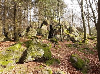
Los mejores recorridos (15)
![Excursión A pie Rimbach - Rundwanderweg Rimbach 5: Wechnitztaler Berg-Tour - Photo](https://media.geolcdn.com/t/350/260/c8958efc-3071-49f4-b7f4-19d0b39eead1.jpeg&format=jpg&maxdim=2)
![A pie A pie](https://static1.geolcdn.com/sitytour/trail-icons/100.png)
Km
A pie
![](/images/other/stat-length.png)
![](https://static1.geolcdn.com/siteimages/upload/files/1508320355ic_sort_den_pos_24dp.png)
![](https://static1.geolcdn.com/siteimages/upload/files/1508320355ic_sort_den_neg_24dp.png)
![](https://static1.geolcdn.com/siteimages/upload/files/16400158638029165_repeat_loop_refresh_sync_direction_icon.png)
• Trail created by Odenwaldklub. Symbol: Grüne 5 im oben offenen Kreis, in der Öffnung die Regional-Kennung R
![Excursión A pie Rimbach - Rundwanderweg Rimbach Trommblick 2: Reh-Weg - Photo](https://media.geolcdn.com/t/350/260/0e1a7c41-5749-4d0a-b802-c2aecbce126a.jpeg&format=jpg&maxdim=2)
![A pie A pie](https://static1.geolcdn.com/sitytour/trail-icons/100.png)
Km
A pie
![](/images/other/stat-length.png)
![](https://static1.geolcdn.com/siteimages/upload/files/1508320355ic_sort_den_pos_24dp.png)
![](https://static1.geolcdn.com/siteimages/upload/files/1508320355ic_sort_den_neg_24dp.png)
![](https://static1.geolcdn.com/siteimages/upload/files/16400158638029165_repeat_loop_refresh_sync_direction_icon.png)
• Trail created by Geo-Naturpark Bergstraße-Odenwald. Symbol: Gelbe 2 im gelben Kreis
![Excursión A pie Rimbach - Rundwanderweg Rimbach Mitlechtern Im Dorf 3: Fasanen-Weg - Photo](https://media.geolcdn.com/t/350/260/0e4f1d56-dc51-410e-9463-7254c4c048e5.jpeg&format=jpg&maxdim=2)
![A pie A pie](https://static1.geolcdn.com/sitytour/trail-icons/100.png)
Km
A pie
![](/images/other/stat-length.png)
![](https://static1.geolcdn.com/siteimages/upload/files/1508320355ic_sort_den_pos_24dp.png)
![](https://static1.geolcdn.com/siteimages/upload/files/1508320355ic_sort_den_neg_24dp.png)
![](https://static1.geolcdn.com/siteimages/upload/files/16400158638029165_repeat_loop_refresh_sync_direction_icon.png)
• Trail created by Geo-Naturpark Bergstraße-Odenwald. Symbol: Gelbe 3 im gelben Kreis
![Excursión A pie Rimbach - Rundwanderweg Rimbach Mitlechtern Im Dorf 5: Kreiswald-Weg - Photo](https://media.geolcdn.com/t/350/260/52a7c210-8120-4670-a7c3-f3bf758c2012.jpeg&format=jpg&maxdim=2)
![A pie A pie](https://static1.geolcdn.com/sitytour/trail-icons/100.png)
Km
A pie
![](/images/other/stat-length.png)
![](https://static1.geolcdn.com/siteimages/upload/files/1508320355ic_sort_den_pos_24dp.png)
![](https://static1.geolcdn.com/siteimages/upload/files/1508320355ic_sort_den_neg_24dp.png)
![](https://static1.geolcdn.com/siteimages/upload/files/16400158638029165_repeat_loop_refresh_sync_direction_icon.png)
• Trail created by Geo-Naturpark Bergstraße-Odenwald. Symbol: Gelbe 5 im gelben Kreis
![Excursión A pie Rimbach - Rundwanderweg Rimbach Mitlechtern Im Dorf 4: Steigkopf-Weg - Photo](https://media.geolcdn.com/t/350/260/93a94b53-2b89-4ae6-8da9-1efaccc12055.jpeg&format=jpg&maxdim=2)
![A pie A pie](https://static1.geolcdn.com/sitytour/trail-icons/100.png)
Km
A pie
![](/images/other/stat-length.png)
![](https://static1.geolcdn.com/siteimages/upload/files/1508320355ic_sort_den_pos_24dp.png)
![](https://static1.geolcdn.com/siteimages/upload/files/1508320355ic_sort_den_neg_24dp.png)
![](https://static1.geolcdn.com/siteimages/upload/files/16400158638029165_repeat_loop_refresh_sync_direction_icon.png)
• Trail created by Geo-Naturpark Bergstraße-Odenwald. Symbol: Gelbe 4 im gelben Kreis
![Excursión A pie Rimbach - Rundwanderweg Rimbach Trommblick 1: Hasen-Weg - Photo](https://media.geolcdn.com/t/350/260/551f473e-3e35-45dd-93e1-2ac862483c15.jpeg&format=jpg&maxdim=2)
![A pie A pie](https://static1.geolcdn.com/sitytour/trail-icons/100.png)
Km
A pie
![](/images/other/stat-length.png)
![](https://static1.geolcdn.com/siteimages/upload/files/1508320355ic_sort_den_pos_24dp.png)
![](https://static1.geolcdn.com/siteimages/upload/files/1508320355ic_sort_den_neg_24dp.png)
![](https://static1.geolcdn.com/siteimages/upload/files/16400158638029165_repeat_loop_refresh_sync_direction_icon.png)
• Trail created by Geo-Naturpark Bergstraße-Odenwald. Symbol: Gelbe 1 im gelben Kreis
![Excursión A pie Rimbach - Rundwanderweg Rimbach Kreiswald 11: Büchertshüttenweg - Photo](https://media.geolcdn.com/t/350/260/ce0e0668-cfb4-4ad3-8cd0-cbc9746f8007.jpeg&format=jpg&maxdim=2)
![A pie A pie](https://static1.geolcdn.com/sitytour/trail-icons/100.png)
Km
A pie
![](/images/other/stat-length.png)
![](https://static1.geolcdn.com/siteimages/upload/files/1508320355ic_sort_den_pos_24dp.png)
![](https://static1.geolcdn.com/siteimages/upload/files/1508320355ic_sort_den_neg_24dp.png)
![](https://static1.geolcdn.com/siteimages/upload/files/16400158638029165_repeat_loop_refresh_sync_direction_icon.png)
• Trail created by Geo-Naturpark Bergstraße-Odenwald. Symbol: Gelbe 11 im gelben Kreis
![Excursión A pie Rimbach - Rundwanderweg Rimbach Kreiswald 10: Bügeleisenweg - Photo](https://media.geolcdn.com/t/350/260/32d99343-5d5a-40ce-81f9-624c89c8f6ba.jpeg&format=jpg&maxdim=2)
![A pie A pie](https://static1.geolcdn.com/sitytour/trail-icons/100.png)
Km
A pie
![](/images/other/stat-length.png)
![](https://static1.geolcdn.com/siteimages/upload/files/1508320355ic_sort_den_pos_24dp.png)
![](https://static1.geolcdn.com/siteimages/upload/files/1508320355ic_sort_den_neg_24dp.png)
![](https://static1.geolcdn.com/siteimages/upload/files/16400158638029165_repeat_loop_refresh_sync_direction_icon.png)
• Trail created by Geo-Naturpark Bergstraße-Odenwald. Symbol: Gelbe 10 im gelben Kreis
![Excursión A pie Rimbach - Rundwanderweg Rimbach 2: Büchertshof-Weg - Photo](https://media.geolcdn.com/t/350/260/868d8249-a58a-43b6-a96b-c1bc5959f734.jpeg&format=jpg&maxdim=2)
![A pie A pie](https://static1.geolcdn.com/sitytour/trail-icons/100.png)
Km
A pie
![](/images/other/stat-length.png)
![](https://static1.geolcdn.com/siteimages/upload/files/1508320355ic_sort_den_pos_24dp.png)
![](https://static1.geolcdn.com/siteimages/upload/files/1508320355ic_sort_den_neg_24dp.png)
![](https://static1.geolcdn.com/siteimages/upload/files/16400158638029165_repeat_loop_refresh_sync_direction_icon.png)
• Trail created by Geo-Naturpark Bergstraße-Odenwald. Symbol: Weiße 2 im oben offenen Kreis, in Öffnung "R"
![Excursión A pie Rimbach - Rundwanderweg Rimbach 1: Hoppershof-Weg - Photo](https://media.geolcdn.com/t/350/260/868d8249-a58a-43b6-a96b-c1bc5959f734.jpeg&format=jpg&maxdim=2)
![A pie A pie](https://static1.geolcdn.com/sitytour/trail-icons/100.png)
Km
A pie
![](/images/other/stat-length.png)
![](https://static1.geolcdn.com/siteimages/upload/files/1508320355ic_sort_den_pos_24dp.png)
![](https://static1.geolcdn.com/siteimages/upload/files/1508320355ic_sort_den_neg_24dp.png)
![](https://static1.geolcdn.com/siteimages/upload/files/16400158638029165_repeat_loop_refresh_sync_direction_icon.png)
• Trail created by Geo-Naturpark Bergstraße-Odenwald. Symbol: Weiße 1 im oben offenen Kreis, in Öffnung "R"
![Excursión A pie Rimbach - Rundwanderweg Rimbach Im Kreuz 9: Trommweg - Photo](https://media.geolcdn.com/t/350/260/fcf7afd7-4b16-481d-97fb-01fbc6d2d277.jpeg&format=jpg&maxdim=2)
![A pie A pie](https://static1.geolcdn.com/sitytour/trail-icons/100.png)
Km
A pie
![](/images/other/stat-length.png)
![](https://static1.geolcdn.com/siteimages/upload/files/1508320355ic_sort_den_pos_24dp.png)
![](https://static1.geolcdn.com/siteimages/upload/files/1508320355ic_sort_den_neg_24dp.png)
![](https://static1.geolcdn.com/siteimages/upload/files/16400158638029165_repeat_loop_refresh_sync_direction_icon.png)
• Trail created by Geo-Naturpark Bergstraße-Odenwald. Symbol: Gelbe 9 im gelben Kreis
![Excursión A pie Rimbach - Rundwanderweg Rimbach Im Kreuz 5: Zotzenbach-Weg - Photo](https://media.geolcdn.com/t/350/260/fcf7afd7-4b16-481d-97fb-01fbc6d2d277.jpeg&format=jpg&maxdim=2)
![A pie A pie](https://static1.geolcdn.com/sitytour/trail-icons/100.png)
Km
A pie
![](/images/other/stat-length.png)
![](https://static1.geolcdn.com/siteimages/upload/files/1508320355ic_sort_den_pos_24dp.png)
![](https://static1.geolcdn.com/siteimages/upload/files/1508320355ic_sort_den_neg_24dp.png)
![](https://static1.geolcdn.com/siteimages/upload/files/16400158638029165_repeat_loop_refresh_sync_direction_icon.png)
• Trail created by Geo-Naturpark Bergstraße-Odenwald. Symbol: Gelbe 5 im gelben Kreis
![Excursión A pie Rimbach - Rundwanderweg Rimbach 3: Hochwald-Weg - Photo](https://media.geolcdn.com/t/350/260/8d2a2b72-4d32-46f1-b699-2f991934b981.jpeg&format=jpg&maxdim=2)
![A pie A pie](https://static1.geolcdn.com/sitytour/trail-icons/100.png)
Km
A pie
![](/images/other/stat-length.png)
![](https://static1.geolcdn.com/siteimages/upload/files/1508320355ic_sort_den_pos_24dp.png)
![](https://static1.geolcdn.com/siteimages/upload/files/1508320355ic_sort_den_neg_24dp.png)
![](https://static1.geolcdn.com/siteimages/upload/files/16400158638029165_repeat_loop_refresh_sync_direction_icon.png)
• Trail created by Geo-Naturpark Bergstraße-Odenwald. Symbol: Weiße 3 im oben offenen Kreis, in Öffnung "R"
![Excursión A pie Rimbach - Rundwanderweg Rimbach An der Tränke 1: Münschbach-Weg - Photo](https://media.geolcdn.com/t/350/260/8d2a2b72-4d32-46f1-b699-2f991934b981.jpeg&format=jpg&maxdim=2)
![A pie A pie](https://static1.geolcdn.com/sitytour/trail-icons/100.png)
Km
A pie
![](/images/other/stat-length.png)
![](https://static1.geolcdn.com/siteimages/upload/files/1508320355ic_sort_den_pos_24dp.png)
![](https://static1.geolcdn.com/siteimages/upload/files/1508320355ic_sort_den_neg_24dp.png)
![](https://static1.geolcdn.com/siteimages/upload/files/16400158638029165_repeat_loop_refresh_sync_direction_icon.png)
• Trail created by Geo-Naturpark Bergstraße-Odenwald. Symbol: Gelbe 1 im gelben Kreis
![Excursión A pie Rimbach - Rundwanderweg Zotzenbach 1: Bannels-Weg - Photo](https://media.geolcdn.com/t/350/260/ext.jpg?maxdim=2&url=https%3A%2F%2Fstatic1.geolcdn.com%2Fsiteimages%2Fupload%2Ffiles%2F1545311037marcheuse_200dpi.jpg)
![A pie A pie](https://static1.geolcdn.com/sitytour/trail-icons/100.png)
Km
A pie
![](/images/other/stat-length.png)
![](https://static1.geolcdn.com/siteimages/upload/files/1508320355ic_sort_den_pos_24dp.png)
![](https://static1.geolcdn.com/siteimages/upload/files/1508320355ic_sort_den_neg_24dp.png)
![](https://static1.geolcdn.com/siteimages/upload/files/16400158638029165_repeat_loop_refresh_sync_direction_icon.png)
• Trail created by Geo-Naturpark Bergstraße-Odenwald. Symbol: Weiße 1 in einem oben offenen Kreis, darüber weißes Zo
15 excursiones mostradas en 15
Aplicación GPS de excursión GRATIS