![](/images/other/stat-length.png)
- Excursiones
- Outdoor
- Germany
- Hesse
- Kreis Bergstraße
- Wald-Michelbach
Wald-Michelbach, Kreis Bergstraße: Los mejores itinerarios de excursión, recorridos, paseos y sendas
Wald-Michelbach: Descubra las mejores excursiones: 48 a pie. Todos estos circuitos, recorridos, itinerarios y actividades al aire libre están disponibles en nuestras aplicaciones SityTrail para smartphone y tablet.
Los mejores recorridos (48)
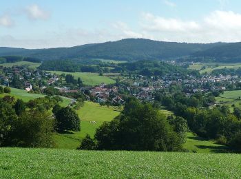
![Excursión A pie Wald-Michelbach - Rundwanderweg Wald-Michelbach Kreidacher Höhe 4: Kreidacher-Weg - Photo](https://media.geolcdn.com/t/350/260/8e49eae8-9180-4248-b987-073bf25328dc.jpeg&format=jpg&maxdim=2)
![A pie A pie](https://static1.geolcdn.com/sitytour/trail-icons/100.png)
Km
A pie
![](/images/other/stat-length.png)
![](https://static1.geolcdn.com/siteimages/upload/files/1508320355ic_sort_den_pos_24dp.png)
![](https://static1.geolcdn.com/siteimages/upload/files/1508320355ic_sort_den_neg_24dp.png)
![](https://static1.geolcdn.com/siteimages/upload/files/16400158638029165_repeat_loop_refresh_sync_direction_icon.png)
• Trail created by Geo-Naturpark Bergstraße-Odenwald. Symbol: Gelbe 4 im gelben Kreis
![Excursión A pie Wald-Michelbach - Rundwanderweg Wald-Michelbach Kreidacher Höhe 3: Gaderner-Weg - Photo](https://media.geolcdn.com/t/350/260/8e49eae8-9180-4248-b987-073bf25328dc.jpeg&format=jpg&maxdim=2)
![A pie A pie](https://static1.geolcdn.com/sitytour/trail-icons/100.png)
Km
A pie
![](/images/other/stat-length.png)
![](https://static1.geolcdn.com/siteimages/upload/files/1508320355ic_sort_den_pos_24dp.png)
![](https://static1.geolcdn.com/siteimages/upload/files/1508320355ic_sort_den_neg_24dp.png)
![](https://static1.geolcdn.com/siteimages/upload/files/16400158638029165_repeat_loop_refresh_sync_direction_icon.png)
• Trail created by Geo-Naturpark Bergstraße-Odenwald. Symbol: Gelbe 3 im gelben Kreis
![Excursión A pie Wald-Michelbach - Rundwanderweg Wald-Michelbach 3: Schimmelberg-Weg - Photo](https://media.geolcdn.com/t/350/260/8e49eae8-9180-4248-b987-073bf25328dc.jpeg&format=jpg&maxdim=2)
![A pie A pie](https://static1.geolcdn.com/sitytour/trail-icons/100.png)
Km
A pie
![](/images/other/stat-length.png)
![](https://static1.geolcdn.com/siteimages/upload/files/1508320355ic_sort_den_pos_24dp.png)
![](https://static1.geolcdn.com/siteimages/upload/files/1508320355ic_sort_den_neg_24dp.png)
![](https://static1.geolcdn.com/siteimages/upload/files/16400158638029165_repeat_loop_refresh_sync_direction_icon.png)
• Trail created by Geo-Naturpark Bergstraße-Odenwald. Symbol: Weiße 3 im oben offenen Kreis, in der Öffnung die Region...
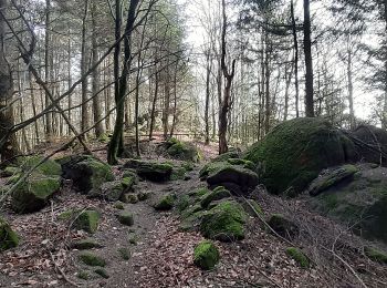
![Excursión A pie Wald-Michelbach - Rundwanderweg Wald-Michelbach 5: Höhenwanderweg Tromm - Photo](https://media.geolcdn.com/t/350/260/af92c64b-622c-4236-8cc5-d09593c02d7f.jpeg&format=jpg&maxdim=2)
![A pie A pie](https://static1.geolcdn.com/sitytour/trail-icons/100.png)
Km
A pie
![](/images/other/stat-length.png)
![](https://static1.geolcdn.com/siteimages/upload/files/1508320355ic_sort_den_pos_24dp.png)
![](https://static1.geolcdn.com/siteimages/upload/files/1508320355ic_sort_den_neg_24dp.png)
![](https://static1.geolcdn.com/siteimages/upload/files/16400158638029165_repeat_loop_refresh_sync_direction_icon.png)
• Trail created by Odenwaldklub. Symbol: Grüne 5 in einem grünen oben offenen Kreis darin ein grünes W
![Excursión A pie Wald-Michelbach - Rundwanderweg Wald-Michelbach 9: Lannertskopf-Weg - Photo](https://media.geolcdn.com/t/350/260/c194f68b-565c-441e-b4b0-c188bb6bea05.jpeg&format=jpg&maxdim=2)
![A pie A pie](https://static1.geolcdn.com/sitytour/trail-icons/100.png)
Km
A pie
![](/images/other/stat-length.png)
![](https://static1.geolcdn.com/siteimages/upload/files/1508320355ic_sort_den_pos_24dp.png)
![](https://static1.geolcdn.com/siteimages/upload/files/1508320355ic_sort_den_neg_24dp.png)
![](https://static1.geolcdn.com/siteimages/upload/files/16400158638029165_repeat_loop_refresh_sync_direction_icon.png)
• Trail created by Geo-Naturpark Bergstraße-Odenwald. Symbol: Weiße 9 im oben offenen Kreis, in der Öffnung die Region...
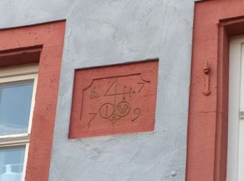
![Excursión A pie Wald-Michelbach - Rundwanderweg Wald-Michelbach 8: Dürr-Ellenbach-Weg - Photo](https://media.geolcdn.com/t/350/260/10f19071-baf5-417a-b163-825b941d0ce9.jpeg&format=jpg&maxdim=2)
![A pie A pie](https://static1.geolcdn.com/sitytour/trail-icons/100.png)
Km
A pie
![](/images/other/stat-length.png)
![](https://static1.geolcdn.com/siteimages/upload/files/1508320355ic_sort_den_pos_24dp.png)
![](https://static1.geolcdn.com/siteimages/upload/files/1508320355ic_sort_den_neg_24dp.png)
![](https://static1.geolcdn.com/siteimages/upload/files/16400158638029165_repeat_loop_refresh_sync_direction_icon.png)
• Trail created by Geo-Naturpark Bergstraße-Odenwald. Symbol: Weiße 8 im oben offenen Kreis, in der Öffnung die Region...
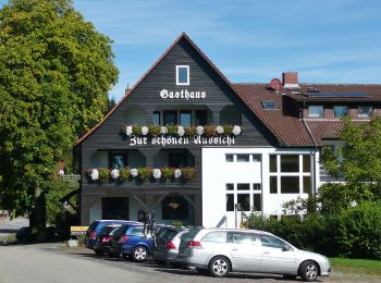
![Excursión A pie Wald-Michelbach - Rundwanderweg Affolterbach 4: Rainer-Türk-Weg - Photo](https://media.geolcdn.com/t/350/260/bde0987b-0a93-4ab7-86ac-a1542aa9015e.jpeg&format=jpg&maxdim=2)
![A pie A pie](https://static1.geolcdn.com/sitytour/trail-icons/100.png)
Km
A pie
![](/images/other/stat-length.png)
![](https://static1.geolcdn.com/siteimages/upload/files/1508320355ic_sort_den_pos_24dp.png)
![](https://static1.geolcdn.com/siteimages/upload/files/1508320355ic_sort_den_neg_24dp.png)
![](https://static1.geolcdn.com/siteimages/upload/files/16400158638029165_repeat_loop_refresh_sync_direction_icon.png)
• Trail created by Geo-Naturpark Bergstraße-Odenwald. Symbol: Weiße 4 im oben offenen Kreis, in der Öffnung die Region...
![Excursión A pie Wald-Michelbach - Rundwanderweg Aschbach 4: Dürr-Ellenbach-Weg - Photo](https://media.geolcdn.com/t/350/260/10f19071-baf5-417a-b163-825b941d0ce9.jpeg&format=jpg&maxdim=2)
![A pie A pie](https://static1.geolcdn.com/sitytour/trail-icons/100.png)
Km
A pie
![](/images/other/stat-length.png)
![](https://static1.geolcdn.com/siteimages/upload/files/1508320355ic_sort_den_pos_24dp.png)
![](https://static1.geolcdn.com/siteimages/upload/files/1508320355ic_sort_den_neg_24dp.png)
![](https://static1.geolcdn.com/siteimages/upload/files/16400158638029165_repeat_loop_refresh_sync_direction_icon.png)
• Trail created by Geo-Naturpark Bergstraße-Odenwald.
![Excursión A pie Wald-Michelbach - Rundwanderweg Wald-Michelbach 2: Wald-Michelbacher-Buch-Weg - Photo](https://media.geolcdn.com/t/350/260/c194f68b-565c-441e-b4b0-c188bb6bea05.jpeg&format=jpg&maxdim=2)
![A pie A pie](https://static1.geolcdn.com/sitytour/trail-icons/100.png)
Km
A pie
![](/images/other/stat-length.png)
![](https://static1.geolcdn.com/siteimages/upload/files/1508320355ic_sort_den_pos_24dp.png)
![](https://static1.geolcdn.com/siteimages/upload/files/1508320355ic_sort_den_neg_24dp.png)
![](https://static1.geolcdn.com/siteimages/upload/files/16400158638029165_repeat_loop_refresh_sync_direction_icon.png)
• Trail created by Geo-Naturpark Bergstraße-Odenwald. Symbol: Weiße 2 im oben offenen Kreis, in der Öffnung die Region...
![Excursión A pie Wald-Michelbach - Rundwanderweg Waldschwimmbad 3: Kottenbergweg - Photo](https://media.geolcdn.com/t/350/260/c194f68b-565c-441e-b4b0-c188bb6bea05.jpeg&format=jpg&maxdim=2)
![A pie A pie](https://static1.geolcdn.com/sitytour/trail-icons/100.png)
Km
A pie
![](/images/other/stat-length.png)
![](https://static1.geolcdn.com/siteimages/upload/files/1508320355ic_sort_den_pos_24dp.png)
![](https://static1.geolcdn.com/siteimages/upload/files/1508320355ic_sort_den_neg_24dp.png)
![](https://static1.geolcdn.com/siteimages/upload/files/16400158638029165_repeat_loop_refresh_sync_direction_icon.png)
• Trail created by Geo-Naturpark Bergstraße-Odenwald. Symbol: Gelbe 3 im gelben Kreis
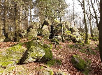
![Excursión A pie Wald-Michelbach - Rundwanderweg Wald-Michelbach Am Bannholz 3: Tromm-Weg - Photo](https://media.geolcdn.com/t/350/260/fcf7afd7-4b16-481d-97fb-01fbc6d2d277.jpeg&format=jpg&maxdim=2)
![A pie A pie](https://static1.geolcdn.com/sitytour/trail-icons/100.png)
Km
A pie
![](/images/other/stat-length.png)
![](https://static1.geolcdn.com/siteimages/upload/files/1508320355ic_sort_den_pos_24dp.png)
![](https://static1.geolcdn.com/siteimages/upload/files/1508320355ic_sort_den_neg_24dp.png)
![](https://static1.geolcdn.com/siteimages/upload/files/16400158638029165_repeat_loop_refresh_sync_direction_icon.png)
• Trail created by Geo-Naturpark Bergstraße-Odenwald. Symbol: Gelbe 3 im gelben Kreis
![Excursión A pie Wald-Michelbach - Rundwanderweg Waldschwimmbad 4: Boschwaldweg - Photo](https://media.geolcdn.com/t/350/260/c194f68b-565c-441e-b4b0-c188bb6bea05.jpeg&format=jpg&maxdim=2)
![A pie A pie](https://static1.geolcdn.com/sitytour/trail-icons/100.png)
Km
A pie
![](/images/other/stat-length.png)
![](https://static1.geolcdn.com/siteimages/upload/files/1508320355ic_sort_den_pos_24dp.png)
![](https://static1.geolcdn.com/siteimages/upload/files/1508320355ic_sort_den_neg_24dp.png)
![](https://static1.geolcdn.com/siteimages/upload/files/16400158638029165_repeat_loop_refresh_sync_direction_icon.png)
• Trail created by Geo-Naturpark Bergstraße-Odenwald. Symbol: Gelbe 4 im gelben Kreis
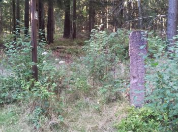
![Excursión A pie Wald-Michelbach - Rundwanderweg Beerfelden Olfener Steinbruch 4: Grenz-Weg - Photo](https://media.geolcdn.com/t/350/260/318ec9f1-255a-4ede-903b-31cb4ebae3f1.jpeg&format=jpg&maxdim=2)
![A pie A pie](https://static1.geolcdn.com/sitytour/trail-icons/100.png)
Km
A pie
![](/images/other/stat-length.png)
![](https://static1.geolcdn.com/siteimages/upload/files/1508320355ic_sort_den_pos_24dp.png)
![](https://static1.geolcdn.com/siteimages/upload/files/1508320355ic_sort_den_neg_24dp.png)
![](https://static1.geolcdn.com/siteimages/upload/files/16400158638029165_repeat_loop_refresh_sync_direction_icon.png)
• Trail created by Geo-Naturpark Bergstraße-Odenwald. Symbol: Gelbe 4 im gelben Kreis
![Excursión A pie Wald-Michelbach - Rundwanderweg Affolterbach 1: Rotes-Wasser-Weg - Photo](https://media.geolcdn.com/t/350/260/318ec9f1-255a-4ede-903b-31cb4ebae3f1.jpeg&format=jpg&maxdim=2)
![A pie A pie](https://static1.geolcdn.com/sitytour/trail-icons/100.png)
Km
A pie
![](/images/other/stat-length.png)
![](https://static1.geolcdn.com/siteimages/upload/files/1508320355ic_sort_den_pos_24dp.png)
![](https://static1.geolcdn.com/siteimages/upload/files/1508320355ic_sort_den_neg_24dp.png)
![](https://static1.geolcdn.com/siteimages/upload/files/16400158638029165_repeat_loop_refresh_sync_direction_icon.png)
• Trail created by Geo-Naturpark Bergstraße-Odenwald. Symbol: Weiße 1 im oben offenen Kreis, in der Öffnung die Region...
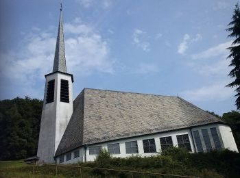
![Excursión A pie Wald-Michelbach - Rundwanderweg Affolterbach 6: Hilsberg-Weg - Photo](https://media.geolcdn.com/t/350/260/3866d0d9-c92d-4bf3-afff-ac0bbd659547.jpeg&format=jpg&maxdim=2)
![A pie A pie](https://static1.geolcdn.com/sitytour/trail-icons/100.png)
Km
A pie
![](/images/other/stat-length.png)
![](https://static1.geolcdn.com/siteimages/upload/files/1508320355ic_sort_den_pos_24dp.png)
![](https://static1.geolcdn.com/siteimages/upload/files/1508320355ic_sort_den_neg_24dp.png)
![](https://static1.geolcdn.com/siteimages/upload/files/16400158638029165_repeat_loop_refresh_sync_direction_icon.png)
• Trail created by Geo-Naturpark Bergstraße-Odenwald. Symbol: Weiße 6 im oben offenen Kreis, in der Öffnung die Region...
![Excursión A pie Wald-Michelbach - Rundwanderweg Affolterbach 2: Verbotstein-Weg - Photo](https://media.geolcdn.com/t/350/260/318ec9f1-255a-4ede-903b-31cb4ebae3f1.jpeg&format=jpg&maxdim=2)
![A pie A pie](https://static1.geolcdn.com/sitytour/trail-icons/100.png)
Km
A pie
![](/images/other/stat-length.png)
![](https://static1.geolcdn.com/siteimages/upload/files/1508320355ic_sort_den_pos_24dp.png)
![](https://static1.geolcdn.com/siteimages/upload/files/1508320355ic_sort_den_neg_24dp.png)
![](https://static1.geolcdn.com/siteimages/upload/files/16400158638029165_repeat_loop_refresh_sync_direction_icon.png)
• Trail created by Geo-Naturpark Bergstraße-Odenwald. Symbol: Weiße 2 im oben offenen Kreis, in der Öffnung die Region...
![Excursión A pie Wald-Michelbach - Rundwanderweg Wald-Michelbach Am Kochert 3: Im Rod-Weg - Photo](https://media.geolcdn.com/t/350/260/3866d0d9-c92d-4bf3-afff-ac0bbd659547.jpeg&format=jpg&maxdim=2)
![A pie A pie](https://static1.geolcdn.com/sitytour/trail-icons/100.png)
Km
A pie
![](/images/other/stat-length.png)
![](https://static1.geolcdn.com/siteimages/upload/files/1508320355ic_sort_den_pos_24dp.png)
![](https://static1.geolcdn.com/siteimages/upload/files/1508320355ic_sort_den_neg_24dp.png)
![](https://static1.geolcdn.com/siteimages/upload/files/16400158638029165_repeat_loop_refresh_sync_direction_icon.png)
• Trail created by Geo-Naturpark Bergstraße-Odenwald. Symbol: Gelbe 3 im gelben Kreis
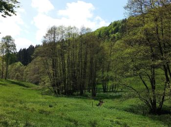
![Excursión A pie Wald-Michelbach - Rundwanderweg Wald-Michelbach Lichtenklingen 1: Lichtenklinger-Hof-Weg - Photo](https://media.geolcdn.com/t/350/260/dc532a96-05b3-4641-bde9-13382a8f2e04.jpeg&format=jpg&maxdim=2)
![A pie A pie](https://static1.geolcdn.com/sitytour/trail-icons/100.png)
Km
A pie
![](/images/other/stat-length.png)
![](https://static1.geolcdn.com/siteimages/upload/files/1508320355ic_sort_den_pos_24dp.png)
![](https://static1.geolcdn.com/siteimages/upload/files/1508320355ic_sort_den_neg_24dp.png)
![](https://static1.geolcdn.com/siteimages/upload/files/16400158638029165_repeat_loop_refresh_sync_direction_icon.png)
• Trail created by Geo-Naturpark Bergstraße-Odenwald. Symbol: Gelbe 1 im gelben Kreis
![Excursión A pie Wald-Michelbach - Rundwanderweg Wald-Michelbach Lichtenklingen 4: Adlerstein-Weg - Photo](https://media.geolcdn.com/t/350/260/dc532a96-05b3-4641-bde9-13382a8f2e04.jpeg&format=jpg&maxdim=2)
![A pie A pie](https://static1.geolcdn.com/sitytour/trail-icons/100.png)
Km
A pie
![](/images/other/stat-length.png)
![](https://static1.geolcdn.com/siteimages/upload/files/1508320355ic_sort_den_pos_24dp.png)
![](https://static1.geolcdn.com/siteimages/upload/files/1508320355ic_sort_den_neg_24dp.png)
![](https://static1.geolcdn.com/siteimages/upload/files/16400158638029165_repeat_loop_refresh_sync_direction_icon.png)
• Trail created by Geo-Naturpark Bergstraße-Odenwald. Symbol: Gelbe 4 im gelben Kreis
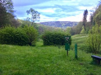
![Excursión A pie Wald-Michelbach - Rundwanderweg Wald-Michelbach Hardberg 4 Stiefelhütten-Weg - Photo](https://media.geolcdn.com/t/350/260/78e8faf9-ace8-41eb-be33-a77bf7ebe4ba.jpeg&format=jpg&maxdim=2)
![A pie A pie](https://static1.geolcdn.com/sitytour/trail-icons/100.png)
Km
A pie
![](/images/other/stat-length.png)
![](https://static1.geolcdn.com/siteimages/upload/files/1508320355ic_sort_den_pos_24dp.png)
![](https://static1.geolcdn.com/siteimages/upload/files/1508320355ic_sort_den_neg_24dp.png)
![](https://static1.geolcdn.com/siteimages/upload/files/16400158638029165_repeat_loop_refresh_sync_direction_icon.png)
• Trail created by Geo-Naturpark Bergstraße-Odenwald. Symbol: Gelbe 4 im gelben Kreis
20 excursiones mostradas en 48
Aplicación GPS de excursión GRATIS