![](/images/other/stat-length.png)
- Excursiones
- Outdoor
- Germany
- Turingia
- Greiz
- Zeulenroda-Triebes
Zeulenroda-Triebes, Greiz: Los mejores itinerarios de excursión, recorridos, paseos y sendas
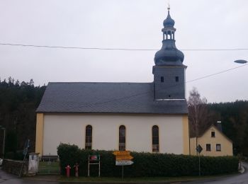
Zeulenroda-Triebes: Descubra las mejores excursiones: 6 a pie. Todos estos circuitos, recorridos, itinerarios y actividades al aire libre están disponibles en nuestras aplicaciones SityTrail para smartphone y tablet.
Los mejores recorridos (6)
![Excursión A pie Zeulenroda-Triebes - Rundweg Vorsperre Pisselsmühle - Photo](https://media.geolcdn.com/t/350/260/d6a56bf3-1dd3-423e-aaae-9f14453bca15.jpeg&format=jpg&maxdim=2)
![A pie A pie](https://static1.geolcdn.com/sitytour/trail-icons/100.png)
Km
A pie
![](/images/other/stat-length.png)
![](https://static1.geolcdn.com/siteimages/upload/files/1508320355ic_sort_den_pos_24dp.png)
![](https://static1.geolcdn.com/siteimages/upload/files/1508320355ic_sort_den_neg_24dp.png)
![](https://static1.geolcdn.com/siteimages/upload/files/16400158638029165_repeat_loop_refresh_sync_direction_icon.png)
• Symbol: blue letter π (Pi) and red dot on top;all together on white ground
![Excursión A pie Zeulenroda-Triebes - Rundweg Staudamm - Photo](https://media.geolcdn.com/t/350/260/fa2fa4e3-ba29-4720-90d6-ba14eed49c07.jpeg&format=jpg&maxdim=2)
![A pie A pie](https://static1.geolcdn.com/sitytour/trail-icons/100.png)
Km
A pie
![](/images/other/stat-length.png)
![](https://static1.geolcdn.com/siteimages/upload/files/1508320355ic_sort_den_pos_24dp.png)
![](https://static1.geolcdn.com/siteimages/upload/files/1508320355ic_sort_den_neg_24dp.png)
![](https://static1.geolcdn.com/siteimages/upload/files/16400158638029165_repeat_loop_refresh_sync_direction_icon.png)
• Symbol: blue letter π (Pi) and red dot on top;all together on white ground
![Excursión A pie Zeulenroda-Triebes - Poellwitzer Rundweg Nord - Photo](https://media.geolcdn.com/t/350/260/08d50e8f-d2a9-439f-9a77-dff38f8003bb.jpeg&format=jpg&maxdim=2)
![A pie A pie](https://static1.geolcdn.com/sitytour/trail-icons/100.png)
Km
A pie
![](/images/other/stat-length.png)
![](https://static1.geolcdn.com/siteimages/upload/files/1508320355ic_sort_den_pos_24dp.png)
![](https://static1.geolcdn.com/siteimages/upload/files/1508320355ic_sort_den_neg_24dp.png)
![](https://static1.geolcdn.com/siteimages/upload/files/16400158638029165_repeat_loop_refresh_sync_direction_icon.png)
• Im Januar 2014 längere Abschnitte durch Holzeinschlag aufgefahren - nur bei Frost ohne Morast begehbar. Symbol: gelb...
![Excursión A pie Zeulenroda-Triebes - Poellwitzer Rundweg Sued - Photo](https://media.geolcdn.com/t/350/260/08d50e8f-d2a9-439f-9a77-dff38f8003bb.jpeg&format=jpg&maxdim=2)
![A pie A pie](https://static1.geolcdn.com/sitytour/trail-icons/100.png)
Km
A pie
![](/images/other/stat-length.png)
![](https://static1.geolcdn.com/siteimages/upload/files/1508320355ic_sort_den_pos_24dp.png)
![](https://static1.geolcdn.com/siteimages/upload/files/1508320355ic_sort_den_neg_24dp.png)
![](https://static1.geolcdn.com/siteimages/upload/files/16400158638029165_repeat_loop_refresh_sync_direction_icon.png)
• Im Januar 2014 längere Abschnitte durch Holzeinschlag aufgefahren - nur bei Frost ohne Morast begehbar. Symbol: gelb...
![Excursión A pie Zeulenroda-Triebes - Rundweg Vorsperre Riedelmühle - Photo](https://media.geolcdn.com/t/350/260/2686b8ea-0d55-48ac-a769-2a556de217e4.jpeg&format=jpg&maxdim=2)
![A pie A pie](https://static1.geolcdn.com/sitytour/trail-icons/100.png)
Km
A pie
![](/images/other/stat-length.png)
![](https://static1.geolcdn.com/siteimages/upload/files/1508320355ic_sort_den_pos_24dp.png)
![](https://static1.geolcdn.com/siteimages/upload/files/1508320355ic_sort_den_neg_24dp.png)
![](https://static1.geolcdn.com/siteimages/upload/files/16400158638029165_repeat_loop_refresh_sync_direction_icon.png)
• Symbol: blue letter π (Pi) and red dot on top;all together on white ground
![Excursión A pie Zeulenroda-Triebes - Rundweg Zeulenrodaer Meer - Photo](https://media.geolcdn.com/t/350/260/1a42912a-a8ac-4535-99f4-ffd9e219648c.jpeg&format=jpg&maxdim=2)
![A pie A pie](https://static1.geolcdn.com/sitytour/trail-icons/100.png)
Km
A pie
![](/images/other/stat-length.png)
![](https://static1.geolcdn.com/siteimages/upload/files/1508320355ic_sort_den_pos_24dp.png)
![](https://static1.geolcdn.com/siteimages/upload/files/1508320355ic_sort_den_neg_24dp.png)
![](https://static1.geolcdn.com/siteimages/upload/files/16400158638029165_repeat_loop_refresh_sync_direction_icon.png)
• Symbol: blue letter π (Pi) and red dot on top;all together on white ground
6 excursiones mostradas en 6
Aplicación GPS de excursión GRATIS