![](/images/other/stat-length.png)
- Excursiones
- Outdoor
- Germany
- Turingia
- Landkreis Saalfeld-Rudolstadt
Landkreis Saalfeld-Rudolstadt, Turingia: Los mejores itinerarios de excursión, recorridos, paseos y sendas
Landkreis Saalfeld-Rudolstadt: Descubra las mejores excursiones: 40 a pie. Todos estos circuitos, recorridos, itinerarios y actividades al aire libre están disponibles en nuestras aplicaciones SityTrail para smartphone y tablet.
Los mejores recorridos (40)
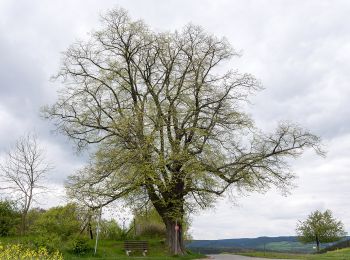
![Excursión A pie Rudolstadt - Rundwanderweg 5 - Photo](https://media.geolcdn.com/t/350/260/639184e6-4bf6-47e6-bdb9-3e22f18a4486.jpeg&format=jpg&maxdim=2)
![A pie A pie](https://static1.geolcdn.com/sitytour/trail-icons/100.png)
Km
A pie
![](/images/other/stat-length.png)
![](https://static1.geolcdn.com/siteimages/upload/files/1508320355ic_sort_den_pos_24dp.png)
![](https://static1.geolcdn.com/siteimages/upload/files/1508320355ic_sort_den_neg_24dp.png)
![](https://static1.geolcdn.com/siteimages/upload/files/16400158638029165_repeat_loop_refresh_sync_direction_icon.png)
• Symbol: Schwarze 5 auf gelben Untergrund
![Excursión A pie Rudolstadt - Rundwanderweg 4 - Photo](https://media.geolcdn.com/t/350/260/639184e6-4bf6-47e6-bdb9-3e22f18a4486.jpeg&format=jpg&maxdim=2)
![A pie A pie](https://static1.geolcdn.com/sitytour/trail-icons/100.png)
Km
A pie
![](/images/other/stat-length.png)
![](https://static1.geolcdn.com/siteimages/upload/files/1508320355ic_sort_den_pos_24dp.png)
![](https://static1.geolcdn.com/siteimages/upload/files/1508320355ic_sort_den_neg_24dp.png)
![](https://static1.geolcdn.com/siteimages/upload/files/16400158638029165_repeat_loop_refresh_sync_direction_icon.png)
• Symbol: Schwarze 4 auf gelben Untergrund
![Excursión A pie Rudolstadt - Rundwanderweg 3 - Photo](https://media.geolcdn.com/t/350/260/639184e6-4bf6-47e6-bdb9-3e22f18a4486.jpeg&format=jpg&maxdim=2)
![A pie A pie](https://static1.geolcdn.com/sitytour/trail-icons/100.png)
Km
A pie
![](/images/other/stat-length.png)
![](https://static1.geolcdn.com/siteimages/upload/files/1508320355ic_sort_den_pos_24dp.png)
![](https://static1.geolcdn.com/siteimages/upload/files/1508320355ic_sort_den_neg_24dp.png)
![](https://static1.geolcdn.com/siteimages/upload/files/16400158638029165_repeat_loop_refresh_sync_direction_icon.png)
• Symbol: Schwarze 3 auf gelben Untergrund
![Excursión A pie Rudolstadt - Rundwanderweg 2 - Photo](https://media.geolcdn.com/t/350/260/639184e6-4bf6-47e6-bdb9-3e22f18a4486.jpeg&format=jpg&maxdim=2)
![A pie A pie](https://static1.geolcdn.com/sitytour/trail-icons/100.png)
Km
A pie
![](/images/other/stat-length.png)
![](https://static1.geolcdn.com/siteimages/upload/files/1508320355ic_sort_den_pos_24dp.png)
![](https://static1.geolcdn.com/siteimages/upload/files/1508320355ic_sort_den_neg_24dp.png)
![](https://static1.geolcdn.com/siteimages/upload/files/16400158638029165_repeat_loop_refresh_sync_direction_icon.png)
• Symbol: Schwarze 2 auf gelben Untergrund
![Excursión A pie Rudolstadt - Rundwanderweg 1 - Photo](https://media.geolcdn.com/t/350/260/639184e6-4bf6-47e6-bdb9-3e22f18a4486.jpeg&format=jpg&maxdim=2)
![A pie A pie](https://static1.geolcdn.com/sitytour/trail-icons/100.png)
Km
A pie
![](/images/other/stat-length.png)
![](https://static1.geolcdn.com/siteimages/upload/files/1508320355ic_sort_den_pos_24dp.png)
![](https://static1.geolcdn.com/siteimages/upload/files/1508320355ic_sort_den_neg_24dp.png)
![](https://static1.geolcdn.com/siteimages/upload/files/16400158638029165_repeat_loop_refresh_sync_direction_icon.png)
• Symbol: Schwarze 1 auf gelben Untergrund
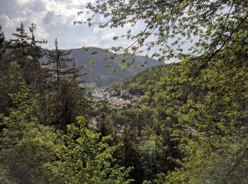
![Excursión A pie Unterwellenborn - Rundwanderweg H4 - Photo](https://media.geolcdn.com/t/350/260/650a665d-4e6b-4ae3-adf3-42d7643532a9.jpeg&format=jpg&maxdim=2)
![A pie A pie](https://static1.geolcdn.com/sitytour/trail-icons/100.png)
Km
A pie
![](/images/other/stat-length.png)
![](https://static1.geolcdn.com/siteimages/upload/files/1508320355ic_sort_den_pos_24dp.png)
![](https://static1.geolcdn.com/siteimages/upload/files/1508320355ic_sort_den_neg_24dp.png)
![](https://static1.geolcdn.com/siteimages/upload/files/16400158638029165_repeat_loop_refresh_sync_direction_icon.png)
• Symbol: Schwarzes H4 auf weißem Untergrund
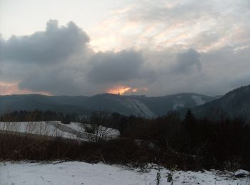
![Excursión A pie Unterwellenborn - Rundwanderweg H6 - Photo](https://media.geolcdn.com/t/350/260/f51754a2-6f54-4199-965b-740ae53fc231.jpeg&format=jpg&maxdim=2)
![A pie A pie](https://static1.geolcdn.com/sitytour/trail-icons/100.png)
Km
A pie
![](/images/other/stat-length.png)
![](https://static1.geolcdn.com/siteimages/upload/files/1508320355ic_sort_den_pos_24dp.png)
![](https://static1.geolcdn.com/siteimages/upload/files/1508320355ic_sort_den_neg_24dp.png)
![](https://static1.geolcdn.com/siteimages/upload/files/16400158638029165_repeat_loop_refresh_sync_direction_icon.png)
• Symbol: Schwarzes H6 auf weißem Untergrund
![Excursión A pie Leutenberg - Rundwanderweg H3 - Photo](https://media.geolcdn.com/t/350/260/650a665d-4e6b-4ae3-adf3-42d7643532a9.jpeg&format=jpg&maxdim=2)
![A pie A pie](https://static1.geolcdn.com/sitytour/trail-icons/100.png)
Km
A pie
![](/images/other/stat-length.png)
![](https://static1.geolcdn.com/siteimages/upload/files/1508320355ic_sort_den_pos_24dp.png)
![](https://static1.geolcdn.com/siteimages/upload/files/1508320355ic_sort_den_neg_24dp.png)
![](https://static1.geolcdn.com/siteimages/upload/files/16400158638029165_repeat_loop_refresh_sync_direction_icon.png)
• Symbol: Schwarzes H3 auf weißem Untergrund
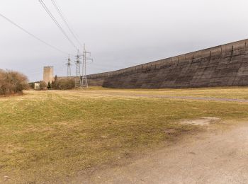
![Excursión A pie Leutenberg - Rundwanderweg Oberbecken - Photo](https://media.geolcdn.com/t/350/260/c72f0238-480d-404c-b1d0-8d8258cdd22d.jpeg&format=jpg&maxdim=2)
![A pie A pie](https://static1.geolcdn.com/sitytour/trail-icons/100.png)
Km
A pie
![](/images/other/stat-length.png)
![](https://static1.geolcdn.com/siteimages/upload/files/1508320355ic_sort_den_pos_24dp.png)
![](https://static1.geolcdn.com/siteimages/upload/files/1508320355ic_sort_den_neg_24dp.png)
![](https://static1.geolcdn.com/siteimages/upload/files/16400158638029165_repeat_loop_refresh_sync_direction_icon.png)
• Symbol: Gelber waagerechter Strich auf weißem Untergrund
![Excursión A pie Hohenwarte - Rundwanderweg H2 - Photo](https://media.geolcdn.com/t/350/260/650a665d-4e6b-4ae3-adf3-42d7643532a9.jpeg&format=jpg&maxdim=2)
![A pie A pie](https://static1.geolcdn.com/sitytour/trail-icons/100.png)
Km
A pie
![](/images/other/stat-length.png)
![](https://static1.geolcdn.com/siteimages/upload/files/1508320355ic_sort_den_pos_24dp.png)
![](https://static1.geolcdn.com/siteimages/upload/files/1508320355ic_sort_den_neg_24dp.png)
![](https://static1.geolcdn.com/siteimages/upload/files/16400158638029165_repeat_loop_refresh_sync_direction_icon.png)
• Symbol: Schwarzes H2 auf weißem Untergrund
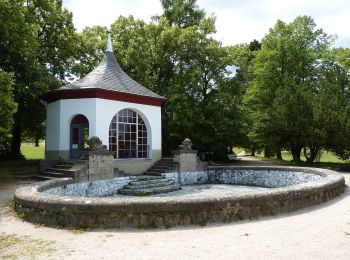
![Excursión A pie Saalfeld/Saale - Rundwanderweg Südstadt - Photo](https://media.geolcdn.com/t/350/260/8e0c1987-5516-4148-86f0-c10b3cb17d6c.jpeg&format=jpg&maxdim=2)
![A pie A pie](https://static1.geolcdn.com/sitytour/trail-icons/100.png)
Km
A pie
![](/images/other/stat-length.png)
![](https://static1.geolcdn.com/siteimages/upload/files/1508320355ic_sort_den_pos_24dp.png)
![](https://static1.geolcdn.com/siteimages/upload/files/1508320355ic_sort_den_neg_24dp.png)
![](https://static1.geolcdn.com/siteimages/upload/files/16400158638029165_repeat_loop_refresh_sync_direction_icon.png)
• Symbol: Gelbes Dreieck mit Spitze nach oben auf weißem Untergrund
![Excursión A pie Rudolstadt - Natur-Lehrpfad](https://media.geolcdn.com/t/350/260/85dade6c-dff5-4985-b2c1-8201f991cec3.jpeg&format=jpg&maxdim=2)
![A pie A pie](https://static1.geolcdn.com/sitytour/trail-icons/100.png)
Km
A pie
![](/images/other/stat-length.png)
![](https://static1.geolcdn.com/siteimages/upload/files/1508320355ic_sort_den_pos_24dp.png)
![](https://static1.geolcdn.com/siteimages/upload/files/1508320355ic_sort_den_neg_24dp.png)
![](https://static1.geolcdn.com/siteimages/upload/files/16400158638029165_repeat_loop_refresh_sync_direction_icon.png)
• Symbol: Grüner Backslash auf weißem Grund
![Excursión A pie Saalfeld/Saale - Spitzberg Rundweg (Grünes Dreieck) - Photo](https://media.geolcdn.com/t/350/260/7a2e3127-38ca-49ac-a051-f9eb54769492.jpeg&format=jpg&maxdim=2)
![A pie A pie](https://static1.geolcdn.com/sitytour/trail-icons/100.png)
Km
A pie
![](/images/other/stat-length.png)
![](https://static1.geolcdn.com/siteimages/upload/files/1508320355ic_sort_den_pos_24dp.png)
![](https://static1.geolcdn.com/siteimages/upload/files/1508320355ic_sort_den_neg_24dp.png)
![](https://static1.geolcdn.com/siteimages/upload/files/16400158638029165_repeat_loop_refresh_sync_direction_icon.png)
• Symbol: Grünes Dreieck mit Spitze nach oben auf weißem Untergrund
![Excursión A pie Saalfeld/Saale - Gelber Punkt Saalfeld - Photo](https://media.geolcdn.com/t/350/260/6609740d-c9b6-43a5-a340-0a0527864c63.jpeg&format=jpg&maxdim=2)
![A pie A pie](https://static1.geolcdn.com/sitytour/trail-icons/100.png)
Km
A pie
![](/images/other/stat-length.png)
![](https://static1.geolcdn.com/siteimages/upload/files/1508320355ic_sort_den_pos_24dp.png)
![](https://static1.geolcdn.com/siteimages/upload/files/1508320355ic_sort_den_neg_24dp.png)
![](https://static1.geolcdn.com/siteimages/upload/files/16400158638029165_repeat_loop_refresh_sync_direction_icon.png)
• Symbol: Gelber Punkt auf weißem Untergrund
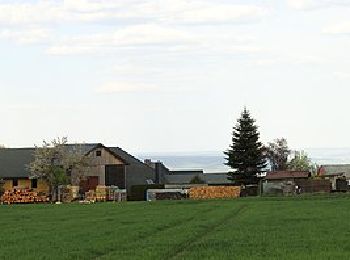
![Excursión A pie Saalfeld/Saale - Gelber Strich Unterwirbach - Wittmannsgereuth - Photo](https://media.geolcdn.com/t/350/260/bb7f48e3-a1c2-49c0-a95e-92c26a1f7764.jpeg&format=jpg&maxdim=2)
![A pie A pie](https://static1.geolcdn.com/sitytour/trail-icons/100.png)
Km
A pie
![](/images/other/stat-length.png)
![](https://static1.geolcdn.com/siteimages/upload/files/1508320355ic_sort_den_pos_24dp.png)
![](https://static1.geolcdn.com/siteimages/upload/files/1508320355ic_sort_den_neg_24dp.png)
![](https://static1.geolcdn.com/siteimages/upload/files/16400158638029165_repeat_loop_refresh_sync_direction_icon.png)
• Symbol: Gelber waagerechter Strich auf weißem Untergrund
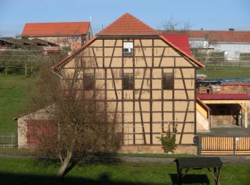
![Excursión A pie Uhlstädt-Kirchhasel - Gelber Strich Kirchhasel-Teichweiden - Photo](https://media.geolcdn.com/t/350/260/a0047547-4c81-4a46-a1e2-a363318e85ad.jpeg&format=jpg&maxdim=2)
![A pie A pie](https://static1.geolcdn.com/sitytour/trail-icons/100.png)
Km
A pie
![](/images/other/stat-length.png)
![](https://static1.geolcdn.com/siteimages/upload/files/1508320355ic_sort_den_pos_24dp.png)
![](https://static1.geolcdn.com/siteimages/upload/files/1508320355ic_sort_den_neg_24dp.png)
![](https://static1.geolcdn.com/siteimages/upload/files/16400158638029165_repeat_loop_refresh_sync_direction_icon.png)
• Symbol: Gelber waagerechter Strich auf weißem Untergrund
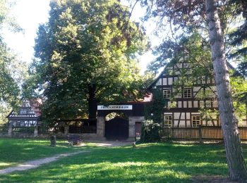
![Excursión A pie Unterwellenborn - Wanderweg Rudolstadt - Kulm - Photo](https://media.geolcdn.com/t/350/260/25c2df19-f839-46a9-b22c-1ebe8ec6136e.jpeg&format=jpg&maxdim=2)
![A pie A pie](https://static1.geolcdn.com/sitytour/trail-icons/100.png)
Km
A pie
![](/images/other/stat-length.png)
![](https://static1.geolcdn.com/siteimages/upload/files/1508320355ic_sort_den_pos_24dp.png)
![](https://static1.geolcdn.com/siteimages/upload/files/1508320355ic_sort_den_neg_24dp.png)
![](https://static1.geolcdn.com/siteimages/upload/files/16400158638029165_repeat_loop_refresh_sync_direction_icon.png)
• Symbol: Grüner waagerechter Balken auf weißem Untergrund
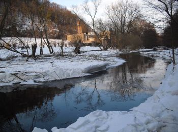
![Excursión A pie Bad Blankenburg - Grünes Kreuz Bad Blankenburg - Hainberg - Oberwirbach - Photo](https://media.geolcdn.com/t/350/260/d4bdc37c-160f-48bc-b212-ea147ae04bb1.jpeg&format=jpg&maxdim=2)
![A pie A pie](https://static1.geolcdn.com/sitytour/trail-icons/100.png)
Km
A pie
![](/images/other/stat-length.png)
![](https://static1.geolcdn.com/siteimages/upload/files/1508320355ic_sort_den_pos_24dp.png)
![](https://static1.geolcdn.com/siteimages/upload/files/1508320355ic_sort_den_neg_24dp.png)
![](https://static1.geolcdn.com/siteimages/upload/files/16400158638029165_repeat_loop_refresh_sync_direction_icon.png)
• Symbol: Grünes Kreuz auf weißem Grund
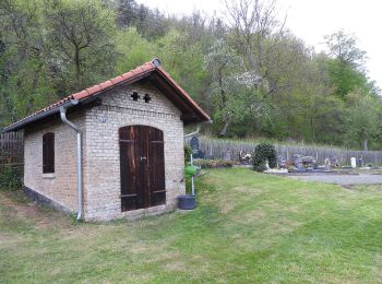
![Excursión A pie Saalfeld/Saale - Bienen und Naturlehrpfad - Photo](https://media.geolcdn.com/t/350/260/f785c3c1-bdf8-49af-9ca1-99a582412e6e.jpeg&format=jpg&maxdim=2)
![A pie A pie](https://static1.geolcdn.com/sitytour/trail-icons/100.png)
Km
A pie
![](/images/other/stat-length.png)
![](https://static1.geolcdn.com/siteimages/upload/files/1508320355ic_sort_den_pos_24dp.png)
![](https://static1.geolcdn.com/siteimages/upload/files/1508320355ic_sort_den_neg_24dp.png)
![](https://static1.geolcdn.com/siteimages/upload/files/16400158638029165_repeat_loop_refresh_sync_direction_icon.png)
• Trail created by Touristinfo Saalfeld. Sitio web: https://www.saalfeld-tourismus.de/Aktivangebote/Wandern/Wanderwe...
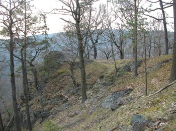
![Excursión A pie Schwarzburg - Naturlehrpfad Heinrich Cotta - Photo](https://media.geolcdn.com/t/350/260/0e26b14c-933b-401d-b1bd-04acb34e7fed.jpeg&format=jpg&maxdim=2)
![A pie A pie](https://static1.geolcdn.com/sitytour/trail-icons/100.png)
Km
A pie
![](/images/other/stat-length.png)
![](https://static1.geolcdn.com/siteimages/upload/files/1508320355ic_sort_den_pos_24dp.png)
![](https://static1.geolcdn.com/siteimages/upload/files/1508320355ic_sort_den_neg_24dp.png)
![](https://static1.geolcdn.com/siteimages/upload/files/16400158638029165_repeat_loop_refresh_sync_direction_icon.png)
• Symbol angenähert Symbol: grüne Fichte auf weißem Grund
20 excursiones mostradas en 40
Aplicación GPS de excursión GRATIS