![](/images/other/stat-length.png)
- Excursiones
- Outdoor
- Germany
- Renania del Norte-Westfalia
- Essen
- Desconocido
Desconocido, Essen: Los mejores itinerarios de excursión, recorridos, paseos y sendas
Desconocido: Descubra las mejores excursiones: 36 a pie. Todos estos circuitos, recorridos, itinerarios y actividades al aire libre están disponibles en nuestras aplicaciones SityTrail para smartphone y tablet.
Los mejores recorridos (36)
![Excursión A pie Desconocido - Kettwiger Panoramasteig - Photo](https://media.geolcdn.com/t/350/260/c4c1ff8e-1ed2-4bc5-830a-9183bb44de95.jpeg&format=jpg&maxdim=2)
![A pie A pie](https://static1.geolcdn.com/sitytour/trail-icons/100.png)
Km
A pie
![](/images/other/stat-length.png)
![](https://static1.geolcdn.com/siteimages/upload/files/1508320355ic_sort_den_pos_24dp.png)
![](https://static1.geolcdn.com/siteimages/upload/files/1508320355ic_sort_den_neg_24dp.png)
![](https://static1.geolcdn.com/siteimages/upload/files/16400158638029165_repeat_loop_refresh_sync_direction_icon.png)
• Trail created by Stadt Essen. Symbol: Rote Zickzack Linie, darunter blaue Linie, darunter der Name: Kettwiger Panora...
![Excursión A pie Desconocido - Pilgerweg Heidhausen - Essen - Photo](https://media.geolcdn.com/t/350/260/982c6e32-3d1c-4d42-a67d-562ea32f65b9.jpeg&format=jpg&maxdim=2)
![A pie A pie](https://static1.geolcdn.com/sitytour/trail-icons/100.png)
Km
A pie
![](/images/other/stat-length.png)
![](https://static1.geolcdn.com/siteimages/upload/files/1508320355ic_sort_den_pos_24dp.png)
![](https://static1.geolcdn.com/siteimages/upload/files/1508320355ic_sort_den_neg_24dp.png)
![](https://static1.geolcdn.com/siteimages/upload/files/16400158638029165_repeat_loop_refresh_sync_direction_icon.png)
• Trail created by Bistum Essen. Symbol: weisser Fisch auf pinkem Grund
![Excursión A pie Desconocido - Pilgerweg Du-E - Photo](https://media.geolcdn.com/t/350/260/37b64d57-4b3c-4254-bf55-652036043d32.jpeg&format=jpg&maxdim=2)
![A pie A pie](https://static1.geolcdn.com/sitytour/trail-icons/100.png)
Km
A pie
![](/images/other/stat-length.png)
![](https://static1.geolcdn.com/siteimages/upload/files/1508320355ic_sort_den_pos_24dp.png)
![](https://static1.geolcdn.com/siteimages/upload/files/1508320355ic_sort_den_neg_24dp.png)
![](https://static1.geolcdn.com/siteimages/upload/files/16400158638029165_repeat_loop_refresh_sync_direction_icon.png)
• Trail created by Bistum Essen. Symbol: weisser Fisch auf pinkem Grund
![Excursión A pie Desconocido - Pilgerweg Bot-E - Photo](https://media.geolcdn.com/t/350/260/3f619a03-42c2-4e61-bc08-142ed6db49eb.jpeg&format=jpg&maxdim=2)
![A pie A pie](https://static1.geolcdn.com/sitytour/trail-icons/100.png)
Km
A pie
![](/images/other/stat-length.png)
![](https://static1.geolcdn.com/siteimages/upload/files/1508320355ic_sort_den_pos_24dp.png)
![](https://static1.geolcdn.com/siteimages/upload/files/1508320355ic_sort_den_neg_24dp.png)
![](https://static1.geolcdn.com/siteimages/upload/files/16400158638029165_repeat_loop_refresh_sync_direction_icon.png)
• Trail created by Bistum Essen. Symbol: weisser Fisch auf pinkem Grund
![Excursión A pie Desconocido - BaldeneySteig - Photo](https://media.geolcdn.com/t/350/260/6b304d79-4029-4f4c-bae2-94841998b36b.jpeg&format=jpg&maxdim=2)
![A pie A pie](https://static1.geolcdn.com/sitytour/trail-icons/100.png)
Km
A pie
![](/images/other/stat-length.png)
![](https://static1.geolcdn.com/siteimages/upload/files/1508320355ic_sort_den_pos_24dp.png)
![](https://static1.geolcdn.com/siteimages/upload/files/1508320355ic_sort_den_neg_24dp.png)
![](https://static1.geolcdn.com/siteimages/upload/files/16400158638029165_repeat_loop_refresh_sync_direction_icon.png)
• Trail created by Projektbüro Grüne Hauptstadt Europas. Symbol: grüne Zickzack Linie, darunter blaue Linie, darunter ...
![Excursión A pie Desconocido - Isenbügel Rundweg A2 - Photo](https://media.geolcdn.com/t/350/260/58b23ba0-f4be-49fb-b2e8-8f0d898b9043.jpeg&format=jpg&maxdim=2)
![A pie A pie](https://static1.geolcdn.com/sitytour/trail-icons/100.png)
Km
A pie
![](/images/other/stat-length.png)
![](https://static1.geolcdn.com/siteimages/upload/files/1508320355ic_sort_den_pos_24dp.png)
![](https://static1.geolcdn.com/siteimages/upload/files/1508320355ic_sort_den_neg_24dp.png)
![](https://static1.geolcdn.com/siteimages/upload/files/16400158638029165_repeat_loop_refresh_sync_direction_icon.png)
• Trail created by Sauerländischer Gebirgsverein.
![Excursión A pie Desconocido - Dreieck Wattenscheid - Essen-Horst - Photo](https://media.geolcdn.com/t/350/260/d3b81799-5190-40a7-9cac-e6db6353a38f.jpeg&format=jpg&maxdim=2)
![A pie A pie](https://static1.geolcdn.com/sitytour/trail-icons/100.png)
Km
A pie
![](/images/other/stat-length.png)
![](https://static1.geolcdn.com/siteimages/upload/files/1508320355ic_sort_den_pos_24dp.png)
![](https://static1.geolcdn.com/siteimages/upload/files/1508320355ic_sort_den_neg_24dp.png)
![](https://static1.geolcdn.com/siteimages/upload/files/16400158638029165_repeat_loop_refresh_sync_direction_icon.png)
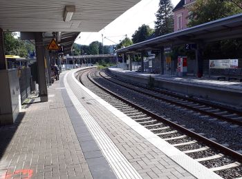
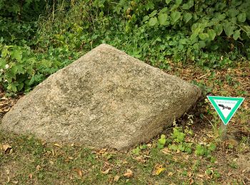
• Trail created by Sauerländischer Gebirgsverein. Symbol: Weißes, leeres Dreieck
![Excursión A pie Desconocido - Rundweg Burgaltendorf A3 - Photo](https://media.geolcdn.com/t/350/260/db9695fc-8351-489b-af0e-1f5bf4dcebe5.jpeg&format=jpg&maxdim=2)
![A pie A pie](https://static1.geolcdn.com/sitytour/trail-icons/100.png)
Km
A pie
![](/images/other/stat-length.png)
![](https://static1.geolcdn.com/siteimages/upload/files/1508320355ic_sort_den_pos_24dp.png)
![](https://static1.geolcdn.com/siteimages/upload/files/1508320355ic_sort_den_neg_24dp.png)
![](https://static1.geolcdn.com/siteimages/upload/files/16400158638029165_repeat_loop_refresh_sync_direction_icon.png)
• Trail created by Sauerländischer Gebirgsverein. Symbol: Weißer Schriftzug A3 auf schwarzem Grund
![Excursión A pie Desconocido - Rundweg Burgaltendorf A2 - Photo](https://media.geolcdn.com/t/350/260/def9cb8c-5f18-4142-ba5d-24f8e82255ad.jpeg&format=jpg&maxdim=2)
![A pie A pie](https://static1.geolcdn.com/sitytour/trail-icons/100.png)
Km
A pie
![](/images/other/stat-length.png)
![](https://static1.geolcdn.com/siteimages/upload/files/1508320355ic_sort_den_pos_24dp.png)
![](https://static1.geolcdn.com/siteimages/upload/files/1508320355ic_sort_den_neg_24dp.png)
![](https://static1.geolcdn.com/siteimages/upload/files/16400158638029165_repeat_loop_refresh_sync_direction_icon.png)
• Trail created by Sauerländischer Gebirgsverein. Symbol: weißer Schriftzug A2 auf schwarzem Grund
![Excursión A pie Desconocido - Rundweg Burgaltendorf A1 - Photo](https://media.geolcdn.com/t/350/260/b520bc81-3cf6-452b-9297-14e6994aa438.jpeg&format=jpg&maxdim=2)
![A pie A pie](https://static1.geolcdn.com/sitytour/trail-icons/100.png)
Km
A pie
![](/images/other/stat-length.png)
![](https://static1.geolcdn.com/siteimages/upload/files/1508320355ic_sort_den_pos_24dp.png)
![](https://static1.geolcdn.com/siteimages/upload/files/1508320355ic_sort_den_neg_24dp.png)
![](https://static1.geolcdn.com/siteimages/upload/files/16400158638029165_repeat_loop_refresh_sync_direction_icon.png)
• Trail created by Sauerländischer Gebirgsverein. Symbol: weißer Schriftzug A1 auf schwarzem Grund
![Excursión A pie Desconocido - Langenhorst Rundweg A2 - Photo](https://media.geolcdn.com/t/350/260/37de7098-65d5-4f9b-8826-39875ca85d50.jpeg&format=jpg&maxdim=2)
![A pie A pie](https://static1.geolcdn.com/sitytour/trail-icons/100.png)
Km
A pie
![](/images/other/stat-length.png)
![](https://static1.geolcdn.com/siteimages/upload/files/1508320355ic_sort_den_pos_24dp.png)
![](https://static1.geolcdn.com/siteimages/upload/files/1508320355ic_sort_den_neg_24dp.png)
![](https://static1.geolcdn.com/siteimages/upload/files/16400158638029165_repeat_loop_refresh_sync_direction_icon.png)
• Trail created by Sauerländischer Gebirgsverein. Symbol: Weißer Schriftzug A2 auf schwarzem Grund
![Excursión A pie Desconocido - Naturfreundeweg Ruhrtalhaus - Werden - Tönisheide - Photo](https://media.geolcdn.com/t/350/260/8893a24b-e061-4946-8526-b0b57bfb0c41.jpeg&format=jpg&maxdim=2)
![A pie A pie](https://static1.geolcdn.com/sitytour/trail-icons/100.png)
Km
A pie
![](/images/other/stat-length.png)
![](https://static1.geolcdn.com/siteimages/upload/files/1508320355ic_sort_den_pos_24dp.png)
![](https://static1.geolcdn.com/siteimages/upload/files/1508320355ic_sort_den_neg_24dp.png)
![](https://static1.geolcdn.com/siteimages/upload/files/16400158638029165_repeat_loop_refresh_sync_direction_icon.png)
• Trail created by Die Naturfreunde. Symbol: weißer Buchstabe "N" auf schwarzem Grund
![Excursión A pie Desconocido - Rundwanderweg Stoppenberg: A2 - Photo](https://media.geolcdn.com/t/350/260/1c421204-7a07-4fd0-a252-b2c147c18937.jpeg&format=jpg&maxdim=2)
![A pie A pie](https://static1.geolcdn.com/sitytour/trail-icons/100.png)
Km
A pie
![](/images/other/stat-length.png)
![](https://static1.geolcdn.com/siteimages/upload/files/1508320355ic_sort_den_pos_24dp.png)
![](https://static1.geolcdn.com/siteimages/upload/files/1508320355ic_sort_den_neg_24dp.png)
![](https://static1.geolcdn.com/siteimages/upload/files/16400158638029165_repeat_loop_refresh_sync_direction_icon.png)
• Trail created by Sauerländerischer Gebirgsverein. Symbol: weißes großes "A", Zahl "2" weiß, auf rechteckigen schwarz...
![Excursión A pie Desconocido - Rundwanderweg Stoppenberg: A1 - Photo](https://media.geolcdn.com/t/350/260/ef366d59-ce1d-40b2-867d-e288ea6f6456.jpeg&format=jpg&maxdim=2)
![A pie A pie](https://static1.geolcdn.com/sitytour/trail-icons/100.png)
Km
A pie
![](/images/other/stat-length.png)
![](https://static1.geolcdn.com/siteimages/upload/files/1508320355ic_sort_den_pos_24dp.png)
![](https://static1.geolcdn.com/siteimages/upload/files/1508320355ic_sort_den_neg_24dp.png)
![](https://static1.geolcdn.com/siteimages/upload/files/16400158638029165_repeat_loop_refresh_sync_direction_icon.png)
• Trail created by Sauerländischer Gebirgsverein. Symbol: Großes "A" in weiß, Zahl "1" in weiß, auf schwarzem rechteck...
![Excursión A pie Desconocido - Rundwanderweg Heissiwald A2 - Photo](https://media.geolcdn.com/t/350/260/c6a2cb87-ea19-42a9-923c-74ebad52d330.jpeg&format=jpg&maxdim=2)
![A pie A pie](https://static1.geolcdn.com/sitytour/trail-icons/100.png)
Km
A pie
![](/images/other/stat-length.png)
![](https://static1.geolcdn.com/siteimages/upload/files/1508320355ic_sort_den_pos_24dp.png)
![](https://static1.geolcdn.com/siteimages/upload/files/1508320355ic_sort_den_neg_24dp.png)
![](https://static1.geolcdn.com/siteimages/upload/files/16400158638029165_repeat_loop_refresh_sync_direction_icon.png)
• Trail created by Sauerländischer Gebirgsverein. Symbol: weißer Schriftzug A2 auf schwarzem Grund
![Excursión A pie Desconocido - Rundweg A2 (Schellenberger Wald) - Photo](https://media.geolcdn.com/t/350/260/504d63b2-c697-414a-bdb7-972e481d5cb1.jpeg&format=jpg&maxdim=2)
![A pie A pie](https://static1.geolcdn.com/sitytour/trail-icons/100.png)
Km
A pie
![](/images/other/stat-length.png)
![](https://static1.geolcdn.com/siteimages/upload/files/1508320355ic_sort_den_pos_24dp.png)
![](https://static1.geolcdn.com/siteimages/upload/files/1508320355ic_sort_den_neg_24dp.png)
![](https://static1.geolcdn.com/siteimages/upload/files/16400158638029165_repeat_loop_refresh_sync_direction_icon.png)
• Trail created by Sauerländischer Gebirgsverein.
![Excursión A pie Desconocido - Z Kupferdreh-Werden - Photo](https://media.geolcdn.com/t/350/260/0881da2c-3257-4f42-8a0c-ca3f55f63cfd.jpeg&format=jpg&maxdim=2)
![A pie A pie](https://static1.geolcdn.com/sitytour/trail-icons/100.png)
Km
A pie
![](/images/other/stat-length.png)
![](https://static1.geolcdn.com/siteimages/upload/files/1508320355ic_sort_den_pos_24dp.png)
![](https://static1.geolcdn.com/siteimages/upload/files/1508320355ic_sort_den_neg_24dp.png)
![](https://static1.geolcdn.com/siteimages/upload/files/16400158638029165_repeat_loop_refresh_sync_direction_icon.png)
• Trail created by Sauerländischer Gebirgsverein. Symbol: weißer Buchstabe Z auf schwarzem Grund
![Excursión A pie Desconocido - Rundweg A3 (Baldeney) - Photo](https://media.geolcdn.com/t/350/260/7b945514-5838-4261-a56f-73600c65b4bb.jpeg&format=jpg&maxdim=2)
![A pie A pie](https://static1.geolcdn.com/sitytour/trail-icons/100.png)
Km
A pie
![](/images/other/stat-length.png)
![](https://static1.geolcdn.com/siteimages/upload/files/1508320355ic_sort_den_pos_24dp.png)
![](https://static1.geolcdn.com/siteimages/upload/files/1508320355ic_sort_den_neg_24dp.png)
![](https://static1.geolcdn.com/siteimages/upload/files/16400158638029165_repeat_loop_refresh_sync_direction_icon.png)
• Trail created by Sauerländischer Gebirgsverein. Symbol: weißer Schriftzug A3 auf schwarzem Grund
![Excursión A pie Desconocido - Rundweg A1 (Schellenberger Wald) - Photo](https://media.geolcdn.com/t/350/260/681e6e67-35a5-4844-8b5f-10a53f0400e0.jpeg&format=jpg&maxdim=2)
![A pie A pie](https://static1.geolcdn.com/sitytour/trail-icons/100.png)
Km
A pie
![](/images/other/stat-length.png)
![](https://static1.geolcdn.com/siteimages/upload/files/1508320355ic_sort_den_pos_24dp.png)
![](https://static1.geolcdn.com/siteimages/upload/files/1508320355ic_sort_den_neg_24dp.png)
![](https://static1.geolcdn.com/siteimages/upload/files/16400158638029165_repeat_loop_refresh_sync_direction_icon.png)
• Trail created by Sauerländischer Gebirgsverein.
![Excursión A pie Desconocido - Dreiecksweg Kettwig - Mülheim - Photo](https://media.geolcdn.com/t/350/260/882e315b-2a5a-42a9-8c87-cfa647c78e94.jpeg&format=jpg&maxdim=2)
![A pie A pie](https://static1.geolcdn.com/sitytour/trail-icons/100.png)
Km
A pie
![](/images/other/stat-length.png)
![](https://static1.geolcdn.com/siteimages/upload/files/1508320355ic_sort_den_pos_24dp.png)
![](https://static1.geolcdn.com/siteimages/upload/files/1508320355ic_sort_den_neg_24dp.png)
![](https://static1.geolcdn.com/siteimages/upload/files/16400158638029165_repeat_loop_refresh_sync_direction_icon.png)
• Trail created by Sauerländischer Gebirgsverein. Symbol: weißes ausgefülltes Dreieck auf schwarzem Grund
20 excursiones mostradas en 36
Aplicación GPS de excursión GRATIS