![](/images/other/stat-length.png)
- Excursiones
- Outdoor
- Germany
- Renania del Norte-Westfalia
- Dortmund
- Desconocido
Desconocido, Dortmund: Los mejores itinerarios de excursión, recorridos, paseos y sendas
Desconocido: Descubra las mejores excursiones: 24 a pie. Todos estos circuitos, recorridos, itinerarios y actividades al aire libre están disponibles en nuestras aplicaciones SityTrail para smartphone y tablet.
Los mejores recorridos (24)
![Excursión A pie Desconocido - Brackel Rundweg A2 - Photo](https://media.geolcdn.com/t/350/260/6d92d4d6-53fb-41ff-8410-0e06f24fba3d.jpeg&format=jpg&maxdim=2)
![A pie A pie](https://static1.geolcdn.com/sitytour/trail-icons/100.png)
Km
A pie
![](/images/other/stat-length.png)
![](https://static1.geolcdn.com/siteimages/upload/files/1508320355ic_sort_den_pos_24dp.png)
![](https://static1.geolcdn.com/siteimages/upload/files/1508320355ic_sort_den_neg_24dp.png)
![](https://static1.geolcdn.com/siteimages/upload/files/16400158638029165_repeat_loop_refresh_sync_direction_icon.png)
• Trail created by Sauerländischer Gebirgsverein. Symbol: weißes A2 auf schwarzem Grund
![Excursión A pie Desconocido - Brackel Rundweg A1 - Photo](https://media.geolcdn.com/t/350/260/19eeb7b1-833d-4792-af75-7c157a7bc4b8.jpeg&format=jpg&maxdim=2)
![A pie A pie](https://static1.geolcdn.com/sitytour/trail-icons/100.png)
Km
A pie
![](/images/other/stat-length.png)
![](https://static1.geolcdn.com/siteimages/upload/files/1508320355ic_sort_den_pos_24dp.png)
![](https://static1.geolcdn.com/siteimages/upload/files/1508320355ic_sort_den_neg_24dp.png)
![](https://static1.geolcdn.com/siteimages/upload/files/16400158638029165_repeat_loop_refresh_sync_direction_icon.png)
• Trail created by Sauerländischer Gebirgsverein. Symbol: weißes A1 auf schwarzem Grund
![Excursión A pie Desconocido - Bodelschwingh Rundweg A4 - Photo](https://media.geolcdn.com/t/350/260/7f52ba4f-0af2-4f94-ac7c-b0a1cae76af9.jpeg&format=jpg&maxdim=2)
![A pie A pie](https://static1.geolcdn.com/sitytour/trail-icons/100.png)
Km
A pie
![](/images/other/stat-length.png)
![](https://static1.geolcdn.com/siteimages/upload/files/1508320355ic_sort_den_pos_24dp.png)
![](https://static1.geolcdn.com/siteimages/upload/files/1508320355ic_sort_den_neg_24dp.png)
![](https://static1.geolcdn.com/siteimages/upload/files/16400158638029165_repeat_loop_refresh_sync_direction_icon.png)
• Trail created by Sauerländischer Gebirgsverein Bezirk Dortmund Ardey. Symbol: weißes A4 auf schwarzem Grund
![Excursión A pie Desconocido - Bodelschwingh Rundweg A3 - Photo](https://media.geolcdn.com/t/350/260/c8cabd55-18b1-44fa-89c1-c58dfaa086bc.jpeg&format=jpg&maxdim=2)
![A pie A pie](https://static1.geolcdn.com/sitytour/trail-icons/100.png)
Km
A pie
![](/images/other/stat-length.png)
![](https://static1.geolcdn.com/siteimages/upload/files/1508320355ic_sort_den_pos_24dp.png)
![](https://static1.geolcdn.com/siteimages/upload/files/1508320355ic_sort_den_neg_24dp.png)
![](https://static1.geolcdn.com/siteimages/upload/files/16400158638029165_repeat_loop_refresh_sync_direction_icon.png)
• Trail created by Sauerländischer Gebirgsverein Bezirk Dortmund Ardey. Symbol: weißes A3 auf schwarzem Grund
![Excursión A pie Desconocido - Aplerbeck Rundweg - Photo](https://media.geolcdn.com/t/350/260/7830819a-3d4e-4d40-8f2d-920913d2b561.jpeg&format=jpg&maxdim=2)
![A pie A pie](https://static1.geolcdn.com/sitytour/trail-icons/100.png)
Km
A pie
![](/images/other/stat-length.png)
![](https://static1.geolcdn.com/siteimages/upload/files/1508320355ic_sort_den_pos_24dp.png)
![](https://static1.geolcdn.com/siteimages/upload/files/1508320355ic_sort_den_neg_24dp.png)
![](https://static1.geolcdn.com/siteimages/upload/files/16400158638029165_repeat_loop_refresh_sync_direction_icon.png)
• Trail created by Sauerländischer Gebirgsverein Bezirk Dortmund Ardey.
![Excursión A pie Desconocido - Dortmund-Mittelhöchsten Rundweg A3 - Photo](https://media.geolcdn.com/t/350/260/5bfa077f-c5bb-4b4b-a5d3-7f57095203d7.jpeg&format=jpg&maxdim=2)
![A pie A pie](https://static1.geolcdn.com/sitytour/trail-icons/100.png)
Km
A pie
![](/images/other/stat-length.png)
![](https://static1.geolcdn.com/siteimages/upload/files/1508320355ic_sort_den_pos_24dp.png)
![](https://static1.geolcdn.com/siteimages/upload/files/1508320355ic_sort_den_neg_24dp.png)
![](https://static1.geolcdn.com/siteimages/upload/files/16400158638029165_repeat_loop_refresh_sync_direction_icon.png)
• Trail created by Sauerländischer Gebrigsverein. Symbol: weißes A3 auf schwarzem Grund
![Excursión A pie Desconocido - Dortmund-Mittelhöchsten Rundweg A2 - Photo](https://media.geolcdn.com/t/350/260/5bfa077f-c5bb-4b4b-a5d3-7f57095203d7.jpeg&format=jpg&maxdim=2)
![A pie A pie](https://static1.geolcdn.com/sitytour/trail-icons/100.png)
Km
A pie
![](/images/other/stat-length.png)
![](https://static1.geolcdn.com/siteimages/upload/files/1508320355ic_sort_den_pos_24dp.png)
![](https://static1.geolcdn.com/siteimages/upload/files/1508320355ic_sort_den_neg_24dp.png)
![](https://static1.geolcdn.com/siteimages/upload/files/16400158638029165_repeat_loop_refresh_sync_direction_icon.png)
• Trail created by Sauerländischer Gebrigsverein. Symbol: weißes A2 auf schwarzem Grund
![Excursión A pie Desconocido - Dortmund-Mittelhöchsten Rundweg A1 - Photo](https://media.geolcdn.com/t/350/260/5bfa077f-c5bb-4b4b-a5d3-7f57095203d7.jpeg&format=jpg&maxdim=2)
![A pie A pie](https://static1.geolcdn.com/sitytour/trail-icons/100.png)
Km
A pie
![](/images/other/stat-length.png)
![](https://static1.geolcdn.com/siteimages/upload/files/1508320355ic_sort_den_pos_24dp.png)
![](https://static1.geolcdn.com/siteimages/upload/files/1508320355ic_sort_den_neg_24dp.png)
![](https://static1.geolcdn.com/siteimages/upload/files/16400158638029165_repeat_loop_refresh_sync_direction_icon.png)
• Trail created by Sauerländischer Gebrigsverein. Symbol: weißes A1 auf schwarzem Grund
![Excursión A pie Desconocido - Wickeder Rundweg - Photo](https://media.geolcdn.com/t/350/260/4efed827-7f25-4a37-856b-02aad854926e.jpeg&format=jpg&maxdim=2)
![A pie A pie](https://static1.geolcdn.com/sitytour/trail-icons/100.png)
Km
A pie
![](/images/other/stat-length.png)
![](https://static1.geolcdn.com/siteimages/upload/files/1508320355ic_sort_den_pos_24dp.png)
![](https://static1.geolcdn.com/siteimages/upload/files/1508320355ic_sort_den_neg_24dp.png)
![](https://static1.geolcdn.com/siteimages/upload/files/16400158638029165_repeat_loop_refresh_sync_direction_icon.png)
• Trail created by Sauerländischer Gebirgsverein Bezirk Dortmund Ardey.
![Excursión A pie Desconocido - Mengede Rundweg A3 - Photo](https://media.geolcdn.com/t/350/260/25c5679b-1525-44af-ba10-873b12324ab6.jpeg&format=jpg&maxdim=2)
![A pie A pie](https://static1.geolcdn.com/sitytour/trail-icons/100.png)
Km
A pie
![](/images/other/stat-length.png)
![](https://static1.geolcdn.com/siteimages/upload/files/1508320355ic_sort_den_pos_24dp.png)
![](https://static1.geolcdn.com/siteimages/upload/files/1508320355ic_sort_den_neg_24dp.png)
![](https://static1.geolcdn.com/siteimages/upload/files/16400158638029165_repeat_loop_refresh_sync_direction_icon.png)
• Trail created by Sauerländischer Gebirgsverein Bezirk Dortmund Ardey. Symbol: weißes A3 auf schwarzem Grund
![Excursión A pie Desconocido - Mengede Rundweg A1 - Photo](https://media.geolcdn.com/t/350/260/99c1831a-871b-48db-91d2-68df283e8965.jpeg&format=jpg&maxdim=2)
![A pie A pie](https://static1.geolcdn.com/sitytour/trail-icons/100.png)
Km
A pie
![](/images/other/stat-length.png)
![](https://static1.geolcdn.com/siteimages/upload/files/1508320355ic_sort_den_pos_24dp.png)
![](https://static1.geolcdn.com/siteimages/upload/files/1508320355ic_sort_den_neg_24dp.png)
![](https://static1.geolcdn.com/siteimages/upload/files/16400158638029165_repeat_loop_refresh_sync_direction_icon.png)
• Trail created by Sauerländischer Gebirgsverein Bezirk Dortmund Ardey. Symbol: weißes A1 auf schwarzem Grund
![Excursión A pie Desconocido - Löttringhausen Rundweg A4 - Photo](https://media.geolcdn.com/t/350/260/1cd5c06e-e244-4763-9306-8b5d1f9bc187.jpeg&format=jpg&maxdim=2)
![A pie A pie](https://static1.geolcdn.com/sitytour/trail-icons/100.png)
Km
A pie
![](/images/other/stat-length.png)
![](https://static1.geolcdn.com/siteimages/upload/files/1508320355ic_sort_den_pos_24dp.png)
![](https://static1.geolcdn.com/siteimages/upload/files/1508320355ic_sort_den_neg_24dp.png)
![](https://static1.geolcdn.com/siteimages/upload/files/16400158638029165_repeat_loop_refresh_sync_direction_icon.png)
• Trail created by Sauerländischer Gebirgsverein Bezirk Dortmund Ardey. Symbol: weißes A4 auf schwarzem Grund
![Excursión A pie Desconocido - Westerfilde Rundweg A1 - Photo](https://media.geolcdn.com/t/350/260/d46b428f-8027-445a-b8d5-0a3076261b54.jpeg&format=jpg&maxdim=2)
![A pie A pie](https://static1.geolcdn.com/sitytour/trail-icons/100.png)
Km
A pie
![](/images/other/stat-length.png)
![](https://static1.geolcdn.com/siteimages/upload/files/1508320355ic_sort_den_pos_24dp.png)
![](https://static1.geolcdn.com/siteimages/upload/files/1508320355ic_sort_den_neg_24dp.png)
![](https://static1.geolcdn.com/siteimages/upload/files/16400158638029165_repeat_loop_refresh_sync_direction_icon.png)
• Trail created by Sauerländischer Gebirgsverein Bezirk Dortmund Ardey. Symbol: weißes A1 auf schwarzem Grund
![Excursión A pie Desconocido - Westerfilde Rundweg A2 - Photo](https://media.geolcdn.com/t/350/260/d46b428f-8027-445a-b8d5-0a3076261b54.jpeg&format=jpg&maxdim=2)
![A pie A pie](https://static1.geolcdn.com/sitytour/trail-icons/100.png)
Km
A pie
![](/images/other/stat-length.png)
![](https://static1.geolcdn.com/siteimages/upload/files/1508320355ic_sort_den_pos_24dp.png)
![](https://static1.geolcdn.com/siteimages/upload/files/1508320355ic_sort_den_neg_24dp.png)
![](https://static1.geolcdn.com/siteimages/upload/files/16400158638029165_repeat_loop_refresh_sync_direction_icon.png)
• Trail created by Sauerländischer Gebirgsverein Bezirk Dortmund Ardey. Symbol: weißes A1 auf schwarzem Grund
![Excursión A pie Desconocido - Lütgendortmund Rundweg A3 - Photo](https://media.geolcdn.com/t/350/260/94efa19f-9034-49d4-ac68-23b935d7f8d3.jpeg&format=jpg&maxdim=2)
![A pie A pie](https://static1.geolcdn.com/sitytour/trail-icons/100.png)
Km
A pie
![](/images/other/stat-length.png)
![](https://static1.geolcdn.com/siteimages/upload/files/1508320355ic_sort_den_pos_24dp.png)
![](https://static1.geolcdn.com/siteimages/upload/files/1508320355ic_sort_den_neg_24dp.png)
![](https://static1.geolcdn.com/siteimages/upload/files/16400158638029165_repeat_loop_refresh_sync_direction_icon.png)
• Trail created by Sauerländischer Gebirgsverein Bezirk Dortmund Ardey. Symbol: weißes A3 auf schwarzem Grund
![Excursión A pie Desconocido - Lütgendortmund Rundweg A2 - Photo](https://media.geolcdn.com/t/350/260/74fcc15b-562e-46cd-bd7b-1babd48cb994.jpeg&format=jpg&maxdim=2)
![A pie A pie](https://static1.geolcdn.com/sitytour/trail-icons/100.png)
Km
A pie
![](/images/other/stat-length.png)
![](https://static1.geolcdn.com/siteimages/upload/files/1508320355ic_sort_den_pos_24dp.png)
![](https://static1.geolcdn.com/siteimages/upload/files/1508320355ic_sort_den_neg_24dp.png)
![](https://static1.geolcdn.com/siteimages/upload/files/16400158638029165_repeat_loop_refresh_sync_direction_icon.png)
• Trail created by Sauerländischer Gebirgsverein Bezirk Dortmund Ardey. Symbol: weißes A2 auf schwarzem Grund
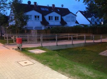
![Excursión A pie Desconocido - [S1] Um den Syberg - Photo](https://media.geolcdn.com/t/350/260/3858086d-bf9c-479b-9500-35a9a92851a8.jpeg&format=jpg&maxdim=2)
![A pie A pie](https://static1.geolcdn.com/sitytour/trail-icons/100.png)
Km
A pie
![](/images/other/stat-length.png)
![](https://static1.geolcdn.com/siteimages/upload/files/1508320355ic_sort_den_pos_24dp.png)
![](https://static1.geolcdn.com/siteimages/upload/files/1508320355ic_sort_den_neg_24dp.png)
![](https://static1.geolcdn.com/siteimages/upload/files/16400158638029165_repeat_loop_refresh_sync_direction_icon.png)
• Trail created by Sauerländischer Gebirgsverein Bezirk Dortmund Ardey.
![Excursión A pie Desconocido - Sechs Profile, ein Gesicht - Photo](https://media.geolcdn.com/t/350/260/a8287a5f-bc36-409b-8efc-eccc305eeab0.jpeg&format=jpg&maxdim=2)
![A pie A pie](https://static1.geolcdn.com/sitytour/trail-icons/100.png)
Km
A pie
![](/images/other/stat-length.png)
![](https://static1.geolcdn.com/siteimages/upload/files/1508320355ic_sort_den_pos_24dp.png)
![](https://static1.geolcdn.com/siteimages/upload/files/1508320355ic_sort_den_neg_24dp.png)
![](https://static1.geolcdn.com/siteimages/upload/files/16400158638029165_repeat_loop_refresh_sync_direction_icon.png)
• Trail created by Sauerländischer Gebirgsverein Bezirk Dortmund Ardey.
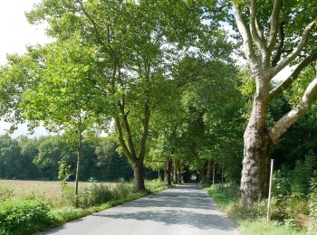
![Excursión A pie Desconocido - [S3] Klusenbergrundweg - Photo](https://media.geolcdn.com/t/350/260/48a0ef8e-3704-4b57-a4cf-02a57ebc2595.jpeg&format=jpg&maxdim=2)
![A pie A pie](https://static1.geolcdn.com/sitytour/trail-icons/100.png)
Km
A pie
![](/images/other/stat-length.png)
![](https://static1.geolcdn.com/siteimages/upload/files/1508320355ic_sort_den_pos_24dp.png)
![](https://static1.geolcdn.com/siteimages/upload/files/1508320355ic_sort_den_neg_24dp.png)
![](https://static1.geolcdn.com/siteimages/upload/files/16400158638029165_repeat_loop_refresh_sync_direction_icon.png)
• Trail created by Sauerländischer Gebirgsverein Bezirk Dortmund Ardey.
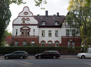
![Excursión A pie Desconocido - [S2] Klusenberghangweg - Photo](https://media.geolcdn.com/t/350/260/5f1f8fb9-4492-4816-a6a6-b31bfc037ad3.jpeg&format=jpg&maxdim=2)
![A pie A pie](https://static1.geolcdn.com/sitytour/trail-icons/100.png)
Km
A pie
![](/images/other/stat-length.png)
![](https://static1.geolcdn.com/siteimages/upload/files/1508320355ic_sort_den_pos_24dp.png)
![](https://static1.geolcdn.com/siteimages/upload/files/1508320355ic_sort_den_neg_24dp.png)
![](https://static1.geolcdn.com/siteimages/upload/files/16400158638029165_repeat_loop_refresh_sync_direction_icon.png)
• Trail created by Sauerländischer Gebirgsverein Bezirk Dortmund Ardey.
20 excursiones mostradas en 24
Aplicación GPS de excursión GRATIS