


29 km | 35 km-effort
Eschweiler: Descubra las mejores excursiones: 8 a pie. Todos estos circuitos, recorridos, itinerarios y actividades al aire libre están disponibles en nuestras aplicaciones SityTrail para smartphone y tablet.

A pie


• Trail created by Eifelverein Eschweiler. Symbol: schwarze 5 auf weissem Grund
A pie
• Trail created by Eifelverein Eschweiler. Auf Wanderkarten des Eifelvereins seit 2014 nicht mehr enthalten Symbol: s...
A pie
• Trail created by Eifelverein Eschweiler. Auf Wanderkarten des Eifelvereins seit 2014 nicht mehr enthalten Symbol: s...
A pie
A pie
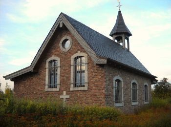
• Trail created by Förderverein Gedächtniskapelle Kirchspiel Lohn e.V.. Symbol: Blau/Grün umrandetes Sechseck mit Text...
A pie
• Trail created by Förderverein Gedächtniskapelle Kirchspiel Lohn e.V.. Symbol: Blau/Grün umrandetes Sechseck mit Text...

Senderismo
Senderismo
8 excursiones mostradas en 8
Aplicación GPS de excursión GRATIS
 SityTrail
IGN / Institutos geográficos
SityTrail World
El mundo es suyo