![](/images/other/stat-length.png)
- Excursiones
- Outdoor
- Germany
- Renania del Norte-Westfalia
- Kreis Siegen-Wittgenstein
Kreis Siegen-Wittgenstein, Renania del Norte-Westfalia: Los mejores itinerarios de excursión, recorridos, paseos y sendas
Kreis Siegen-Wittgenstein: Descubra las mejores excursiones: 102 a pie. Todos estos circuitos, recorridos, itinerarios y actividades al aire libre están disponibles en nuestras aplicaciones SityTrail para smartphone y tablet.
Los mejores recorridos (102)
![Excursión A pie Bad Berleburg - westlicher Rothaarsteig-Zuweg Bad Berleburg - Photo](https://media.geolcdn.com/t/350/260/fa125998-2caa-4393-aaff-ac83a075ba7d.jpeg&format=jpg&maxdim=2)
![A pie A pie](https://static1.geolcdn.com/sitytour/trail-icons/100.png)
Km
A pie
![](/images/other/stat-length.png)
![](https://static1.geolcdn.com/siteimages/upload/files/1508320355ic_sort_den_pos_24dp.png)
![](https://static1.geolcdn.com/siteimages/upload/files/1508320355ic_sort_den_neg_24dp.png)
![](https://static1.geolcdn.com/siteimages/upload/files/16400158638029165_repeat_loop_refresh_sync_direction_icon.png)
• Trail created by Rothaarsteigverein.
![Excursión A pie Bad Berleburg - östlicher Rothaarsteig-Zuweg Bad Berleburg - Photo](https://media.geolcdn.com/t/350/260/fa125998-2caa-4393-aaff-ac83a075ba7d.jpeg&format=jpg&maxdim=2)
![A pie A pie](https://static1.geolcdn.com/sitytour/trail-icons/100.png)
Km
A pie
![](/images/other/stat-length.png)
![](https://static1.geolcdn.com/siteimages/upload/files/1508320355ic_sort_den_pos_24dp.png)
![](https://static1.geolcdn.com/siteimages/upload/files/1508320355ic_sort_den_neg_24dp.png)
![](https://static1.geolcdn.com/siteimages/upload/files/16400158638029165_repeat_loop_refresh_sync_direction_icon.png)
• Trail created by Rothaarsteigverein.
![Excursión A pie Kreuztal - Historischer Rundweg A2 - Photo](https://media.geolcdn.com/t/350/260/8d2c2a1d-04c4-4946-aac5-5f1e613070c0.jpeg&format=jpg&maxdim=2)
![A pie A pie](https://static1.geolcdn.com/sitytour/trail-icons/100.png)
Km
A pie
![](/images/other/stat-length.png)
![](https://static1.geolcdn.com/siteimages/upload/files/1508320355ic_sort_den_pos_24dp.png)
![](https://static1.geolcdn.com/siteimages/upload/files/1508320355ic_sort_den_neg_24dp.png)
![](https://static1.geolcdn.com/siteimages/upload/files/16400158638029165_repeat_loop_refresh_sync_direction_icon.png)
• Trail created by Sauerländischer Gebirgsverein Abteilung Krombach. Symbol: weißer Text A2
![Excursión A pie Bad Berleburg - Hallenberg Rundweg H5 Grenzweg - Photo](https://media.geolcdn.com/t/350/260/af454e4b-c0ce-4bd8-8736-e8e30868c2db.jpeg&format=jpg&maxdim=2)
![A pie A pie](https://static1.geolcdn.com/sitytour/trail-icons/100.png)
Km
A pie
![](/images/other/stat-length.png)
![](https://static1.geolcdn.com/siteimages/upload/files/1508320355ic_sort_den_pos_24dp.png)
![](https://static1.geolcdn.com/siteimages/upload/files/1508320355ic_sort_den_neg_24dp.png)
![](https://static1.geolcdn.com/siteimages/upload/files/16400158638029165_repeat_loop_refresh_sync_direction_icon.png)
• Trail created by Sauerländischer Gebirgsverein (SGV).
![Excursión A pie Hilchenbach - Kalorienpfad - Photo](https://media.geolcdn.com/t/350/260/9550eaf3-03b2-456f-beeb-d1874be36fe7.jpeg&format=jpg&maxdim=2)
![A pie A pie](https://static1.geolcdn.com/sitytour/trail-icons/100.png)
Km
A pie
![](/images/other/stat-length.png)
![](https://static1.geolcdn.com/siteimages/upload/files/1508320355ic_sort_den_pos_24dp.png)
![](https://static1.geolcdn.com/siteimages/upload/files/1508320355ic_sort_den_neg_24dp.png)
![](https://static1.geolcdn.com/siteimages/upload/files/16400158638029165_repeat_loop_refresh_sync_direction_icon.png)
• Trail created by Sauerländischer Gebirgsverein. Symbol: Eine Art "liegendes S im Kreis"
![Excursión A pie Wilnsdorf - Auf Bergmannspfaden - Photo](https://media.geolcdn.com/t/350/260/371a93d2-a99f-4c23-af34-75110e2dd7d9.jpeg&format=jpg&maxdim=2)
![A pie A pie](https://static1.geolcdn.com/sitytour/trail-icons/100.png)
Km
A pie
![](/images/other/stat-length.png)
![](https://static1.geolcdn.com/siteimages/upload/files/1508320355ic_sort_den_pos_24dp.png)
![](https://static1.geolcdn.com/siteimages/upload/files/1508320355ic_sort_den_neg_24dp.png)
![](https://static1.geolcdn.com/siteimages/upload/files/16400158638029165_repeat_loop_refresh_sync_direction_icon.png)
• Trail created by Sauerländischer Gebirgsverein. Symbol: Eine Art "liegendes S im Kreis"
![Excursión A pie Bad Berleburg - Naturfreundeweg Girkhausen - Mollseifen - Photo](https://media.geolcdn.com/t/350/260/7182370a-4bfe-4553-8b23-16ab6c901e23.jpeg&format=jpg&maxdim=2)
![A pie A pie](https://static1.geolcdn.com/sitytour/trail-icons/100.png)
Km
A pie
![](/images/other/stat-length.png)
![](https://static1.geolcdn.com/siteimages/upload/files/1508320355ic_sort_den_pos_24dp.png)
![](https://static1.geolcdn.com/siteimages/upload/files/1508320355ic_sort_den_neg_24dp.png)
![](https://static1.geolcdn.com/siteimages/upload/files/16400158638029165_repeat_loop_refresh_sync_direction_icon.png)
• Trail created by Naturfreunde.
![Excursión A pie Kreuztal - Littfeld über Kreuzbank zum Altenberg - Photo](https://media.geolcdn.com/t/350/260/98981978-02c5-4787-95cc-e5db6458547d.jpeg&format=jpg&maxdim=2)
![A pie A pie](https://static1.geolcdn.com/sitytour/trail-icons/100.png)
Km
A pie
![](/images/other/stat-length.png)
![](https://static1.geolcdn.com/siteimages/upload/files/1508320355ic_sort_den_pos_24dp.png)
![](https://static1.geolcdn.com/siteimages/upload/files/1508320355ic_sort_den_neg_24dp.png)
![](https://static1.geolcdn.com/siteimages/upload/files/16400158638029165_repeat_loop_refresh_sync_direction_icon.png)
• Trail created by Sauerländischer Gebirgsverein Abteilung Littfeld.
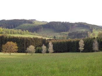
![Excursión A pie Hilchenbach - Jung-Stilling-Rundweg - Photo](https://media.geolcdn.com/t/350/260/41f1a15c-e71c-4995-8a51-2d4f5d1565c3.jpeg&format=jpg&maxdim=2)
![A pie A pie](https://static1.geolcdn.com/sitytour/trail-icons/100.png)
Km
A pie
![](/images/other/stat-length.png)
![](https://static1.geolcdn.com/siteimages/upload/files/1508320355ic_sort_den_pos_24dp.png)
![](https://static1.geolcdn.com/siteimages/upload/files/1508320355ic_sort_den_neg_24dp.png)
![](https://static1.geolcdn.com/siteimages/upload/files/16400158638029165_repeat_loop_refresh_sync_direction_icon.png)
• Trail created by Heimatverein Grund. Symbol: Weißer Kreis mit weißem J auf schwarzem Hintergrund
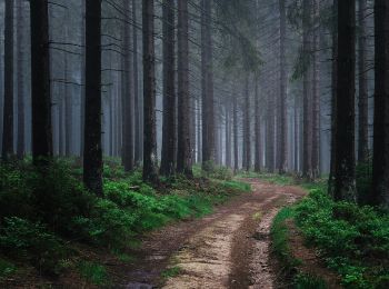
![Excursión A pie Hilchenbach - Sonnenhang Rundweg A1 - Photo](https://media.geolcdn.com/t/350/260/c78b0dad-364d-492a-bc08-0264dfd25c4e.jpeg&format=jpg&maxdim=2)
![A pie A pie](https://static1.geolcdn.com/sitytour/trail-icons/100.png)
Km
A pie
![](/images/other/stat-length.png)
![](https://static1.geolcdn.com/siteimages/upload/files/1508320355ic_sort_den_pos_24dp.png)
![](https://static1.geolcdn.com/siteimages/upload/files/1508320355ic_sort_den_neg_24dp.png)
![](https://static1.geolcdn.com/siteimages/upload/files/16400158638029165_repeat_loop_refresh_sync_direction_icon.png)
• Symbol: Weißes A1 auf schwarzem Grund
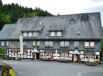
![Excursión A pie Bad Berleburg - Doppelbalken Latrop - Wingeshausen - Photo](https://media.geolcdn.com/t/350/260/f2ed0de9-f834-46b4-95c7-f614332ed1de.jpeg&format=jpg&maxdim=2)
![A pie A pie](https://static1.geolcdn.com/sitytour/trail-icons/100.png)
Km
A pie
![](/images/other/stat-length.png)
![](https://static1.geolcdn.com/siteimages/upload/files/1508320355ic_sort_den_pos_24dp.png)
![](https://static1.geolcdn.com/siteimages/upload/files/1508320355ic_sort_den_neg_24dp.png)
![](https://static1.geolcdn.com/siteimages/upload/files/16400158638029165_repeat_loop_refresh_sync_direction_icon.png)
• Symbol: Weißes Gleichheitszeichen auf schwarzem Grund
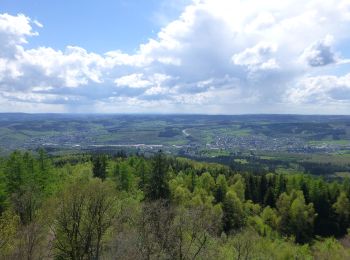
![Excursión A pie Hilchenbach - Müsen Rundweg A1 - Photo](https://media.geolcdn.com/t/350/260/dbf71cb9-2d14-406d-a639-4a36d37963a9.jpeg&format=jpg&maxdim=2)
![A pie A pie](https://static1.geolcdn.com/sitytour/trail-icons/100.png)
Km
A pie
![](/images/other/stat-length.png)
![](https://static1.geolcdn.com/siteimages/upload/files/1508320355ic_sort_den_pos_24dp.png)
![](https://static1.geolcdn.com/siteimages/upload/files/1508320355ic_sort_den_neg_24dp.png)
![](https://static1.geolcdn.com/siteimages/upload/files/16400158638029165_repeat_loop_refresh_sync_direction_icon.png)
• Symbol: A1
![Excursión A pie Hilchenbach - Giller Rundwanderweg A3 - Photo](https://media.geolcdn.com/t/350/260/a4642d2f-c544-4c8a-8da0-a8c838b1eedf.jpeg&format=jpg&maxdim=2)
![A pie A pie](https://static1.geolcdn.com/sitytour/trail-icons/100.png)
Km
A pie
![](/images/other/stat-length.png)
![](https://static1.geolcdn.com/siteimages/upload/files/1508320355ic_sort_den_pos_24dp.png)
![](https://static1.geolcdn.com/siteimages/upload/files/1508320355ic_sort_den_neg_24dp.png)
![](https://static1.geolcdn.com/siteimages/upload/files/16400158638029165_repeat_loop_refresh_sync_direction_icon.png)
• Symbol: Weißes A3 auf schwarzem Grund
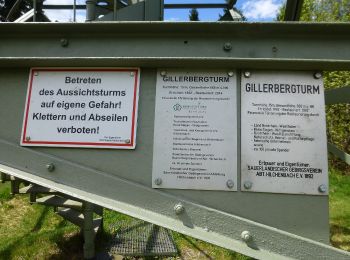
![Excursión A pie Hilchenbach - Giller Rundwanderweg A2 - Photo](https://media.geolcdn.com/t/350/260/a4642d2f-c544-4c8a-8da0-a8c838b1eedf.jpeg&format=jpg&maxdim=2)
![A pie A pie](https://static1.geolcdn.com/sitytour/trail-icons/100.png)
Km
A pie
![](/images/other/stat-length.png)
![](https://static1.geolcdn.com/siteimages/upload/files/1508320355ic_sort_den_pos_24dp.png)
![](https://static1.geolcdn.com/siteimages/upload/files/1508320355ic_sort_den_neg_24dp.png)
![](https://static1.geolcdn.com/siteimages/upload/files/16400158638029165_repeat_loop_refresh_sync_direction_icon.png)
• Symbol: Weißes A2 auf schwarzem Grund
![Excursión A pie Hilchenbach - Kindelsbergpfad - Photo](https://media.geolcdn.com/t/350/260/dbf71cb9-2d14-406d-a639-4a36d37963a9.jpeg&format=jpg&maxdim=2)
![A pie A pie](https://static1.geolcdn.com/sitytour/trail-icons/100.png)
Km
A pie
![](/images/other/stat-length.png)
![](https://static1.geolcdn.com/siteimages/upload/files/1508320355ic_sort_den_pos_24dp.png)
![](https://static1.geolcdn.com/siteimages/upload/files/1508320355ic_sort_den_neg_24dp.png)
![](https://static1.geolcdn.com/siteimages/upload/files/16400158638029165_repeat_loop_refresh_sync_direction_icon.png)
• FIXME: mit kleiner Lücke, wie Alternativrouten / Abstecher? Symbol: Eine Art "liegendes S im Kreis"
![Excursión A pie Siegen - Historischer Rundweg Achenbach - Photo](https://media.geolcdn.com/t/350/260/ba96490b-5501-48d0-a4d0-a0cc4900cf67.jpeg&format=jpg&maxdim=2)
![A pie A pie](https://static1.geolcdn.com/sitytour/trail-icons/100.png)
Km
A pie
![](/images/other/stat-length.png)
![](https://static1.geolcdn.com/siteimages/upload/files/1508320355ic_sort_den_pos_24dp.png)
![](https://static1.geolcdn.com/siteimages/upload/files/1508320355ic_sort_den_neg_24dp.png)
![](https://static1.geolcdn.com/siteimages/upload/files/16400158638029165_repeat_loop_refresh_sync_direction_icon.png)
• Teil der Wanderhöhepunkte links und rechts des Rothaarsteigs Symbol: Hügelkette im Kreis
![Excursión A pie Bad Berleburg - westlicher Rothaarsteig-Zuweg Aue-Wingeshausen - Photo](https://media.geolcdn.com/t/350/260/d7df5311-d294-440f-8a2c-559365cc50f3.jpeg&format=jpg&maxdim=2)
![A pie A pie](https://static1.geolcdn.com/sitytour/trail-icons/100.png)
Km
A pie
![](/images/other/stat-length.png)
![](https://static1.geolcdn.com/siteimages/upload/files/1508320355ic_sort_den_pos_24dp.png)
![](https://static1.geolcdn.com/siteimages/upload/files/1508320355ic_sort_den_neg_24dp.png)
![](https://static1.geolcdn.com/siteimages/upload/files/16400158638029165_repeat_loop_refresh_sync_direction_icon.png)
• Trail created by Rothaarsteigverein.
![Excursión A pie Hilchenbach - nördlicher Rothaarsteig-Zuweg Hilchenbach - Photo](https://media.geolcdn.com/t/350/260/c49b7fa8-4542-4d9f-ad1e-c6440627ce5e.jpeg&format=jpg&maxdim=2)
![A pie A pie](https://static1.geolcdn.com/sitytour/trail-icons/100.png)
Km
A pie
![](/images/other/stat-length.png)
![](https://static1.geolcdn.com/siteimages/upload/files/1508320355ic_sort_den_pos_24dp.png)
![](https://static1.geolcdn.com/siteimages/upload/files/1508320355ic_sort_den_neg_24dp.png)
![](https://static1.geolcdn.com/siteimages/upload/files/16400158638029165_repeat_loop_refresh_sync_direction_icon.png)
• Trail created by Rothaarsteigverein.
![Excursión A pie Bad Berleburg - WaldSkulpturenWeg - Wittgenstein-Sauerland - Photo](https://media.geolcdn.com/t/350/260/fa125998-2caa-4393-aaff-ac83a075ba7d.jpeg&format=jpg&maxdim=2)
![A pie A pie](https://static1.geolcdn.com/sitytour/trail-icons/100.png)
Km
A pie
![](/images/other/stat-length.png)
![](https://static1.geolcdn.com/siteimages/upload/files/1508320355ic_sort_den_pos_24dp.png)
![](https://static1.geolcdn.com/siteimages/upload/files/1508320355ic_sort_den_neg_24dp.png)
![](https://static1.geolcdn.com/siteimages/upload/files/16400158638029165_repeat_loop_refresh_sync_direction_icon.png)
• Erleben Sie schwingende Landschaften und Erholung pur im Schmallenberger Sauerland und der Ferienregion Eslohe. Ob Wa...
![Excursión A pie Siegen - Niederfischbach Rundweg N13 - Photo](https://media.geolcdn.com/t/350/260/66e72e8d-dbd4-4ecb-84ac-21d2d61e27a3.jpeg&format=jpg&maxdim=2)
![A pie A pie](https://static1.geolcdn.com/sitytour/trail-icons/100.png)
Km
A pie
![](/images/other/stat-length.png)
![](https://static1.geolcdn.com/siteimages/upload/files/1508320355ic_sort_den_pos_24dp.png)
![](https://static1.geolcdn.com/siteimages/upload/files/1508320355ic_sort_den_neg_24dp.png)
![](https://static1.geolcdn.com/siteimages/upload/files/16400158638029165_repeat_loop_refresh_sync_direction_icon.png)
• Symbol: Weißes "N13" auf blauem Grund
20 excursiones mostradas en 102
Aplicación GPS de excursión GRATIS