![](/images/other/stat-length.png)
- Excursiones
- Outdoor
- Germany
- Baden-Wurtemberg
- Ortenaukreis
- Lahr/Schwarzwald
Lahr/Schwarzwald, Ortenaukreis: Los mejores itinerarios de excursión, recorridos, paseos y sendas
Lahr/Schwarzwald: Descubra las mejores excursiones: 6 a pie y 1 en bici o bici de montaña. Todos estos circuitos, recorridos, itinerarios y actividades al aire libre están disponibles en nuestras aplicaciones SityTrail para smartphone y tablet.
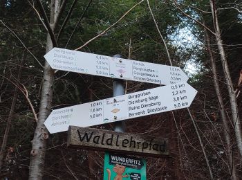
Los mejores recorridos (7)
![Excursión Senderismo Lahr/Schwarzwald - suuntoapp-Hiking-2024-04-01T08-10-15Z - Photo](https://media.geolcdn.com/t/350/260/10059e06-b36e-4a5b-8ab2-d9bfde83146b.jpg&format=jpg&maxdim=2)
![Senderismo Senderismo](https://static1.geolcdn.com/sitytour/trail-icons/101.png)
Km
Senderismo
![](/images/other/stat-length.png)
![](https://static1.geolcdn.com/siteimages/upload/files/1508320355ic_sort_den_pos_24dp.png)
![](https://static1.geolcdn.com/siteimages/upload/files/1508320355ic_sort_den_neg_24dp.png)
![](https://static1.geolcdn.com/siteimages/upload/files/16400158638029165_repeat_loop_refresh_sync_direction_icon.png)
![Excursión A pie Lahr/Schwarzwald - Beim dreieckigen Bannstein- Grüner Platz - Photo](https://media.geolcdn.com/t/350/260/79181245-e7b3-4454-bbd9-616e737fb39e.jpeg&format=jpg&maxdim=2)
![A pie A pie](https://static1.geolcdn.com/sitytour/trail-icons/100.png)
Km
A pie
![](/images/other/stat-length.png)
![](https://static1.geolcdn.com/siteimages/upload/files/1508320355ic_sort_den_pos_24dp.png)
![](https://static1.geolcdn.com/siteimages/upload/files/1508320355ic_sort_den_neg_24dp.png)
![](https://static1.geolcdn.com/siteimages/upload/files/16400158638029165_repeat_loop_refresh_sync_direction_icon.png)
• Trail created by Schwarzwaldverein. Symbol: Gelbe Raute auf weißem Grund
![Excursión A pie Lahr/Schwarzwald - Lahr Erneteck - Dreieckiger Bannstein - Photo](https://media.geolcdn.com/t/350/260/79181245-e7b3-4454-bbd9-616e737fb39e.jpeg&format=jpg&maxdim=2)
![A pie A pie](https://static1.geolcdn.com/sitytour/trail-icons/100.png)
Km
A pie
![](/images/other/stat-length.png)
![](https://static1.geolcdn.com/siteimages/upload/files/1508320355ic_sort_den_pos_24dp.png)
![](https://static1.geolcdn.com/siteimages/upload/files/1508320355ic_sort_den_neg_24dp.png)
![](https://static1.geolcdn.com/siteimages/upload/files/16400158638029165_repeat_loop_refresh_sync_direction_icon.png)
• Trail created by Schwarzwaldverein. Symbol: Gelbe Raute auf weißem Grund
![Excursión A pie Lahr/Schwarzwald - Lahr - Pionierstein - Photo](https://media.geolcdn.com/t/350/260/861411a4-8bfc-4d5e-8f45-1f7108eba35b.jpeg&format=jpg&maxdim=2)
![A pie A pie](https://static1.geolcdn.com/sitytour/trail-icons/100.png)
Km
A pie
![](/images/other/stat-length.png)
![](https://static1.geolcdn.com/siteimages/upload/files/1508320355ic_sort_den_pos_24dp.png)
![](https://static1.geolcdn.com/siteimages/upload/files/1508320355ic_sort_den_neg_24dp.png)
![](https://static1.geolcdn.com/siteimages/upload/files/16400158638029165_repeat_loop_refresh_sync_direction_icon.png)
• Trail created by Schwarzwaldverein. Symbol: Blaue Raute auf weißem Grund
![Excursión A pie Lahr/Schwarzwald - Lahr - Elzach - Photo](https://media.geolcdn.com/t/350/260/78ac5f7f-6ae6-41d1-9555-9ace7b2ea966.jpeg&format=jpg&maxdim=2)
![A pie A pie](https://static1.geolcdn.com/sitytour/trail-icons/100.png)
Km
A pie
![](/images/other/stat-length.png)
![](https://static1.geolcdn.com/siteimages/upload/files/1508320355ic_sort_den_pos_24dp.png)
![](https://static1.geolcdn.com/siteimages/upload/files/1508320355ic_sort_den_neg_24dp.png)
![](https://static1.geolcdn.com/siteimages/upload/files/16400158638029165_repeat_loop_refresh_sync_direction_icon.png)
• Trail created by Schwarzwaldverein. Symbol: Blaue Raute auf weißem Grund
![Excursión A pie Lahr/Schwarzwald - Lahr - Diersburg - Photo](https://media.geolcdn.com/t/350/260/18b17998-8037-46a8-90eb-2584179e0447.jpeg&format=jpg&maxdim=2)
![A pie A pie](https://static1.geolcdn.com/sitytour/trail-icons/100.png)
Km
A pie
![](/images/other/stat-length.png)
![](https://static1.geolcdn.com/siteimages/upload/files/1508320355ic_sort_den_pos_24dp.png)
![](https://static1.geolcdn.com/siteimages/upload/files/1508320355ic_sort_den_neg_24dp.png)
![](https://static1.geolcdn.com/siteimages/upload/files/16400158638029165_repeat_loop_refresh_sync_direction_icon.png)
• Trail created by Schwarzwaldverein. Symbol: Blaue Raute auf weißem Grund
![Excursión Bici de carretera Lahr/Schwarzwald - LAHR GUTACH - Photo](https://media.geolcdn.com/t/350/260/ext.jpg?maxdim=2&url=https%3A%2F%2Fstatic1.geolcdn.com%2Fsiteimages%2Fupload%2Ffiles%2F1524743154velo.jpg)
![Bici de carretera Bici de carretera](https://static1.geolcdn.com/sitytour/trail-icons/201.png)
Km
Bici de carretera
![](/images/other/stat-length.png)
![](https://static1.geolcdn.com/siteimages/upload/files/1508320355ic_sort_den_pos_24dp.png)
![](https://static1.geolcdn.com/siteimages/upload/files/1508320355ic_sort_den_neg_24dp.png)
![](https://static1.geolcdn.com/siteimages/upload/files/16400158638029165_repeat_loop_refresh_sync_direction_icon.png)
7 excursiones mostradas en 7
Aplicación GPS de excursión GRATIS