![](/images/other/stat-length.png)
Igersheim, Main-Tauber-Kreis: Los mejores itinerarios de excursión, recorridos, paseos y sendas
Igersheim: Descubra las mejores excursiones: 5 a pie. Todos estos circuitos, recorridos, itinerarios y actividades al aire libre están disponibles en nuestras aplicaciones SityTrail para smartphone y tablet.
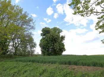
Los mejores recorridos (5)
![Excursión A pie Igersheim - Rundwanderweg Igersheim 56 - Photo](https://media.geolcdn.com/t/350/260/b1bffefa-cfc6-4b09-8649-35eb87e06b00.jpeg&format=jpg&maxdim=2)
![A pie A pie](https://static1.geolcdn.com/sitytour/trail-icons/100.png)
Km
A pie
![](/images/other/stat-length.png)
![](https://static1.geolcdn.com/siteimages/upload/files/1508320355ic_sort_den_pos_24dp.png)
![](https://static1.geolcdn.com/siteimages/upload/files/1508320355ic_sort_den_neg_24dp.png)
![](https://static1.geolcdn.com/siteimages/upload/files/16400158638029165_repeat_loop_refresh_sync_direction_icon.png)
• Symbol: Gelbes Schild mit schwarzer 56 (Zusatz Gemeinde Igersheim)
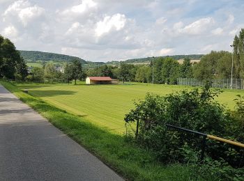
![Excursión A pie Igersheim - Rundwanderweg Igersheim 54 - Photo](https://media.geolcdn.com/t/350/260/b7c8e323-a5fc-46ba-bcb0-9eece59fa630.jpeg&format=jpg&maxdim=2)
![A pie A pie](https://static1.geolcdn.com/sitytour/trail-icons/100.png)
Km
A pie
![](/images/other/stat-length.png)
![](https://static1.geolcdn.com/siteimages/upload/files/1508320355ic_sort_den_pos_24dp.png)
![](https://static1.geolcdn.com/siteimages/upload/files/1508320355ic_sort_den_neg_24dp.png)
![](https://static1.geolcdn.com/siteimages/upload/files/16400158638029165_repeat_loop_refresh_sync_direction_icon.png)
• Symbol: Gelbes Schild mit schwarzer 54 (Zusatz Gemeinde Igersheim)
![Excursión A pie Igersheim - Rundwanderweg Igersheim 52 - Photo](https://media.geolcdn.com/t/350/260/b7c8e323-a5fc-46ba-bcb0-9eece59fa630.jpeg&format=jpg&maxdim=2)
![A pie A pie](https://static1.geolcdn.com/sitytour/trail-icons/100.png)
Km
A pie
![](/images/other/stat-length.png)
![](https://static1.geolcdn.com/siteimages/upload/files/1508320355ic_sort_den_pos_24dp.png)
![](https://static1.geolcdn.com/siteimages/upload/files/1508320355ic_sort_den_neg_24dp.png)
![](https://static1.geolcdn.com/siteimages/upload/files/16400158638029165_repeat_loop_refresh_sync_direction_icon.png)
• Symbol: Gelbes Schild mit schwarzer 52 (Zusatz Gemeinde Igersheim)
![Excursión A pie Igersheim - Rundwanderweg Igersheim 51 - Photo](https://media.geolcdn.com/t/350/260/a6ff97eb-042a-477c-bdbf-39604203cbf6.jpeg&format=jpg&maxdim=2)
![A pie A pie](https://static1.geolcdn.com/sitytour/trail-icons/100.png)
Km
A pie
![](/images/other/stat-length.png)
![](https://static1.geolcdn.com/siteimages/upload/files/1508320355ic_sort_den_pos_24dp.png)
![](https://static1.geolcdn.com/siteimages/upload/files/1508320355ic_sort_den_neg_24dp.png)
![](https://static1.geolcdn.com/siteimages/upload/files/16400158638029165_repeat_loop_refresh_sync_direction_icon.png)
• Symbol: Gelbes Schild mit schwarzer 51 (Zusatz Gemeinde Igersheim)
![Excursión A pie Igersheim - Rundwanderweg Igersheim 57 - Photo](https://media.geolcdn.com/t/350/260/ext.jpg?maxdim=2&url=https%3A%2F%2Fstatic1.geolcdn.com%2Fsiteimages%2Fupload%2Ffiles%2F1545311037marcheuse_200dpi.jpg)
![A pie A pie](https://static1.geolcdn.com/sitytour/trail-icons/100.png)
Km
A pie
![](/images/other/stat-length.png)
![](https://static1.geolcdn.com/siteimages/upload/files/1508320355ic_sort_den_pos_24dp.png)
![](https://static1.geolcdn.com/siteimages/upload/files/1508320355ic_sort_den_neg_24dp.png)
![](https://static1.geolcdn.com/siteimages/upload/files/16400158638029165_repeat_loop_refresh_sync_direction_icon.png)
• Symbol: Gelbes Schild mit schwarzer 57 (Zusatz Gemeinde Igersheim)
5 excursiones mostradas en 5
Aplicación GPS de excursión GRATIS