![](/images/other/stat-length.png)
Reichental, Gernsbach: Los mejores itinerarios de excursión, recorridos, paseos y sendas
Reichental: Descubra las mejores excursiones: 3 a pie. Todos estos circuitos, recorridos, itinerarios y actividades al aire libre están disponibles en nuestras aplicaciones SityTrail para smartphone y tablet.
Los mejores recorridos (4)
![Excursión A pie Gernsbach - Orgelfelsenhaus-Teufelsmühle - Photo](https://media.geolcdn.com/t/350/260/e9d5d20a-a27c-4330-84a4-dc94b22c0093.jpeg&format=jpg&maxdim=2)
![A pie A pie](https://static1.geolcdn.com/sitytour/trail-icons/100.png)
Km
A pie
![](/images/other/stat-length.png)
![](https://static1.geolcdn.com/siteimages/upload/files/1508320355ic_sort_den_pos_24dp.png)
![](https://static1.geolcdn.com/siteimages/upload/files/1508320355ic_sort_den_neg_24dp.png)
![](https://static1.geolcdn.com/siteimages/upload/files/16400158638029165_repeat_loop_refresh_sync_direction_icon.png)
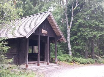
• Trail created by Schwarzwaldverein. Symbol: Gelbe Raute auf weißem Grund
![Excursión A pie Gernsbach - Naturerlebnisweg Kaltenbronn - Photo](https://media.geolcdn.com/t/350/260/5abeb0a5-14eb-4923-a9ca-7d878e1f579c.jpeg&format=jpg&maxdim=2)
![A pie A pie](https://static1.geolcdn.com/sitytour/trail-icons/100.png)
Km
A pie
![](/images/other/stat-length.png)
![](https://static1.geolcdn.com/siteimages/upload/files/1508320355ic_sort_den_pos_24dp.png)
![](https://static1.geolcdn.com/siteimages/upload/files/1508320355ic_sort_den_neg_24dp.png)
![](https://static1.geolcdn.com/siteimages/upload/files/16400158638029165_repeat_loop_refresh_sync_direction_icon.png)
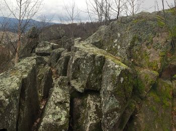
• Trail created by Infozentrum Kaltenbronn. Die Wegweiser sind gemeisselte Steine, deshalb gibts kein Farbschema. Sym...
![Excursión A pie Gernsbach - Rundweg Nr. 1 - Grünhütten-Rundweg - Photo](https://media.geolcdn.com/t/350/260/7fcc4a4c-c1cf-45e1-a893-e8b90459f9e9.jpeg&format=jpg&maxdim=2)
![A pie A pie](https://static1.geolcdn.com/sitytour/trail-icons/100.png)
Km
A pie
![](/images/other/stat-length.png)
![](https://static1.geolcdn.com/siteimages/upload/files/1508320355ic_sort_den_pos_24dp.png)
![](https://static1.geolcdn.com/siteimages/upload/files/1508320355ic_sort_den_neg_24dp.png)
![](https://static1.geolcdn.com/siteimages/upload/files/16400158638029165_repeat_loop_refresh_sync_direction_icon.png)
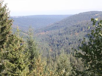
• Trail created by Infozentrum Kaltenbronn. Symbol: Weißes Quadrat, mit dünner lila Linie umrahmt. Große schwarze 1 in...
![Excursión Otra actividad Gernsbach - Kaltenbronn - Wilde - Gruenhuette - Photo](https://media.geolcdn.com/t/350/260/ext.jpg?maxdim=2&url=https%3A%2F%2Fservices.sitytrail.com%2FGeolivesWS%2FDownloadMedia.ashx%3FTrailID%3D613348%26Media%3Dfix__20160812124451.jpg)
![Otra actividad Otra actividad](https://static1.geolcdn.com/sitytour/trail-icons/900.png)
Km
Otra actividad
![](/images/other/stat-length.png)
![](https://static1.geolcdn.com/siteimages/upload/files/1508320355ic_sort_den_pos_24dp.png)
![](https://static1.geolcdn.com/siteimages/upload/files/1508320355ic_sort_den_neg_24dp.png)
![](https://static1.geolcdn.com/siteimages/upload/files/16400158638029165_repeat_loop_refresh_sync_direction_icon.png)
4 excursiones mostradas en 4
Aplicación GPS de excursión GRATIS