![](/images/other/stat-length.png)
- Excursiones
- Outdoor
- Germany
- Baviera
- Landkreis Neumarkt in der Oberpfalz
Landkreis Neumarkt in der Oberpfalz, Baviera: Los mejores itinerarios de excursión, recorridos, paseos y sendas
Landkreis Neumarkt in der Oberpfalz: Descubra las mejores excursiones: 78 a pie. Todos estos circuitos, recorridos, itinerarios y actividades al aire libre están disponibles en nuestras aplicaciones SityTrail para smartphone y tablet.
Los mejores recorridos (78)
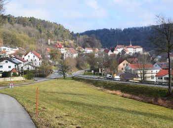
![Excursión A pie Berching - Wasser- und Mühlenweg - Photo](https://media.geolcdn.com/t/350/260/0f30577b-cb8c-433c-9898-83c9e06a4cab.jpeg&format=jpg&maxdim=2)
![A pie A pie](https://static1.geolcdn.com/sitytour/trail-icons/100.png)
Km
A pie
![](/images/other/stat-length.png)
![](https://static1.geolcdn.com/siteimages/upload/files/1508320355ic_sort_den_pos_24dp.png)
![](https://static1.geolcdn.com/siteimages/upload/files/1508320355ic_sort_den_neg_24dp.png)
![](https://static1.geolcdn.com/siteimages/upload/files/16400158638029165_repeat_loop_refresh_sync_direction_icon.png)
• Trail created by Landkreis Neumarkt i.d.OPf.. Symbol: braunes Mühlrad auf gelben Grund
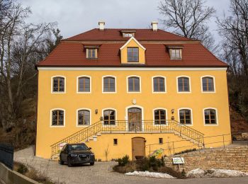
![Excursión A pie Mühlhausen - Sulzbürger Wanderweg Nr. 1 - Photo](https://media.geolcdn.com/t/350/260/841ff72c-2080-49d8-ac66-49057e29c74e.jpeg&format=jpg&maxdim=2)
![A pie A pie](https://static1.geolcdn.com/sitytour/trail-icons/100.png)
Km
A pie
![](/images/other/stat-length.png)
![](https://static1.geolcdn.com/siteimages/upload/files/1508320355ic_sort_den_pos_24dp.png)
![](https://static1.geolcdn.com/siteimages/upload/files/1508320355ic_sort_den_neg_24dp.png)
![](https://static1.geolcdn.com/siteimages/upload/files/16400158638029165_repeat_loop_refresh_sync_direction_icon.png)
• Symbol: Schwarze "1" auf gelbem Grund
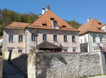
![Excursión A pie Breitenbrunn - Wasserbüffelweg - Photo](https://media.geolcdn.com/t/350/260/4ee78c09-d7d8-40aa-9b66-39e45d976375.jpeg&format=jpg&maxdim=2)
![A pie A pie](https://static1.geolcdn.com/sitytour/trail-icons/100.png)
Km
A pie
![](/images/other/stat-length.png)
![](https://static1.geolcdn.com/siteimages/upload/files/1508320355ic_sort_den_pos_24dp.png)
![](https://static1.geolcdn.com/siteimages/upload/files/1508320355ic_sort_den_neg_24dp.png)
![](https://static1.geolcdn.com/siteimages/upload/files/16400158638029165_repeat_loop_refresh_sync_direction_icon.png)
• Trail created by Markt Breitenbrunn. abgeschlossen (Mai 2014, by cycling_zno) Symbol: Grüne 6 auf gelbem Grund
![Excursión A pie Breitenbrunn - Rund uma dum Breitenbrunn - Photo](https://media.geolcdn.com/t/350/260/4ee78c09-d7d8-40aa-9b66-39e45d976375.jpeg&format=jpg&maxdim=2)
![A pie A pie](https://static1.geolcdn.com/sitytour/trail-icons/100.png)
Km
A pie
![](/images/other/stat-length.png)
![](https://static1.geolcdn.com/siteimages/upload/files/1508320355ic_sort_den_pos_24dp.png)
![](https://static1.geolcdn.com/siteimages/upload/files/1508320355ic_sort_den_neg_24dp.png)
![](https://static1.geolcdn.com/siteimages/upload/files/16400158638029165_repeat_loop_refresh_sync_direction_icon.png)
• Trail created by Markt Breitenbrunn. Symbol: Grüne 4 auf gelbem Grund
![Excursión A pie Breitenbrunn - Rosenweg - Photo](https://media.geolcdn.com/t/350/260/4ee78c09-d7d8-40aa-9b66-39e45d976375.jpeg&format=jpg&maxdim=2)
![A pie A pie](https://static1.geolcdn.com/sitytour/trail-icons/100.png)
Km
A pie
![](/images/other/stat-length.png)
![](https://static1.geolcdn.com/siteimages/upload/files/1508320355ic_sort_den_pos_24dp.png)
![](https://static1.geolcdn.com/siteimages/upload/files/1508320355ic_sort_den_neg_24dp.png)
![](https://static1.geolcdn.com/siteimages/upload/files/16400158638029165_repeat_loop_refresh_sync_direction_icon.png)
• Trail created by Markt Breitenbrunn. abgeschlossen (März 2014, by cycling_zno) Symbol: Grüne 1 auf gelbem Grund
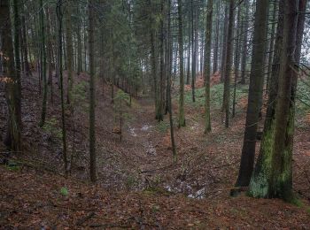
![Excursión A pie Lauterhofen - Rundweg Lauterhofen LTH6 - Photo](https://media.geolcdn.com/t/350/260/4522e1b4-2c90-43aa-9e67-54281ced8865.jpeg&format=jpg&maxdim=2)
![A pie A pie](https://static1.geolcdn.com/sitytour/trail-icons/100.png)
Km
A pie
![](/images/other/stat-length.png)
![](https://static1.geolcdn.com/siteimages/upload/files/1508320355ic_sort_den_pos_24dp.png)
![](https://static1.geolcdn.com/siteimages/upload/files/1508320355ic_sort_den_neg_24dp.png)
![](https://static1.geolcdn.com/siteimages/upload/files/16400158638029165_repeat_loop_refresh_sync_direction_icon.png)
• Trail created by Markt Lauterhofen. abgeschlossen (Feb. 2014, by cycling_zno) Symbol: Grüne LTH6 auf gelbem Grund
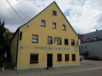
![Excursión A pie Lauterhofen - Rundweg Lauterhofen LTH5 - Photo](https://media.geolcdn.com/t/350/260/6b6eb54f-d01b-4711-b10d-05a7898f2584.jpeg&format=jpg&maxdim=2)
![A pie A pie](https://static1.geolcdn.com/sitytour/trail-icons/100.png)
Km
A pie
![](/images/other/stat-length.png)
![](https://static1.geolcdn.com/siteimages/upload/files/1508320355ic_sort_den_pos_24dp.png)
![](https://static1.geolcdn.com/siteimages/upload/files/1508320355ic_sort_den_neg_24dp.png)
![](https://static1.geolcdn.com/siteimages/upload/files/16400158638029165_repeat_loop_refresh_sync_direction_icon.png)
• Trail created by Markt Lauterhofen. abgeschlossen (Feb. 2014, by cycling_zno) Symbol: Grüne LTH5 auf gelbem Grund
![Excursión A pie Lauterhofen - Rundweg Lauterhofen LTH3 - Photo](https://media.geolcdn.com/t/350/260/6b6eb54f-d01b-4711-b10d-05a7898f2584.jpeg&format=jpg&maxdim=2)
![A pie A pie](https://static1.geolcdn.com/sitytour/trail-icons/100.png)
Km
A pie
![](/images/other/stat-length.png)
![](https://static1.geolcdn.com/siteimages/upload/files/1508320355ic_sort_den_pos_24dp.png)
![](https://static1.geolcdn.com/siteimages/upload/files/1508320355ic_sort_den_neg_24dp.png)
![](https://static1.geolcdn.com/siteimages/upload/files/16400158638029165_repeat_loop_refresh_sync_direction_icon.png)
• Trail created by Markt Lauterhofen. abgeschlossen (Feb. 2014, by cycling_zno) Symbol: Grüne LTH3 auf gelbem Grund
![Excursión A pie Lauterhofen - Rundweg Lauterhofen LTH4 - Photo](https://media.geolcdn.com/t/350/260/6b6eb54f-d01b-4711-b10d-05a7898f2584.jpeg&format=jpg&maxdim=2)
![A pie A pie](https://static1.geolcdn.com/sitytour/trail-icons/100.png)
Km
A pie
![](/images/other/stat-length.png)
![](https://static1.geolcdn.com/siteimages/upload/files/1508320355ic_sort_den_pos_24dp.png)
![](https://static1.geolcdn.com/siteimages/upload/files/1508320355ic_sort_den_neg_24dp.png)
![](https://static1.geolcdn.com/siteimages/upload/files/16400158638029165_repeat_loop_refresh_sync_direction_icon.png)
• Trail created by Markt Lauterhofen. abgeschlossen (Feb. 2014, by cycling_zno) Symbol: Grüne LTH4 auf gelbem Grund
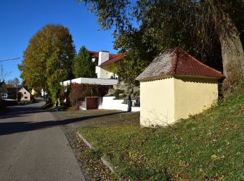
![Excursión A pie Berching - Plankstetten - Oening - Photo](https://media.geolcdn.com/t/350/260/24a9071a-4aed-476c-b913-466963111fef.jpeg&format=jpg&maxdim=2)
![A pie A pie](https://static1.geolcdn.com/sitytour/trail-icons/100.png)
Km
A pie
![](/images/other/stat-length.png)
![](https://static1.geolcdn.com/siteimages/upload/files/1508320355ic_sort_den_pos_24dp.png)
![](https://static1.geolcdn.com/siteimages/upload/files/1508320355ic_sort_den_neg_24dp.png)
![](https://static1.geolcdn.com/siteimages/upload/files/16400158638029165_repeat_loop_refresh_sync_direction_icon.png)
• Trail created by Stadt Berching. Symbol: Schwarze W3 auf gelbem Grund
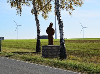
![Excursión A pie Berching - Berching - Holnstein - Photo](https://media.geolcdn.com/t/350/260/70bc2a95-37ba-468c-83c7-8ce50370f65b.jpeg&format=jpg&maxdim=2)
![A pie A pie](https://static1.geolcdn.com/sitytour/trail-icons/100.png)
Km
A pie
![](/images/other/stat-length.png)
![](https://static1.geolcdn.com/siteimages/upload/files/1508320355ic_sort_den_pos_24dp.png)
![](https://static1.geolcdn.com/siteimages/upload/files/1508320355ic_sort_den_neg_24dp.png)
![](https://static1.geolcdn.com/siteimages/upload/files/16400158638029165_repeat_loop_refresh_sync_direction_icon.png)
• Trail created by Stadt Berching. Symbol: Schwarze W1b auf gelbem Grund
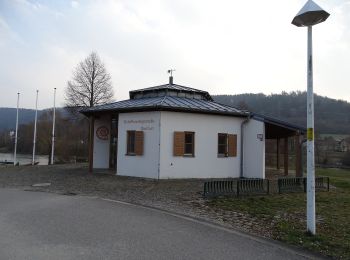
![Excursión A pie Dietfurt an der Altmühl - Dietfurter Wasserwege (Technik & Natur) - Photo](https://media.geolcdn.com/t/350/260/7fa80b07-24d7-49ad-92b8-2004a04c8b75.jpeg&format=jpg&maxdim=2)
![A pie A pie](https://static1.geolcdn.com/sitytour/trail-icons/100.png)
Km
A pie
![](/images/other/stat-length.png)
![](https://static1.geolcdn.com/siteimages/upload/files/1508320355ic_sort_den_pos_24dp.png)
![](https://static1.geolcdn.com/siteimages/upload/files/1508320355ic_sort_den_neg_24dp.png)
![](https://static1.geolcdn.com/siteimages/upload/files/16400158638029165_repeat_loop_refresh_sync_direction_icon.png)
• Trail created by Stadt Dietfurt. Symbol: Gelbes W2 auf blauem Grund
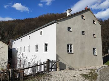
![Excursión A pie Dietfurt an der Altmühl - Dietfurter Wasserwege (Zurück zur Quelle) - Photo](https://media.geolcdn.com/t/350/260/40261bff-4a38-444a-b7b0-328635d3bc0e.jpeg&format=jpg&maxdim=2)
![A pie A pie](https://static1.geolcdn.com/sitytour/trail-icons/100.png)
Km
A pie
![](/images/other/stat-length.png)
![](https://static1.geolcdn.com/siteimages/upload/files/1508320355ic_sort_den_pos_24dp.png)
![](https://static1.geolcdn.com/siteimages/upload/files/1508320355ic_sort_den_neg_24dp.png)
![](https://static1.geolcdn.com/siteimages/upload/files/16400158638029165_repeat_loop_refresh_sync_direction_icon.png)
• Trail created by Stadt Dietfurt. abgeschlossen (Feb. 2014, by cycling_zno) Symbol: Gelbes W3 auf blauem Grund
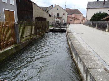
![Excursión A pie Dietfurt an der Altmühl - Dietfurter Wasserwege (Stadtspaziergang) - Photo](https://media.geolcdn.com/t/350/260/862dc7cb-c5b9-40c3-91cf-087ccb2e4660.jpeg&format=jpg&maxdim=2)
![A pie A pie](https://static1.geolcdn.com/sitytour/trail-icons/100.png)
Km
A pie
![](/images/other/stat-length.png)
![](https://static1.geolcdn.com/siteimages/upload/files/1508320355ic_sort_den_pos_24dp.png)
![](https://static1.geolcdn.com/siteimages/upload/files/1508320355ic_sort_den_neg_24dp.png)
![](https://static1.geolcdn.com/siteimages/upload/files/16400158638029165_repeat_loop_refresh_sync_direction_icon.png)
• Trail created by Stadt Dietfurt. Symbol: Gelbes W1 auf blauem Grund
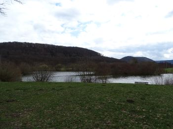
![Excursión A pie Dietfurt an der Altmühl - QiGong-Weg - Photo](https://media.geolcdn.com/t/350/260/8a4e5930-d498-4004-bf3d-ec18db1eb5a0.jpeg&format=jpg&maxdim=2)
![A pie A pie](https://static1.geolcdn.com/sitytour/trail-icons/100.png)
Km
A pie
![](/images/other/stat-length.png)
![](https://static1.geolcdn.com/siteimages/upload/files/1508320355ic_sort_den_pos_24dp.png)
![](https://static1.geolcdn.com/siteimages/upload/files/1508320355ic_sort_den_neg_24dp.png)
![](https://static1.geolcdn.com/siteimages/upload/files/16400158638029165_repeat_loop_refresh_sync_direction_icon.png)
• Trail created by Stadt Dietfurt. abgeschlossen (Januar 2014, cycling_zno) Symbol: Grüne 8 auf gelbem Grund
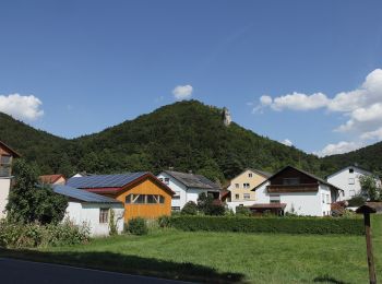
![Excursión A pie Dietfurt an der Altmühl - Wildensteiner Steig - Photo](https://media.geolcdn.com/t/350/260/837f69fb-dc78-4893-9844-6bb2e70098cf.jpeg&format=jpg&maxdim=2)
![A pie A pie](https://static1.geolcdn.com/sitytour/trail-icons/100.png)
Km
A pie
![](/images/other/stat-length.png)
![](https://static1.geolcdn.com/siteimages/upload/files/1508320355ic_sort_den_pos_24dp.png)
![](https://static1.geolcdn.com/siteimages/upload/files/1508320355ic_sort_den_neg_24dp.png)
![](https://static1.geolcdn.com/siteimages/upload/files/16400158638029165_repeat_loop_refresh_sync_direction_icon.png)
• Trail created by Stadt Dietfurt. abgeschlossen (Januar 2014, cycling_zno) Symbol: Grüne 5 auf gelbem Grund
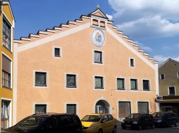
![Excursión A pie Dietfurt an der Altmühl - Walderlebnispfad Wolfsberg - Photo](https://media.geolcdn.com/t/350/260/cc3bc6e1-b2fc-4048-994a-81e61f02ba18.jpeg&format=jpg&maxdim=2)
![A pie A pie](https://static1.geolcdn.com/sitytour/trail-icons/100.png)
Km
A pie
![](/images/other/stat-length.png)
![](https://static1.geolcdn.com/siteimages/upload/files/1508320355ic_sort_den_pos_24dp.png)
![](https://static1.geolcdn.com/siteimages/upload/files/1508320355ic_sort_den_neg_24dp.png)
![](https://static1.geolcdn.com/siteimages/upload/files/16400158638029165_repeat_loop_refresh_sync_direction_icon.png)
• Trail created by Stadt Dietfurt. abgeschlossen (Januar 2014, cycling_zno) Symbol: Grüne 4 auf gelbem Grund
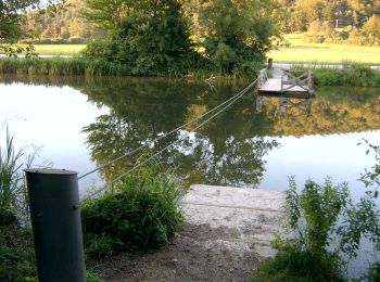
![Excursión A pie Dietfurt an der Altmühl - Altmühlbergweg - Photo](https://media.geolcdn.com/t/350/260/9fca1159-7b87-46e1-9972-29b961fbe478.jpeg&format=jpg&maxdim=2)
![A pie A pie](https://static1.geolcdn.com/sitytour/trail-icons/100.png)
Km
A pie
![](/images/other/stat-length.png)
![](https://static1.geolcdn.com/siteimages/upload/files/1508320355ic_sort_den_pos_24dp.png)
![](https://static1.geolcdn.com/siteimages/upload/files/1508320355ic_sort_den_neg_24dp.png)
![](https://static1.geolcdn.com/siteimages/upload/files/16400158638029165_repeat_loop_refresh_sync_direction_icon.png)
• Trail created by Stadt Dietfurt. abgeschlossen (Januar 2014, cycling_zno) Symbol: Grüne 3 auf gelbem Grund
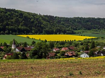
![Excursión A pie Dietfurt an der Altmühl - Moosbärnweg - Photo](https://media.geolcdn.com/t/350/260/50a67f0a-37c2-4eba-8bbd-5e0e4fa1c835.jpeg&format=jpg&maxdim=2)
![A pie A pie](https://static1.geolcdn.com/sitytour/trail-icons/100.png)
Km
A pie
![](/images/other/stat-length.png)
![](https://static1.geolcdn.com/siteimages/upload/files/1508320355ic_sort_den_pos_24dp.png)
![](https://static1.geolcdn.com/siteimages/upload/files/1508320355ic_sort_den_neg_24dp.png)
![](https://static1.geolcdn.com/siteimages/upload/files/16400158638029165_repeat_loop_refresh_sync_direction_icon.png)
• Trail created by Stadt Dietfurt. abgeschlossen (Januar 2014, cycling_zno) Symbol: Grüne 2 auf gelbem Grund
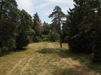
![Excursión A pie Dietfurt an der Altmühl - Kreuzbergweg - Photo](https://media.geolcdn.com/t/350/260/6bb03e6d-2967-4549-a4ef-e5766f5a4c8c.jpeg&format=jpg&maxdim=2)
![A pie A pie](https://static1.geolcdn.com/sitytour/trail-icons/100.png)
Km
A pie
![](/images/other/stat-length.png)
![](https://static1.geolcdn.com/siteimages/upload/files/1508320355ic_sort_den_pos_24dp.png)
![](https://static1.geolcdn.com/siteimages/upload/files/1508320355ic_sort_den_neg_24dp.png)
![](https://static1.geolcdn.com/siteimages/upload/files/16400158638029165_repeat_loop_refresh_sync_direction_icon.png)
• Trail created by Stadt Dietfurt. abgeschlossen (Januar 2014, cycling_zno) Symbol: Grüne 1 auf gelbem Grund
20 excursiones mostradas en 78
Aplicación GPS de excursión GRATIS