![](/images/other/stat-length.png)
- Excursiones
- Outdoor
- Germany
- Baviera
- Landkreis Cham
Landkreis Cham, Baviera: Los mejores itinerarios de excursión, recorridos, paseos y sendas
Landkreis Cham: Descubra las mejores excursiones: 59 a pie. Todos estos circuitos, recorridos, itinerarios y actividades al aire libre están disponibles en nuestras aplicaciones SityTrail para smartphone y tablet.
Los mejores recorridos (59)
![Excursión A pie Roding - Wilder Mann 059, Naturpark Vorderer Bayerischer Wald - Photo](https://media.geolcdn.com/t/350/260/fdd8170c-14f5-4566-9fcb-db79d95f1227.jpeg&format=jpg&maxdim=2)
![A pie A pie](https://static1.geolcdn.com/sitytour/trail-icons/100.png)
Km
A pie
![](/images/other/stat-length.png)
![](https://static1.geolcdn.com/siteimages/upload/files/1508320355ic_sort_den_pos_24dp.png)
![](https://static1.geolcdn.com/siteimages/upload/files/1508320355ic_sort_den_neg_24dp.png)
![](https://static1.geolcdn.com/siteimages/upload/files/16400158638029165_repeat_loop_refresh_sync_direction_icon.png)
• Trail created by Verein Naturpark Vorderer Bayerischer Wald. Symbol: Auf einem rechteckigen weißen Grund in Schwarz ...
![Excursión A pie Furth im Wald - Fu11 »Hammerschmiedeweg« (Furth im Wald) - Photo](https://media.geolcdn.com/t/350/260/cdbb5a43-9cac-40d7-b43c-e7a2012f82b2.jpeg&format=jpg&maxdim=2)
![A pie A pie](https://static1.geolcdn.com/sitytour/trail-icons/100.png)
Km
A pie
![](/images/other/stat-length.png)
![](https://static1.geolcdn.com/siteimages/upload/files/1508320355ic_sort_den_pos_24dp.png)
![](https://static1.geolcdn.com/siteimages/upload/files/1508320355ic_sort_den_neg_24dp.png)
![](https://static1.geolcdn.com/siteimages/upload/files/16400158638029165_repeat_loop_refresh_sync_direction_icon.png)
• Trail created by ARGE Further Wanderwege ??. Symbol: Schwarze Wegnummer im weißen Bereich des oben weißen / unten ro...
![Excursión A pie Furth im Wald - Fu05 Arnschwanger Weg - Photo](https://media.geolcdn.com/t/350/260/352f0aa5-db68-4e23-babc-b1d03c091cf4.jpeg&format=jpg&maxdim=2)
![A pie A pie](https://static1.geolcdn.com/sitytour/trail-icons/100.png)
Km
A pie
![](/images/other/stat-length.png)
![](https://static1.geolcdn.com/siteimages/upload/files/1508320355ic_sort_den_pos_24dp.png)
![](https://static1.geolcdn.com/siteimages/upload/files/1508320355ic_sort_den_neg_24dp.png)
![](https://static1.geolcdn.com/siteimages/upload/files/16400158638029165_repeat_loop_refresh_sync_direction_icon.png)
• Trail created by ARGE Further Wanderwege. Symbol: rot Fu05 auf Weiß, darunter rot
![Excursión A pie Furth im Wald - Fu04 Steinbruchseeweg - Photo](https://media.geolcdn.com/t/350/260/457098b4-ffd5-4d32-ac88-228ffbf0283a.jpeg&format=jpg&maxdim=2)
![A pie A pie](https://static1.geolcdn.com/sitytour/trail-icons/100.png)
Km
A pie
![](/images/other/stat-length.png)
![](https://static1.geolcdn.com/siteimages/upload/files/1508320355ic_sort_den_pos_24dp.png)
![](https://static1.geolcdn.com/siteimages/upload/files/1508320355ic_sort_den_neg_24dp.png)
![](https://static1.geolcdn.com/siteimages/upload/files/16400158638029165_repeat_loop_refresh_sync_direction_icon.png)
• Trail created by ARGE Further Wanderwege. Symbol: rot F04 auf Weiß, darunter rot
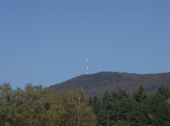
![Excursión A pie Furth im Wald - Fu03 Hohenbogenweg - Photo](https://media.geolcdn.com/t/350/260/3c4f947b-7ce4-437f-ba58-8a2d63e6bc8c.jpeg&format=jpg&maxdim=2)
![A pie A pie](https://static1.geolcdn.com/sitytour/trail-icons/100.png)
Km
A pie
![](/images/other/stat-length.png)
![](https://static1.geolcdn.com/siteimages/upload/files/1508320355ic_sort_den_pos_24dp.png)
![](https://static1.geolcdn.com/siteimages/upload/files/1508320355ic_sort_den_neg_24dp.png)
![](https://static1.geolcdn.com/siteimages/upload/files/16400158638029165_repeat_loop_refresh_sync_direction_icon.png)
• Trail created by ARGE Further Wanderwege. Symbol: rot F03 auf Weiß, darunter rot
![Excursión A pie Arnschwang - As03 (Kalkofenrundweg, Arnschwang) - Photo](https://media.geolcdn.com/t/350/260/352f0aa5-db68-4e23-babc-b1d03c091cf4.jpeg&format=jpg&maxdim=2)
![A pie A pie](https://static1.geolcdn.com/sitytour/trail-icons/100.png)
Km
A pie
![](/images/other/stat-length.png)
![](https://static1.geolcdn.com/siteimages/upload/files/1508320355ic_sort_den_pos_24dp.png)
![](https://static1.geolcdn.com/siteimages/upload/files/1508320355ic_sort_den_neg_24dp.png)
![](https://static1.geolcdn.com/siteimages/upload/files/16400158638029165_repeat_loop_refresh_sync_direction_icon.png)
• Trail created by FIXME. Symbol: rot As03 auf Weiß, darunter rot
![Excursión A pie Arnschwang - As02 (Kapellenweg, Arnschwang) - Photo](https://media.geolcdn.com/t/350/260/352f0aa5-db68-4e23-babc-b1d03c091cf4.jpeg&format=jpg&maxdim=2)
![A pie A pie](https://static1.geolcdn.com/sitytour/trail-icons/100.png)
Km
A pie
![](/images/other/stat-length.png)
![](https://static1.geolcdn.com/siteimages/upload/files/1508320355ic_sort_den_pos_24dp.png)
![](https://static1.geolcdn.com/siteimages/upload/files/1508320355ic_sort_den_neg_24dp.png)
![](https://static1.geolcdn.com/siteimages/upload/files/16400158638029165_repeat_loop_refresh_sync_direction_icon.png)
• Trail created by FIXME. Symbol: rot As02 auf Weiß, darunter rot
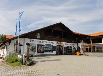
![Excursión A pie Arrach - Kaitersberg-Panorama-Weg - Photo](https://media.geolcdn.com/t/350/260/9a6f7fe4-88f4-4cf7-9770-b514d4cd75e5.jpeg&format=jpg&maxdim=2)
![A pie A pie](https://static1.geolcdn.com/sitytour/trail-icons/100.png)
Km
A pie
![](/images/other/stat-length.png)
![](https://static1.geolcdn.com/siteimages/upload/files/1508320355ic_sort_den_pos_24dp.png)
![](https://static1.geolcdn.com/siteimages/upload/files/1508320355ic_sort_den_neg_24dp.png)
![](https://static1.geolcdn.com/siteimages/upload/files/16400158638029165_repeat_loop_refresh_sync_direction_icon.png)
• Trail created by Naturpark Oberer Bayerischer Wald.
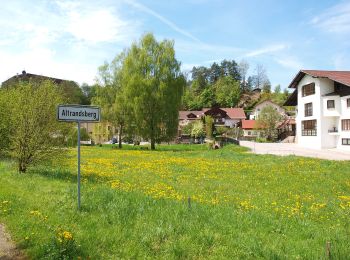
![Excursión A pie Miltach - A2 Altrandsberg – Moosbach – Altrandsberg - Photo](https://media.geolcdn.com/t/350/260/ad47f50f-b38c-41ac-86e4-ef618f9cb01f.jpeg&format=jpg&maxdim=2)
![A pie A pie](https://static1.geolcdn.com/sitytour/trail-icons/100.png)
Km
A pie
![](/images/other/stat-length.png)
![](https://static1.geolcdn.com/siteimages/upload/files/1508320355ic_sort_den_pos_24dp.png)
![](https://static1.geolcdn.com/siteimages/upload/files/1508320355ic_sort_den_neg_24dp.png)
![](https://static1.geolcdn.com/siteimages/upload/files/16400158638029165_repeat_loop_refresh_sync_direction_icon.png)
• Trail created by Gemeinde Miltach. Symbol: Schwarze Wegnummer im weißen Bereich des oben weißen / unten roten, recht...
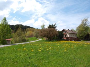
![Excursión A pie Miltach - A3 Altransberg Riedern Hammersdorf - Photo](https://media.geolcdn.com/t/350/260/49129e21-578a-4924-8900-e181f3ae180c.jpeg&format=jpg&maxdim=2)
![A pie A pie](https://static1.geolcdn.com/sitytour/trail-icons/100.png)
Km
A pie
![](/images/other/stat-length.png)
![](https://static1.geolcdn.com/siteimages/upload/files/1508320355ic_sort_den_pos_24dp.png)
![](https://static1.geolcdn.com/siteimages/upload/files/1508320355ic_sort_den_neg_24dp.png)
![](https://static1.geolcdn.com/siteimages/upload/files/16400158638029165_repeat_loop_refresh_sync_direction_icon.png)
• Trail created by Gemeinde Miltach. Symbol: Rote Wegnummer im weißen Bereich des oben weißen / unten roten, rechtecki...
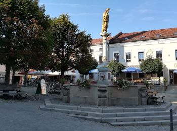
![Excursión A pie Bad Kötzting - K1 Rundwanderweg Sperlhammer - Photo](https://media.geolcdn.com/t/350/260/3d4e08e8-355a-4dc6-b681-3e8b4fbead30.jpeg&format=jpg&maxdim=2)
![A pie A pie](https://static1.geolcdn.com/sitytour/trail-icons/100.png)
Km
A pie
![](/images/other/stat-length.png)
![](https://static1.geolcdn.com/siteimages/upload/files/1508320355ic_sort_den_pos_24dp.png)
![](https://static1.geolcdn.com/siteimages/upload/files/1508320355ic_sort_den_neg_24dp.png)
![](https://static1.geolcdn.com/siteimages/upload/files/16400158638029165_repeat_loop_refresh_sync_direction_icon.png)
• Trail created by Stadt Kötzting. Symbol: Rote Wegnummer im weißen Bereich des oben weißen / unten roten, rechteckige...
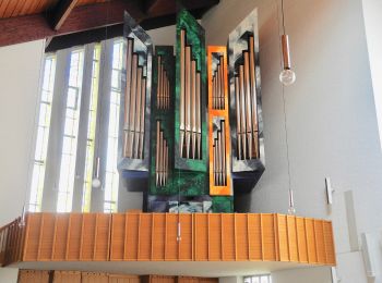
![Excursión A pie Runding - Ru02 Rundweg Haidstein 2 - Photo](https://media.geolcdn.com/t/350/260/7308d6e0-4230-4fc6-8f78-1f399efac390.jpeg&format=jpg&maxdim=2)
![A pie A pie](https://static1.geolcdn.com/sitytour/trail-icons/100.png)
Km
A pie
![](/images/other/stat-length.png)
![](https://static1.geolcdn.com/siteimages/upload/files/1508320355ic_sort_den_pos_24dp.png)
![](https://static1.geolcdn.com/siteimages/upload/files/1508320355ic_sort_den_neg_24dp.png)
![](https://static1.geolcdn.com/siteimages/upload/files/16400158638029165_repeat_loop_refresh_sync_direction_icon.png)
• Trail created by Gemeinde Runding.
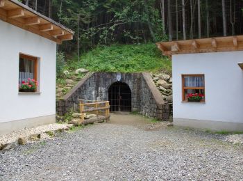
![Excursión A pie Lam - LP Lamer Panoramaweg - Photo](https://media.geolcdn.com/t/350/260/e25ed577-2416-4f93-9100-e7f7f39724fa.jpeg&format=jpg&maxdim=2)
![A pie A pie](https://static1.geolcdn.com/sitytour/trail-icons/100.png)
Km
A pie
![](/images/other/stat-length.png)
![](https://static1.geolcdn.com/siteimages/upload/files/1508320355ic_sort_den_pos_24dp.png)
![](https://static1.geolcdn.com/siteimages/upload/files/1508320355ic_sort_den_neg_24dp.png)
![](https://static1.geolcdn.com/siteimages/upload/files/16400158638029165_repeat_loop_refresh_sync_direction_icon.png)
• Trail created by Naturpark Oberer Bayerischer Wald. Symbol: Schwarze Wegnummer im weißen Bereich des oben weißen / u...
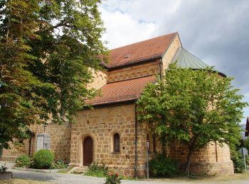
![Excursión A pie Roding - Wilder Mann 055, Naturpark Vorderer Bayerischer Wald - Photo](https://media.geolcdn.com/t/350/260/a8ebdd7c-295d-40b0-a9f7-97483a78cf4a.jpeg&format=jpg&maxdim=2)
![A pie A pie](https://static1.geolcdn.com/sitytour/trail-icons/100.png)
Km
A pie
![](/images/other/stat-length.png)
![](https://static1.geolcdn.com/siteimages/upload/files/1508320355ic_sort_den_pos_24dp.png)
![](https://static1.geolcdn.com/siteimages/upload/files/1508320355ic_sort_den_neg_24dp.png)
![](https://static1.geolcdn.com/siteimages/upload/files/16400158638029165_repeat_loop_refresh_sync_direction_icon.png)
• Trail created by Verein Naturpark Vorderer Bayerischer Wald. Originalwanderzeichen auf Karte nicht darstellbar Symb...
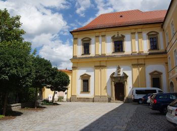
![Excursión A pie Reichenbach - Wilder Mann 47 »Pfaffen-Steinweg«, Naturpark Vorderer Bayerischer Wald - Photo](https://media.geolcdn.com/t/350/260/a6261e49-d1b7-47de-8b16-98d3a81d44c5.jpeg&format=jpg&maxdim=2)
![A pie A pie](https://static1.geolcdn.com/sitytour/trail-icons/100.png)
Km
A pie
![](/images/other/stat-length.png)
![](https://static1.geolcdn.com/siteimages/upload/files/1508320355ic_sort_den_pos_24dp.png)
![](https://static1.geolcdn.com/siteimages/upload/files/1508320355ic_sort_den_neg_24dp.png)
![](https://static1.geolcdn.com/siteimages/upload/files/16400158638029165_repeat_loop_refresh_sync_direction_icon.png)
• Trail created by Verein Naturpark Vorderer Bayerischer Wald e.V.. Symbol: Auf einem rechteckigen weißen Grund in Sch...
![Excursión A pie Reichenbach - O 36 Reichenbach - Wald (Grünes Rechteck) - Photo](https://media.geolcdn.com/t/350/260/a6261e49-d1b7-47de-8b16-98d3a81d44c5.jpeg&format=jpg&maxdim=2)
![A pie A pie](https://static1.geolcdn.com/sitytour/trail-icons/100.png)
Km
A pie
![](/images/other/stat-length.png)
![](https://static1.geolcdn.com/siteimages/upload/files/1508320355ic_sort_den_pos_24dp.png)
![](https://static1.geolcdn.com/siteimages/upload/files/1508320355ic_sort_den_neg_24dp.png)
![](https://static1.geolcdn.com/siteimages/upload/files/16400158638029165_repeat_loop_refresh_sync_direction_icon.png)
• Trail created by Waldverein Regensburg. Symbol: Grünes Rechteck auf weißem Grund
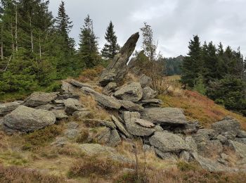
![Excursión A pie - Lo 1 Osserpfad (Lohberg) - Photo](https://media.geolcdn.com/t/350/260/cd6368dc-f40d-41f9-a41b-727bb4be759d.jpeg&format=jpg&maxdim=2)
![A pie A pie](https://static1.geolcdn.com/sitytour/trail-icons/100.png)
Km
A pie
![](/images/other/stat-length.png)
![](https://static1.geolcdn.com/siteimages/upload/files/1508320355ic_sort_den_pos_24dp.png)
![](https://static1.geolcdn.com/siteimages/upload/files/1508320355ic_sort_den_neg_24dp.png)
![](https://static1.geolcdn.com/siteimages/upload/files/16400158638029165_repeat_loop_refresh_sync_direction_icon.png)
• Trail created by Naturpark Oberer Bayerischer Wald. Symbol: Auf oben weißem / unten rotem, rechteckigem Hintergrund ...
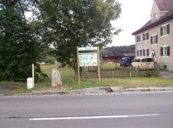
![Excursión A pie Eschlkam - E3 Eschlkam-Landesgrenze - Photo](https://media.geolcdn.com/t/350/260/b074a25e-6383-4972-8cef-25058bd813c0.jpeg&format=jpg&maxdim=2)
![A pie A pie](https://static1.geolcdn.com/sitytour/trail-icons/100.png)
Km
A pie
![](/images/other/stat-length.png)
![](https://static1.geolcdn.com/siteimages/upload/files/1508320355ic_sort_den_pos_24dp.png)
![](https://static1.geolcdn.com/siteimages/upload/files/1508320355ic_sort_den_neg_24dp.png)
![](https://static1.geolcdn.com/siteimages/upload/files/16400158638029165_repeat_loop_refresh_sync_direction_icon.png)
• Symbol: rot E3 auf weiß, darunter rot
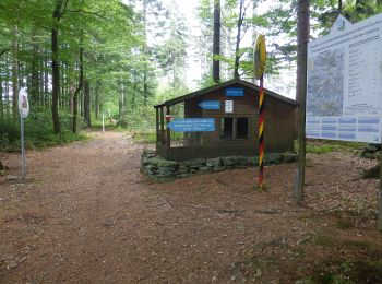
![Excursión A pie Waldmünchen - Wm5 »Böhmerwaldweg« (Waldmünchen) - Photo](https://media.geolcdn.com/t/350/260/925a1e31-e6f2-4614-9e6b-da996f61c722.jpeg&format=jpg&maxdim=2)
![A pie A pie](https://static1.geolcdn.com/sitytour/trail-icons/100.png)
Km
A pie
![](/images/other/stat-length.png)
![](https://static1.geolcdn.com/siteimages/upload/files/1508320355ic_sort_den_pos_24dp.png)
![](https://static1.geolcdn.com/siteimages/upload/files/1508320355ic_sort_den_neg_24dp.png)
![](https://static1.geolcdn.com/siteimages/upload/files/16400158638029165_repeat_loop_refresh_sync_direction_icon.png)
• Trail created by ARGE Further Wanderwege. Symbol: Schwarze Wegnummer im weißen Bereich des oben weißen / unten roten...
![Excursión A pie Arnschwang - As01 (Sebastiansweg, Arnschwang) - Photo](https://media.geolcdn.com/t/350/260/352f0aa5-db68-4e23-babc-b1d03c091cf4.jpeg&format=jpg&maxdim=2)
![A pie A pie](https://static1.geolcdn.com/sitytour/trail-icons/100.png)
Km
A pie
![](/images/other/stat-length.png)
![](https://static1.geolcdn.com/siteimages/upload/files/1508320355ic_sort_den_pos_24dp.png)
![](https://static1.geolcdn.com/siteimages/upload/files/1508320355ic_sort_den_neg_24dp.png)
![](https://static1.geolcdn.com/siteimages/upload/files/16400158638029165_repeat_loop_refresh_sync_direction_icon.png)
• Trail created by FIXME. Symbol: rot As01 auf Weiß, darunter rot
20 excursiones mostradas en 59
Aplicación GPS de excursión GRATIS