![](/images/other/stat-length.png)
- Excursiones
- Outdoor
- Germany
- Baviera
- Landkreis Schweinfurt
Landkreis Schweinfurt, Baviera: Los mejores itinerarios de excursión, recorridos, paseos y sendas
Landkreis Schweinfurt: Descubra las mejores excursiones: 40 a pie. Todos estos circuitos, recorridos, itinerarios y actividades al aire libre están disponibles en nuestras aplicaciones SityTrail para smartphone y tablet.
Los mejores recorridos (40)
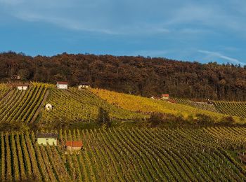
![Excursión A pie Donnersdorf - Falkenberger Hüttentour - Photo](https://media.geolcdn.com/t/350/260/56e4334a-8b1d-441a-9979-1e014b69f265.jpeg&format=jpg&maxdim=2)
![A pie A pie](https://static1.geolcdn.com/sitytour/trail-icons/100.png)
Km
A pie
![](/images/other/stat-length.png)
![](https://static1.geolcdn.com/siteimages/upload/files/1508320355ic_sort_den_pos_24dp.png)
![](https://static1.geolcdn.com/siteimages/upload/files/1508320355ic_sort_den_neg_24dp.png)
![](https://static1.geolcdn.com/siteimages/upload/files/16400158638029165_repeat_loop_refresh_sync_direction_icon.png)
• Trail created by Gemeinde Gerolzhofen. Symbol: Grüne Hütte auf weißem Hindergrund
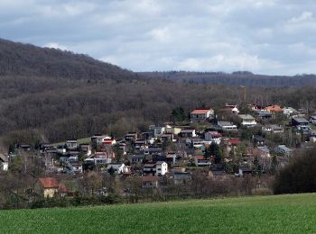
![Excursión A pie Bürgerwald - Rundweg Michelau M6 - Photo](https://media.geolcdn.com/t/350/260/8dddb9d6-2098-46cc-8c62-50658740efe5.jpeg&format=jpg&maxdim=2)
![A pie A pie](https://static1.geolcdn.com/sitytour/trail-icons/100.png)
Km
A pie
![](/images/other/stat-length.png)
![](https://static1.geolcdn.com/siteimages/upload/files/1508320355ic_sort_den_pos_24dp.png)
![](https://static1.geolcdn.com/siteimages/upload/files/1508320355ic_sort_den_neg_24dp.png)
![](https://static1.geolcdn.com/siteimages/upload/files/16400158638029165_repeat_loop_refresh_sync_direction_icon.png)
• Trail created by Gemeinde Michelau i.Steigerwald. Symbol: Schwarze M6 auf gelbem Hintergrund
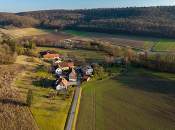
![Excursión A pie Stollbergerforst - Rundweg Oberschwarzach O1 - Photo](https://media.geolcdn.com/t/350/260/d01c44f3-91c5-4b45-ac95-79ba7cb389b3.jpeg&format=jpg&maxdim=2)
![A pie A pie](https://static1.geolcdn.com/sitytour/trail-icons/100.png)
Km
A pie
![](/images/other/stat-length.png)
![](https://static1.geolcdn.com/siteimages/upload/files/1508320355ic_sort_den_pos_24dp.png)
![](https://static1.geolcdn.com/siteimages/upload/files/1508320355ic_sort_den_neg_24dp.png)
![](https://static1.geolcdn.com/siteimages/upload/files/16400158638029165_repeat_loop_refresh_sync_direction_icon.png)
• Trail created by Gemeinde Oberschwarzach. Symbol: Schwarze O 1 auf gelbem Hintergrund
![Excursión A pie Oberschwarzach - Rundweg Stollburg - Photo](https://media.geolcdn.com/t/350/260/d01c44f3-91c5-4b45-ac95-79ba7cb389b3.jpeg&format=jpg&maxdim=2)
![A pie A pie](https://static1.geolcdn.com/sitytour/trail-icons/100.png)
Km
A pie
![](/images/other/stat-length.png)
![](https://static1.geolcdn.com/siteimages/upload/files/1508320355ic_sort_den_pos_24dp.png)
![](https://static1.geolcdn.com/siteimages/upload/files/1508320355ic_sort_den_neg_24dp.png)
![](https://static1.geolcdn.com/siteimages/upload/files/16400158638029165_repeat_loop_refresh_sync_direction_icon.png)
• Symbol: Stilisierte Burgruine auf hellblauem Grund
![Excursión A pie Oberschwarzach - Rundweg Waldläufer O2 - Photo](https://media.geolcdn.com/t/350/260/d01c44f3-91c5-4b45-ac95-79ba7cb389b3.jpeg&format=jpg&maxdim=2)
![A pie A pie](https://static1.geolcdn.com/sitytour/trail-icons/100.png)
Km
A pie
![](/images/other/stat-length.png)
![](https://static1.geolcdn.com/siteimages/upload/files/1508320355ic_sort_den_pos_24dp.png)
![](https://static1.geolcdn.com/siteimages/upload/files/1508320355ic_sort_den_neg_24dp.png)
![](https://static1.geolcdn.com/siteimages/upload/files/16400158638029165_repeat_loop_refresh_sync_direction_icon.png)
• Trail created by Gemeinde Oberschwarzach. Teilweise auch Markierung "Schwarze O2 auf gelbem Hintergrund" Symbol: Gr...
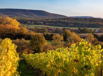
![Excursión A pie Oberschwarzach - Rundweg O5 - Photo](https://media.geolcdn.com/t/350/260/d8a1cb9f-7a37-4a27-851a-3b1df85e082c.jpeg&format=jpg&maxdim=2)
![A pie A pie](https://static1.geolcdn.com/sitytour/trail-icons/100.png)
Km
A pie
![](/images/other/stat-length.png)
![](https://static1.geolcdn.com/siteimages/upload/files/1508320355ic_sort_den_pos_24dp.png)
![](https://static1.geolcdn.com/siteimages/upload/files/1508320355ic_sort_den_neg_24dp.png)
![](https://static1.geolcdn.com/siteimages/upload/files/16400158638029165_repeat_loop_refresh_sync_direction_icon.png)
• Trail created by Gemeinde Oberschwarzach. Symbol: Schwarze O 5 auf gelbem Hintergrund
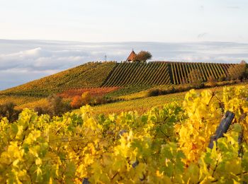
![Excursión A pie Oberschwarzach - Rundweg Hörnle - Photo](https://media.geolcdn.com/t/350/260/7c130285-0209-4a5e-a0ec-bcbda90efd55.jpeg&format=jpg&maxdim=2)
![A pie A pie](https://static1.geolcdn.com/sitytour/trail-icons/100.png)
Km
A pie
![](/images/other/stat-length.png)
![](https://static1.geolcdn.com/siteimages/upload/files/1508320355ic_sort_den_pos_24dp.png)
![](https://static1.geolcdn.com/siteimages/upload/files/1508320355ic_sort_den_neg_24dp.png)
![](https://static1.geolcdn.com/siteimages/upload/files/16400158638029165_repeat_loop_refresh_sync_direction_icon.png)
• Symbol: Stilisierte pyramidenförmige Kirche auf hellblauem Grund
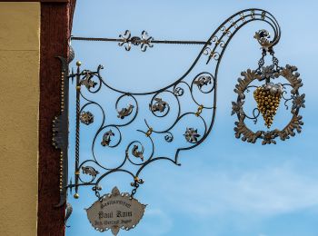
![Excursión A pie Geiersberg - Rundweg Oberschwarzach O4 - Photo](https://media.geolcdn.com/t/350/260/49154601-850b-43bb-9b48-b34ba75c0f3a.jpeg&format=jpg&maxdim=2)
![A pie A pie](https://static1.geolcdn.com/sitytour/trail-icons/100.png)
Km
A pie
![](/images/other/stat-length.png)
![](https://static1.geolcdn.com/siteimages/upload/files/1508320355ic_sort_den_pos_24dp.png)
![](https://static1.geolcdn.com/siteimages/upload/files/1508320355ic_sort_den_neg_24dp.png)
![](https://static1.geolcdn.com/siteimages/upload/files/16400158638029165_repeat_loop_refresh_sync_direction_icon.png)
• Trail created by Gemeinde Oberschwarzach. Symbol: Schwarze O 4 auf gelbem Hintergrund
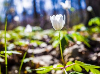
![Excursión A pie Schonungen - Mainberger Runde - Photo](https://media.geolcdn.com/t/350/260/3caae30f-ac4c-4818-b9c4-74202d0a383e.jpeg&format=jpg&maxdim=2)
![A pie A pie](https://static1.geolcdn.com/sitytour/trail-icons/100.png)
Km
A pie
![](/images/other/stat-length.png)
![](https://static1.geolcdn.com/siteimages/upload/files/1508320355ic_sort_den_pos_24dp.png)
![](https://static1.geolcdn.com/siteimages/upload/files/1508320355ic_sort_den_neg_24dp.png)
![](https://static1.geolcdn.com/siteimages/upload/files/16400158638029165_repeat_loop_refresh_sync_direction_icon.png)
• Symbol: letter 'M' in a circle with an arrowhead at NW position
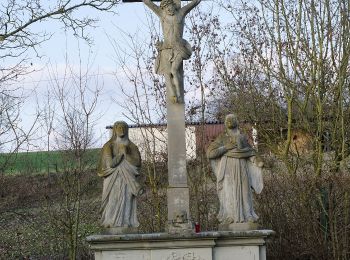
![Excursión A pie Dittelbrunn - Römerweg - Photo](https://media.geolcdn.com/t/350/260/b3272551-ac7a-4ef4-8442-3a8800654808.jpeg&format=jpg&maxdim=2)
![A pie A pie](https://static1.geolcdn.com/sitytour/trail-icons/100.png)
Km
A pie
![](/images/other/stat-length.png)
![](https://static1.geolcdn.com/siteimages/upload/files/1508320355ic_sort_den_pos_24dp.png)
![](https://static1.geolcdn.com/siteimages/upload/files/1508320355ic_sort_den_neg_24dp.png)
![](https://static1.geolcdn.com/siteimages/upload/files/16400158638029165_repeat_loop_refresh_sync_direction_icon.png)
• Symbol: light brown shoe on dark brown dot
![Excursión A pie Grafenrheinfeld - Verwunschen-Verwunschen - Photo](https://media.geolcdn.com/t/350/260/89e2db0b-a6c1-45ec-98f2-5fe3a5afc5b3.jpeg&format=jpg&maxdim=2)
![A pie A pie](https://static1.geolcdn.com/sitytour/trail-icons/100.png)
Km
A pie
![](/images/other/stat-length.png)
![](https://static1.geolcdn.com/siteimages/upload/files/1508320355ic_sort_den_pos_24dp.png)
![](https://static1.geolcdn.com/siteimages/upload/files/1508320355ic_sort_den_neg_24dp.png)
![](https://static1.geolcdn.com/siteimages/upload/files/16400158638029165_repeat_loop_refresh_sync_direction_icon.png)
• Symbol: Weiße, laublose Weide auf blau/grünem Hintergrund
![Excursión A pie Röthlein - Heidenfelds Grüne Lunge - Photo](https://media.geolcdn.com/t/350/260/44954e7e-cc14-4e37-b588-ace6d2e3fc87.jpeg&format=jpg&maxdim=2)
![A pie A pie](https://static1.geolcdn.com/sitytour/trail-icons/100.png)
Km
A pie
![](/images/other/stat-length.png)
![](https://static1.geolcdn.com/siteimages/upload/files/1508320355ic_sort_den_pos_24dp.png)
![](https://static1.geolcdn.com/siteimages/upload/files/1508320355ic_sort_den_neg_24dp.png)
![](https://static1.geolcdn.com/siteimages/upload/files/16400158638029165_repeat_loop_refresh_sync_direction_icon.png)
• Symbol: green dot on white ground
![Excursión A pie Sennfeld - Igel-Weg - Photo](https://media.geolcdn.com/t/350/260/5f1d6ece-2151-40bd-8771-a0496d3ca9a5.jpeg&format=jpg&maxdim=2)
![A pie A pie](https://static1.geolcdn.com/sitytour/trail-icons/100.png)
Km
A pie
![](/images/other/stat-length.png)
![](https://static1.geolcdn.com/siteimages/upload/files/1508320355ic_sort_den_pos_24dp.png)
![](https://static1.geolcdn.com/siteimages/upload/files/1508320355ic_sort_den_neg_24dp.png)
![](https://static1.geolcdn.com/siteimages/upload/files/16400158638029165_repeat_loop_refresh_sync_direction_icon.png)
• Symbol: Black silhouette of an hedgehog on green background
![Excursión A pie Sennfeld - Sennfelder Seenkranz - Photo](https://media.geolcdn.com/t/350/260/fb4e949b-c16b-4acb-9449-60131840c553.jpeg&format=jpg&maxdim=2)
![A pie A pie](https://static1.geolcdn.com/sitytour/trail-icons/100.png)
Km
A pie
![](/images/other/stat-length.png)
![](https://static1.geolcdn.com/siteimages/upload/files/1508320355ic_sort_den_pos_24dp.png)
![](https://static1.geolcdn.com/siteimages/upload/files/1508320355ic_sort_den_neg_24dp.png)
![](https://static1.geolcdn.com/siteimages/upload/files/16400158638029165_repeat_loop_refresh_sync_direction_icon.png)
• Symbol: Red circle on white background
![Excursión A pie Sennfeld - Hase-Weg - Photo](https://media.geolcdn.com/t/350/260/5f1d6ece-2151-40bd-8771-a0496d3ca9a5.jpeg&format=jpg&maxdim=2)
![A pie A pie](https://static1.geolcdn.com/sitytour/trail-icons/100.png)
Km
A pie
![](/images/other/stat-length.png)
![](https://static1.geolcdn.com/siteimages/upload/files/1508320355ic_sort_den_pos_24dp.png)
![](https://static1.geolcdn.com/siteimages/upload/files/1508320355ic_sort_den_neg_24dp.png)
![](https://static1.geolcdn.com/siteimages/upload/files/16400158638029165_repeat_loop_refresh_sync_direction_icon.png)
• Symbol: Black silhouette of an jackrabbit on orange background
![Excursión A pie Dingolshausen - Rundweg Michelau M1 - Photo](https://media.geolcdn.com/t/350/260/8dddb9d6-2098-46cc-8c62-50658740efe5.jpeg&format=jpg&maxdim=2)
![A pie A pie](https://static1.geolcdn.com/sitytour/trail-icons/100.png)
Km
A pie
![](/images/other/stat-length.png)
![](https://static1.geolcdn.com/siteimages/upload/files/1508320355ic_sort_den_pos_24dp.png)
![](https://static1.geolcdn.com/siteimages/upload/files/1508320355ic_sort_den_neg_24dp.png)
![](https://static1.geolcdn.com/siteimages/upload/files/16400158638029165_repeat_loop_refresh_sync_direction_icon.png)
• Trail created by Gemeinde Michelau i.Steigerwald. Symbol: Schwarze M1 auf gelbem Hintergrund
![Excursión A pie Schonungen - Naturpfad - Photo](https://media.geolcdn.com/t/350/260/1ff501fe-19ba-4926-ab12-96f13199470a.jpeg&format=jpg&maxdim=2)
![A pie A pie](https://static1.geolcdn.com/sitytour/trail-icons/100.png)
Km
A pie
![](/images/other/stat-length.png)
![](https://static1.geolcdn.com/siteimages/upload/files/1508320355ic_sort_den_pos_24dp.png)
![](https://static1.geolcdn.com/siteimages/upload/files/1508320355ic_sort_den_neg_24dp.png)
![](https://static1.geolcdn.com/siteimages/upload/files/16400158638029165_repeat_loop_refresh_sync_direction_icon.png)
• Trail created by Naturfreunde Ortsgruppe Schweinfurt. Symbol: Blaues "N" in schwarzem Kreis auf weißem Hintergrund
![Excursión A pie Kolitzheim - Lindacher Land-Erlebnisweg - Photo](https://media.geolcdn.com/t/350/260/3c09dec8-210d-4535-b2b4-248fada4bf13.jpeg&format=jpg&maxdim=2)
![A pie A pie](https://static1.geolcdn.com/sitytour/trail-icons/100.png)
Km
A pie
![](/images/other/stat-length.png)
![](https://static1.geolcdn.com/siteimages/upload/files/1508320355ic_sort_den_pos_24dp.png)
![](https://static1.geolcdn.com/siteimages/upload/files/1508320355ic_sort_den_neg_24dp.png)
![](https://static1.geolcdn.com/siteimages/upload/files/16400158638029165_repeat_loop_refresh_sync_direction_icon.png)
• Der Wegverlauf ist identisch mit dem "Lindacher Kreuzpfad"
![Excursión A pie Schonungen - Apfelweg - Photo](https://media.geolcdn.com/t/350/260/a34454d9-38d1-4173-b123-5cdf217ebc55.jpeg&format=jpg&maxdim=2)
![A pie A pie](https://static1.geolcdn.com/sitytour/trail-icons/100.png)
Km
A pie
![](/images/other/stat-length.png)
![](https://static1.geolcdn.com/siteimages/upload/files/1508320355ic_sort_den_pos_24dp.png)
![](https://static1.geolcdn.com/siteimages/upload/files/1508320355ic_sort_den_neg_24dp.png)
![](https://static1.geolcdn.com/siteimages/upload/files/16400158638029165_repeat_loop_refresh_sync_direction_icon.png)
• Trail created by VGL Schonungen. Symbol: Ein grüner, blauer und gelber Apfel auf weißem Grund.
![Excursión A pie Schonungen - AV Grün Route 3 - Photo](https://media.geolcdn.com/t/350/260/a34454d9-38d1-4173-b123-5cdf217ebc55.jpeg&format=jpg&maxdim=2)
![A pie A pie](https://static1.geolcdn.com/sitytour/trail-icons/100.png)
Km
A pie
![](/images/other/stat-length.png)
![](https://static1.geolcdn.com/siteimages/upload/files/1508320355ic_sort_den_pos_24dp.png)
![](https://static1.geolcdn.com/siteimages/upload/files/1508320355ic_sort_den_neg_24dp.png)
![](https://static1.geolcdn.com/siteimages/upload/files/16400158638029165_repeat_loop_refresh_sync_direction_icon.png)
• Trail created by DAV Sektion Schweinfurt. Symbol: AV Grün auf Weiß
20 excursiones mostradas en 40
Aplicación GPS de excursión GRATIS