![](/images/other/stat-length.png)
- Excursiones
- Outdoor
- Germany
- Baviera
- Landkreis Amberg-Sulzbach
- Hirschbach
Hirschbach, Landkreis Amberg-Sulzbach: Los mejores itinerarios de excursión, recorridos, paseos y sendas
Hirschbach: Descubra las mejores excursiones: 10 a pie. Todos estos circuitos, recorridos, itinerarios y actividades al aire libre están disponibles en nuestras aplicaciones SityTrail para smartphone y tablet.
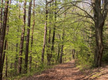
Los mejores recorridos (10)
![Excursión A pie Hirschbach - Eschenfelden Rundweg 11 - Photo](https://media.geolcdn.com/t/350/260/3b6986bc-9e27-425e-85b6-5d9a6cdb54e8.jpeg&format=jpg&maxdim=2)
![A pie A pie](https://static1.geolcdn.com/sitytour/trail-icons/100.png)
Km
A pie
![](/images/other/stat-length.png)
![](https://static1.geolcdn.com/siteimages/upload/files/1508320355ic_sort_den_pos_24dp.png)
![](https://static1.geolcdn.com/siteimages/upload/files/1508320355ic_sort_den_neg_24dp.png)
![](https://static1.geolcdn.com/siteimages/upload/files/16400158638029165_repeat_loop_refresh_sync_direction_icon.png)
• Trail created by Gemeinde Hirschbach (Eschenfelden). geprüft (Jan. 2015 by cycling_zno) Symbol: Weisse 11 auf rotem...
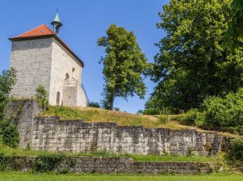
![Excursión A pie Hirschbach - Eschenfelden Rundweg 10 - Photo](https://media.geolcdn.com/t/350/260/3b6986bc-9e27-425e-85b6-5d9a6cdb54e8.jpeg&format=jpg&maxdim=2)
![A pie A pie](https://static1.geolcdn.com/sitytour/trail-icons/100.png)
Km
A pie
![](/images/other/stat-length.png)
![](https://static1.geolcdn.com/siteimages/upload/files/1508320355ic_sort_den_pos_24dp.png)
![](https://static1.geolcdn.com/siteimages/upload/files/1508320355ic_sort_den_neg_24dp.png)
![](https://static1.geolcdn.com/siteimages/upload/files/16400158638029165_repeat_loop_refresh_sync_direction_icon.png)
• Trail created by Gemeinde Hirschbach (Eschenfelden). geprüft (Jan. 2015 by cycling_zno) Symbol: Weisse 10 auf rotem...
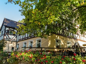
![Excursión A pie Hirschbach - Eschenfelden Rundweg 9 - Photo](https://media.geolcdn.com/t/350/260/76fcf6a1-d0d2-44de-b4f7-4e55b241dbe5.jpeg&format=jpg&maxdim=2)
![A pie A pie](https://static1.geolcdn.com/sitytour/trail-icons/100.png)
Km
A pie
![](/images/other/stat-length.png)
![](https://static1.geolcdn.com/siteimages/upload/files/1508320355ic_sort_den_pos_24dp.png)
![](https://static1.geolcdn.com/siteimages/upload/files/1508320355ic_sort_den_neg_24dp.png)
![](https://static1.geolcdn.com/siteimages/upload/files/16400158638029165_repeat_loop_refresh_sync_direction_icon.png)
• Trail created by Gemeinde Hirschbach (Eschenfelden). geprüft (Jan. 2015 by cycling_zno) Symbol: Weisse 9 auf rotem ...
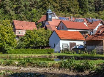
![Excursión A pie Hirschbach - Hirschbacher Ziegenrundwanderweg - Photo](https://media.geolcdn.com/t/350/260/5d4755c4-a9ff-4916-a64b-a10f93013296.jpeg&format=jpg&maxdim=2)
![A pie A pie](https://static1.geolcdn.com/sitytour/trail-icons/100.png)
Km
A pie
![](/images/other/stat-length.png)
![](https://static1.geolcdn.com/siteimages/upload/files/1508320355ic_sort_den_pos_24dp.png)
![](https://static1.geolcdn.com/siteimages/upload/files/1508320355ic_sort_den_neg_24dp.png)
![](https://static1.geolcdn.com/siteimages/upload/files/16400158638029165_repeat_loop_refresh_sync_direction_icon.png)
• Trail created by Gemeinde Hirschbach. geprüft (Jan. 2015 by cycling_zno) Symbol: Grüner Ring auf weissem Grund
![Excursión A pie Hirschbach - Rundwanderweg Hirschbach Nr. 1 - Photo](https://media.geolcdn.com/t/350/260/0c817e5f-d725-4378-9a3e-9365f7f7b2d8.jpeg&format=jpg&maxdim=2)
![A pie A pie](https://static1.geolcdn.com/sitytour/trail-icons/100.png)
Km
A pie
![](/images/other/stat-length.png)
![](https://static1.geolcdn.com/siteimages/upload/files/1508320355ic_sort_den_pos_24dp.png)
![](https://static1.geolcdn.com/siteimages/upload/files/1508320355ic_sort_den_neg_24dp.png)
![](https://static1.geolcdn.com/siteimages/upload/files/16400158638029165_repeat_loop_refresh_sync_direction_icon.png)
• Trail created by Gemeinde Hirschbach. geprüft (Jan. 2015 by cycling_zno) Symbol: Weisse Eins auf grünem Grund
![Excursión A pie Hirschbach - Eschenfelden Rundweg 4 - Photo](https://media.geolcdn.com/t/350/260/f0be76b4-78ef-4eae-9ebb-845055ad9335.jpeg&format=jpg&maxdim=2)
![A pie A pie](https://static1.geolcdn.com/sitytour/trail-icons/100.png)
Km
A pie
![](/images/other/stat-length.png)
![](https://static1.geolcdn.com/siteimages/upload/files/1508320355ic_sort_den_pos_24dp.png)
![](https://static1.geolcdn.com/siteimages/upload/files/1508320355ic_sort_den_neg_24dp.png)
![](https://static1.geolcdn.com/siteimages/upload/files/16400158638029165_repeat_loop_refresh_sync_direction_icon.png)
• Trail created by Gemeinde Hirschbach (Eschenfelden). geprüft (Jan. 2015 by cycling_zno) Symbol: Weiße 4 auf rotem G...
![Excursión A pie Hirschbach - Bruckberger Weg - Photo](https://media.geolcdn.com/t/350/260/0c817e5f-d725-4378-9a3e-9365f7f7b2d8.jpeg&format=jpg&maxdim=2)
![A pie A pie](https://static1.geolcdn.com/sitytour/trail-icons/100.png)
Km
A pie
![](/images/other/stat-length.png)
![](https://static1.geolcdn.com/siteimages/upload/files/1508320355ic_sort_den_pos_24dp.png)
![](https://static1.geolcdn.com/siteimages/upload/files/1508320355ic_sort_den_neg_24dp.png)
![](https://static1.geolcdn.com/siteimages/upload/files/16400158638029165_repeat_loop_refresh_sync_direction_icon.png)
• Trail created by Gemeinde Hirschbach. geprüft (Jan. 2015 by cycling_zno) Symbol: Gelber Ring auf weißem Grund
![Excursión A pie Hirschbach - Eschenfelden Rundweg 7 - Photo](https://media.geolcdn.com/t/350/260/ceb85919-99b0-4b8e-a5fc-3f8db25701f9.jpeg&format=jpg&maxdim=2)
![A pie A pie](https://static1.geolcdn.com/sitytour/trail-icons/100.png)
Km
A pie
![](/images/other/stat-length.png)
![](https://static1.geolcdn.com/siteimages/upload/files/1508320355ic_sort_den_pos_24dp.png)
![](https://static1.geolcdn.com/siteimages/upload/files/1508320355ic_sort_den_neg_24dp.png)
![](https://static1.geolcdn.com/siteimages/upload/files/16400158638029165_repeat_loop_refresh_sync_direction_icon.png)
• Trail created by Gemeinde Hirschbach (Eschenfelden). geprüft (Jan. 2015 by cycling_zno) Symbol: Weisse 7 auf rotem ...
![Excursión A pie Hirschbach - Eschenfelden Rundweg 6 - Photo](https://media.geolcdn.com/t/350/260/ext.jpg?maxdim=2&url=https%3A%2F%2Fstatic1.geolcdn.com%2Fsiteimages%2Fupload%2Ffiles%2F1545311037marcheuse_200dpi.jpg)
![A pie A pie](https://static1.geolcdn.com/sitytour/trail-icons/100.png)
Km
A pie
![](/images/other/stat-length.png)
![](https://static1.geolcdn.com/siteimages/upload/files/1508320355ic_sort_den_pos_24dp.png)
![](https://static1.geolcdn.com/siteimages/upload/files/1508320355ic_sort_den_neg_24dp.png)
![](https://static1.geolcdn.com/siteimages/upload/files/16400158638029165_repeat_loop_refresh_sync_direction_icon.png)
• Trail created by Gemeinde Hirschbach (Eschenfelden). geprüft (Jan. 2015 by cycling_zno) Symbol: Weiße 6 auf rotem G...
![Excursión A pie Hirschbach - Eschenfelden Rundweg 8 - Photo](https://media.geolcdn.com/t/350/260/ext.jpg?maxdim=2&url=https%3A%2F%2Fstatic1.geolcdn.com%2Fsiteimages%2Fupload%2Ffiles%2F1545311037marcheuse_200dpi.jpg)
![A pie A pie](https://static1.geolcdn.com/sitytour/trail-icons/100.png)
Km
A pie
![](/images/other/stat-length.png)
![](https://static1.geolcdn.com/siteimages/upload/files/1508320355ic_sort_den_pos_24dp.png)
![](https://static1.geolcdn.com/siteimages/upload/files/1508320355ic_sort_den_neg_24dp.png)
![](https://static1.geolcdn.com/siteimages/upload/files/16400158638029165_repeat_loop_refresh_sync_direction_icon.png)
• Trail created by Gemeinde Hirschbach (Eschenfelden). geprüft (Jan. 2015 by cycling_zno) Symbol: Weisse 8 auf rotem ...
10 excursiones mostradas en 10
Aplicación GPS de excursión GRATIS