![](/images/other/stat-length.png)
- Excursiones
- Outdoor
- Germany
- Baviera
- Landkreis Bamberg
- Königsfeld
Königsfeld, Landkreis Bamberg: Los mejores itinerarios de excursión, recorridos, paseos y sendas
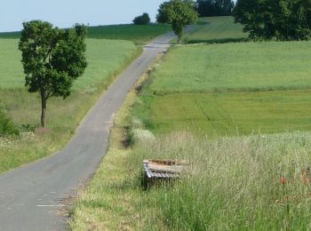
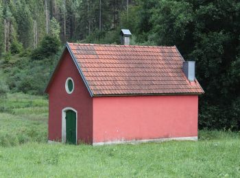
Königsfeld: Descubra las mejores excursiones: 7 a pie. Todos estos circuitos, recorridos, itinerarios y actividades al aire libre están disponibles en nuestras aplicaciones SityTrail para smartphone y tablet.
Los mejores recorridos (7)
![Excursión A pie Königsfeld - Kapellenweg Königsfeld - Gelbe Route - Photo](https://media.geolcdn.com/t/350/260/f78fc4a3-fe8c-4d00-b3a3-673dfcbcc3e6.jpeg&format=jpg&maxdim=2)
![A pie A pie](https://static1.geolcdn.com/sitytour/trail-icons/100.png)
Km
A pie
![](/images/other/stat-length.png)
![](https://static1.geolcdn.com/siteimages/upload/files/1508320355ic_sort_den_pos_24dp.png)
![](https://static1.geolcdn.com/siteimages/upload/files/1508320355ic_sort_den_neg_24dp.png)
![](https://static1.geolcdn.com/siteimages/upload/files/16400158638029165_repeat_loop_refresh_sync_direction_icon.png)
• Trail created by Gemeinde Königsfeld. Symbol: Stilisierte Kapelle in gelbem Ring auf weißem Hintergrund
![Excursión A pie Königsfeld - Kapellenweg Königsfeld - Grüne Route - Photo](https://media.geolcdn.com/t/350/260/6b47b26b-45ee-4422-8d8d-ff8ae5558995.jpeg&format=jpg&maxdim=2)
![A pie A pie](https://static1.geolcdn.com/sitytour/trail-icons/100.png)
Km
A pie
![](/images/other/stat-length.png)
![](https://static1.geolcdn.com/siteimages/upload/files/1508320355ic_sort_den_pos_24dp.png)
![](https://static1.geolcdn.com/siteimages/upload/files/1508320355ic_sort_den_neg_24dp.png)
![](https://static1.geolcdn.com/siteimages/upload/files/16400158638029165_repeat_loop_refresh_sync_direction_icon.png)
• Trail created by Gemeinde Königsfeld. Symbol: Stilisierte Kapelle in grünem Ring auf weißem Hintergrund
![Excursión A pie Königsfeld - Kapellenweg Königsfeld - Rote Route - Photo](https://media.geolcdn.com/t/350/260/2a7341fa-f823-4ee3-bfd4-378fee99b278.jpeg&format=jpg&maxdim=2)
![A pie A pie](https://static1.geolcdn.com/sitytour/trail-icons/100.png)
Km
A pie
![](/images/other/stat-length.png)
![](https://static1.geolcdn.com/siteimages/upload/files/1508320355ic_sort_den_pos_24dp.png)
![](https://static1.geolcdn.com/siteimages/upload/files/1508320355ic_sort_den_neg_24dp.png)
![](https://static1.geolcdn.com/siteimages/upload/files/16400158638029165_repeat_loop_refresh_sync_direction_icon.png)
• Trail created by Gemeinde Königsfeld. Symbol: Stilisierte Kapelle in rotem Ring auf weißem Hintergrund
![Excursión A pie Königsfeld - Kapellenweg Königsfeld - Blaue Route - Photo](https://media.geolcdn.com/t/350/260/642fac65-56bc-406a-b86c-d08b55f9b316.jpeg&format=jpg&maxdim=2)
![A pie A pie](https://static1.geolcdn.com/sitytour/trail-icons/100.png)
Km
A pie
![](/images/other/stat-length.png)
![](https://static1.geolcdn.com/siteimages/upload/files/1508320355ic_sort_den_pos_24dp.png)
![](https://static1.geolcdn.com/siteimages/upload/files/1508320355ic_sort_den_neg_24dp.png)
![](https://static1.geolcdn.com/siteimages/upload/files/16400158638029165_repeat_loop_refresh_sync_direction_icon.png)
• Trail created by Gemeinde Königsfeld. Symbol: Stilisierte Kapelle in blauem Ring auf weißem Hintergrund
![Excursión A pie Königsfeld - Auf den Höhen des Jura - Photo](https://media.geolcdn.com/t/350/260/c38567a0-9776-4c2e-8a9e-11c68786399e.jpeg&format=jpg&maxdim=2)
![A pie A pie](https://static1.geolcdn.com/sitytour/trail-icons/100.png)
Km
A pie
![](/images/other/stat-length.png)
![](https://static1.geolcdn.com/siteimages/upload/files/1508320355ic_sort_den_pos_24dp.png)
![](https://static1.geolcdn.com/siteimages/upload/files/1508320355ic_sort_den_neg_24dp.png)
![](https://static1.geolcdn.com/siteimages/upload/files/16400158638029165_repeat_loop_refresh_sync_direction_icon.png)
• Symbol: Schwarzer Ring auf weißem Hintergrund
![Excursión A pie Königsfeld - Rundweg Paradiestal - Photo](https://media.geolcdn.com/t/350/260/bd985c37-dd8c-4b18-9704-9329deb97fbd.jpeg&format=jpg&maxdim=2)
![A pie A pie](https://static1.geolcdn.com/sitytour/trail-icons/100.png)
Km
A pie
![](/images/other/stat-length.png)
![](https://static1.geolcdn.com/siteimages/upload/files/1508320355ic_sort_den_pos_24dp.png)
![](https://static1.geolcdn.com/siteimages/upload/files/1508320355ic_sort_den_neg_24dp.png)
![](https://static1.geolcdn.com/siteimages/upload/files/16400158638029165_repeat_loop_refresh_sync_direction_icon.png)
• Trail created by Landkreis Lichtenfels. Symbol: Blauer Ring auf weißem Hintergrund
![Excursión A pie Königsfeld - Pfaffenritt - Photo](https://media.geolcdn.com/t/350/260/b2fb81ae-0cd0-46ea-9dda-3918c4ec1253.jpeg&format=jpg&maxdim=2)
![A pie A pie](https://static1.geolcdn.com/sitytour/trail-icons/100.png)
Km
A pie
![](/images/other/stat-length.png)
![](https://static1.geolcdn.com/siteimages/upload/files/1508320355ic_sort_den_pos_24dp.png)
![](https://static1.geolcdn.com/siteimages/upload/files/1508320355ic_sort_den_neg_24dp.png)
![](https://static1.geolcdn.com/siteimages/upload/files/16400158638029165_repeat_loop_refresh_sync_direction_icon.png)
• Trail created by Rennsteigverein 1896. Symbol: rotes Hufeisen auf weißem Grund Sitio web: http://www.rennsteigvere...
7 excursiones mostradas en 7
Aplicación GPS de excursión GRATIS