![](/images/other/stat-length.png)
- Excursiones
- Outdoor
- Czech Republic
- Severovýchod
- Královéhradecký kraj
- Rokytnice v Orlických horách
Rokytnice v Orlických horách, Královéhradecký kraj: Los mejores itinerarios de excursión, recorridos, paseos y sendas
Rokytnice v Orlických horách: Descubra las mejores excursiones: 3 a pie. Todos estos circuitos, recorridos, itinerarios y actividades al aire libre están disponibles en nuestras aplicaciones SityTrail para smartphone y tablet.
Los mejores recorridos (3)
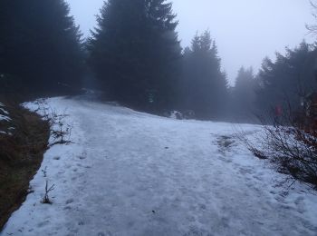
![Excursión A pie Rokytnice v Orlických horách - [Z] Říčky v Orl. h. - Horní Rokytnice - Photo](https://media.geolcdn.com/t/350/260/ee733087-daf8-4ced-ba45-cb70cdb3ebdb.jpeg&format=jpg&maxdim=2)
![A pie A pie](https://static1.geolcdn.com/sitytour/trail-icons/100.png)
Km
A pie
![](/images/other/stat-length.png)
![](https://static1.geolcdn.com/siteimages/upload/files/1508320355ic_sort_den_pos_24dp.png)
![](https://static1.geolcdn.com/siteimages/upload/files/1508320355ic_sort_den_neg_24dp.png)
![](https://static1.geolcdn.com/siteimages/upload/files/16400158638029165_repeat_loop_refresh_sync_direction_icon.png)
• Ruta creada por cz:KČT.
![Excursión A pie Rokytnice v Orlických horách - NS Opevnění Rokytnicka - Photo](https://media.geolcdn.com/t/350/260/a0c96dca-eb28-4f93-abc6-4ce39ab56662.jpeg&format=jpg&maxdim=2)
![A pie A pie](https://static1.geolcdn.com/sitytour/trail-icons/100.png)
Km
A pie
![](/images/other/stat-length.png)
![](https://static1.geolcdn.com/siteimages/upload/files/1508320355ic_sort_den_pos_24dp.png)
![](https://static1.geolcdn.com/siteimages/upload/files/1508320355ic_sort_den_neg_24dp.png)
![](https://static1.geolcdn.com/siteimages/upload/files/16400158638029165_repeat_loop_refresh_sync_direction_icon.png)
• Ruta creada por cz:KČT.
![Excursión A pie Rokytnice v Orlických horách - [Ž] Rokytnice v Orl. h - Žampach - Photo](https://media.geolcdn.com/t/350/260/ext.jpg?maxdim=2&url=https%3A%2F%2Fstatic1.geolcdn.com%2Fsiteimages%2Fupload%2Ffiles%2F1545311037marcheuse_200dpi.jpg)
![A pie A pie](https://static1.geolcdn.com/sitytour/trail-icons/100.png)
Km
A pie
![](/images/other/stat-length.png)
![](https://static1.geolcdn.com/siteimages/upload/files/1508320355ic_sort_den_pos_24dp.png)
![](https://static1.geolcdn.com/siteimages/upload/files/1508320355ic_sort_den_neg_24dp.png)
![](https://static1.geolcdn.com/siteimages/upload/files/16400158638029165_repeat_loop_refresh_sync_direction_icon.png)
• Ruta creada por cz:KČT. Rokytnice v Orlických horách - Žamberk - Žampach
3 excursiones mostradas en 3
Aplicación GPS de excursión GRATIS