


11,4 km | 12,3 km-effort
Burgenland: Descubra las mejores excursiones: 172 a pie. Todos estos circuitos, recorridos, itinerarios y actividades al aire libre están disponibles en nuestras aplicaciones SityTrail para smartphone y tablet.
A pie


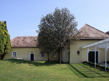
• Trail created by Tourismusverband Siegendorf.
A pie
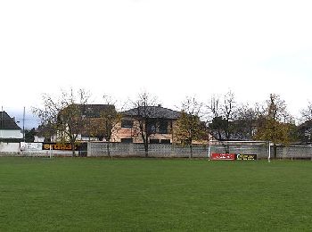
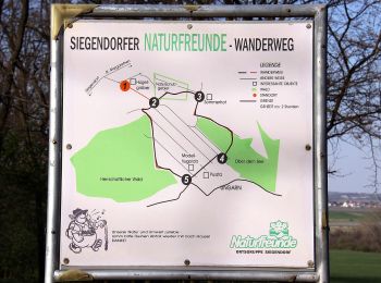
• Trail created by Naturfreunde Ortsgruppe Siegendorf.
A pie
• Trail created by Tourismusverband Siegendorf.
A pie
• Trail created by Tourismusverband Siegendorf.
A pie
• Trail created by Tourismusverband Siegendorf.
A pie
• Trail created by Tourismusverband Siegendorf.
A pie
• Trail created by Tourismusverband Siegendorf.
A pie
• Trail created by Tourismus Südburgenland.
A pie
• Trail created by Tourismus Südburgenland.
A pie
• Trail created by Tourismus Südburgenland.
A pie
• Trail created by Gemeinde Schützen am Gebirge.
A pie
• Trail created by Bewegungsarena Hornbach. Symbol: blauer Pfeil, 4
A pie
• Trail created by Via.Carnuntum.
A pie
• Trail created by Tourismusverband Edelstal.
A pie
• Trail created by Naturfreunde Mattersburg. insgesamt sehr schlecht markiert Symbol: rot-weiss-rot 921
A pie
• Symbol: Weißer Pfeil mit Schriftzug "Kreuz & Quer-Weg" auf gelbem Hintergrund
A pie
• Trail created by Leithaland. Symbol: Weißer Pfeil mit Schriftzug "Kreuz & Quer-Weg" auf rotbraunem Hintergrund
A pie
• Trail created by Leithaland. beim Hohen Berg teilweise fast zugewachsen
A pie
• Trail created by Bewegungsarena Hornbach. Symbol: roter Pfeil, 2
A pie
• Trail created by Tourismusverband Region Rosalia. Symbol: grünes Schild mit Pfeil
20 excursiones mostradas en 172
Aplicación GPS de excursión GRATIS
 SityTrail
IGN / Institutos geográficos
SityTrail World
El mundo es suyo