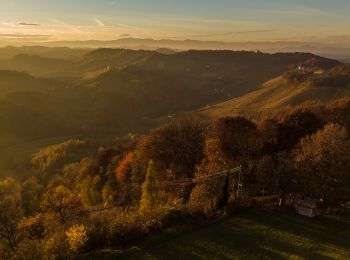
![](/images/other/stat-length.png)
- Excursiones
- Outdoor
- Austria
- Estiria
- Bezirk Leibnitz
- Ehrenhausen an der Weinstraße
Ehrenhausen an der Weinstraße, Bezirk Leibnitz: Los mejores itinerarios de excursión, recorridos, paseos y sendas
Ehrenhausen an der Weinstraße: Descubra las mejores excursiones: 8 a pie. Todos estos circuitos, recorridos, itinerarios y actividades al aire libre están disponibles en nuestras aplicaciones SityTrail para smartphone y tablet.
Los mejores recorridos (8)
![Excursión A pie Ehrenhausen an der Weinstraße - Berghausen 1 - Photo](https://media.geolcdn.com/t/350/260/74815bba-e24d-4ad5-9cfc-9c7a0b388939.jpeg&format=jpg&maxdim=2)
![A pie A pie](https://static1.geolcdn.com/sitytour/trail-icons/100.png)
Km
A pie
![](/images/other/stat-length.png)
![](https://static1.geolcdn.com/siteimages/upload/files/1508320355ic_sort_den_pos_24dp.png)
![](https://static1.geolcdn.com/siteimages/upload/files/1508320355ic_sort_den_neg_24dp.png)
![](https://static1.geolcdn.com/siteimages/upload/files/16400158638029165_repeat_loop_refresh_sync_direction_icon.png)
• Trail created by Südsteirische Weinstraße. Symbol: gelbe Schilder
![Excursión A pie Ehrenhausen an der Weinstraße - Ehrenhausen 1 - Photo](https://media.geolcdn.com/t/350/260/4aae38a0-c3b6-4f3a-939c-d40c3c3416c5.jpeg&format=jpg&maxdim=2)
![A pie A pie](https://static1.geolcdn.com/sitytour/trail-icons/100.png)
Km
A pie
![](/images/other/stat-length.png)
![](https://static1.geolcdn.com/siteimages/upload/files/1508320355ic_sort_den_pos_24dp.png)
![](https://static1.geolcdn.com/siteimages/upload/files/1508320355ic_sort_den_neg_24dp.png)
![](https://static1.geolcdn.com/siteimages/upload/files/16400158638029165_repeat_loop_refresh_sync_direction_icon.png)
• Trail created by Ehrenhausen. Symbol: weiße Tafel mit grünem Mausoleum-Logo
![Excursión A pie Ehrenhausen an der Weinstraße - Ehrenhausen 2 - Photo](https://media.geolcdn.com/t/350/260/e5d71411-2f0d-4292-8ff2-c008b6f49357.jpeg&format=jpg&maxdim=2)
![A pie A pie](https://static1.geolcdn.com/sitytour/trail-icons/100.png)
Km
A pie
![](/images/other/stat-length.png)
![](https://static1.geolcdn.com/siteimages/upload/files/1508320355ic_sort_den_pos_24dp.png)
![](https://static1.geolcdn.com/siteimages/upload/files/1508320355ic_sort_den_neg_24dp.png)
![](https://static1.geolcdn.com/siteimages/upload/files/16400158638029165_repeat_loop_refresh_sync_direction_icon.png)
• Trail created by Ehrenhausen. Symbol: weiße Tafel mit grünem Mausoleum-Logo
![Excursión A pie Ehrenhausen an der Weinstraße - Ehrenhausen 4 - Photo](https://media.geolcdn.com/t/350/260/b19dbf09-8ef0-4f6f-bff2-cfaf3f20d6fe.jpeg&format=jpg&maxdim=2)
![A pie A pie](https://static1.geolcdn.com/sitytour/trail-icons/100.png)
Km
A pie
![](/images/other/stat-length.png)
![](https://static1.geolcdn.com/siteimages/upload/files/1508320355ic_sort_den_pos_24dp.png)
![](https://static1.geolcdn.com/siteimages/upload/files/1508320355ic_sort_den_neg_24dp.png)
![](https://static1.geolcdn.com/siteimages/upload/files/16400158638029165_repeat_loop_refresh_sync_direction_icon.png)
• Trail created by Ehrenhausen. Symbol: weiße Tafel mit grünem Mausoleum-Logo
![Excursión A pie Ehrenhausen an der Weinstraße - Natur-Kultur-Archäologie-Weg - Photo](https://media.geolcdn.com/t/350/260/e32fdd88-ded1-4bfe-9de9-de8e0a429387.jpeg&format=jpg&maxdim=2)
![A pie A pie](https://static1.geolcdn.com/sitytour/trail-icons/100.png)
Km
A pie
![](/images/other/stat-length.png)
![](https://static1.geolcdn.com/siteimages/upload/files/1508320355ic_sort_den_pos_24dp.png)
![](https://static1.geolcdn.com/siteimages/upload/files/1508320355ic_sort_den_neg_24dp.png)
![](https://static1.geolcdn.com/siteimages/upload/files/16400158638029165_repeat_loop_refresh_sync_direction_icon.png)
• Symbol: grüner Doppelpfeil mit 2 Sonnen und schwarzer Schrift
![Excursión A pie Ehrenhausen an der Weinstraße - Welschlauf Südsteiermark - Photo](https://media.geolcdn.com/t/350/260/19c45851-bd56-49f2-a671-0bafde2a43cb.jpeg&format=jpg&maxdim=2)
![A pie A pie](https://static1.geolcdn.com/sitytour/trail-icons/100.png)
Km
A pie
![](/images/other/stat-length.png)
![](https://static1.geolcdn.com/siteimages/upload/files/1508320355ic_sort_den_pos_24dp.png)
![](https://static1.geolcdn.com/siteimages/upload/files/1508320355ic_sort_den_neg_24dp.png)
![](https://static1.geolcdn.com/siteimages/upload/files/16400158638029165_repeat_loop_refresh_sync_direction_icon.png)
• ganzjährig ausgeschilderte Strecke des Welschlaufs Symbol: roter Fuss (ostwärts) bzw. grüner Fuss (westwärts)
![Excursión A pie Ehrenhausen an der Weinstraße - Weinwanderweg Ratsch-Ottenberg - Photo](https://media.geolcdn.com/t/350/260/39dd7879-8932-4def-b98f-67f275659118.jpeg&format=jpg&maxdim=2)
![A pie A pie](https://static1.geolcdn.com/sitytour/trail-icons/100.png)
Km
A pie
![](/images/other/stat-length.png)
![](https://static1.geolcdn.com/siteimages/upload/files/1508320355ic_sort_den_pos_24dp.png)
![](https://static1.geolcdn.com/siteimages/upload/files/1508320355ic_sort_den_neg_24dp.png)
![](https://static1.geolcdn.com/siteimages/upload/files/16400158638029165_repeat_loop_refresh_sync_direction_icon.png)
![Excursión A pie Ehrenhausen an der Weinstraße - Berghausen 2 - Photo](https://media.geolcdn.com/t/350/260/26ba5adf-fa10-4d5b-a1d4-f90a62321dfa.jpeg&format=jpg&maxdim=2)
![A pie A pie](https://static1.geolcdn.com/sitytour/trail-icons/100.png)
Km
A pie
![](/images/other/stat-length.png)
![](https://static1.geolcdn.com/siteimages/upload/files/1508320355ic_sort_den_pos_24dp.png)
![](https://static1.geolcdn.com/siteimages/upload/files/1508320355ic_sort_den_neg_24dp.png)
![](https://static1.geolcdn.com/siteimages/upload/files/16400158638029165_repeat_loop_refresh_sync_direction_icon.png)
• Trail created by Südsteirische Weinstraße. Symbol: Gelbes Schild, Berghausener Rundwanderweg
8 excursiones mostradas en 8
Aplicación GPS de excursión GRATIS