![](/images/other/stat-length.png)
- Excursiones
- Outdoor
- Austria
- Baja Austria
- Bezirk Wiener Neustadt
- Gemeinde Hochneukirchen-Gschaidt
Gemeinde Hochneukirchen-Gschaidt, Bezirk Wiener Neustadt: Los mejores itinerarios de excursión, recorridos, paseos y sendas
Gemeinde Hochneukirchen-Gschaidt: Descubra las mejores excursiones: 9 a pie. Todos estos circuitos, recorridos, itinerarios y actividades al aire libre están disponibles en nuestras aplicaciones SityTrail para smartphone y tablet.
Los mejores recorridos (9)
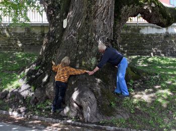
![Excursión A pie Gemeinde Hochneukirchen-Gschaidt - Rundwanderweg Gschaidt - Photo](https://media.geolcdn.com/t/350/260/9e21553f-bee3-48a5-8d60-50b80ad77def.jpeg&format=jpg&maxdim=2)
![A pie A pie](https://static1.geolcdn.com/sitytour/trail-icons/100.png)
Km
A pie
![](/images/other/stat-length.png)
![](https://static1.geolcdn.com/siteimages/upload/files/1508320355ic_sort_den_pos_24dp.png)
![](https://static1.geolcdn.com/siteimages/upload/files/1508320355ic_sort_den_neg_24dp.png)
![](https://static1.geolcdn.com/siteimages/upload/files/16400158638029165_repeat_loop_refresh_sync_direction_icon.png)
• Trail created by Tourismus- und Verschönerungsverein Hochneukirchen-Gschaidt. Symbol: gelber waagerechter Balken
![Excursión A pie Gemeinde Hochneukirchen-Gschaidt - Hochneukirchen - Ofenegg - Dreiländerstein - Ulrichsdorf - Gschaidt - Photo](https://media.geolcdn.com/t/350/260/9e21553f-bee3-48a5-8d60-50b80ad77def.jpeg&format=jpg&maxdim=2)
![A pie A pie](https://static1.geolcdn.com/sitytour/trail-icons/100.png)
Km
A pie
![](/images/other/stat-length.png)
![](https://static1.geolcdn.com/siteimages/upload/files/1508320355ic_sort_den_pos_24dp.png)
![](https://static1.geolcdn.com/siteimages/upload/files/1508320355ic_sort_den_neg_24dp.png)
![](https://static1.geolcdn.com/siteimages/upload/files/16400158638029165_repeat_loop_refresh_sync_direction_icon.png)
• Symbol: blauer,waagrechter Balken
![Excursión A pie Gemeinde Hochneukirchen-Gschaidt - Hochneukirchen - Mölterner Höhe - Hosien - Photo](https://media.geolcdn.com/t/350/260/e60ddde0-2e6f-45af-8fcc-5326442757ad.jpeg&format=jpg&maxdim=2)
![A pie A pie](https://static1.geolcdn.com/sitytour/trail-icons/100.png)
Km
A pie
![](/images/other/stat-length.png)
![](https://static1.geolcdn.com/siteimages/upload/files/1508320355ic_sort_den_pos_24dp.png)
![](https://static1.geolcdn.com/siteimages/upload/files/1508320355ic_sort_den_neg_24dp.png)
![](https://static1.geolcdn.com/siteimages/upload/files/16400158638029165_repeat_loop_refresh_sync_direction_icon.png)
• Symbol: gelber, waagerechter Balken
![Excursión A pie Gemeinde Hochneukirchen-Gschaidt - Hochneukirchen - Gschaidt - Photo](https://media.geolcdn.com/t/350/260/9e21553f-bee3-48a5-8d60-50b80ad77def.jpeg&format=jpg&maxdim=2)
![A pie A pie](https://static1.geolcdn.com/sitytour/trail-icons/100.png)
Km
A pie
![](/images/other/stat-length.png)
![](https://static1.geolcdn.com/siteimages/upload/files/1508320355ic_sort_den_pos_24dp.png)
![](https://static1.geolcdn.com/siteimages/upload/files/1508320355ic_sort_den_neg_24dp.png)
![](https://static1.geolcdn.com/siteimages/upload/files/16400158638029165_repeat_loop_refresh_sync_direction_icon.png)
• Symbol: blauer,waagrechter Balken
![Excursión A pie Gemeinde Hochneukirchen-Gschaidt - Hochneukirchen - Maltern - Photo](https://media.geolcdn.com/t/350/260/e60ddde0-2e6f-45af-8fcc-5326442757ad.jpeg&format=jpg&maxdim=2)
![A pie A pie](https://static1.geolcdn.com/sitytour/trail-icons/100.png)
Km
A pie
![](/images/other/stat-length.png)
![](https://static1.geolcdn.com/siteimages/upload/files/1508320355ic_sort_den_pos_24dp.png)
![](https://static1.geolcdn.com/siteimages/upload/files/1508320355ic_sort_den_neg_24dp.png)
![](https://static1.geolcdn.com/siteimages/upload/files/16400158638029165_repeat_loop_refresh_sync_direction_icon.png)
• Symbol: grüner, waagrechter Balken
![Excursión A pie Gemeinde Hochneukirchen-Gschaidt - Hochneukirchen - Hutwisch - Steinstückel - Kienberg - Bernstein - Photo](https://media.geolcdn.com/t/350/260/6db4e493-0a30-4e81-b409-d074e2fb35f1.jpeg&format=jpg&maxdim=2)
![A pie A pie](https://static1.geolcdn.com/sitytour/trail-icons/100.png)
Km
A pie
![](/images/other/stat-length.png)
![](https://static1.geolcdn.com/siteimages/upload/files/1508320355ic_sort_den_pos_24dp.png)
![](https://static1.geolcdn.com/siteimages/upload/files/1508320355ic_sort_den_neg_24dp.png)
![](https://static1.geolcdn.com/siteimages/upload/files/16400158638029165_repeat_loop_refresh_sync_direction_icon.png)
• Trail created by Österreichischer Touristenklub. Symbol: grüner, waagrechter Balken
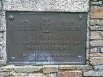
![Excursión A pie Gemeinde Hochneukirchen-Gschaidt - Bad Schönau - Hutwisch - Photo](https://media.geolcdn.com/t/350/260/f8141916-dd2d-4f40-95f9-35ed433f0c0f.jpeg&format=jpg&maxdim=2)
![A pie A pie](https://static1.geolcdn.com/sitytour/trail-icons/100.png)
Km
A pie
![](/images/other/stat-length.png)
![](https://static1.geolcdn.com/siteimages/upload/files/1508320355ic_sort_den_pos_24dp.png)
![](https://static1.geolcdn.com/siteimages/upload/files/1508320355ic_sort_den_neg_24dp.png)
![](https://static1.geolcdn.com/siteimages/upload/files/16400158638029165_repeat_loop_refresh_sync_direction_icon.png)
• Symbol: roter Balken, E1
![Excursión A pie Gemeinde Hochneukirchen-Gschaidt - Hochneukirchen - Schwarzer Graben - Maltern - Photo](https://media.geolcdn.com/t/350/260/cd73ad99-8020-41d6-8814-205048782353.jpeg&format=jpg&maxdim=2)
![A pie A pie](https://static1.geolcdn.com/sitytour/trail-icons/100.png)
Km
A pie
![](/images/other/stat-length.png)
![](https://static1.geolcdn.com/siteimages/upload/files/1508320355ic_sort_den_pos_24dp.png)
![](https://static1.geolcdn.com/siteimages/upload/files/1508320355ic_sort_den_neg_24dp.png)
![](https://static1.geolcdn.com/siteimages/upload/files/16400158638029165_repeat_loop_refresh_sync_direction_icon.png)
![Excursión A pie Gemeinde Hochneukirchen-Gschaidt - Gschaidt - Burgerschlag - Grametschlag - Maltern - Photo](https://media.geolcdn.com/t/350/260/ext.jpg?maxdim=2&url=https%3A%2F%2Fstatic1.geolcdn.com%2Fsiteimages%2Fupload%2Ffiles%2F1545311037marcheuse_200dpi.jpg)
![A pie A pie](https://static1.geolcdn.com/sitytour/trail-icons/100.png)
Km
A pie
![](/images/other/stat-length.png)
![](https://static1.geolcdn.com/siteimages/upload/files/1508320355ic_sort_den_pos_24dp.png)
![](https://static1.geolcdn.com/siteimages/upload/files/1508320355ic_sort_den_neg_24dp.png)
![](https://static1.geolcdn.com/siteimages/upload/files/16400158638029165_repeat_loop_refresh_sync_direction_icon.png)
• Symbol: roter waagerechter Balken, F5
9 excursiones mostradas en 9
Aplicación GPS de excursión GRATIS