![](/images/other/stat-length.png)
- Excursiones
- Outdoor
- Austria
- Baja Austria
- Bezirk Neunkirchen
- Gemeinde Warth
Gemeinde Warth, Bezirk Neunkirchen: Los mejores itinerarios de excursión, recorridos, paseos y sendas
Gemeinde Warth: Descubra las mejores excursiones: 14 a pie. Todos estos circuitos, recorridos, itinerarios y actividades al aire libre están disponibles en nuestras aplicaciones SityTrail para smartphone y tablet.
Los mejores recorridos (14)
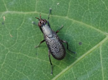
![Excursión A pie Gemeinde Warth - Mostheurigen Weg (Ausgangspunkt: Kirchau Kirchenplatz) - Photo](https://media.geolcdn.com/t/350/260/f18e4c43-4b4a-4f9e-bbcf-a15e87308003.jpeg&format=jpg&maxdim=2)
![A pie A pie](https://static1.geolcdn.com/sitytour/trail-icons/100.png)
Km
A pie
![](/images/other/stat-length.png)
![](https://static1.geolcdn.com/siteimages/upload/files/1508320355ic_sort_den_pos_24dp.png)
![](https://static1.geolcdn.com/siteimages/upload/files/1508320355ic_sort_den_neg_24dp.png)
![](https://static1.geolcdn.com/siteimages/upload/files/16400158638029165_repeat_loop_refresh_sync_direction_icon.png)
• Trail created by DEV Kirchau. Symbol: roter Punkt auf weißem Grund
![Excursión A pie Gemeinde Warth - Kulmer Weg (Ausgangspunkt: Kirchau Kirchenplatz) - Photo](https://media.geolcdn.com/t/350/260/f18e4c43-4b4a-4f9e-bbcf-a15e87308003.jpeg&format=jpg&maxdim=2)
![A pie A pie](https://static1.geolcdn.com/sitytour/trail-icons/100.png)
Km
A pie
![](/images/other/stat-length.png)
![](https://static1.geolcdn.com/siteimages/upload/files/1508320355ic_sort_den_pos_24dp.png)
![](https://static1.geolcdn.com/siteimages/upload/files/1508320355ic_sort_den_neg_24dp.png)
![](https://static1.geolcdn.com/siteimages/upload/files/16400158638029165_repeat_loop_refresh_sync_direction_icon.png)
• Trail created by DEV Kirchau. Symbol: roter Punkt auf weißem Grund
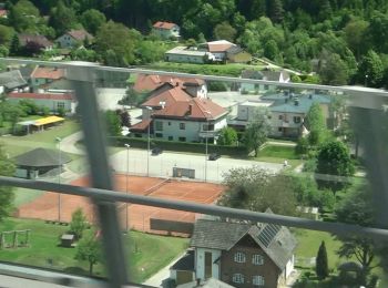
![Excursión A pie Gemeinde Warth - Orchideen Weg (Ausgangspunkt: Warth Hauptplatz) - Photo](https://media.geolcdn.com/t/350/260/970ab4d4-72c1-417a-a00d-aa9297c367b1.jpeg&format=jpg&maxdim=2)
![A pie A pie](https://static1.geolcdn.com/sitytour/trail-icons/100.png)
Km
A pie
![](/images/other/stat-length.png)
![](https://static1.geolcdn.com/siteimages/upload/files/1508320355ic_sort_den_pos_24dp.png)
![](https://static1.geolcdn.com/siteimages/upload/files/1508320355ic_sort_den_neg_24dp.png)
![](https://static1.geolcdn.com/siteimages/upload/files/16400158638029165_repeat_loop_refresh_sync_direction_icon.png)
• Trail created by DEV Kirchau. Symbol: grüner Punkt auf weißem Grund
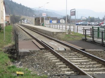
![Excursión A pie Gemeinde Warth - Leidinger Weg (Ausgangspunkt: Petersbaumgarten Kapellenplatz) - Photo](https://media.geolcdn.com/t/350/260/158a56e6-c9c6-4d07-b8a5-485fd0302378.jpeg&format=jpg&maxdim=2)
![A pie A pie](https://static1.geolcdn.com/sitytour/trail-icons/100.png)
Km
A pie
![](/images/other/stat-length.png)
![](https://static1.geolcdn.com/siteimages/upload/files/1508320355ic_sort_den_pos_24dp.png)
![](https://static1.geolcdn.com/siteimages/upload/files/1508320355ic_sort_den_neg_24dp.png)
![](https://static1.geolcdn.com/siteimages/upload/files/16400158638029165_repeat_loop_refresh_sync_direction_icon.png)
• Trail created by DEV Kirchau. Symbol: gelber Punkt auf weißem Grund
![Excursión A pie Gemeinde Warth - Gretel Weg (Ausgangspunkt: Warth Bushaltestelle) - Photo](https://media.geolcdn.com/t/350/260/970ab4d4-72c1-417a-a00d-aa9297c367b1.jpeg&format=jpg&maxdim=2)
![A pie A pie](https://static1.geolcdn.com/sitytour/trail-icons/100.png)
Km
A pie
![](/images/other/stat-length.png)
![](https://static1.geolcdn.com/siteimages/upload/files/1508320355ic_sort_den_pos_24dp.png)
![](https://static1.geolcdn.com/siteimages/upload/files/1508320355ic_sort_den_neg_24dp.png)
![](https://static1.geolcdn.com/siteimages/upload/files/16400158638029165_repeat_loop_refresh_sync_direction_icon.png)
• Trail created by DEV Kirchau. Symbol: grüner Punkt auf weißem Grund
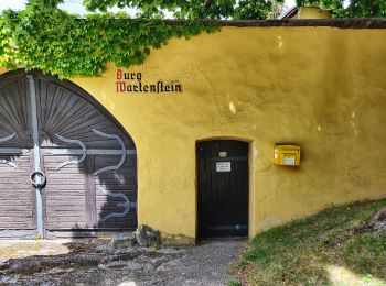
![Excursión A pie Gemeinde Warth - Urbankapelle -Ödenkirchen - Rams - Raach - Schlagl - Maria Schutz - Photo](https://media.geolcdn.com/t/350/260/8cb61248-f720-4028-a202-b65a40f0f104.jpeg&format=jpg&maxdim=2)
![A pie A pie](https://static1.geolcdn.com/sitytour/trail-icons/100.png)
Km
A pie
![](/images/other/stat-length.png)
![](https://static1.geolcdn.com/siteimages/upload/files/1508320355ic_sort_den_pos_24dp.png)
![](https://static1.geolcdn.com/siteimages/upload/files/1508320355ic_sort_den_neg_24dp.png)
![](https://static1.geolcdn.com/siteimages/upload/files/16400158638029165_repeat_loop_refresh_sync_direction_icon.png)
• Trail created by Österreichischer Touristenklub, Sektion Neunkirchen. Symbol: gelber, waagerechter Balken
![Excursión A pie Gemeinde Warth - Haßbach - Ödenkirchen - Photo](https://media.geolcdn.com/t/350/260/f3dac0c1-1617-42b2-b198-f8316af0fe29.jpeg&format=jpg&maxdim=2)
![A pie A pie](https://static1.geolcdn.com/sitytour/trail-icons/100.png)
Km
A pie
![](/images/other/stat-length.png)
![](https://static1.geolcdn.com/siteimages/upload/files/1508320355ic_sort_den_pos_24dp.png)
![](https://static1.geolcdn.com/siteimages/upload/files/1508320355ic_sort_den_neg_24dp.png)
![](https://static1.geolcdn.com/siteimages/upload/files/16400158638029165_repeat_loop_refresh_sync_direction_icon.png)
• Trail created by Österreichischer Touristenklub, Sektion Neunkirchen. Symbol: blauer, waagrechter Balken
![Excursión A pie Gemeinde Warth - Haßbach - Urbankapelle - Feistritz - Photo](https://media.geolcdn.com/t/350/260/4a86f957-fcc5-402a-917f-df6cd752d245.jpeg&format=jpg&maxdim=2)
![A pie A pie](https://static1.geolcdn.com/sitytour/trail-icons/100.png)
Km
A pie
![](/images/other/stat-length.png)
![](https://static1.geolcdn.com/siteimages/upload/files/1508320355ic_sort_den_pos_24dp.png)
![](https://static1.geolcdn.com/siteimages/upload/files/1508320355ic_sort_den_neg_24dp.png)
![](https://static1.geolcdn.com/siteimages/upload/files/16400158638029165_repeat_loop_refresh_sync_direction_icon.png)
• Trail created by Österreichischer Touristenklub, Sektion Neunkirchen. Symbol: roter, waagrechter Balken
![Excursión A pie Gemeinde Warth - Haßbach - Talarhof - Photo](https://media.geolcdn.com/t/350/260/cc6cca82-35a2-4996-bd5c-f49be613b184.jpeg&format=jpg&maxdim=2)
![A pie A pie](https://static1.geolcdn.com/sitytour/trail-icons/100.png)
Km
A pie
![](/images/other/stat-length.png)
![](https://static1.geolcdn.com/siteimages/upload/files/1508320355ic_sort_den_pos_24dp.png)
![](https://static1.geolcdn.com/siteimages/upload/files/1508320355ic_sort_den_neg_24dp.png)
![](https://static1.geolcdn.com/siteimages/upload/files/16400158638029165_repeat_loop_refresh_sync_direction_icon.png)
• Trail created by Österreichischer Touristenklub, Sektion Neunkirchen. Symbol: gelber, waagerechter Balken
![Excursión A pie Gemeinde Warth - Kulmberg Weg (Ausgangspunkt: Haßbach - GH Maier) - Photo](https://media.geolcdn.com/t/350/260/f3dac0c1-1617-42b2-b198-f8316af0fe29.jpeg&format=jpg&maxdim=2)
![A pie A pie](https://static1.geolcdn.com/sitytour/trail-icons/100.png)
Km
A pie
![](/images/other/stat-length.png)
![](https://static1.geolcdn.com/siteimages/upload/files/1508320355ic_sort_den_pos_24dp.png)
![](https://static1.geolcdn.com/siteimages/upload/files/1508320355ic_sort_den_neg_24dp.png)
![](https://static1.geolcdn.com/siteimages/upload/files/16400158638029165_repeat_loop_refresh_sync_direction_icon.png)
• Symbol: blauer Punkt auf weißem Grund
![Excursión A pie Gemeinde Warth - Hochegger Kapellenweg - Photo](https://media.geolcdn.com/t/350/260/5479a425-8f69-40ee-8eac-02e495dc2ccc.jpeg&format=jpg&maxdim=2)
![A pie A pie](https://static1.geolcdn.com/sitytour/trail-icons/100.png)
Km
A pie
![](/images/other/stat-length.png)
![](https://static1.geolcdn.com/siteimages/upload/files/1508320355ic_sort_den_pos_24dp.png)
![](https://static1.geolcdn.com/siteimages/upload/files/1508320355ic_sort_den_neg_24dp.png)
![](https://static1.geolcdn.com/siteimages/upload/files/16400158638029165_repeat_loop_refresh_sync_direction_icon.png)
![Excursión A pie Gemeinde Warth - Petersbaumgarten - Bernreith - Kienegg - Photo](https://media.geolcdn.com/t/350/260/158a56e6-c9c6-4d07-b8a5-485fd0302378.jpeg&format=jpg&maxdim=2)
![A pie A pie](https://static1.geolcdn.com/sitytour/trail-icons/100.png)
Km
A pie
![](/images/other/stat-length.png)
![](https://static1.geolcdn.com/siteimages/upload/files/1508320355ic_sort_den_pos_24dp.png)
![](https://static1.geolcdn.com/siteimages/upload/files/1508320355ic_sort_den_neg_24dp.png)
![](https://static1.geolcdn.com/siteimages/upload/files/16400158638029165_repeat_loop_refresh_sync_direction_icon.png)
• Trail created by Marktgemeinde Warth. Symbol: grüner, waagrechter Balken
![Excursión A pie Gemeinde Warth - Haßbach - Molfritz - Eben - Kulmriegel - Photo](https://media.geolcdn.com/t/350/260/f3dac0c1-1617-42b2-b198-f8316af0fe29.jpeg&format=jpg&maxdim=2)
![A pie A pie](https://static1.geolcdn.com/sitytour/trail-icons/100.png)
Km
A pie
![](/images/other/stat-length.png)
![](https://static1.geolcdn.com/siteimages/upload/files/1508320355ic_sort_den_pos_24dp.png)
![](https://static1.geolcdn.com/siteimages/upload/files/1508320355ic_sort_den_neg_24dp.png)
![](https://static1.geolcdn.com/siteimages/upload/files/16400158638029165_repeat_loop_refresh_sync_direction_icon.png)
• Trail created by Österreichischer Touristenklub, Sektion Neunkirchen. Symbol: blauer, waagrechter Balken
![Excursión A pie Gemeinde Warth - Molfritz - Urbankapelle - Photo](https://media.geolcdn.com/t/350/260/ext.jpg?maxdim=2&url=https%3A%2F%2Fstatic1.geolcdn.com%2Fsiteimages%2Fupload%2Ffiles%2F1545311037marcheuse_200dpi.jpg)
![A pie A pie](https://static1.geolcdn.com/sitytour/trail-icons/100.png)
Km
A pie
![](/images/other/stat-length.png)
![](https://static1.geolcdn.com/siteimages/upload/files/1508320355ic_sort_den_pos_24dp.png)
![](https://static1.geolcdn.com/siteimages/upload/files/1508320355ic_sort_den_neg_24dp.png)
![](https://static1.geolcdn.com/siteimages/upload/files/16400158638029165_repeat_loop_refresh_sync_direction_icon.png)
• Trail created by Österreichischer Touristenklub, Sektion Neunkirchen. Symbol: grüner, waagrechter Balken
14 excursiones mostradas en 14
Aplicación GPS de excursión GRATIS