![](/images/other/stat-length.png)
- Excursiones
- Outdoor
- Austria
- Baja Austria
- Bezirk Krems
Bezirk Krems, Baja Austria: Los mejores itinerarios de excursión, recorridos, paseos y sendas
Bezirk Krems: Descubra las mejores excursiones: 46 a pie. Todos estos circuitos, recorridos, itinerarios y actividades al aire libre están disponibles en nuestras aplicaciones SityTrail para smartphone y tablet.
Los mejores recorridos (46)
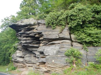
![Excursión A pie Gemeinde Rossatz-Arnsdorf - St. Lorenz - Seekopf - Photo](https://media.geolcdn.com/t/350/260/f7c3b641-ea5d-4a83-b625-32a4080e0569.jpeg&format=jpg&maxdim=2)
![A pie A pie](https://static1.geolcdn.com/sitytour/trail-icons/100.png)
Km
A pie
![](/images/other/stat-length.png)
![](https://static1.geolcdn.com/siteimages/upload/files/1508320355ic_sort_den_pos_24dp.png)
![](https://static1.geolcdn.com/siteimages/upload/files/1508320355ic_sort_den_neg_24dp.png)
![](https://static1.geolcdn.com/siteimages/upload/files/16400158638029165_repeat_loop_refresh_sync_direction_icon.png)
• Der ÖTK gilt als Pionier des Fremdenverkehrs. Heute ist der ÖTK mit über 360 Kursen und geführten Touren in 50 Freize...
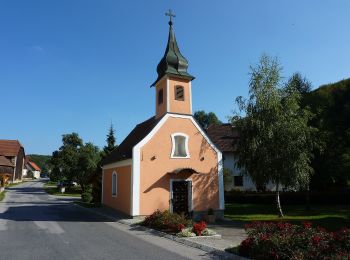
![Excursión A pie Gemeinde Gföhl - 43 - Photo](https://media.geolcdn.com/t/350/260/df37aff4-75d7-437d-9e06-dc5040de26cb.jpeg&format=jpg&maxdim=2)
![A pie A pie](https://static1.geolcdn.com/sitytour/trail-icons/100.png)
Km
A pie
![](/images/other/stat-length.png)
![](https://static1.geolcdn.com/siteimages/upload/files/1508320355ic_sort_den_pos_24dp.png)
![](https://static1.geolcdn.com/siteimages/upload/files/1508320355ic_sort_den_neg_24dp.png)
![](https://static1.geolcdn.com/siteimages/upload/files/16400158638029165_repeat_loop_refresh_sync_direction_icon.png)
• Symbol: weiss-rot-weiss
![Excursión A pie Gemeinde Jaidhof - 91 - Photo](https://media.geolcdn.com/t/350/260/9abdc417-ce5e-4575-b15d-5e293d86da9c.jpeg&format=jpg&maxdim=2)
![A pie A pie](https://static1.geolcdn.com/sitytour/trail-icons/100.png)
Km
A pie
![](/images/other/stat-length.png)
![](https://static1.geolcdn.com/siteimages/upload/files/1508320355ic_sort_den_pos_24dp.png)
![](https://static1.geolcdn.com/siteimages/upload/files/1508320355ic_sort_den_neg_24dp.png)
![](https://static1.geolcdn.com/siteimages/upload/files/16400158638029165_repeat_loop_refresh_sync_direction_icon.png)
• Symbol: weiss-rot-weiss
![Excursión A pie Gemeinde Jaidhof - 90 - Photo](https://media.geolcdn.com/t/350/260/229fc2de-a413-4bea-9e92-3c38c481b281.jpeg&format=jpg&maxdim=2)
![A pie A pie](https://static1.geolcdn.com/sitytour/trail-icons/100.png)
Km
A pie
![](/images/other/stat-length.png)
![](https://static1.geolcdn.com/siteimages/upload/files/1508320355ic_sort_den_pos_24dp.png)
![](https://static1.geolcdn.com/siteimages/upload/files/1508320355ic_sort_den_neg_24dp.png)
![](https://static1.geolcdn.com/siteimages/upload/files/16400158638029165_repeat_loop_refresh_sync_direction_icon.png)
• Symbol: weiss-rot-weiss
![Excursión A pie Gemeinde Jaidhof - 40 - Photo](https://media.geolcdn.com/t/350/260/97c7a586-414c-40f9-b294-518d4d1ffb8f.jpeg&format=jpg&maxdim=2)
![A pie A pie](https://static1.geolcdn.com/sitytour/trail-icons/100.png)
Km
A pie
![](/images/other/stat-length.png)
![](https://static1.geolcdn.com/siteimages/upload/files/1508320355ic_sort_den_pos_24dp.png)
![](https://static1.geolcdn.com/siteimages/upload/files/1508320355ic_sort_den_neg_24dp.png)
![](https://static1.geolcdn.com/siteimages/upload/files/16400158638029165_repeat_loop_refresh_sync_direction_icon.png)
• Symbol: weiss-rot-weiss
![Excursión A pie Gemeinde St. Leonhard am Hornerwald - 61 - Photo](https://media.geolcdn.com/t/350/260/628ac569-d799-4998-a3c5-40cfcb76db15.jpeg&format=jpg&maxdim=2)
![A pie A pie](https://static1.geolcdn.com/sitytour/trail-icons/100.png)
Km
A pie
![](/images/other/stat-length.png)
![](https://static1.geolcdn.com/siteimages/upload/files/1508320355ic_sort_den_pos_24dp.png)
![](https://static1.geolcdn.com/siteimages/upload/files/1508320355ic_sort_den_neg_24dp.png)
![](https://static1.geolcdn.com/siteimages/upload/files/16400158638029165_repeat_loop_refresh_sync_direction_icon.png)
• Symbol: rot-weiss-rot 61
![Excursión A pie Gemeinde Rastenfeld - Golfwanderweg 82 - Photo](https://media.geolcdn.com/t/350/260/598fc3a2-3f2a-4ffa-86bf-a3e7b967625e.jpeg&format=jpg&maxdim=2)
![A pie A pie](https://static1.geolcdn.com/sitytour/trail-icons/100.png)
Km
A pie
![](/images/other/stat-length.png)
![](https://static1.geolcdn.com/siteimages/upload/files/1508320355ic_sort_den_pos_24dp.png)
![](https://static1.geolcdn.com/siteimages/upload/files/1508320355ic_sort_den_neg_24dp.png)
![](https://static1.geolcdn.com/siteimages/upload/files/16400158638029165_repeat_loop_refresh_sync_direction_icon.png)
• Symbol: 82 auf gelbem Grund
![Excursión A pie Gemeinde Rastenfeld - Natur Energie Kraft 80 kurz - Photo](https://media.geolcdn.com/t/350/260/2a44c46a-bf65-40cf-988f-c100f480a2fd.jpeg&format=jpg&maxdim=2)
![A pie A pie](https://static1.geolcdn.com/sitytour/trail-icons/100.png)
Km
A pie
![](/images/other/stat-length.png)
![](https://static1.geolcdn.com/siteimages/upload/files/1508320355ic_sort_den_pos_24dp.png)
![](https://static1.geolcdn.com/siteimages/upload/files/1508320355ic_sort_den_neg_24dp.png)
![](https://static1.geolcdn.com/siteimages/upload/files/16400158638029165_repeat_loop_refresh_sync_direction_icon.png)
• Symbol: 80 auf gelbem Grund
![Excursión A pie Gemeinde Rastenfeld - Natur Energie Kraft 80a - Photo](https://media.geolcdn.com/t/350/260/2a44c46a-bf65-40cf-988f-c100f480a2fd.jpeg&format=jpg&maxdim=2)
![A pie A pie](https://static1.geolcdn.com/sitytour/trail-icons/100.png)
Km
A pie
![](/images/other/stat-length.png)
![](https://static1.geolcdn.com/siteimages/upload/files/1508320355ic_sort_den_pos_24dp.png)
![](https://static1.geolcdn.com/siteimages/upload/files/1508320355ic_sort_den_neg_24dp.png)
![](https://static1.geolcdn.com/siteimages/upload/files/16400158638029165_repeat_loop_refresh_sync_direction_icon.png)
• Symbol: 80 auf gelbem Grund
![Excursión A pie Gemeinde Rastenfeld - Wanderweg 3 - Photo](https://media.geolcdn.com/t/350/260/cf39e390-dbd5-4646-93c3-d300fd4f3ffd.jpeg&format=jpg&maxdim=2)
![A pie A pie](https://static1.geolcdn.com/sitytour/trail-icons/100.png)
Km
A pie
![](/images/other/stat-length.png)
![](https://static1.geolcdn.com/siteimages/upload/files/1508320355ic_sort_den_pos_24dp.png)
![](https://static1.geolcdn.com/siteimages/upload/files/1508320355ic_sort_den_neg_24dp.png)
![](https://static1.geolcdn.com/siteimages/upload/files/16400158638029165_repeat_loop_refresh_sync_direction_icon.png)
• Symbol: 3 auf rot - weiß
![Excursión A pie Gemeinde Krumau am Kamp - Thurnberger Stauseetour - Photo](https://media.geolcdn.com/t/350/260/1f90fdc8-db93-4d4c-90d2-489a4f125096.jpeg&format=jpg&maxdim=2)
![A pie A pie](https://static1.geolcdn.com/sitytour/trail-icons/100.png)
Km
A pie
![](/images/other/stat-length.png)
![](https://static1.geolcdn.com/siteimages/upload/files/1508320355ic_sort_den_pos_24dp.png)
![](https://static1.geolcdn.com/siteimages/upload/files/1508320355ic_sort_den_neg_24dp.png)
![](https://static1.geolcdn.com/siteimages/upload/files/16400158638029165_repeat_loop_refresh_sync_direction_icon.png)
• Die angegebenen Wegnummern sind widersprüchlich und schwankt zwischen Nr. 70 Nr. 71.
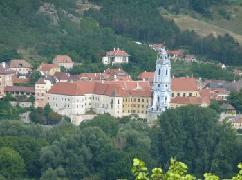
![Excursión A pie Gemeinde Rossatz-Arnsdorf - Rossatz - Maria Langegg - Photo](https://media.geolcdn.com/t/350/260/b0c8f463-de9a-4fa0-b35d-18dc7b74e8e8.jpeg&format=jpg&maxdim=2)
![A pie A pie](https://static1.geolcdn.com/sitytour/trail-icons/100.png)
Km
A pie
![](/images/other/stat-length.png)
![](https://static1.geolcdn.com/siteimages/upload/files/1508320355ic_sort_den_pos_24dp.png)
![](https://static1.geolcdn.com/siteimages/upload/files/1508320355ic_sort_den_neg_24dp.png)
![](https://static1.geolcdn.com/siteimages/upload/files/16400158638029165_repeat_loop_refresh_sync_direction_icon.png)
• Der ÖTK gilt als Pionier des Fremdenverkehrs. Heute ist der ÖTK mit über 360 Kursen und geführten Touren in 50 Freize...
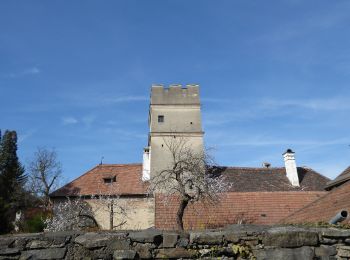
![Excursión A pie Gemeinde Spitz - Schwallenbach-Ruine Hinterhaus-Spitz - Photo](https://media.geolcdn.com/t/350/260/80a4842e-07bc-421f-b7f6-a45fb5110c0e.jpeg&format=jpg&maxdim=2)
![A pie A pie](https://static1.geolcdn.com/sitytour/trail-icons/100.png)
Km
A pie
![](/images/other/stat-length.png)
![](https://static1.geolcdn.com/siteimages/upload/files/1508320355ic_sort_den_pos_24dp.png)
![](https://static1.geolcdn.com/siteimages/upload/files/1508320355ic_sort_den_neg_24dp.png)
![](https://static1.geolcdn.com/siteimages/upload/files/16400158638029165_repeat_loop_refresh_sync_direction_icon.png)
• Der ÖTK gilt als Pionier des Fremdenverkehrs. Heute ist der ÖTK mit über 360 Kursen und geführten Touren in 50 Freize...
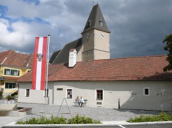
![Excursión A pie Maria Laach am Jauerling - Maria-Laacher-Steig - Photo](https://media.geolcdn.com/t/350/260/28d84243-ffaf-4055-b2b9-ae1481379ba2.jpeg&format=jpg&maxdim=2)
![A pie A pie](https://static1.geolcdn.com/sitytour/trail-icons/100.png)
Km
A pie
![](/images/other/stat-length.png)
![](https://static1.geolcdn.com/siteimages/upload/files/1508320355ic_sort_den_pos_24dp.png)
![](https://static1.geolcdn.com/siteimages/upload/files/1508320355ic_sort_den_neg_24dp.png)
![](https://static1.geolcdn.com/siteimages/upload/files/16400158638029165_repeat_loop_refresh_sync_direction_icon.png)
• Der ÖTK gilt als Pionier des Fremdenverkehrs. Heute ist der ÖTK mit über 360 Kursen und geführten Touren in 50 Freize...
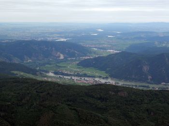
![Excursión A pie Gemeinde Weinzierl am Walde - Wolfenreith-Mühldorf - Photo](https://media.geolcdn.com/t/350/260/503345dc-36ce-4ac2-b4eb-c64d833be577.jpeg&format=jpg&maxdim=2)
![A pie A pie](https://static1.geolcdn.com/sitytour/trail-icons/100.png)
Km
A pie
![](/images/other/stat-length.png)
![](https://static1.geolcdn.com/siteimages/upload/files/1508320355ic_sort_den_pos_24dp.png)
![](https://static1.geolcdn.com/siteimages/upload/files/1508320355ic_sort_den_neg_24dp.png)
![](https://static1.geolcdn.com/siteimages/upload/files/16400158638029165_repeat_loop_refresh_sync_direction_icon.png)
• Der ÖTK gilt als Pionier des Fremdenverkehrs. Heute ist der ÖTK mit über 360 Kursen und geführten Touren in 50 Freize...
![Excursión A pie Gemeinde Mühldorf - Mühldorf-Wolfenreith - Photo](https://media.geolcdn.com/t/350/260/503345dc-36ce-4ac2-b4eb-c64d833be577.jpeg&format=jpg&maxdim=2)
![A pie A pie](https://static1.geolcdn.com/sitytour/trail-icons/100.png)
Km
A pie
![](/images/other/stat-length.png)
![](https://static1.geolcdn.com/siteimages/upload/files/1508320355ic_sort_den_pos_24dp.png)
![](https://static1.geolcdn.com/siteimages/upload/files/1508320355ic_sort_den_neg_24dp.png)
![](https://static1.geolcdn.com/siteimages/upload/files/16400158638029165_repeat_loop_refresh_sync_direction_icon.png)
• Der ÖTK gilt als Pionier des Fremdenverkehrs. Heute ist der ÖTK mit über 360 Kursen und geführten Touren in 50 Freize...
![Excursión A pie Gemeinde Spitz - Spitz - Buschandlwand/Gruberwarte - Photo](https://media.geolcdn.com/t/350/260/235606d7-b03a-4078-977d-a39bcf19fae5.jpeg&format=jpg&maxdim=2)
![A pie A pie](https://static1.geolcdn.com/sitytour/trail-icons/100.png)
Km
A pie
![](/images/other/stat-length.png)
![](https://static1.geolcdn.com/siteimages/upload/files/1508320355ic_sort_den_pos_24dp.png)
![](https://static1.geolcdn.com/siteimages/upload/files/1508320355ic_sort_den_neg_24dp.png)
![](https://static1.geolcdn.com/siteimages/upload/files/16400158638029165_repeat_loop_refresh_sync_direction_icon.png)
• Der ÖTK gilt als Pionier des Fremdenverkehrs. Heute ist der ÖTK mit über 360 Kursen und geführten Touren in 50 Freize...
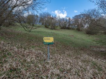
![Excursión A pie Gemeinde Spitz - Rotes Tor Rundwanderung - Photo](https://media.geolcdn.com/t/350/260/c880dc64-65cd-498b-bb2f-39dd5bb6708b.jpeg&format=jpg&maxdim=2)
![A pie A pie](https://static1.geolcdn.com/sitytour/trail-icons/100.png)
Km
A pie
![](/images/other/stat-length.png)
![](https://static1.geolcdn.com/siteimages/upload/files/1508320355ic_sort_den_pos_24dp.png)
![](https://static1.geolcdn.com/siteimages/upload/files/1508320355ic_sort_den_neg_24dp.png)
![](https://static1.geolcdn.com/siteimages/upload/files/16400158638029165_repeat_loop_refresh_sync_direction_icon.png)
• Der ÖTK gilt als Pionier des Fremdenverkehrs. Heute ist der ÖTK mit über 360 Kursen und geführten Touren in 50 Freize...
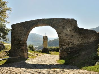
![Excursión A pie Gemeinde Spitz - Buchberg Rundwanderung - Photo](https://media.geolcdn.com/t/350/260/4796baa1-b9a2-42af-9e74-5dc91b432f87.jpeg&format=jpg&maxdim=2)
![A pie A pie](https://static1.geolcdn.com/sitytour/trail-icons/100.png)
Km
A pie
![](/images/other/stat-length.png)
![](https://static1.geolcdn.com/siteimages/upload/files/1508320355ic_sort_den_pos_24dp.png)
![](https://static1.geolcdn.com/siteimages/upload/files/1508320355ic_sort_den_neg_24dp.png)
![](https://static1.geolcdn.com/siteimages/upload/files/16400158638029165_repeat_loop_refresh_sync_direction_icon.png)
• Trail created by Österreichischer Touristenklub.
![Excursión A pie Gemeinde Weißenkirchen in der Wachau - St. Michael-Gruberwarte/Buschandlwand (gelb) - Photo](https://media.geolcdn.com/t/350/260/7b3cc25c-8141-4be0-821b-9e3e5fb1473f.jpeg&format=jpg&maxdim=2)
![A pie A pie](https://static1.geolcdn.com/sitytour/trail-icons/100.png)
Km
A pie
![](/images/other/stat-length.png)
![](https://static1.geolcdn.com/siteimages/upload/files/1508320355ic_sort_den_pos_24dp.png)
![](https://static1.geolcdn.com/siteimages/upload/files/1508320355ic_sort_den_neg_24dp.png)
![](https://static1.geolcdn.com/siteimages/upload/files/16400158638029165_repeat_loop_refresh_sync_direction_icon.png)
• Der ÖTK gilt als Pionier des Fremdenverkehrs. Heute ist der ÖTK mit über 360 Kursen und geführten Touren in 50 Freize...
20 excursiones mostradas en 46
Aplicación GPS de excursión GRATIS
Actividades
Regiones próximas
- Aggsbach
- Bergern im Dunkelsteinerwald
- Gemeinde Dürnstein
- Gemeinde Furth bei Göttweig
- Gemeinde Gföhl
- Gemeinde Jaidhof
- Gemeinde Krumau am Kamp
- Gemeinde Langenlois
- Gemeinde Mautern an der Donau
- Gemeinde Mühldorf
- Gemeinde Paudorf
- Gemeinde Rastenfeld
- Gemeinde Rossatz-Arnsdorf
- Gemeinde Spitz
- Gemeinde St. Leonhard am Hornerwald
- Gemeinde Weinzierl am Walde
- Gemeinde Weißenkirchen in der Wachau
- Maria Laach am Jauerling