![](/images/other/stat-length.png)
- Excursiones
- Outdoor
- Austria
- Baja Austria
- Bezirk St. Pölten
Bezirk St. Pölten, Baja Austria: Los mejores itinerarios de excursión, recorridos, paseos y sendas
Bezirk St. Pölten: Descubra las mejores excursiones: 81 a pie y 3 en bici o bici de montaña. Todos estos circuitos, recorridos, itinerarios y actividades al aire libre están disponibles en nuestras aplicaciones SityTrail para smartphone y tablet.
Los mejores recorridos (84)
![Excursión A pie Gemeinde Tullnerbach - Tullnerbach Pressbaum - Strohzogl - Photo](https://media.geolcdn.com/t/350/260/5184b4b3-af75-40f3-bd37-1b19c21493d3.jpeg&format=jpg&maxdim=2)
![A pie A pie](https://static1.geolcdn.com/sitytour/trail-icons/100.png)
Km
A pie
![](/images/other/stat-length.png)
![](https://static1.geolcdn.com/siteimages/upload/files/1508320355ic_sort_den_pos_24dp.png)
![](https://static1.geolcdn.com/siteimages/upload/files/1508320355ic_sort_den_neg_24dp.png)
![](https://static1.geolcdn.com/siteimages/upload/files/16400158638029165_repeat_loop_refresh_sync_direction_icon.png)
• Trail created by ÖTK Klosterneuburg. Sitio web: https://www.oetk-klosterneuburg.at/unsere-wege/weg-zeit-plaene#Tul...
![Excursión A pie Altlengbach - laufend geniessen (Hotel Lengbachhof) - Photo](https://media.geolcdn.com/t/350/260/50769c63-2c41-4d9a-a1b9-de289f89fc45.jpeg&format=jpg&maxdim=2)
![A pie A pie](https://static1.geolcdn.com/sitytour/trail-icons/100.png)
Km
A pie
![](/images/other/stat-length.png)
![](https://static1.geolcdn.com/siteimages/upload/files/1508320355ic_sort_den_pos_24dp.png)
![](https://static1.geolcdn.com/siteimages/upload/files/1508320355ic_sort_den_neg_24dp.png)
![](https://static1.geolcdn.com/siteimages/upload/files/16400158638029165_repeat_loop_refresh_sync_direction_icon.png)
• Symbol: blauer Pfeil auf gelbem Grund
![Excursión A pie Gemeinde Purkersdorf - Rundwanderweg Süßfeld - Photo](https://media.geolcdn.com/t/350/260/bd3f9cd5-d3c9-4d01-a449-f4d79f964f17.jpeg&format=jpg&maxdim=2)
![A pie A pie](https://static1.geolcdn.com/sitytour/trail-icons/100.png)
Km
A pie
![](/images/other/stat-length.png)
![](https://static1.geolcdn.com/siteimages/upload/files/1508320355ic_sort_den_pos_24dp.png)
![](https://static1.geolcdn.com/siteimages/upload/files/1508320355ic_sort_den_neg_24dp.png)
![](https://static1.geolcdn.com/siteimages/upload/files/16400158638029165_repeat_loop_refresh_sync_direction_icon.png)
• Trail created by Wienerwald Tourismus.
![Excursión A pie Gemeinde Gablitz - Gablitz - Troppberg - Photo](https://media.geolcdn.com/t/350/260/8b853524-2e5c-4b10-85dc-ab9672d39888.jpeg&format=jpg&maxdim=2)
![A pie A pie](https://static1.geolcdn.com/sitytour/trail-icons/100.png)
Km
A pie
![](/images/other/stat-length.png)
![](https://static1.geolcdn.com/siteimages/upload/files/1508320355ic_sort_den_pos_24dp.png)
![](https://static1.geolcdn.com/siteimages/upload/files/1508320355ic_sort_den_neg_24dp.png)
![](https://static1.geolcdn.com/siteimages/upload/files/16400158638029165_repeat_loop_refresh_sync_direction_icon.png)
• Trail created by ÖTK Klosterneuburg.
![Excursión A pie Gemeinde Gablitz - Gablitz - Troppberg - Photo](https://media.geolcdn.com/t/350/260/8b853524-2e5c-4b10-85dc-ab9672d39888.jpeg&format=jpg&maxdim=2)
![A pie A pie](https://static1.geolcdn.com/sitytour/trail-icons/100.png)
Km
A pie
![](/images/other/stat-length.png)
![](https://static1.geolcdn.com/siteimages/upload/files/1508320355ic_sort_den_pos_24dp.png)
![](https://static1.geolcdn.com/siteimages/upload/files/1508320355ic_sort_den_neg_24dp.png)
![](https://static1.geolcdn.com/siteimages/upload/files/16400158638029165_repeat_loop_refresh_sync_direction_icon.png)
• Trail created by Wienerwald Tourismus.
![Excursión A pie Gemeinde Gablitz - Gablitz - Hochramalpe - Troppberg - Photo](https://media.geolcdn.com/t/350/260/96ce75bd-767b-4165-bda7-f6cddab95264.jpeg&format=jpg&maxdim=2)
![A pie A pie](https://static1.geolcdn.com/sitytour/trail-icons/100.png)
Km
A pie
![](/images/other/stat-length.png)
![](https://static1.geolcdn.com/siteimages/upload/files/1508320355ic_sort_den_pos_24dp.png)
![](https://static1.geolcdn.com/siteimages/upload/files/1508320355ic_sort_den_neg_24dp.png)
![](https://static1.geolcdn.com/siteimages/upload/files/16400158638029165_repeat_loop_refresh_sync_direction_icon.png)
• Trail created by Wienerwald Tourismus.
![Excursión A pie Gemeinde Gablitz - Gablitz - Höbersbach - Photo](https://media.geolcdn.com/t/350/260/ded69ef3-592d-4be7-b03e-41ad75358bc1.jpeg&format=jpg&maxdim=2)
![A pie A pie](https://static1.geolcdn.com/sitytour/trail-icons/100.png)
Km
A pie
![](/images/other/stat-length.png)
![](https://static1.geolcdn.com/siteimages/upload/files/1508320355ic_sort_den_pos_24dp.png)
![](https://static1.geolcdn.com/siteimages/upload/files/1508320355ic_sort_den_neg_24dp.png)
![](https://static1.geolcdn.com/siteimages/upload/files/16400158638029165_repeat_loop_refresh_sync_direction_icon.png)
• Trail created by Wienerwald Tourismus. Auf Übersichtskarten als Rundeweg dargestellt. Markierung aber nur bis zum We...
![Excursión A pie Gemeinde Gablitz - Gablitz - Laabach - Photo](https://media.geolcdn.com/t/350/260/96ce75bd-767b-4165-bda7-f6cddab95264.jpeg&format=jpg&maxdim=2)
![A pie A pie](https://static1.geolcdn.com/sitytour/trail-icons/100.png)
Km
A pie
![](/images/other/stat-length.png)
![](https://static1.geolcdn.com/siteimages/upload/files/1508320355ic_sort_den_pos_24dp.png)
![](https://static1.geolcdn.com/siteimages/upload/files/1508320355ic_sort_den_neg_24dp.png)
![](https://static1.geolcdn.com/siteimages/upload/files/16400158638029165_repeat_loop_refresh_sync_direction_icon.png)
• Trail created by Wienerwald Tourismus.
![Excursión A pie Gemeinde Mauerbach - 2 - Photo](https://media.geolcdn.com/t/350/260/8a232dc7-7727-41c9-a60d-eecf8d080c78.jpeg&format=jpg&maxdim=2)
![A pie A pie](https://static1.geolcdn.com/sitytour/trail-icons/100.png)
Km
A pie
![](/images/other/stat-length.png)
![](https://static1.geolcdn.com/siteimages/upload/files/1508320355ic_sort_den_pos_24dp.png)
![](https://static1.geolcdn.com/siteimages/upload/files/1508320355ic_sort_den_neg_24dp.png)
![](https://static1.geolcdn.com/siteimages/upload/files/16400158638029165_repeat_loop_refresh_sync_direction_icon.png)
• Symbol: rote 2 auf gelbem Quadrat
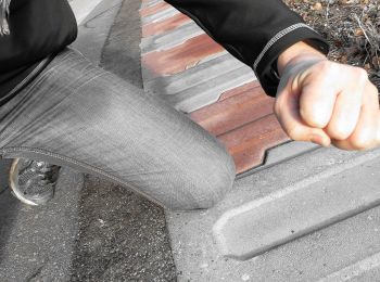
![Excursión A pie Gemeinde Kirchstetten - Bachweg - Photo](https://media.geolcdn.com/t/350/260/9279017a-71bb-406f-abb8-8567b678046d.jpeg&format=jpg&maxdim=2)
![A pie A pie](https://static1.geolcdn.com/sitytour/trail-icons/100.png)
Km
A pie
![](/images/other/stat-length.png)
![](https://static1.geolcdn.com/siteimages/upload/files/1508320355ic_sort_den_pos_24dp.png)
![](https://static1.geolcdn.com/siteimages/upload/files/1508320355ic_sort_den_neg_24dp.png)
![](https://static1.geolcdn.com/siteimages/upload/files/16400158638029165_repeat_loop_refresh_sync_direction_icon.png)
• Trail created by Verein der Freunde Totzenbachs. Symbol: Blauer Punkt auf gelbem Grund
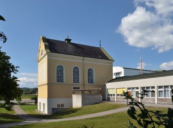
![Excursión A pie Gemeinde Kirchstetten - Totzenbach - Clementinum - Photo](https://media.geolcdn.com/t/350/260/22e5b3ed-5582-4035-aa07-0f3d2b2e4752.jpeg&format=jpg&maxdim=2)
![A pie A pie](https://static1.geolcdn.com/sitytour/trail-icons/100.png)
Km
A pie
![](/images/other/stat-length.png)
![](https://static1.geolcdn.com/siteimages/upload/files/1508320355ic_sort_den_pos_24dp.png)
![](https://static1.geolcdn.com/siteimages/upload/files/1508320355ic_sort_den_neg_24dp.png)
![](https://static1.geolcdn.com/siteimages/upload/files/16400158638029165_repeat_loop_refresh_sync_direction_icon.png)
• Trail created by Verein der Freunde Totzenbachs. Symbol: Grüner Punkt auf gelbem Grund
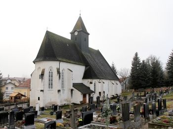
![Excursión A pie Gemeinde Kirchstetten - Große Rundwanderung Totzenbach - Photo](https://media.geolcdn.com/t/350/260/2b14d06f-ea94-42fe-bdfa-b5b74c1b8af4.jpeg&format=jpg&maxdim=2)
![A pie A pie](https://static1.geolcdn.com/sitytour/trail-icons/100.png)
Km
A pie
![](/images/other/stat-length.png)
![](https://static1.geolcdn.com/siteimages/upload/files/1508320355ic_sort_den_pos_24dp.png)
![](https://static1.geolcdn.com/siteimages/upload/files/1508320355ic_sort_den_neg_24dp.png)
![](https://static1.geolcdn.com/siteimages/upload/files/16400158638029165_repeat_loop_refresh_sync_direction_icon.png)
• Trail created by Verein der Freunde Totzenbachs. Symbol: Schwarzer Punkt auf gelbem Grund
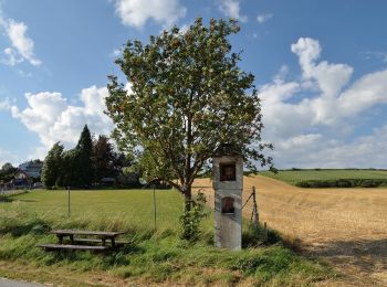
![Excursión A pie Gemeinde Kirchstetten - Totzenbach - Riesenfichte - Photo](https://media.geolcdn.com/t/350/260/4d763bfc-b337-4cde-8aef-2722de20bb17.jpeg&format=jpg&maxdim=2)
![A pie A pie](https://static1.geolcdn.com/sitytour/trail-icons/100.png)
Km
A pie
![](/images/other/stat-length.png)
![](https://static1.geolcdn.com/siteimages/upload/files/1508320355ic_sort_den_pos_24dp.png)
![](https://static1.geolcdn.com/siteimages/upload/files/1508320355ic_sort_den_neg_24dp.png)
![](https://static1.geolcdn.com/siteimages/upload/files/16400158638029165_repeat_loop_refresh_sync_direction_icon.png)
• Trail created by Verein der Freunde Totzenbachs. Symbol: Lila Punkt auf gelbem Grund
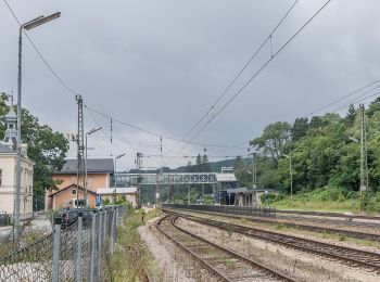
![Excursión A pie Gemeinde Tullnerbach - Tullnerbach (Bhf Tullnerbach-Preßbaum) - Wolfsgraben - Photo](https://media.geolcdn.com/t/350/260/fc71861d-045d-41a5-bb92-c725044e4ca5.jpeg&format=jpg&maxdim=2)
![A pie A pie](https://static1.geolcdn.com/sitytour/trail-icons/100.png)
Km
A pie
![](/images/other/stat-length.png)
![](https://static1.geolcdn.com/siteimages/upload/files/1508320355ic_sort_den_pos_24dp.png)
![](https://static1.geolcdn.com/siteimages/upload/files/1508320355ic_sort_den_neg_24dp.png)
![](https://static1.geolcdn.com/siteimages/upload/files/16400158638029165_repeat_loop_refresh_sync_direction_icon.png)
• Trail created by Österreichischer Touristenklub, Sektion Wienerwald. Symbol: weiss-rot-weiss
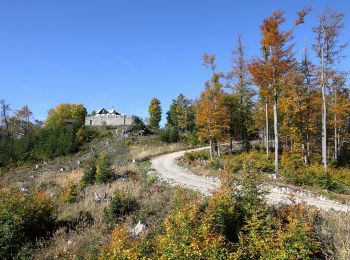
![Excursión A pie Gemeinde Kirchberg an der Pielach - Hohenstein - Photo](https://media.geolcdn.com/t/350/260/2735be4a-1529-4803-891b-a39e9c93f578.jpeg&format=jpg&maxdim=2)
![A pie A pie](https://static1.geolcdn.com/sitytour/trail-icons/100.png)
Km
A pie
![](/images/other/stat-length.png)
![](https://static1.geolcdn.com/siteimages/upload/files/1508320355ic_sort_den_pos_24dp.png)
![](https://static1.geolcdn.com/siteimages/upload/files/1508320355ic_sort_den_neg_24dp.png)
![](https://static1.geolcdn.com/siteimages/upload/files/16400158638029165_repeat_loop_refresh_sync_direction_icon.png)
• Symbol: rot-weiß-rot
![Excursión A pie Gemeinde Wilhelmsburg - Wilhelmsburger Rundwanderweg - Photo](https://media.geolcdn.com/t/350/260/694f6731-47c8-4e50-888d-b38b4f70c68a.jpeg&format=jpg&maxdim=2)
![A pie A pie](https://static1.geolcdn.com/sitytour/trail-icons/100.png)
Km
A pie
![](/images/other/stat-length.png)
![](https://static1.geolcdn.com/siteimages/upload/files/1508320355ic_sort_den_pos_24dp.png)
![](https://static1.geolcdn.com/siteimages/upload/files/1508320355ic_sort_den_neg_24dp.png)
![](https://static1.geolcdn.com/siteimages/upload/files/16400158638029165_repeat_loop_refresh_sync_direction_icon.png)
• Trail created by Naturfreunde Wilhelmsburg. Symbol: blau gelber Balken
![Excursión A pie Gemeinde Frankenfels - Frankenfelsberg - Höhenweg - Photo](https://media.geolcdn.com/t/350/260/4b0a704a-69c8-4557-b14b-e2ef4a1fb49c.jpeg&format=jpg&maxdim=2)
![A pie A pie](https://static1.geolcdn.com/sitytour/trail-icons/100.png)
Km
A pie
![](/images/other/stat-length.png)
![](https://static1.geolcdn.com/siteimages/upload/files/1508320355ic_sort_den_pos_24dp.png)
![](https://static1.geolcdn.com/siteimages/upload/files/1508320355ic_sort_den_neg_24dp.png)
![](https://static1.geolcdn.com/siteimages/upload/files/16400158638029165_repeat_loop_refresh_sync_direction_icon.png)
• Symbol: rot-weiss-rot
![Excursión A pie Gemeinde Rabenstein an der Pielach - Jubiläumsweg - Photo](https://media.geolcdn.com/t/350/260/39e2a591-96fa-4eca-b436-b653cce09fbb.jpeg&format=jpg&maxdim=2)
![A pie A pie](https://static1.geolcdn.com/sitytour/trail-icons/100.png)
Km
A pie
![](/images/other/stat-length.png)
![](https://static1.geolcdn.com/siteimages/upload/files/1508320355ic_sort_den_pos_24dp.png)
![](https://static1.geolcdn.com/siteimages/upload/files/1508320355ic_sort_den_neg_24dp.png)
![](https://static1.geolcdn.com/siteimages/upload/files/16400158638029165_repeat_loop_refresh_sync_direction_icon.png)
• Symbol: Blue bar on top yellow bar below
![Excursión A pie Gemeinde Kirchberg an der Pielach - 5/04 Karl-Stolz-Weg - Photo](https://media.geolcdn.com/t/350/260/9959508c-e25b-45af-b0c9-3898cfe42747.jpeg&format=jpg&maxdim=2)
![A pie A pie](https://static1.geolcdn.com/sitytour/trail-icons/100.png)
Km
A pie
![](/images/other/stat-length.png)
![](https://static1.geolcdn.com/siteimages/upload/files/1508320355ic_sort_den_pos_24dp.png)
![](https://static1.geolcdn.com/siteimages/upload/files/1508320355ic_sort_den_neg_24dp.png)
![](https://static1.geolcdn.com/siteimages/upload/files/16400158638029165_repeat_loop_refresh_sync_direction_icon.png)
• Herzlich Willkommen in der Marktgemeinde Kirchberg an der Pielach Sitio web: http://kirchberg-pielach.at/index.php?o...
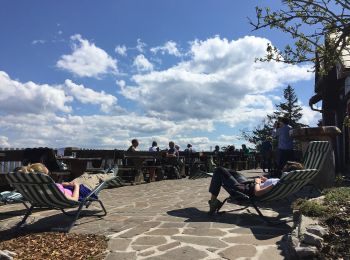
![Excursión A pie Gemeinde Kirchberg an der Pielach - Hohenstein - Photo](https://media.geolcdn.com/t/350/260/05984c94-b186-421d-8c96-d37ee3fab762.jpeg&format=jpg&maxdim=2)
![A pie A pie](https://static1.geolcdn.com/sitytour/trail-icons/100.png)
Km
A pie
![](/images/other/stat-length.png)
![](https://static1.geolcdn.com/siteimages/upload/files/1508320355ic_sort_den_pos_24dp.png)
![](https://static1.geolcdn.com/siteimages/upload/files/1508320355ic_sort_den_neg_24dp.png)
![](https://static1.geolcdn.com/siteimages/upload/files/16400158638029165_repeat_loop_refresh_sync_direction_icon.png)
• Trail created by Alpenverein. Symbol: rot-weiß-rot Sitio web: https://www.bergfex.at/sommer/niederoesterreich/tour...
20 excursiones mostradas en 84
Aplicación GPS de excursión GRATIS
Actividades
Regiones próximas
- Altlengbach
- Böheimkirchen
- Eichgraben
- Gemeinde Brand-Laaben
- Gemeinde Frankenfels
- Gemeinde Gablitz
- Gemeinde Kirchberg an der Pielach
- Gemeinde Kirchstetten
- Gemeinde Mauerbach
- Gemeinde Michelbach
- Gemeinde Neulengbach
- Gemeinde Pressbaum
- Gemeinde Purkersdorf
- Gemeinde Pyhra
- Gemeinde Rabenstein an der Pielach
- Gemeinde Stössing
- Gemeinde Tullnerbach
- Gemeinde Wilhelmsburg
- Gemeinde Wolfsgraben
- Kasten bei Böheimkirchen
- Maria Anzbach
- Neustift-Innermanzing
- Traismauer