


11,2 km | 14,2 km-effort
Spain: Descubra los 47 mejores circuitos de excursión a pie o en bici. Nuestro catálogo, preparado manualmente por nuestros excursionistas, está lleno de magníficos paisajes para explorar. Descargue estos itinerarios en SityTrail, nuestra aplicación de GPS de excursiones gratis disponible en Android e iOS.
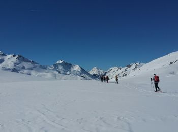
Raquetas de nieve


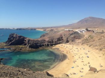
• Lanzarote marche le long de la cote, dépaart port de Playa Blanca jusqu'à la point de Papagayo, très belles plages (d...
Raquetas de nieve
Raquetas de nieve
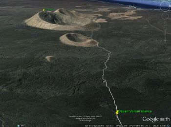
• Lanzarote-rando autour du Volcan Blanca 462m mesuré au sommet - prévoir de bonnes chaussure de rando semelles épaisses

Raquetas de nieve
• Lanzarote marche le long de la cote, dépaart port de Playa Blanca jusqu'à la point de Papagayo, très belles plages (d...
Raquetas de nieve
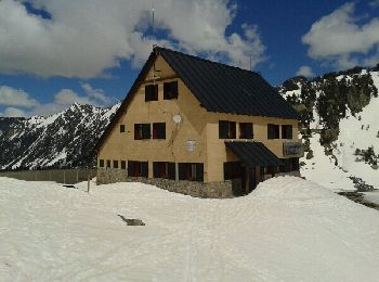
• Raquettes depuis le refuge de Colomers le 12 Avril 2014; Très beau cirque. Traversées sur de nombreux lacs gelés.
Raquetas de nieve

Raquetas de nieve
Raquetas de nieve
Raquetas de nieve
Raquetas de nieve
Raquetas de nieve
Raquetas de nieve
Raquetas de nieve

Esquí de fondo
Esquí de fondo
Esquí de fondo
Raquetas de nieve
Raquetas de nieve
Raquetas de nieve
Esquí de fondo
20 excursiones mostradas en 47
Aplicación GPS de excursión GRATIS
 SityTrail
IGN / Institutos geográficos
SityTrail World
El mundo es suyo