![](/images/other/stat-length.png)
- Excursiones
- A pie
- Portugal
- Norte
- Braga
Braga, Norte, A pie: Los mejores itinerarios de excursión, recorridos, paseos y sendas
Braga: Descubra las mejores excursiones: 42 a pie y 13 senderismo. Todos estos circuitos, recorridos, itinerarios y actividades al aire libre están disponibles en nuestras aplicaciones SityTrail para smartphone y tablet.
Los mejores recorridos (55)
![Excursión A pie Aboim da Nóbrega e Gondomar - Trilho de Terras da Nóbrega - Photo](https://media.geolcdn.com/t/350/260/401b4e82-7c41-4b0c-9ea2-12a0b93045e2.jpeg&format=jpg&maxdim=2)
![A pie A pie](https://static1.geolcdn.com/sitytour/trail-icons/100.png)
Km
A pie
![](/images/other/stat-length.png)
![](https://static1.geolcdn.com/siteimages/upload/files/1508320355ic_sort_den_pos_24dp.png)
![](https://static1.geolcdn.com/siteimages/upload/files/1508320355ic_sort_den_neg_24dp.png)
![](https://static1.geolcdn.com/siteimages/upload/files/16400158638029165_repeat_loop_refresh_sync_direction_icon.png)
• Trail created by Município de Ponte da Barca.
![Excursión A pie Vilar da Veiga - Trilho dos Currais - Photo](https://media.geolcdn.com/t/350/260/a6786d5d-a36f-4450-a6ca-1c2fe6d07e05.jpeg&format=jpg&maxdim=2)
![A pie A pie](https://static1.geolcdn.com/sitytour/trail-icons/100.png)
Km
A pie
![](/images/other/stat-length.png)
![](https://static1.geolcdn.com/siteimages/upload/files/1508320355ic_sort_den_pos_24dp.png)
![](https://static1.geolcdn.com/siteimages/upload/files/1508320355ic_sort_den_neg_24dp.png)
![](https://static1.geolcdn.com/siteimages/upload/files/16400158638029165_repeat_loop_refresh_sync_direction_icon.png)
• A rede de Trilhos Pedestres na Senda de Miguel Torga - Terras de Bouro, pretende ser uma homenagem a um dos maiores v...
![Excursión A pie Antas - Caminhos da Fé - Belinho - Photo](https://media.geolcdn.com/t/350/260/e975be8a-06a3-4a04-a541-6c786e95c32d.jpeg&format=jpg&maxdim=2)
![A pie A pie](https://static1.geolcdn.com/sitytour/trail-icons/100.png)
Km
A pie
![](/images/other/stat-length.png)
![](https://static1.geolcdn.com/siteimages/upload/files/1508320355ic_sort_den_pos_24dp.png)
![](https://static1.geolcdn.com/siteimages/upload/files/1508320355ic_sort_den_neg_24dp.png)
![](https://static1.geolcdn.com/siteimages/upload/files/16400158638029165_repeat_loop_refresh_sync_direction_icon.png)
• Promovido pela Associação Rio Neiva e pela Câmara Municipal de Esposende, este percurso circular inicia-se junto à ig...
![Excursión A pie Apúlia e Fão - Caminho da Memória - Photo](https://media.geolcdn.com/t/350/260/2596fc19-9358-4773-88e5-16d369720916.jpeg&format=jpg&maxdim=2)
![A pie A pie](https://static1.geolcdn.com/sitytour/trail-icons/100.png)
Km
A pie
![](/images/other/stat-length.png)
![](https://static1.geolcdn.com/siteimages/upload/files/1508320355ic_sort_den_pos_24dp.png)
![](https://static1.geolcdn.com/siteimages/upload/files/1508320355ic_sort_den_neg_24dp.png)
![](https://static1.geolcdn.com/siteimages/upload/files/16400158638029165_repeat_loop_refresh_sync_direction_icon.png)
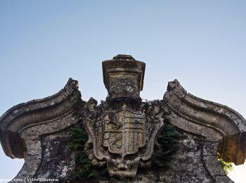
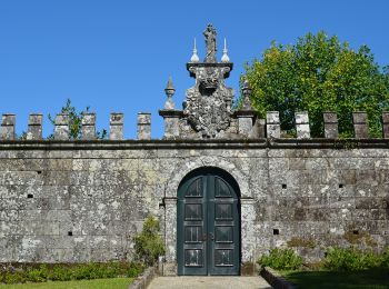
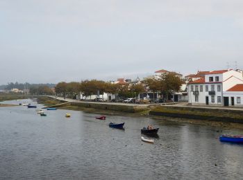
• Percurso Pedonal pela Vila de Fão, de dificuldade baixa e com uma distância aproximada de 6km. Em Fão, antigo centro ...
![Excursión A pie Esposende, Marinhas e Gandra - Caminho dos Mareantes - Photo](https://media.geolcdn.com/t/350/260/323f7de9-d062-4d76-bb37-008e10c3d546.jpeg&format=jpg&maxdim=2)
![A pie A pie](https://static1.geolcdn.com/sitytour/trail-icons/100.png)
Km
A pie
![](/images/other/stat-length.png)
![](https://static1.geolcdn.com/siteimages/upload/files/1508320355ic_sort_den_pos_24dp.png)
![](https://static1.geolcdn.com/siteimages/upload/files/1508320355ic_sort_den_neg_24dp.png)
![](https://static1.geolcdn.com/siteimages/upload/files/16400158638029165_repeat_loop_refresh_sync_direction_icon.png)
• Sitio web: https://www.visitesposende.com/pt/fazer/percursos/pr7-caminho-dos-mareantes
![Excursión A pie Antas - Casa Azenha Branca Trilho das Azenhas das Antas - Photo](https://media.geolcdn.com/t/350/260/dca20f23-8fe5-4cf1-a2cd-c4136ea4587c.jpeg&format=jpg&maxdim=2)
![A pie A pie](https://static1.geolcdn.com/sitytour/trail-icons/100.png)
Km
A pie
![](/images/other/stat-length.png)
![](https://static1.geolcdn.com/siteimages/upload/files/1508320355ic_sort_den_pos_24dp.png)
![](https://static1.geolcdn.com/siteimages/upload/files/1508320355ic_sort_den_neg_24dp.png)
![](https://static1.geolcdn.com/siteimages/upload/files/16400158638029165_repeat_loop_refresh_sync_direction_icon.png)
• Sitio web: https://www.visitesposende.com/pt/fazer/percursos/pr4-trilho-das-azenhas-das-antas
![Excursión A pie Antas - Trilho das Cangostas - Photo](https://media.geolcdn.com/t/350/260/a14ed07d-95eb-4fdc-8b2b-a09d89b9c85b.jpeg&format=jpg&maxdim=2)
![A pie A pie](https://static1.geolcdn.com/sitytour/trail-icons/100.png)
Km
A pie
![](/images/other/stat-length.png)
![](https://static1.geolcdn.com/siteimages/upload/files/1508320355ic_sort_den_pos_24dp.png)
![](https://static1.geolcdn.com/siteimages/upload/files/1508320355ic_sort_den_neg_24dp.png)
![](https://static1.geolcdn.com/siteimages/upload/files/16400158638029165_repeat_loop_refresh_sync_direction_icon.png)
• Sitio web: https://www.visitesposende.com/pt/fazer/percursos/pr3-trilho-das-cangostas
![Excursión A pie Antas - Entre o Neiva e o Atlântico - Photo](https://media.geolcdn.com/t/350/260/b69d3f32-6740-433b-9f17-d978825cbaa4.jpeg&format=jpg&maxdim=2)
![A pie A pie](https://static1.geolcdn.com/sitytour/trail-icons/100.png)
Km
A pie
![](/images/other/stat-length.png)
![](https://static1.geolcdn.com/siteimages/upload/files/1508320355ic_sort_den_pos_24dp.png)
![](https://static1.geolcdn.com/siteimages/upload/files/1508320355ic_sort_den_neg_24dp.png)
![](https://static1.geolcdn.com/siteimages/upload/files/16400158638029165_repeat_loop_refresh_sync_direction_icon.png)
• Sitio web: https://www.visitesposende.com/pt/fazer/percursos/pr1-trilho-entre-o-neiva-e-o-atlantico
![Excursión A pie Vila Chã - Castro de S. Lourenço - Photo](https://media.geolcdn.com/t/350/260/2664dce9-9842-4111-a15b-cb17940929c8.jpeg&format=jpg&maxdim=2)
![A pie A pie](https://static1.geolcdn.com/sitytour/trail-icons/100.png)
Km
A pie
![](/images/other/stat-length.png)
![](https://static1.geolcdn.com/siteimages/upload/files/1508320355ic_sort_den_pos_24dp.png)
![](https://static1.geolcdn.com/siteimages/upload/files/1508320355ic_sort_den_neg_24dp.png)
![](https://static1.geolcdn.com/siteimages/upload/files/16400158638029165_repeat_loop_refresh_sync_direction_icon.png)
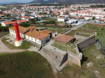
• Sitio web: https://www.visitesposende.com/pt/fazer/percursos/pr6-eps-castro-de-s-lourenco
![Excursión A pie Aboim, Felgueiras, Gontim e Pedraído - Rota dos Espigueiros - Photo](https://media.geolcdn.com/t/350/260/4721000d-4fb7-4011-b70e-710c9bb08f8e.jpeg&format=jpg&maxdim=2)
![A pie A pie](https://static1.geolcdn.com/sitytour/trail-icons/100.png)
Km
A pie
![](/images/other/stat-length.png)
![](https://static1.geolcdn.com/siteimages/upload/files/1508320355ic_sort_den_pos_24dp.png)
![](https://static1.geolcdn.com/siteimages/upload/files/1508320355ic_sort_den_neg_24dp.png)
![](https://static1.geolcdn.com/siteimages/upload/files/16400158638029165_repeat_loop_refresh_sync_direction_icon.png)
• Trail created by Município de Fafe.
![Excursión A pie Campo do Gerês - Trilho da Águia do Sarilhão - Photo](https://media.geolcdn.com/t/350/260/e037a994-5a43-4373-a5ff-85c800269898.jpeg&format=jpg&maxdim=2)
![A pie A pie](https://static1.geolcdn.com/sitytour/trail-icons/100.png)
Km
A pie
![](/images/other/stat-length.png)
![](https://static1.geolcdn.com/siteimages/upload/files/1508320355ic_sort_den_pos_24dp.png)
![](https://static1.geolcdn.com/siteimages/upload/files/1508320355ic_sort_den_neg_24dp.png)
![](https://static1.geolcdn.com/siteimages/upload/files/16400158638029165_repeat_loop_refresh_sync_direction_icon.png)
• A rede de Trilhos Pedestres na Senda de Miguel Torga - Terras de Bouro, pretende ser uma homenagem a um dos maiores v...
![Excursión A pie Monte e Queimadela - Rota do Maroiço - Photo](https://media.geolcdn.com/t/350/260/5193326c-9f6b-46f0-9180-7b8379e2b1a7.jpeg&format=jpg&maxdim=2)
![A pie A pie](https://static1.geolcdn.com/sitytour/trail-icons/100.png)
Km
A pie
![](/images/other/stat-length.png)
![](https://static1.geolcdn.com/siteimages/upload/files/1508320355ic_sort_den_pos_24dp.png)
![](https://static1.geolcdn.com/siteimages/upload/files/1508320355ic_sort_den_neg_24dp.png)
![](https://static1.geolcdn.com/siteimages/upload/files/16400158638029165_repeat_loop_refresh_sync_direction_icon.png)
![Excursión Senderismo Rio Caldo - Sao Bento Peneda Gères - Photo](https://media.geolcdn.com/t/350/260/afdb6820-c09d-4a4f-9ce4-c6a20908e726.jpg&format=jpg&maxdim=2)
![Senderismo Senderismo](https://static1.geolcdn.com/sitytour/trail-icons/101.png)
Km
Senderismo
![](/images/other/stat-length.png)
![](https://static1.geolcdn.com/siteimages/upload/files/1508320355ic_sort_den_pos_24dp.png)
![](https://static1.geolcdn.com/siteimages/upload/files/1508320355ic_sort_den_neg_24dp.png)
![](https://static1.geolcdn.com/siteimages/upload/files/16400158638029165_repeat_loop_refresh_sync_direction_icon.png)
![Excursión A pie - Prados Caveiros - Ponte do Arado - Photo](https://media.geolcdn.com/t/350/260/c3737c89-c069-48fb-aa14-b6d0decde0b4.jpeg&format=jpg&maxdim=2)
![A pie A pie](https://static1.geolcdn.com/sitytour/trail-icons/100.png)
Km
A pie
![](/images/other/stat-length.png)
![](https://static1.geolcdn.com/siteimages/upload/files/1508320355ic_sort_den_pos_24dp.png)
![](https://static1.geolcdn.com/siteimages/upload/files/1508320355ic_sort_den_neg_24dp.png)
![](https://static1.geolcdn.com/siteimages/upload/files/16400158638029165_repeat_loop_refresh_sync_direction_icon.png)
![Excursión A pie Mesão Frio - Pista de Cicloturismo Guimarães-Fafe - Photo](https://media.geolcdn.com/t/350/260/cc4e820e-1279-41f9-b491-0d45a99e15dd.jpeg&format=jpg&maxdim=2)
![A pie A pie](https://static1.geolcdn.com/sitytour/trail-icons/100.png)
Km
A pie
![](/images/other/stat-length.png)
![](https://static1.geolcdn.com/siteimages/upload/files/1508320355ic_sort_den_pos_24dp.png)
![](https://static1.geolcdn.com/siteimages/upload/files/1508320355ic_sort_den_neg_24dp.png)
![](https://static1.geolcdn.com/siteimages/upload/files/16400158638029165_repeat_loop_refresh_sync_direction_icon.png)
![Excursión A pie Este (São Pedro e São Mamede) - A procura da nascente do Rio Este - Photo](https://media.geolcdn.com/t/350/260/2d98d39e-5479-41b5-a9f4-c8294538e15c.jpeg&format=jpg&maxdim=2)
![A pie A pie](https://static1.geolcdn.com/sitytour/trail-icons/100.png)
Km
A pie
![](/images/other/stat-length.png)
![](https://static1.geolcdn.com/siteimages/upload/files/1508320355ic_sort_den_pos_24dp.png)
![](https://static1.geolcdn.com/siteimages/upload/files/1508320355ic_sort_den_neg_24dp.png)
![](https://static1.geolcdn.com/siteimages/upload/files/16400158638029165_repeat_loop_refresh_sync_direction_icon.png)
• Symbol: white blue
![Excursión A pie - Trilho dos Miradouros - Photo](https://media.geolcdn.com/t/350/260/67787b80-0bc1-403f-b763-c40e2c660515.jpeg&format=jpg&maxdim=2)
![A pie A pie](https://static1.geolcdn.com/sitytour/trail-icons/100.png)
Km
A pie
![](/images/other/stat-length.png)
![](https://static1.geolcdn.com/siteimages/upload/files/1508320355ic_sort_den_pos_24dp.png)
![](https://static1.geolcdn.com/siteimages/upload/files/1508320355ic_sort_den_neg_24dp.png)
![](https://static1.geolcdn.com/siteimages/upload/files/16400158638029165_repeat_loop_refresh_sync_direction_icon.png)
![Excursión A pie Rio Caldo - Trilho de S Bento Geres - Photo](https://media.geolcdn.com/t/350/260/5b6d99ea-b22e-4fa1-bb0c-beb9e4f1e7e8.jpeg&format=jpg&maxdim=2)
![A pie A pie](https://static1.geolcdn.com/sitytour/trail-icons/100.png)
Km
A pie
![](/images/other/stat-length.png)
![](https://static1.geolcdn.com/siteimages/upload/files/1508320355ic_sort_den_pos_24dp.png)
![](https://static1.geolcdn.com/siteimages/upload/files/1508320355ic_sort_den_neg_24dp.png)
![](https://static1.geolcdn.com/siteimages/upload/files/16400158638029165_repeat_loop_refresh_sync_direction_icon.png)
![Excursión A pie Chorense e Monte - Trilho dos Moinhos de Santa Isabel do Monte - Photo](https://media.geolcdn.com/t/350/260/41d84fe6-2ef4-49cb-b9d4-5ad2869611ba.jpeg&format=jpg&maxdim=2)
![A pie A pie](https://static1.geolcdn.com/sitytour/trail-icons/100.png)
Km
A pie
![](/images/other/stat-length.png)
![](https://static1.geolcdn.com/siteimages/upload/files/1508320355ic_sort_den_pos_24dp.png)
![](https://static1.geolcdn.com/siteimages/upload/files/1508320355ic_sort_den_neg_24dp.png)
![](https://static1.geolcdn.com/siteimages/upload/files/16400158638029165_repeat_loop_refresh_sync_direction_icon.png)
![Excursión A pie Covide - Trilho do Castelo - Photo](https://media.geolcdn.com/t/350/260/15839c79-4f1a-470b-9c2e-cbb36f7a2c74.jpeg&format=jpg&maxdim=2)
![A pie A pie](https://static1.geolcdn.com/sitytour/trail-icons/100.png)
Km
A pie
![](/images/other/stat-length.png)
![](https://static1.geolcdn.com/siteimages/upload/files/1508320355ic_sort_den_pos_24dp.png)
![](https://static1.geolcdn.com/siteimages/upload/files/1508320355ic_sort_den_neg_24dp.png)
![](https://static1.geolcdn.com/siteimages/upload/files/16400158638029165_repeat_loop_refresh_sync_direction_icon.png)
20 excursiones mostradas en 55
Aplicación GPS de excursión GRATIS
Actividades
Regiones próximas
- Abadim
- Aboim da Nóbrega e Gondomar
- Aboim, Felgueiras, Gontim e Pedraído
- Aborim
- Adaúfe
- Agrela e Serafão
- Airão (Santa Maria), Airão (São João) e Vermil
- Amares e Figueiredo
- Anissó e Soutelo
- Antas
- Apúlia e Fão
- Arco de Baúlhe e Vila Nune
- Arões (Santa Cristina)
- Atães e Rendufe
- Azurém
- Balugães
- Barcelinhos
- Barcelos, Vila Boa e Vila Frescainha (São Martinho e São Pedro)
- Belinho e Mar
- Bouro (Santa Maria)
- Bouro (Santa Marta)
- Briteiros (Santo Estêvão) e Donim
- Britelo, Gémeos e Ourilhe
- Cabeceiras de Basto
- Caldelas, Sequeiros e Paranhos
- Campo do Gerês
- Campo e Tamel (São Pedro Fins)
- Caniçada e Soengas
- Cantelães
- Carvalhal
- Chamoim e Vilar
- Chorense e Monte
- Chorente, Góios, Courel, Pedra Furada e Gueral
- Cibões e Brufe
- Costa
- Covide
- Creixomil
- Esposende, Marinhas e Gandra
- Este (São Pedro e São Mamede)
- Fafe
- Fermentões
- Fervença
- Forjães
- Gemeses
- Geraz do Minho
- Gondiães e Vilar de Cunhas
- Lijó
- Maximinos, Sé e Cividade
- Mesão Frio
- Monte e Queimadela
- Moreira do Rei e Várzea Cova
- Nogueiró e Tenões
- Oliveira, São Paio e São Sebastião
- Palmeira de Faro e Curvos
- Pencelo
- Pereira
- Pinheiro
- Póvoa de Lanhoso
- Ribeiros
- Rio Caldo
- Rio Douro
- Ruivães e Campos
- São José de São Lázaro e São João do Souto
- São Vítor
- Selho (São Lourenço) e Gominhães
- Serzedelo
- Souto
- Tabuaças
- Urgezes
- Valdosende
- Veade, Gagos e Molares
- Vieira do Minho
- Vila Chã
- Vilar da Veiga
- Vilela, Seramil e Paredes Secas