![](/images/other/stat-length.png)
- Excursiones
- A pie
- Poland
- Voivodato de Pomerania Occidental
Voivodato de Pomerania Occidental, Poland, A pie: Los mejores itinerarios de excursión, recorridos, paseos y sendas
Voivodato de Pomerania Occidental: Descubra las mejores excursiones: 59 a pie y 2 senderismo. Todos estos circuitos, recorridos, itinerarios y actividades al aire libre están disponibles en nuestras aplicaciones SityTrail para smartphone y tablet.
Los mejores recorridos (61)
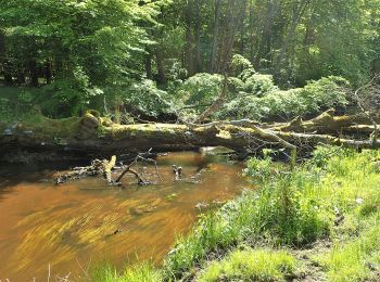
![Excursión A pie - Pętla Widzieńska - Photo](https://media.geolcdn.com/t/350/260/e239dee8-f289-4348-b9db-0bce9861733b.jpeg&format=jpg&maxdim=2)
![A pie A pie](https://static1.geolcdn.com/sitytour/trail-icons/100.png)
Km
A pie
![](/images/other/stat-length.png)
![](https://static1.geolcdn.com/siteimages/upload/files/1508320355ic_sort_den_pos_24dp.png)
![](https://static1.geolcdn.com/siteimages/upload/files/1508320355ic_sort_den_neg_24dp.png)
![](https://static1.geolcdn.com/siteimages/upload/files/16400158638029165_repeat_loop_refresh_sync_direction_icon.png)
• Symbol: niebieski pasek Sitio web: http://szlaki-zachodniopomorskie.pl/articles.php?article_id=159
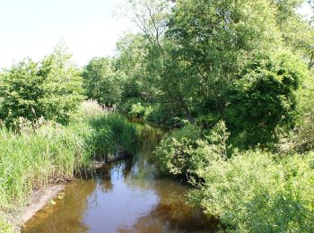
![Excursión A pie - Szlak](https://media.geolcdn.com/t/350/260/0f798efe-d89a-41db-b217-282c02e00928.jpeg&format=jpg&maxdim=2)
![A pie A pie](https://static1.geolcdn.com/sitytour/trail-icons/100.png)
Km
A pie
![](/images/other/stat-length.png)
![](https://static1.geolcdn.com/siteimages/upload/files/1508320355ic_sort_den_pos_24dp.png)
![](https://static1.geolcdn.com/siteimages/upload/files/1508320355ic_sort_den_neg_24dp.png)
![](https://static1.geolcdn.com/siteimages/upload/files/16400158638029165_repeat_loop_refresh_sync_direction_icon.png)
• Symbol: żółty pasek
![Excursión A pie Desconocido - Szlak Buczynowych Wąwozów - Photo](https://media.geolcdn.com/t/350/260/ce4bc84b-489f-4e4f-a652-fa0479f03e41.jpeg&format=jpg&maxdim=2)
![A pie A pie](https://static1.geolcdn.com/sitytour/trail-icons/100.png)
Km
A pie
![](/images/other/stat-length.png)
![](https://static1.geolcdn.com/siteimages/upload/files/1508320355ic_sort_den_pos_24dp.png)
![](https://static1.geolcdn.com/siteimages/upload/files/1508320355ic_sort_den_neg_24dp.png)
![](https://static1.geolcdn.com/siteimages/upload/files/16400158638029165_repeat_loop_refresh_sync_direction_icon.png)
• Symbol: yellow Sitio web: http://szlaki-zachodniopomorskie.pl/articles.php?article_id=78
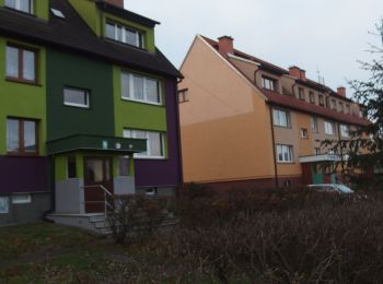
![Excursión A pie Goleniów - Szlak Borów Goleniowskich - Photo](https://media.geolcdn.com/t/350/260/daf55a52-1306-4858-a748-19e46d62e8ec.jpeg&format=jpg&maxdim=2)
![A pie A pie](https://static1.geolcdn.com/sitytour/trail-icons/100.png)
Km
A pie
![](/images/other/stat-length.png)
![](https://static1.geolcdn.com/siteimages/upload/files/1508320355ic_sort_den_pos_24dp.png)
![](https://static1.geolcdn.com/siteimages/upload/files/1508320355ic_sort_den_neg_24dp.png)
![](https://static1.geolcdn.com/siteimages/upload/files/16400158638029165_repeat_loop_refresh_sync_direction_icon.png)
• Symbol: zielony pasek Sitio web: http://szlaki-zachodniopomorskie.pl/articles.php?article_id=29
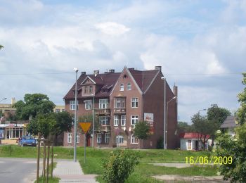
![Excursión A pie Recz - Recz – Choszczno - Photo](https://media.geolcdn.com/t/350/260/b67a86d3-1534-46f4-ba9d-17ad77d93b77.jpeg&format=jpg&maxdim=2)
![A pie A pie](https://static1.geolcdn.com/sitytour/trail-icons/100.png)
Km
A pie
![](/images/other/stat-length.png)
![](https://static1.geolcdn.com/siteimages/upload/files/1508320355ic_sort_den_pos_24dp.png)
![](https://static1.geolcdn.com/siteimages/upload/files/1508320355ic_sort_den_neg_24dp.png)
![](https://static1.geolcdn.com/siteimages/upload/files/16400158638029165_repeat_loop_refresh_sync_direction_icon.png)
• Trail created by PTTK. Sitio web: http://powiatchoszczno.pl/nowa/index.php?option=com_content&view=article&id=124&...
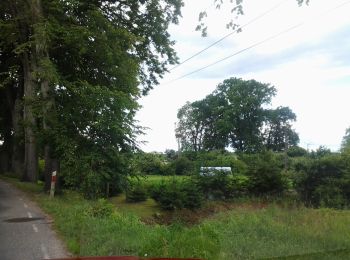
![Excursión A pie Kalisz Pomorski - Szlak wokół Kalisza Pomorskiego - Photo](https://media.geolcdn.com/t/350/260/9ea47848-167b-40cb-87d3-5dfaf166ef4b.jpeg&format=jpg&maxdim=2)
![A pie A pie](https://static1.geolcdn.com/sitytour/trail-icons/100.png)
Km
A pie
![](/images/other/stat-length.png)
![](https://static1.geolcdn.com/siteimages/upload/files/1508320355ic_sort_den_pos_24dp.png)
![](https://static1.geolcdn.com/siteimages/upload/files/1508320355ic_sort_den_neg_24dp.png)
![](https://static1.geolcdn.com/siteimages/upload/files/16400158638029165_repeat_loop_refresh_sync_direction_icon.png)
• Trail created by PTTK.
![Excursión A pie - Pieszy Szlak Stekliński - Photo](https://media.geolcdn.com/t/350/260/14df76e3-213a-4c0a-97ab-f0f0451eb6e8.jpeg&format=jpg&maxdim=2)
![A pie A pie](https://static1.geolcdn.com/sitytour/trail-icons/100.png)
Km
A pie
![](/images/other/stat-length.png)
![](https://static1.geolcdn.com/siteimages/upload/files/1508320355ic_sort_den_pos_24dp.png)
![](https://static1.geolcdn.com/siteimages/upload/files/1508320355ic_sort_den_neg_24dp.png)
![](https://static1.geolcdn.com/siteimages/upload/files/16400158638029165_repeat_loop_refresh_sync_direction_icon.png)
• Trail created by PTTK. Sitio web: http://www.gryfino.pl/WrotaGryfina/chapter_57183.asp
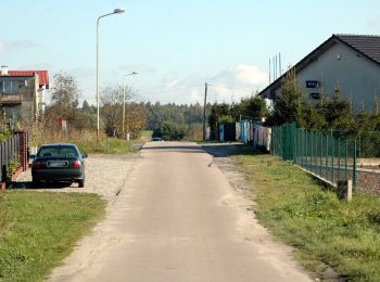
![Excursión A pie Golczewo - Szlak Doliną Niemicy - Photo](https://media.geolcdn.com/t/350/260/a2f9d16e-a89f-4490-a5f7-f7e120add642.jpeg&format=jpg&maxdim=2)
![A pie A pie](https://static1.geolcdn.com/sitytour/trail-icons/100.png)
Km
A pie
![](/images/other/stat-length.png)
![](https://static1.geolcdn.com/siteimages/upload/files/1508320355ic_sort_den_pos_24dp.png)
![](https://static1.geolcdn.com/siteimages/upload/files/1508320355ic_sort_den_neg_24dp.png)
![](https://static1.geolcdn.com/siteimages/upload/files/16400158638029165_repeat_loop_refresh_sync_direction_icon.png)
• Trail created by PTTK. Sitio web: http://szlaki-zachodniopomorskie.pl/articles.php?article_id=91
![Excursión A pie Golczewo - Przez Las Golczewski - Photo](https://media.geolcdn.com/t/350/260/a2f9d16e-a89f-4490-a5f7-f7e120add642.jpeg&format=jpg&maxdim=2)
![A pie A pie](https://static1.geolcdn.com/sitytour/trail-icons/100.png)
Km
A pie
![](/images/other/stat-length.png)
![](https://static1.geolcdn.com/siteimages/upload/files/1508320355ic_sort_den_pos_24dp.png)
![](https://static1.geolcdn.com/siteimages/upload/files/1508320355ic_sort_den_neg_24dp.png)
![](https://static1.geolcdn.com/siteimages/upload/files/16400158638029165_repeat_loop_refresh_sync_direction_icon.png)
• Trail created by PTTK. Sitio web: http://szlaki-zachodniopomorskie.pl/articles.php?article_id=92
![Excursión A pie - Pieszy Szlak Czepiński - Photo](https://media.geolcdn.com/t/350/260/c295acb0-6925-432e-9c52-da84a9409f55.jpeg&format=jpg&maxdim=2)
![A pie A pie](https://static1.geolcdn.com/sitytour/trail-icons/100.png)
Km
A pie
![](/images/other/stat-length.png)
![](https://static1.geolcdn.com/siteimages/upload/files/1508320355ic_sort_den_pos_24dp.png)
![](https://static1.geolcdn.com/siteimages/upload/files/1508320355ic_sort_den_neg_24dp.png)
![](https://static1.geolcdn.com/siteimages/upload/files/16400158638029165_repeat_loop_refresh_sync_direction_icon.png)
• Trail created by PTTK. Sitio web: http://www.gryfino.pl/WrotaGryfina/chapter_57183.asp
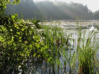
![Excursión A pie Łobez - Lobeliowe Jezioro i Wilczy Gród - Photo](https://media.geolcdn.com/t/350/260/233022ab-e272-4cc5-9947-8e9ae3d00ce2.jpeg&format=jpg&maxdim=2)
![A pie A pie](https://static1.geolcdn.com/sitytour/trail-icons/100.png)
Km
A pie
![](/images/other/stat-length.png)
![](https://static1.geolcdn.com/siteimages/upload/files/1508320355ic_sort_den_pos_24dp.png)
![](https://static1.geolcdn.com/siteimages/upload/files/1508320355ic_sort_den_neg_24dp.png)
![](https://static1.geolcdn.com/siteimages/upload/files/16400158638029165_repeat_loop_refresh_sync_direction_icon.png)
• przebieg szlaku do zbadania
![Excursión A pie Police - Szlak Nordic Walking -](https://media.geolcdn.com/t/350/260/c5d79e57-e09a-425f-b117-5dffdae14eed.jpeg&format=jpg&maxdim=2)
![A pie A pie](https://static1.geolcdn.com/sitytour/trail-icons/100.png)
Km
A pie
![](/images/other/stat-length.png)
![](https://static1.geolcdn.com/siteimages/upload/files/1508320355ic_sort_den_pos_24dp.png)
![](https://static1.geolcdn.com/siteimages/upload/files/1508320355ic_sort_den_neg_24dp.png)
![](https://static1.geolcdn.com/siteimages/upload/files/16400158638029165_repeat_loop_refresh_sync_direction_icon.png)
• Trail created by PTTK ROS - Szczecin.
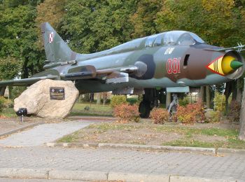
![Excursión A pie - Mirosławiec PKS - Orle - Mirosławiec PKS - Photo](https://media.geolcdn.com/t/350/260/d65ee9f3-2651-4c7f-a008-cfa1f93ae9be.jpeg&format=jpg&maxdim=2)
![A pie A pie](https://static1.geolcdn.com/sitytour/trail-icons/100.png)
Km
A pie
![](/images/other/stat-length.png)
![](https://static1.geolcdn.com/siteimages/upload/files/1508320355ic_sort_den_pos_24dp.png)
![](https://static1.geolcdn.com/siteimages/upload/files/1508320355ic_sort_den_neg_24dp.png)
![](https://static1.geolcdn.com/siteimages/upload/files/16400158638029165_repeat_loop_refresh_sync_direction_icon.png)
• Symbol: niebieski pasek
![Excursión A pie - Szlak Jezior Drawskich - Photo](https://media.geolcdn.com/t/350/260/2ea04398-ecef-4445-8020-3ed989218cfc.jpeg&format=jpg&maxdim=2)
![A pie A pie](https://static1.geolcdn.com/sitytour/trail-icons/100.png)
Km
A pie
![](/images/other/stat-length.png)
![](https://static1.geolcdn.com/siteimages/upload/files/1508320355ic_sort_den_pos_24dp.png)
![](https://static1.geolcdn.com/siteimages/upload/files/1508320355ic_sort_den_neg_24dp.png)
![](https://static1.geolcdn.com/siteimages/upload/files/16400158638029165_repeat_loop_refresh_sync_direction_icon.png)
• Szlak można pokonać rowerem, ale w miejscach niedostępnych lub trudno dostępnych należy skorzystać z proponowanych w ...
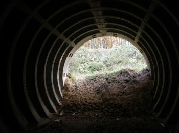
![Excursión A pie Desconocido - Szlak Artyleryjski - Photo](https://media.geolcdn.com/t/350/260/beee6e67-ee5a-4649-a1f5-e9fc67e88796.jpeg&format=jpg&maxdim=2)
![A pie A pie](https://static1.geolcdn.com/sitytour/trail-icons/100.png)
Km
A pie
![](/images/other/stat-length.png)
![](https://static1.geolcdn.com/siteimages/upload/files/1508320355ic_sort_den_pos_24dp.png)
![](https://static1.geolcdn.com/siteimages/upload/files/1508320355ic_sort_den_neg_24dp.png)
![](https://static1.geolcdn.com/siteimages/upload/files/16400158638029165_repeat_loop_refresh_sync_direction_icon.png)
• Symbol: yellow
![Excursión A pie - Szlak Woja Żelisława - Photo](https://media.geolcdn.com/t/350/260/e6fe30eb-a835-410b-bb89-fa6ff019006c.jpeg&format=jpg&maxdim=2)
![A pie A pie](https://static1.geolcdn.com/sitytour/trail-icons/100.png)
Km
A pie
![](/images/other/stat-length.png)
![](https://static1.geolcdn.com/siteimages/upload/files/1508320355ic_sort_den_pos_24dp.png)
![](https://static1.geolcdn.com/siteimages/upload/files/1508320355ic_sort_den_neg_24dp.png)
![](https://static1.geolcdn.com/siteimages/upload/files/16400158638029165_repeat_loop_refresh_sync_direction_icon.png)
• Symbol: green Sitio web: http://szlaki-zachodniopomorskie.pl/articles.php?article_id=32
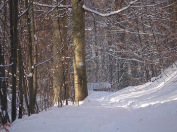
![Excursión A pie Desconocido - Szlak przez Słupi Głaz im. Wojciecha Lipniackiego - Photo](https://media.geolcdn.com/t/350/260/b5c9e698-f69c-4ac7-acd9-796395182d80.jpeg&format=jpg&maxdim=2)
![A pie A pie](https://static1.geolcdn.com/sitytour/trail-icons/100.png)
Km
A pie
![](/images/other/stat-length.png)
![](https://static1.geolcdn.com/siteimages/upload/files/1508320355ic_sort_den_pos_24dp.png)
![](https://static1.geolcdn.com/siteimages/upload/files/1508320355ic_sort_den_neg_24dp.png)
![](https://static1.geolcdn.com/siteimages/upload/files/16400158638029165_repeat_loop_refresh_sync_direction_icon.png)
• Symbol: red
![Excursión A pie Koszalin - Szlak Porwanego Księcia - Photo](https://media.geolcdn.com/t/350/260/f6d08a7c-fb54-4b6f-a2b4-1c61f4ee4c99.jpeg&format=jpg&maxdim=2)
![A pie A pie](https://static1.geolcdn.com/sitytour/trail-icons/100.png)
Km
A pie
![](/images/other/stat-length.png)
![](https://static1.geolcdn.com/siteimages/upload/files/1508320355ic_sort_den_pos_24dp.png)
![](https://static1.geolcdn.com/siteimages/upload/files/1508320355ic_sort_den_neg_24dp.png)
![](https://static1.geolcdn.com/siteimages/upload/files/16400158638029165_repeat_loop_refresh_sync_direction_icon.png)
• Symbol: niebieski pasek Sitio web: http://koszalin.pttk.pl/szlak_piesze.php?szlak=porwanego_ksiecia
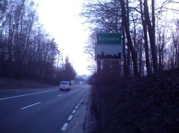
![Excursión A pie Koszalin - Pętla Tatrzańska - Photo](https://media.geolcdn.com/t/350/260/f6d08a7c-fb54-4b6f-a2b4-1c61f4ee4c99.jpeg&format=jpg&maxdim=2)
![A pie A pie](https://static1.geolcdn.com/sitytour/trail-icons/100.png)
Km
A pie
![](/images/other/stat-length.png)
![](https://static1.geolcdn.com/siteimages/upload/files/1508320355ic_sort_den_pos_24dp.png)
![](https://static1.geolcdn.com/siteimages/upload/files/1508320355ic_sort_den_neg_24dp.png)
![](https://static1.geolcdn.com/siteimages/upload/files/16400158638029165_repeat_loop_refresh_sync_direction_icon.png)
• Symbol: żółty pasek Sitio web: http://koszalin.pttk.pl/szlak_piesze.php?szlak=petla_tatrzanska
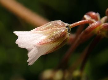
![Excursión A pie Desconocido - Szlak im. Bolesława Czwójdzińskiego - Photo](https://media.geolcdn.com/t/350/260/55ba5fe8-0472-4580-bc89-a194a81c065f.jpeg&format=jpg&maxdim=2)
![A pie A pie](https://static1.geolcdn.com/sitytour/trail-icons/100.png)
Km
A pie
![](/images/other/stat-length.png)
![](https://static1.geolcdn.com/siteimages/upload/files/1508320355ic_sort_den_pos_24dp.png)
![](https://static1.geolcdn.com/siteimages/upload/files/1508320355ic_sort_den_neg_24dp.png)
![](https://static1.geolcdn.com/siteimages/upload/files/16400158638029165_repeat_loop_refresh_sync_direction_icon.png)
• Symbol: green
20 excursiones mostradas en 61
Aplicación GPS de excursión GRATIS