![](/images/other/stat-length.png)
Trieste, Desconocido, A pie: Los mejores itinerarios de excursión, recorridos, paseos y sendas
Trieste: Descubra las mejores excursiones: 14 a pie y 1 senderismo. Todos estos circuitos, recorridos, itinerarios y actividades al aire libre están disponibles en nuestras aplicaciones SityTrail para smartphone y tablet.
Los mejores recorridos (15)
![Excursión A pie Trieste - (SI A26) Basovizza - Centro visite Val Rosandra - Photo](https://media.geolcdn.com/t/350/260/e4db50b9-515f-4542-9739-f4df59c3b8b4.jpeg&format=jpg&maxdim=2)
![A pie A pie](https://static1.geolcdn.com/sitytour/trail-icons/100.png)
Km
A pie
![](/images/other/stat-length.png)
![](https://static1.geolcdn.com/siteimages/upload/files/1508320355ic_sort_den_pos_24dp.png)
![](https://static1.geolcdn.com/siteimages/upload/files/1508320355ic_sort_den_neg_24dp.png)
![](https://static1.geolcdn.com/siteimages/upload/files/16400158638029165_repeat_loop_refresh_sync_direction_icon.png)
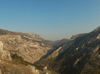
• Sentiero Italia CAI 2019
![Excursión A pie Trieste - IT-26 - Photo](https://media.geolcdn.com/t/350/260/f5edd303-9734-4978-b920-7283e0cdb8f4.jpeg&format=jpg&maxdim=2)
![A pie A pie](https://static1.geolcdn.com/sitytour/trail-icons/100.png)
Km
A pie
![](/images/other/stat-length.png)
![](https://static1.geolcdn.com/siteimages/upload/files/1508320355ic_sort_den_pos_24dp.png)
![](https://static1.geolcdn.com/siteimages/upload/files/1508320355ic_sort_den_neg_24dp.png)
![](https://static1.geolcdn.com/siteimages/upload/files/16400158638029165_repeat_loop_refresh_sync_direction_icon.png)
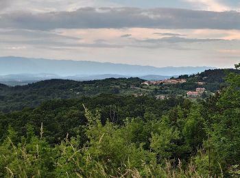
• Trail created by Commissione Giulio Carnica Sentieri, Rifugi e Opere Alpine. Opicina - Borgo Grotta Gigante Symbol:...
![Excursión A pie Trieste - IT-43 - Photo](https://media.geolcdn.com/t/350/260/48d0de8f-089a-42fc-89c5-05dbbe87122f.jpeg&format=jpg&maxdim=2)
![A pie A pie](https://static1.geolcdn.com/sitytour/trail-icons/100.png)
Km
A pie
![](/images/other/stat-length.png)
![](https://static1.geolcdn.com/siteimages/upload/files/1508320355ic_sort_den_pos_24dp.png)
![](https://static1.geolcdn.com/siteimages/upload/files/1508320355ic_sort_den_neg_24dp.png)
![](https://static1.geolcdn.com/siteimages/upload/files/16400158638029165_repeat_loop_refresh_sync_direction_icon.png)
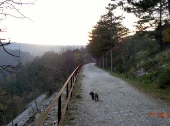
• Trail created by Commissione Giulio Carnica Sentieri, Rifugi e Opere Alpine. Stazione Opicina Campagna - Foiba 149 -...
![Excursión A pie Trieste - IT-2 - Photo](https://media.geolcdn.com/t/350/260/798dfb9f-7a91-4fb1-b95a-f5e0edcbcebb.jpeg&format=jpg&maxdim=2)
![A pie A pie](https://static1.geolcdn.com/sitytour/trail-icons/100.png)
Km
A pie
![](/images/other/stat-length.png)
![](https://static1.geolcdn.com/siteimages/upload/files/1508320355ic_sort_den_pos_24dp.png)
![](https://static1.geolcdn.com/siteimages/upload/files/1508320355ic_sort_den_neg_24dp.png)
![](https://static1.geolcdn.com/siteimages/upload/files/16400158638029165_repeat_loop_refresh_sync_direction_icon.png)
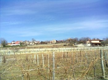
• Trail created by Commissione Giulio Carnica Sentieri, Rifugi e Opere Alpine. Opicina - Trebiciano - Sella Marchesett...
![Excursión A pie Trieste - Sentiero Ressel - Photo](https://media.geolcdn.com/t/350/260/cf51c019-cb5e-4dc6-838c-931a536a5014.jpeg&format=jpg&maxdim=2)
![A pie A pie](https://static1.geolcdn.com/sitytour/trail-icons/100.png)
Km
A pie
![](/images/other/stat-length.png)
![](https://static1.geolcdn.com/siteimages/upload/files/1508320355ic_sort_den_pos_24dp.png)
![](https://static1.geolcdn.com/siteimages/upload/files/1508320355ic_sort_den_neg_24dp.png)
![](https://static1.geolcdn.com/siteimages/upload/files/16400158638029165_repeat_loop_refresh_sync_direction_icon.png)
• Trail created by Commissione Giulio Carnica Sentieri, Rifugi e Opere Alpine. Bivio sentiero n. 1 - Basovizza - Bosco...
![Excursión A pie Trieste - Sentiero Nicolò Cobolli - Photo](https://media.geolcdn.com/t/350/260/798dfb9f-7a91-4fb1-b95a-f5e0edcbcebb.jpeg&format=jpg&maxdim=2)
![A pie A pie](https://static1.geolcdn.com/sitytour/trail-icons/100.png)
Km
A pie
![](/images/other/stat-length.png)
![](https://static1.geolcdn.com/siteimages/upload/files/1508320355ic_sort_den_pos_24dp.png)
![](https://static1.geolcdn.com/siteimages/upload/files/1508320355ic_sort_den_neg_24dp.png)
![](https://static1.geolcdn.com/siteimages/upload/files/16400158638029165_repeat_loop_refresh_sync_direction_icon.png)
• Trail created by Commissione Giulio Carnica Sentieri, Rifugi e Opere Alpine. Borgo San Nazario - Monte Gurca - Poggi...
![Excursión A pie Trieste - IT-17 - Photo](https://media.geolcdn.com/t/350/260/8b149020-f42f-4138-a3fc-743a3ad8d7af.jpeg&format=jpg&maxdim=2)
![A pie A pie](https://static1.geolcdn.com/sitytour/trail-icons/100.png)
Km
A pie
![](/images/other/stat-length.png)
![](https://static1.geolcdn.com/siteimages/upload/files/1508320355ic_sort_den_pos_24dp.png)
![](https://static1.geolcdn.com/siteimages/upload/files/1508320355ic_sort_den_neg_24dp.png)
![](https://static1.geolcdn.com/siteimages/upload/files/16400158638029165_repeat_loop_refresh_sync_direction_icon.png)
• Trail created by Commissione Giulio Carnica Sentieri, Rifugi e Opere Alpine. Pese - Pista ciclopedonale - Draga San ...
![Excursión A pie Trieste - IT-11 - Photo](https://media.geolcdn.com/t/350/260/6c573766-6c20-473e-98dc-5c47bb3a3824.jpeg&format=jpg&maxdim=2)
![A pie A pie](https://static1.geolcdn.com/sitytour/trail-icons/100.png)
Km
A pie
![](/images/other/stat-length.png)
![](https://static1.geolcdn.com/siteimages/upload/files/1508320355ic_sort_den_pos_24dp.png)
![](https://static1.geolcdn.com/siteimages/upload/files/1508320355ic_sort_den_neg_24dp.png)
![](https://static1.geolcdn.com/siteimages/upload/files/16400158638029165_repeat_loop_refresh_sync_direction_icon.png)
• Trail created by Commissione Giulio Carnica Sentieri, Rifugi e Opere Alpine. Rotonda del Boschetto (Trieste) - Bosco...
![Excursión A pie Trieste - Aurisina - Opicina - Photo](https://media.geolcdn.com/t/350/260/798dfb9f-7a91-4fb1-b95a-f5e0edcbcebb.jpeg&format=jpg&maxdim=2)
![A pie A pie](https://static1.geolcdn.com/sitytour/trail-icons/100.png)
Km
A pie
![](/images/other/stat-length.png)
![](https://static1.geolcdn.com/siteimages/upload/files/1508320355ic_sort_den_pos_24dp.png)
![](https://static1.geolcdn.com/siteimages/upload/files/1508320355ic_sort_den_neg_24dp.png)
![](https://static1.geolcdn.com/siteimages/upload/files/16400158638029165_repeat_loop_refresh_sync_direction_icon.png)
• todo
![Excursión A pie Trieste - IT-10 - Photo](https://media.geolcdn.com/t/350/260/0c73d411-d32c-4403-9375-2d37308a7258.jpeg&format=jpg&maxdim=2)
![A pie A pie](https://static1.geolcdn.com/sitytour/trail-icons/100.png)
Km
A pie
![](/images/other/stat-length.png)
![](https://static1.geolcdn.com/siteimages/upload/files/1508320355ic_sort_den_pos_24dp.png)
![](https://static1.geolcdn.com/siteimages/upload/files/1508320355ic_sort_den_neg_24dp.png)
![](https://static1.geolcdn.com/siteimages/upload/files/16400158638029165_repeat_loop_refresh_sync_direction_icon.png)
• Trail created by Commissione Giulio Carnica Sentieri, Rifugi e Opere Alpine. Santa Croce - Samatorza - Monte San Leo...
![Excursión A pie Trieste - IT-19 - Photo](https://media.geolcdn.com/t/350/260/cd4eb0ba-c064-491b-ba04-907e4fb2bffb.jpeg&format=jpg&maxdim=2)
![A pie A pie](https://static1.geolcdn.com/sitytour/trail-icons/100.png)
Km
A pie
![](/images/other/stat-length.png)
![](https://static1.geolcdn.com/siteimages/upload/files/1508320355ic_sort_den_pos_24dp.png)
![](https://static1.geolcdn.com/siteimages/upload/files/1508320355ic_sort_den_neg_24dp.png)
![](https://static1.geolcdn.com/siteimages/upload/files/16400158638029165_repeat_loop_refresh_sync_direction_icon.png)
• Trail created by Commissione Giulio Carnica Sentieri, Rifugi e Opere Alpine. Bivio sentiero n. 6 - Gabrovizza - Grot...
![Excursión A pie Trieste - Strada Basovizzana - Photo](https://media.geolcdn.com/t/350/260/d21558da-0d2a-442b-b36f-848e0ff1e137.jpeg&format=jpg&maxdim=2)
![A pie A pie](https://static1.geolcdn.com/sitytour/trail-icons/100.png)
Km
A pie
![](/images/other/stat-length.png)
![](https://static1.geolcdn.com/siteimages/upload/files/1508320355ic_sort_den_pos_24dp.png)
![](https://static1.geolcdn.com/siteimages/upload/files/1508320355ic_sort_den_neg_24dp.png)
![](https://static1.geolcdn.com/siteimages/upload/files/16400158638029165_repeat_loop_refresh_sync_direction_icon.png)
![Excursión A pie Trieste - Pohod po pečinah - Photo](https://media.geolcdn.com/t/350/260/c3572ffa-4500-4060-933d-6cc467b1b700.jpeg&format=jpg&maxdim=2)
![A pie A pie](https://static1.geolcdn.com/sitytour/trail-icons/100.png)
Km
A pie
![](/images/other/stat-length.png)
![](https://static1.geolcdn.com/siteimages/upload/files/1508320355ic_sort_den_pos_24dp.png)
![](https://static1.geolcdn.com/siteimages/upload/files/1508320355ic_sort_den_neg_24dp.png)
![](https://static1.geolcdn.com/siteimages/upload/files/16400158638029165_repeat_loop_refresh_sync_direction_icon.png)
![Excursión Senderismo Trieste - Trieste - Photo](https://media.geolcdn.com/t/350/260/be472917-5929-405a-9eeb-25c3e8f72bb4.jpg&format=jpg&maxdim=2)
![Senderismo Senderismo](https://static1.geolcdn.com/sitytour/trail-icons/101.png)
Km
Senderismo
![](/images/other/stat-length.png)
![](https://static1.geolcdn.com/siteimages/upload/files/1508320355ic_sort_den_pos_24dp.png)
![](https://static1.geolcdn.com/siteimages/upload/files/1508320355ic_sort_den_neg_24dp.png)
![](https://static1.geolcdn.com/siteimages/upload/files/16400158638029165_repeat_loop_refresh_sync_direction_icon.png)
![Excursión A pie Trieste - 97 - Parco del campo di addestramento militare di Prosecco / Park vojaškega poligona za urjenje na Proseku - Photo](https://media.geolcdn.com/t/350/260/ext.jpg?maxdim=2&url=https%3A%2F%2Fstatic1.geolcdn.com%2Fsiteimages%2Fupload%2Ffiles%2F1545311037marcheuse_200dpi.jpg)
![A pie A pie](https://static1.geolcdn.com/sitytour/trail-icons/100.png)
Km
A pie
![](/images/other/stat-length.png)
![](https://static1.geolcdn.com/siteimages/upload/files/1508320355ic_sort_den_pos_24dp.png)
![](https://static1.geolcdn.com/siteimages/upload/files/1508320355ic_sort_den_neg_24dp.png)
![](https://static1.geolcdn.com/siteimages/upload/files/16400158638029165_repeat_loop_refresh_sync_direction_icon.png)
• Sitio web: http://www.turismofvg.it/code/89801/Parco-97
15 excursiones mostradas en 15
Aplicación GPS de excursión GRATIS