![](/images/other/stat-length.png)
Casina, Reggio nell'Emilia, A pie: Los mejores itinerarios de excursión, recorridos, paseos y sendas
Casina: Descubra las mejores excursiones: 8 a pie. Todos estos circuitos, recorridos, itinerarios y actividades al aire libre están disponibles en nuestras aplicaciones SityTrail para smartphone y tablet.
Los mejores recorridos (8)
![Excursión A pie Casina - Lago dei Pini - Poncema - Pantano - Croce di Petrella - Photo](https://media.geolcdn.com/t/350/260/9b705249-ed58-404a-989a-f32d672175dc.jpeg&format=jpg&maxdim=2)
![A pie A pie](https://static1.geolcdn.com/sitytour/trail-icons/100.png)
Km
A pie
![](/images/other/stat-length.png)
![](https://static1.geolcdn.com/siteimages/upload/files/1508320355ic_sort_den_pos_24dp.png)
![](https://static1.geolcdn.com/siteimages/upload/files/1508320355ic_sort_den_neg_24dp.png)
![](https://static1.geolcdn.com/siteimages/upload/files/16400158638029165_repeat_loop_refresh_sync_direction_icon.png)
• Symbol: 624A on white red flags
![Excursión A pie Casina - MIgliara - Montata - Ariolo - Pianzo - Photo](https://media.geolcdn.com/t/350/260/a7f38c0c-d054-4085-ab58-b618ef088ce1.jpeg&format=jpg&maxdim=2)
![A pie A pie](https://static1.geolcdn.com/sitytour/trail-icons/100.png)
Km
A pie
![](/images/other/stat-length.png)
![](https://static1.geolcdn.com/siteimages/upload/files/1508320355ic_sort_den_pos_24dp.png)
![](https://static1.geolcdn.com/siteimages/upload/files/1508320355ic_sort_den_neg_24dp.png)
![](https://static1.geolcdn.com/siteimages/upload/files/16400158638029165_repeat_loop_refresh_sync_direction_icon.png)
• Symbol: 658 on white red flags
![Excursión A pie Casina - Sella di Monte Barazzone - Barazzone - Mulino di Cortogno - Ariolo - Roncolo - Pineto - Photo](https://media.geolcdn.com/t/350/260/3632078f-594f-455e-b15a-42a093ac9282.jpeg&format=jpg&maxdim=2)
![A pie A pie](https://static1.geolcdn.com/sitytour/trail-icons/100.png)
Km
A pie
![](/images/other/stat-length.png)
![](https://static1.geolcdn.com/siteimages/upload/files/1508320355ic_sort_den_pos_24dp.png)
![](https://static1.geolcdn.com/siteimages/upload/files/1508320355ic_sort_den_neg_24dp.png)
![](https://static1.geolcdn.com/siteimages/upload/files/16400158638029165_repeat_loop_refresh_sync_direction_icon.png)
• Trail created by Provincia di Reggio Emilia. Symbol: 660 on white red flags
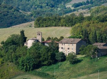
![Excursión A pie Casina - Bergogno - Mulino del Votigno - Casola Canossa - Photo](https://media.geolcdn.com/t/350/260/5bfff336-809d-45ad-8ed0-770684175f1a.jpeg&format=jpg&maxdim=2)
![A pie A pie](https://static1.geolcdn.com/sitytour/trail-icons/100.png)
Km
A pie
![](/images/other/stat-length.png)
![](https://static1.geolcdn.com/siteimages/upload/files/1508320355ic_sort_den_pos_24dp.png)
![](https://static1.geolcdn.com/siteimages/upload/files/1508320355ic_sort_den_neg_24dp.png)
![](https://static1.geolcdn.com/siteimages/upload/files/16400158638029165_repeat_loop_refresh_sync_direction_icon.png)
• Symbol: 656A on white red flags
![Excursión A pie Casina - Bocco - Lezzolo - Paullo - Crocicchio - Cortogno - Mulino di Cortogno - Mulino di Leguigno - Montata - Valletta di Monte Venera - Ariolo - Monte Bocco - Montale - Photo](https://media.geolcdn.com/t/350/260/a7f35108-f7fb-4feb-8072-b434688c4606.jpeg&format=jpg&maxdim=2)
![A pie A pie](https://static1.geolcdn.com/sitytour/trail-icons/100.png)
Km
A pie
![](/images/other/stat-length.png)
![](https://static1.geolcdn.com/siteimages/upload/files/1508320355ic_sort_den_pos_24dp.png)
![](https://static1.geolcdn.com/siteimages/upload/files/1508320355ic_sort_den_neg_24dp.png)
![](https://static1.geolcdn.com/siteimages/upload/files/16400158638029165_repeat_loop_refresh_sync_direction_icon.png)
• Symbol: 656 on white red flags
![Excursión A pie Casina - Mulino del Votigno - Casa Borseto - C.Coda -](https://media.geolcdn.com/t/350/260/88d2114a-c7e5-40c7-9873-ef69d1714390.jpeg&format=jpg&maxdim=2)
![A pie A pie](https://static1.geolcdn.com/sitytour/trail-icons/100.png)
Km
A pie
![](/images/other/stat-length.png)
![](https://static1.geolcdn.com/siteimages/upload/files/1508320355ic_sort_den_pos_24dp.png)
![](https://static1.geolcdn.com/siteimages/upload/files/1508320355ic_sort_den_neg_24dp.png)
![](https://static1.geolcdn.com/siteimages/upload/files/16400158638029165_repeat_loop_refresh_sync_direction_icon.png)
• Symbol: 652A on white red flags
![Excursión A pie Casina - Lago dei Pini - Monte delle Ripe - Mulino del Tasso - Villa - Monte delle Tane - Lago dei Pini - Photo](https://media.geolcdn.com/t/350/260/ext.jpg?maxdim=2&url=https%3A%2F%2Fstatic1.geolcdn.com%2Fsiteimages%2Fupload%2Ffiles%2F1545311037marcheuse_200dpi.jpg)
![A pie A pie](https://static1.geolcdn.com/sitytour/trail-icons/100.png)
Km
A pie
![](/images/other/stat-length.png)
![](https://static1.geolcdn.com/siteimages/upload/files/1508320355ic_sort_den_pos_24dp.png)
![](https://static1.geolcdn.com/siteimages/upload/files/1508320355ic_sort_den_neg_24dp.png)
![](https://static1.geolcdn.com/siteimages/upload/files/16400158638029165_repeat_loop_refresh_sync_direction_icon.png)
• Trail created by Comune di Casina. Symbol: 624 on white red flags
![Excursión A pie Casina - Il Bocco - Casa Monteduro - Monte Duro - Casa Schiavino - Biancana - Iella - La Canala - Photo](https://media.geolcdn.com/t/350/260/ext.jpg?maxdim=2&url=https%3A%2F%2Fstatic1.geolcdn.com%2Fsiteimages%2Fupload%2Ffiles%2F1545311037marcheuse_200dpi.jpg)
![A pie A pie](https://static1.geolcdn.com/sitytour/trail-icons/100.png)
Km
A pie
![](/images/other/stat-length.png)
![](https://static1.geolcdn.com/siteimages/upload/files/1508320355ic_sort_den_pos_24dp.png)
![](https://static1.geolcdn.com/siteimages/upload/files/1508320355ic_sort_den_neg_24dp.png)
![](https://static1.geolcdn.com/siteimages/upload/files/16400158638029165_repeat_loop_refresh_sync_direction_icon.png)
• Trail created by Comune di Casina. Symbol: 626 on white red flags
8 excursiones mostradas en 8
Aplicación GPS de excursión GRATIS