![](/images/other/stat-length.png)
- Excursiones
- A pie
- Italy
- Umbría
- Perugia
Perugia, Umbría, A pie: Los mejores itinerarios de excursión, recorridos, paseos y sendas
Perugia: Descubra las mejores excursiones: 190 a pie y 11 senderismo. Todos estos circuitos, recorridos, itinerarios y actividades al aire libre están disponibles en nuestras aplicaciones SityTrail para smartphone y tablet.
Los mejores recorridos (201)
![Excursión A pie Foligno - Rasiglia - Volperino - Casette Cupigliolo - Photo](https://media.geolcdn.com/t/350/260/52db22d7-5eba-4275-87e0-6c746a0e22fb.jpeg&format=jpg&maxdim=2)
![A pie A pie](https://static1.geolcdn.com/sitytour/trail-icons/100.png)
Km
A pie
![](/images/other/stat-length.png)
![](https://static1.geolcdn.com/siteimages/upload/files/1508320355ic_sort_den_pos_24dp.png)
![](https://static1.geolcdn.com/siteimages/upload/files/1508320355ic_sort_den_neg_24dp.png)
![](https://static1.geolcdn.com/siteimages/upload/files/16400158638029165_repeat_loop_refresh_sync_direction_icon.png)
• Symbol: 374B on white red flags
![Excursión A pie Umbertide - Galera - Monte Acuto - Photo](https://media.geolcdn.com/t/350/260/2207cd07-cee1-4c8d-ad34-c7b19758ea24.jpeg&format=jpg&maxdim=2)
![A pie A pie](https://static1.geolcdn.com/sitytour/trail-icons/100.png)
Km
A pie
![](/images/other/stat-length.png)
![](https://static1.geolcdn.com/siteimages/upload/files/1508320355ic_sort_den_pos_24dp.png)
![](https://static1.geolcdn.com/siteimages/upload/files/1508320355ic_sort_den_neg_24dp.png)
![](https://static1.geolcdn.com/siteimages/upload/files/16400158638029165_repeat_loop_refresh_sync_direction_icon.png)
• Trail created by CAI. Symbol: 170B on white red flag
![Excursión A pie Umbertide - Traversata di Monte Acuto - Photo](https://media.geolcdn.com/t/350/260/3b9eb271-5a99-45ce-bdf8-371425508782.jpeg&format=jpg&maxdim=2)
![A pie A pie](https://static1.geolcdn.com/sitytour/trail-icons/100.png)
Km
A pie
![](/images/other/stat-length.png)
![](https://static1.geolcdn.com/siteimages/upload/files/1508320355ic_sort_den_pos_24dp.png)
![](https://static1.geolcdn.com/siteimages/upload/files/1508320355ic_sort_den_neg_24dp.png)
![](https://static1.geolcdn.com/siteimages/upload/files/16400158638029165_repeat_loop_refresh_sync_direction_icon.png)
• Trail created by CAI. Symbol: 170A on white red flag
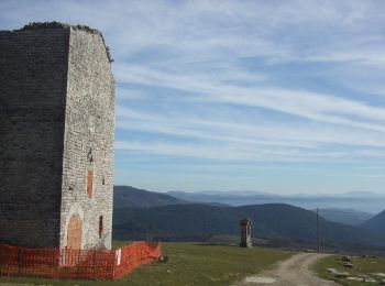
![Excursión A pie Umbertide - Anello di Monte Acuto - Photo](https://media.geolcdn.com/t/350/260/238e2a0f-cf19-40e0-b2ca-474f05d76b5a.jpeg&format=jpg&maxdim=2)
![A pie A pie](https://static1.geolcdn.com/sitytour/trail-icons/100.png)
Km
A pie
![](/images/other/stat-length.png)
![](https://static1.geolcdn.com/siteimages/upload/files/1508320355ic_sort_den_pos_24dp.png)
![](https://static1.geolcdn.com/siteimages/upload/files/1508320355ic_sort_den_neg_24dp.png)
![](https://static1.geolcdn.com/siteimages/upload/files/16400158638029165_repeat_loop_refresh_sync_direction_icon.png)
• Trail created by CAI. Symbol: 170 on whitered flag
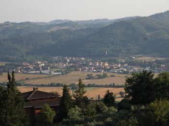
![Excursión A pie Perugia - Ponte Pattoli - Photo](https://media.geolcdn.com/t/350/260/958c4bde-65f8-4d7e-b2a0-6673dfc3f987.jpeg&format=jpg&maxdim=2)
![A pie A pie](https://static1.geolcdn.com/sitytour/trail-icons/100.png)
Km
A pie
![](/images/other/stat-length.png)
![](https://static1.geolcdn.com/siteimages/upload/files/1508320355ic_sort_den_pos_24dp.png)
![](https://static1.geolcdn.com/siteimages/upload/files/1508320355ic_sort_den_neg_24dp.png)
![](https://static1.geolcdn.com/siteimages/upload/files/16400158638029165_repeat_loop_refresh_sync_direction_icon.png)
• number of itinerary being updated Umbria Excursion Network
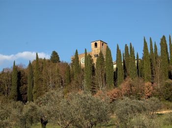
![Excursión A pie Perugia - La Bruna-Montelabate-Casacce - Photo](https://media.geolcdn.com/t/350/260/9b24e17c-da3a-42a3-a7e8-54262460d1df.jpeg&format=jpg&maxdim=2)
![A pie A pie](https://static1.geolcdn.com/sitytour/trail-icons/100.png)
Km
A pie
![](/images/other/stat-length.png)
![](https://static1.geolcdn.com/siteimages/upload/files/1508320355ic_sort_den_pos_24dp.png)
![](https://static1.geolcdn.com/siteimages/upload/files/1508320355ic_sort_den_neg_24dp.png)
![](https://static1.geolcdn.com/siteimages/upload/files/16400158638029165_repeat_loop_refresh_sync_direction_icon.png)
• number of itinerary being updated Umbria Excursion Network
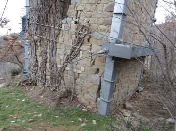
![Excursión A pie Tuoro sul Trasimeno - Sentiero Frassati - Photo](https://media.geolcdn.com/t/350/260/77d63a1c-c3f6-4c18-9821-aa0652df2b0a.jpeg&format=jpg&maxdim=2)
![A pie A pie](https://static1.geolcdn.com/sitytour/trail-icons/100.png)
Km
A pie
![](/images/other/stat-length.png)
![](https://static1.geolcdn.com/siteimages/upload/files/1508320355ic_sort_den_pos_24dp.png)
![](https://static1.geolcdn.com/siteimages/upload/files/1508320355ic_sort_den_neg_24dp.png)
![](https://static1.geolcdn.com/siteimages/upload/files/16400158638029165_repeat_loop_refresh_sync_direction_icon.png)
• number of itinerary being updated Umbria Excursion Network Symbol: 920 on white and red trail signs
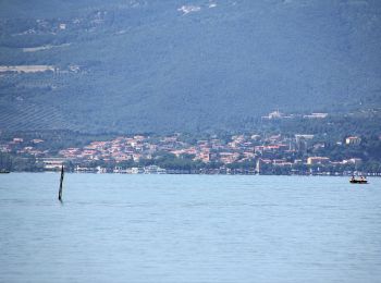
![Excursión A pie Passignano sul Trasimeno - La Martinella - Photo](https://media.geolcdn.com/t/350/260/22482be0-2b01-4200-a1ff-5d94143c7216.jpeg&format=jpg&maxdim=2)
![A pie A pie](https://static1.geolcdn.com/sitytour/trail-icons/100.png)
Km
A pie
![](/images/other/stat-length.png)
![](https://static1.geolcdn.com/siteimages/upload/files/1508320355ic_sort_den_pos_24dp.png)
![](https://static1.geolcdn.com/siteimages/upload/files/1508320355ic_sort_den_neg_24dp.png)
![](https://static1.geolcdn.com/siteimages/upload/files/16400158638029165_repeat_loop_refresh_sync_direction_icon.png)
• Trail created by Comune di Passignano sul Trasimeno. number of itinerary being updated Umbria Excursion Network Sym...
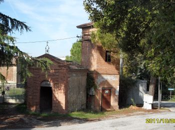
![Excursión A pie Collazzone - Anello di Collazzone - Photo](https://media.geolcdn.com/t/350/260/bc74a1a8-86f5-42e2-a1b6-d8597857bdbf.jpeg&format=jpg&maxdim=2)
![A pie A pie](https://static1.geolcdn.com/sitytour/trail-icons/100.png)
Km
A pie
![](/images/other/stat-length.png)
![](https://static1.geolcdn.com/siteimages/upload/files/1508320355ic_sort_den_pos_24dp.png)
![](https://static1.geolcdn.com/siteimages/upload/files/1508320355ic_sort_den_neg_24dp.png)
![](https://static1.geolcdn.com/siteimages/upload/files/16400158638029165_repeat_loop_refresh_sync_direction_icon.png)
• Trail created by Comune di Collazzone. With rainfall some fords are impassable. Number of itinerary being updated Um...
![Excursión A pie Collazzone - Collepepe-Miniera - Photo](https://media.geolcdn.com/t/350/260/824624c1-d83b-493b-8602-8159e0ff647f.jpeg&format=jpg&maxdim=2)
![A pie A pie](https://static1.geolcdn.com/sitytour/trail-icons/100.png)
Km
A pie
![](/images/other/stat-length.png)
![](https://static1.geolcdn.com/siteimages/upload/files/1508320355ic_sort_den_pos_24dp.png)
![](https://static1.geolcdn.com/siteimages/upload/files/1508320355ic_sort_den_neg_24dp.png)
![](https://static1.geolcdn.com/siteimages/upload/files/16400158638029165_repeat_loop_refresh_sync_direction_icon.png)
• Trail created by Comune di Collazzone. number of itinerary being updated Umbria Excursion Network Symbol: 930 on wh...
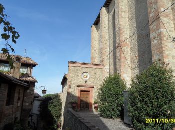
![Excursión A pie Collazzone - Collazzone-Molino delle Botte - Photo](https://media.geolcdn.com/t/350/260/4cf1d3cb-f0bc-4d1f-872a-c0201a927ae8.jpeg&format=jpg&maxdim=2)
![A pie A pie](https://static1.geolcdn.com/sitytour/trail-icons/100.png)
Km
A pie
![](/images/other/stat-length.png)
![](https://static1.geolcdn.com/siteimages/upload/files/1508320355ic_sort_den_pos_24dp.png)
![](https://static1.geolcdn.com/siteimages/upload/files/1508320355ic_sort_den_neg_24dp.png)
![](https://static1.geolcdn.com/siteimages/upload/files/16400158638029165_repeat_loop_refresh_sync_direction_icon.png)
• Trail created by Comune di Collazzone. number of itinerary being updated Umbria Excursion Network Symbol: 931 on wh...
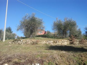
![Excursión A pie Passignano sul Trasimeno - Castel Rigone - Torre Fiume - Photo](https://media.geolcdn.com/t/350/260/9409bc5f-69fc-47cd-9ab7-8dfa80803df1.jpeg&format=jpg&maxdim=2)
![A pie A pie](https://static1.geolcdn.com/sitytour/trail-icons/100.png)
Km
A pie
![](/images/other/stat-length.png)
![](https://static1.geolcdn.com/siteimages/upload/files/1508320355ic_sort_den_pos_24dp.png)
![](https://static1.geolcdn.com/siteimages/upload/files/1508320355ic_sort_den_neg_24dp.png)
![](https://static1.geolcdn.com/siteimages/upload/files/16400158638029165_repeat_loop_refresh_sync_direction_icon.png)
• Trail created by Parco regionale del Lago Trasimeno. number of itinerary being updated Umbria Excursion Network Sym...
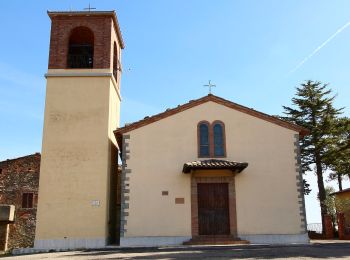
![Excursión A pie Marsciano - Migliano - Fersinone - Fibbino - Photo](https://media.geolcdn.com/t/350/260/34e62cdf-ac07-4a05-8b44-95eccc15f38f.jpeg&format=jpg&maxdim=2)
![A pie A pie](https://static1.geolcdn.com/sitytour/trail-icons/100.png)
Km
A pie
![](/images/other/stat-length.png)
![](https://static1.geolcdn.com/siteimages/upload/files/1508320355ic_sort_den_pos_24dp.png)
![](https://static1.geolcdn.com/siteimages/upload/files/1508320355ic_sort_den_neg_24dp.png)
![](https://static1.geolcdn.com/siteimages/upload/files/16400158638029165_repeat_loop_refresh_sync_direction_icon.png)
• Trail created by Club Alpino Italiano sezione Perugia. number of itinerary being updated Umbria Excursion Network S...
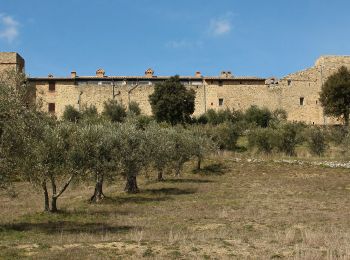
![Excursión A pie Marsciano - Compignano - Monte Lagello - Mercatello - Photo](https://media.geolcdn.com/t/350/260/eb9fa763-b59d-4cd9-99c8-ca12c3eb3449.jpeg&format=jpg&maxdim=2)
![A pie A pie](https://static1.geolcdn.com/sitytour/trail-icons/100.png)
Km
A pie
![](/images/other/stat-length.png)
![](https://static1.geolcdn.com/siteimages/upload/files/1508320355ic_sort_den_pos_24dp.png)
![](https://static1.geolcdn.com/siteimages/upload/files/1508320355ic_sort_den_neg_24dp.png)
![](https://static1.geolcdn.com/siteimages/upload/files/16400158638029165_repeat_loop_refresh_sync_direction_icon.png)
• Trail created by Club Alpino Italiano sezione Perugia. number of itinerary being updated Umbria Excursion Network S...
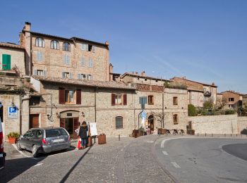
![Excursión A pie Città della Pieve - Città della Pieve - Fosso Molinella - Photo](https://media.geolcdn.com/t/350/260/1f8c7f25-61a1-48e7-b201-7bace27086b0.jpeg&format=jpg&maxdim=2)
![A pie A pie](https://static1.geolcdn.com/sitytour/trail-icons/100.png)
Km
A pie
![](/images/other/stat-length.png)
![](https://static1.geolcdn.com/siteimages/upload/files/1508320355ic_sort_den_pos_24dp.png)
![](https://static1.geolcdn.com/siteimages/upload/files/1508320355ic_sort_den_neg_24dp.png)
![](https://static1.geolcdn.com/siteimages/upload/files/16400158638029165_repeat_loop_refresh_sync_direction_icon.png)
• Trail created by Club Alpino Italiano sezione Perugia. number of itinerary being updated Umbria Excursion Network S...
![Excursión A pie Perugia - Montelabate - Ventia - Photo](https://media.geolcdn.com/t/350/260/9b24e17c-da3a-42a3-a7e8-54262460d1df.jpeg&format=jpg&maxdim=2)
![A pie A pie](https://static1.geolcdn.com/sitytour/trail-icons/100.png)
Km
A pie
![](/images/other/stat-length.png)
![](https://static1.geolcdn.com/siteimages/upload/files/1508320355ic_sort_den_pos_24dp.png)
![](https://static1.geolcdn.com/siteimages/upload/files/1508320355ic_sort_den_neg_24dp.png)
![](https://static1.geolcdn.com/siteimages/upload/files/16400158638029165_repeat_loop_refresh_sync_direction_icon.png)
• Trail created by Club Alpino Italiano sezione Perugia. number of itinerary being updated Umbria Excursion Network S...
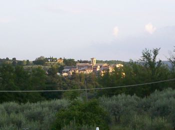
![Excursión A pie Bettona - Bettona - Collemancio - Photo](https://media.geolcdn.com/t/350/260/5205612b-acbc-4603-958a-ef5855e0bbfb.jpeg&format=jpg&maxdim=2)
![A pie A pie](https://static1.geolcdn.com/sitytour/trail-icons/100.png)
Km
A pie
![](/images/other/stat-length.png)
![](https://static1.geolcdn.com/siteimages/upload/files/1508320355ic_sort_den_pos_24dp.png)
![](https://static1.geolcdn.com/siteimages/upload/files/1508320355ic_sort_den_neg_24dp.png)
![](https://static1.geolcdn.com/siteimages/upload/files/16400158638029165_repeat_loop_refresh_sync_direction_icon.png)
• Trail created by Club Alpino Italiano sezione Perugia. number of itinerary being updated Umbria Excursion Network S...
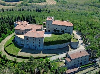
![Excursión A pie Piegaro - Montarale - Greppolischieto - Photo](https://media.geolcdn.com/t/350/260/ae40b1e6-3fe6-4a0a-96ba-6e59c0c8144e.jpeg&format=jpg&maxdim=2)
![A pie A pie](https://static1.geolcdn.com/sitytour/trail-icons/100.png)
Km
A pie
![](/images/other/stat-length.png)
![](https://static1.geolcdn.com/siteimages/upload/files/1508320355ic_sort_den_pos_24dp.png)
![](https://static1.geolcdn.com/siteimages/upload/files/1508320355ic_sort_den_neg_24dp.png)
![](https://static1.geolcdn.com/siteimages/upload/files/16400158638029165_repeat_loop_refresh_sync_direction_icon.png)
• Trail created by CAI Perugia. number of itinerary being updated Umbria Excursion Network Symbol: 925 on white red f...
![Excursión A pie Scheggia e Pascelupo - (SI N12) Isola di Fossara - Chiaserna - Photo](https://media.geolcdn.com/t/350/260/96828596-6784-46ad-ba52-d389ebcde1a6.jpeg&format=jpg&maxdim=2)
![A pie A pie](https://static1.geolcdn.com/sitytour/trail-icons/100.png)
Km
A pie
![](/images/other/stat-length.png)
![](https://static1.geolcdn.com/siteimages/upload/files/1508320355ic_sort_den_pos_24dp.png)
![](https://static1.geolcdn.com/siteimages/upload/files/1508320355ic_sort_den_neg_24dp.png)
![](https://static1.geolcdn.com/siteimages/upload/files/16400158638029165_repeat_loop_refresh_sync_direction_icon.png)
• Sentiero Italia CAI 2019
![Excursión A pie Asís - Via di Francesco - Tappa 11A Assisi-Foligno Escursionistica - Photo](https://media.geolcdn.com/t/350/260/2f95ab6b-69a2-4eb4-9e6c-2dbc24c59e6f.jpeg&format=jpg&maxdim=2)
![A pie A pie](https://static1.geolcdn.com/sitytour/trail-icons/100.png)
Km
A pie
![](/images/other/stat-length.png)
![](https://static1.geolcdn.com/siteimages/upload/files/1508320355ic_sort_den_pos_24dp.png)
![](https://static1.geolcdn.com/siteimages/upload/files/1508320355ic_sort_den_neg_24dp.png)
![](https://static1.geolcdn.com/siteimages/upload/files/16400158638029165_repeat_loop_refresh_sync_direction_icon.png)
• È un unico cammino per raggiungere Assisi sui passi di San Francesco, partendo da Nord (La Verna) o da Sud (Roma) . È...
20 excursiones mostradas en 201
Aplicación GPS de excursión GRATIS
Actividades
Regiones próximas
- Asís
- Bastia Umbra
- Bettona
- Bevagna
- Campello sul Clitunno
- Cascia
- Castel Ritaldi
- Castiglione del Lago
- Citerna
- Città della Pieve
- Città di Castello
- Collazzone
- Corciano
- Costacciaro
- Deruta
- Foligno
- Fossato di Vico
- Giano dell'Umbria
- Gualdo Cattaneo
- Gualdo Tadino
- Gubbio
- Magione
- Marsciano
- Massa Martana
- Monte Castello di Vibio
- Montefalco
- Monteleone di Spoleto
- Nocera Umbra
- Norcia
- Paciano
- Panicale
- Passignano sul Trasimeno
- Perugia
- Piegaro
- Pietralunga
- Poggiodomo
- Preci
- San Giustino
- Scheggia e Pascelupo
- Scheggino
- Sellano
- Sigillo
- Spello
- Spoleto
- Todi
- Torgiano
- Trevi
- Tuoro sul Trasimeno
- Umbertide
- Valfabbrica
- Valtopina