![](/images/other/stat-length.png)
- Excursiones
- A pie
- Hungary
- Alföld és Észak
Alföld és Észak, Hungary, A pie: Los mejores itinerarios de excursión, recorridos, paseos y sendas
Alföld és Észak: Descubra las mejores excursiones: 255 a pie y 1 senderismo. Todos estos circuitos, recorridos, itinerarios y actividades al aire libre están disponibles en nuestras aplicaciones SityTrail para smartphone y tablet.
Los mejores recorridos (256)
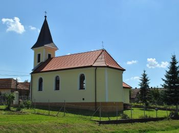
![Excursión A pie Felsőtárkány - P+ (Varró-ház -Oldal-völgy) - Photo](https://media.geolcdn.com/t/350/260/2180e776-7797-4bbb-bd79-41399666d696.jpeg&format=jpg&maxdim=2)
![A pie A pie](https://static1.geolcdn.com/sitytour/trail-icons/100.png)
Km
A pie
![](/images/other/stat-length.png)
![](https://static1.geolcdn.com/siteimages/upload/files/1508320355ic_sort_den_pos_24dp.png)
![](https://static1.geolcdn.com/siteimages/upload/files/1508320355ic_sort_den_neg_24dp.png)
![](https://static1.geolcdn.com/siteimages/upload/files/16400158638029165_repeat_loop_refresh_sync_direction_icon.png)
• Trail created by Kaptárkő. Symbol: red cross
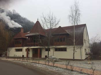
![Excursión A pie Salgótarján - Bányász körút - Photo](https://media.geolcdn.com/t/350/260/aac96509-b9ce-4f0d-b83e-bece29d9db4a.jpeg&format=jpg&maxdim=2)
![A pie A pie](https://static1.geolcdn.com/sitytour/trail-icons/100.png)
Km
A pie
![](/images/other/stat-length.png)
![](https://static1.geolcdn.com/siteimages/upload/files/1508320355ic_sort_den_pos_24dp.png)
![](https://static1.geolcdn.com/siteimages/upload/files/1508320355ic_sort_den_neg_24dp.png)
![](https://static1.geolcdn.com/siteimages/upload/files/16400158638029165_repeat_loop_refresh_sync_direction_icon.png)
• Trail created by Zöld Út Természetjárók Egyesülete.
![Excursión A pie Szurdokpüspöki - Mária Út M56-01 - Photo](https://media.geolcdn.com/t/350/260/2bc93b56-8d7b-4a64-b65d-8ffada04e206.jpeg&format=jpg&maxdim=2)
![A pie A pie](https://static1.geolcdn.com/sitytour/trail-icons/100.png)
Km
A pie
![](/images/other/stat-length.png)
![](https://static1.geolcdn.com/siteimages/upload/files/1508320355ic_sort_den_pos_24dp.png)
![](https://static1.geolcdn.com/siteimages/upload/files/1508320355ic_sort_den_neg_24dp.png)
![](https://static1.geolcdn.com/siteimages/upload/files/16400158638029165_repeat_loop_refresh_sync_direction_icon.png)
• Trail created by MUTKE.
![Excursión A pie Nagyréde - Mária Út M56-02 - Photo](https://media.geolcdn.com/t/350/260/45d757cc-93a4-49fe-871f-80afae3ee0c4.jpeg&format=jpg&maxdim=2)
![A pie A pie](https://static1.geolcdn.com/sitytour/trail-icons/100.png)
Km
A pie
![](/images/other/stat-length.png)
![](https://static1.geolcdn.com/siteimages/upload/files/1508320355ic_sort_den_pos_24dp.png)
![](https://static1.geolcdn.com/siteimages/upload/files/1508320355ic_sort_den_neg_24dp.png)
![](https://static1.geolcdn.com/siteimages/upload/files/16400158638029165_repeat_loop_refresh_sync_direction_icon.png)
• Trail created by MUTKE.
![Excursión A pie Jászárokszállás - Mária Út M56-03 - Photo](https://media.geolcdn.com/t/350/260/32a97334-9531-4a8d-96b7-5494edcd8f86.jpeg&format=jpg&maxdim=2)
![A pie A pie](https://static1.geolcdn.com/sitytour/trail-icons/100.png)
Km
A pie
![](/images/other/stat-length.png)
![](https://static1.geolcdn.com/siteimages/upload/files/1508320355ic_sort_den_pos_24dp.png)
![](https://static1.geolcdn.com/siteimages/upload/files/1508320355ic_sort_den_neg_24dp.png)
![](https://static1.geolcdn.com/siteimages/upload/files/16400158638029165_repeat_loop_refresh_sync_direction_icon.png)
• Trail created by MUTKE.
![Excursión A pie Jászapáti - Mária Út M56-04 - Photo](https://media.geolcdn.com/t/350/260/32a97334-9531-4a8d-96b7-5494edcd8f86.jpeg&format=jpg&maxdim=2)
![A pie A pie](https://static1.geolcdn.com/sitytour/trail-icons/100.png)
Km
A pie
![](/images/other/stat-length.png)
![](https://static1.geolcdn.com/siteimages/upload/files/1508320355ic_sort_den_pos_24dp.png)
![](https://static1.geolcdn.com/siteimages/upload/files/1508320355ic_sort_den_neg_24dp.png)
![](https://static1.geolcdn.com/siteimages/upload/files/16400158638029165_repeat_loop_refresh_sync_direction_icon.png)
• Trail created by MUTKE.
![Excursión A pie Diósjenő - K4 (Hárombarát-nyereg - Pénzásás) - Photo](https://media.geolcdn.com/t/350/260/eadd69ce-cbec-4584-a066-fd6823eaf261.jpeg&format=jpg&maxdim=2)
![A pie A pie](https://static1.geolcdn.com/sitytour/trail-icons/100.png)
Km
A pie
![](/images/other/stat-length.png)
![](https://static1.geolcdn.com/siteimages/upload/files/1508320355ic_sort_den_pos_24dp.png)
![](https://static1.geolcdn.com/siteimages/upload/files/1508320355ic_sort_den_neg_24dp.png)
![](https://static1.geolcdn.com/siteimages/upload/files/16400158638029165_repeat_loop_refresh_sync_direction_icon.png)
• Trail created by BTHE.
![Excursión A pie Miskolc - S+ Bánkút - Ómassa - Photo](https://media.geolcdn.com/t/350/260/0f14e777-c205-4dde-a3be-2eb3f108ce30.jpeg&format=jpg&maxdim=2)
![A pie A pie](https://static1.geolcdn.com/sitytour/trail-icons/100.png)
Km
A pie
![](/images/other/stat-length.png)
![](https://static1.geolcdn.com/siteimages/upload/files/1508320355ic_sort_den_pos_24dp.png)
![](https://static1.geolcdn.com/siteimages/upload/files/1508320355ic_sort_den_neg_24dp.png)
![](https://static1.geolcdn.com/siteimages/upload/files/16400158638029165_repeat_loop_refresh_sync_direction_icon.png)
• Trail created by Borsod-Abaúj-Zemplén Megyei Természetjáró Szövetség.
![Excursión A pie Tornaszentandrás - K■ (Tornaszentandrás - OKT) - Photo](https://media.geolcdn.com/t/350/260/ee43090b-1b8b-4f39-962e-4f4cc440c35c.jpeg&format=jpg&maxdim=2)
![A pie A pie](https://static1.geolcdn.com/sitytour/trail-icons/100.png)
Km
A pie
![](/images/other/stat-length.png)
![](https://static1.geolcdn.com/siteimages/upload/files/1508320355ic_sort_den_pos_24dp.png)
![](https://static1.geolcdn.com/siteimages/upload/files/1508320355ic_sort_den_neg_24dp.png)
![](https://static1.geolcdn.com/siteimages/upload/files/16400158638029165_repeat_loop_refresh_sync_direction_icon.png)
• Trail created by Borsod-Abaúj-Zemplén Megyei Természetjáró Szövetség.
![Excursión A pie Ópusztaszer - K+ Kistelek vá. – Ópusztaszer Nemzeti Történeti Emlékpark - Photo](https://media.geolcdn.com/t/350/260/192f45f3-19e4-4bbe-80a1-3e38a19a7762.jpeg&format=jpg&maxdim=2)
![A pie A pie](https://static1.geolcdn.com/sitytour/trail-icons/100.png)
Km
A pie
![](/images/other/stat-length.png)
![](https://static1.geolcdn.com/siteimages/upload/files/1508320355ic_sort_den_pos_24dp.png)
![](https://static1.geolcdn.com/siteimages/upload/files/1508320355ic_sort_den_neg_24dp.png)
![](https://static1.geolcdn.com/siteimages/upload/files/16400158638029165_repeat_loop_refresh_sync_direction_icon.png)
• Trail created by DÉMÁSZ Elektromos SE.
![Excursión A pie Aggtelek - Karsztbarlangok nyomában tematikus út - Photo](https://media.geolcdn.com/t/350/260/43bbb6e1-a836-4aa3-8ca1-b3f4a91c6d96.jpeg&format=jpg&maxdim=2)
![A pie A pie](https://static1.geolcdn.com/sitytour/trail-icons/100.png)
Km
A pie
![](/images/other/stat-length.png)
![](https://static1.geolcdn.com/siteimages/upload/files/1508320355ic_sort_den_pos_24dp.png)
![](https://static1.geolcdn.com/siteimages/upload/files/1508320355ic_sort_den_neg_24dp.png)
![](https://static1.geolcdn.com/siteimages/upload/files/16400158638029165_repeat_loop_refresh_sync_direction_icon.png)
• Trail created by Borsod-Abaúj-Zemplén Megyei Természetjáró Szövetség.
![Excursión A pie Diósjenő - S■ Diósjenő - Photo](https://media.geolcdn.com/t/350/260/358eb930-42af-45d6-8f0e-f214943df28b.jpeg&format=jpg&maxdim=2)
![A pie A pie](https://static1.geolcdn.com/sitytour/trail-icons/100.png)
Km
A pie
![](/images/other/stat-length.png)
![](https://static1.geolcdn.com/siteimages/upload/files/1508320355ic_sort_den_pos_24dp.png)
![](https://static1.geolcdn.com/siteimages/upload/files/1508320355ic_sort_den_neg_24dp.png)
![](https://static1.geolcdn.com/siteimages/upload/files/16400158638029165_repeat_loop_refresh_sync_direction_icon.png)
• Trail created by BTHE.
![Excursión A pie Felsőpetény - Reformáció Emlékút 1 (Egyházasdengeleg - Nógrád) - Photo](https://media.geolcdn.com/t/350/260/0e16c49f-e8e0-4be0-b672-8ec9e04143b0.jpeg&format=jpg&maxdim=2)
![A pie A pie](https://static1.geolcdn.com/sitytour/trail-icons/100.png)
Km
A pie
![](/images/other/stat-length.png)
![](https://static1.geolcdn.com/siteimages/upload/files/1508320355ic_sort_den_pos_24dp.png)
![](https://static1.geolcdn.com/siteimages/upload/files/1508320355ic_sort_den_neg_24dp.png)
![](https://static1.geolcdn.com/siteimages/upload/files/16400158638029165_repeat_loop_refresh_sync_direction_icon.png)
• Trail created by Magyarországi Evangélikus Egyház.
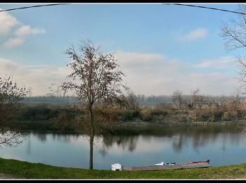
![Excursión A pie Baja - P- - Photo](https://media.geolcdn.com/t/350/260/070725cb-d34e-46b8-96f2-3fbc45707764.jpeg&format=jpg&maxdim=2)
![A pie A pie](https://static1.geolcdn.com/sitytour/trail-icons/100.png)
Km
A pie
![](/images/other/stat-length.png)
![](https://static1.geolcdn.com/siteimages/upload/files/1508320355ic_sort_den_pos_24dp.png)
![](https://static1.geolcdn.com/siteimages/upload/files/1508320355ic_sort_den_neg_24dp.png)
![](https://static1.geolcdn.com/siteimages/upload/files/16400158638029165_repeat_loop_refresh_sync_direction_icon.png)
• Symbol: red circle arrow
![Excursión A pie Nagybaracska - P Baja - Sugovica-part - Vodica - Bátmonostor, Ferenc-tápcsatorna - Photo](https://media.geolcdn.com/t/350/260/aff34eb6-66ea-4a47-8157-a6a44485381c.jpeg&format=jpg&maxdim=2)
![A pie A pie](https://static1.geolcdn.com/sitytour/trail-icons/100.png)
Km
A pie
![](/images/other/stat-length.png)
![](https://static1.geolcdn.com/siteimages/upload/files/1508320355ic_sort_den_pos_24dp.png)
![](https://static1.geolcdn.com/siteimages/upload/files/1508320355ic_sort_den_neg_24dp.png)
![](https://static1.geolcdn.com/siteimages/upload/files/16400158638029165_repeat_loop_refresh_sync_direction_icon.png)
• Symbol: red bar
![Excursión A pie Rakaca - P+ Galvács - Photo](https://media.geolcdn.com/t/350/260/1546f0ae-12bb-4c9e-8355-0010d3e868f6.jpeg&format=jpg&maxdim=2)
![A pie A pie](https://static1.geolcdn.com/sitytour/trail-icons/100.png)
Km
A pie
![](/images/other/stat-length.png)
![](https://static1.geolcdn.com/siteimages/upload/files/1508320355ic_sort_den_pos_24dp.png)
![](https://static1.geolcdn.com/siteimages/upload/files/1508320355ic_sort_den_neg_24dp.png)
![](https://static1.geolcdn.com/siteimages/upload/files/16400158638029165_repeat_loop_refresh_sync_direction_icon.png)
• Trail created by Borsod-Abaúj-Zemplén Megyei Természetjáró Szövetség.
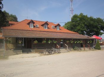
![Excursión A pie Öttömös - S Petróczi iskola (AK) - Csongrád megye magaspontja - Öttömös - Photo](https://media.geolcdn.com/t/350/260/a82c7bfb-4361-4273-b4d7-09b6380ef5d1.jpeg&format=jpg&maxdim=2)
![A pie A pie](https://static1.geolcdn.com/sitytour/trail-icons/100.png)
Km
A pie
![](/images/other/stat-length.png)
![](https://static1.geolcdn.com/siteimages/upload/files/1508320355ic_sort_den_pos_24dp.png)
![](https://static1.geolcdn.com/siteimages/upload/files/1508320355ic_sort_den_neg_24dp.png)
![](https://static1.geolcdn.com/siteimages/upload/files/16400158638029165_repeat_loop_refresh_sync_direction_icon.png)
• Trail created by CSMTSZ. Symbol: Yellow bar on white background
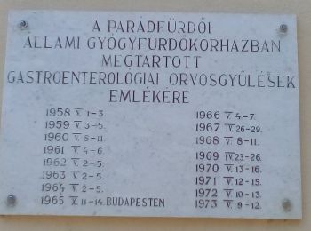
![Excursión A pie Parád - S+ - Photo](https://media.geolcdn.com/t/350/260/9ca43b40-9011-4135-a1cf-0773701c74ef.jpeg&format=jpg&maxdim=2)
![A pie A pie](https://static1.geolcdn.com/sitytour/trail-icons/100.png)
Km
A pie
![](/images/other/stat-length.png)
![](https://static1.geolcdn.com/siteimages/upload/files/1508320355ic_sort_den_pos_24dp.png)
![](https://static1.geolcdn.com/siteimages/upload/files/1508320355ic_sort_den_neg_24dp.png)
![](https://static1.geolcdn.com/siteimages/upload/files/16400158638029165_repeat_loop_refresh_sync_direction_icon.png)
• Trail created by kekesturista.
![Excursión A pie Bükkszentkereszt - Rejteki Tanösvény (nagy kör) - Photo](https://media.geolcdn.com/t/350/260/f8ec61a8-dd0f-47bc-960c-f566c087290e.jpeg&format=jpg&maxdim=2)
![A pie A pie](https://static1.geolcdn.com/sitytour/trail-icons/100.png)
Km
A pie
![](/images/other/stat-length.png)
![](https://static1.geolcdn.com/siteimages/upload/files/1508320355ic_sort_den_pos_24dp.png)
![](https://static1.geolcdn.com/siteimages/upload/files/1508320355ic_sort_den_neg_24dp.png)
![](https://static1.geolcdn.com/siteimages/upload/files/16400158638029165_repeat_loop_refresh_sync_direction_icon.png)
• Trail created by Bükki Nemzeti Park Igazgatóság.
![Excursión A pie Sárospatak - Hegyalja - Malomkő Tanösvény - Photo](https://media.geolcdn.com/t/350/260/4a9e1283-ce79-4471-af9f-c2ed6a787d29.jpeg&format=jpg&maxdim=2)
![A pie A pie](https://static1.geolcdn.com/sitytour/trail-icons/100.png)
Km
A pie
![](/images/other/stat-length.png)
![](https://static1.geolcdn.com/siteimages/upload/files/1508320355ic_sort_den_pos_24dp.png)
![](https://static1.geolcdn.com/siteimages/upload/files/1508320355ic_sort_den_neg_24dp.png)
![](https://static1.geolcdn.com/siteimages/upload/files/16400158638029165_repeat_loop_refresh_sync_direction_icon.png)
• Symbol: red T on white background
20 excursiones mostradas en 256
Aplicación GPS de excursión GRATIS