


13,9 km | 18,5 km-effort
Croatia: Descubra los 444 mejores circuitos de excursión a pie o en bici. Nuestro catálogo, preparado manualmente por nuestros excursionistas, está lleno de magníficos paisajes para explorar. Descargue estos itinerarios en SityTrail, nuestra aplicación de GPS de excursiones gratis disponible en Android e iOS.
Senderismo


A pie
• Ruta creada por PD Plus, Klana ( http://www.pdplis.hr/ ).
A pie
• Ruta creada por HPD HP and HT Učka, Rijeka.
A pie
• Ruta creada por HPD HP i HT Učka, Rijeka.
A pie
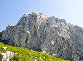
• Ruta creada por PD Paklenica, Zadar (http://www.pdpaklenica.hr).
A pie
• Ruta creada por PD Paklenica, Zadar (http://www.pdpaklenica.hr).
A pie
• Ruta creada por PD Kamenjak, Rab (http://www.pd-kamenjak-rab.com/).
A pie
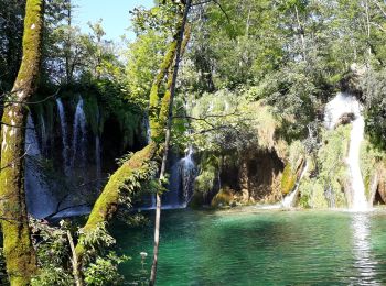
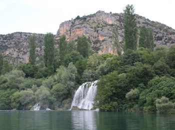
• Ruta creada por NP Krka.
A pie
• Ruta creada por PD Opatija, Opatija.
A pie
• Ruta creada por PD Duga, Rijeka.
A pie
• Ruta creada por PD Duga, Rijeka. Ravno podolje (x) s PP Lepenice za Risnjak - šumskom cestom i putovima kroz Mrzle d...
A pie
• Ruta creada por HPD Zagreb-Matica, Zagreb.
A pie
• Ruta creada por Istra Trails. Símbolo: green bar on yellow ground Sitio web: http://www.istria-trails.com/hr/staze...
A pie
• Park prirode Vransko jezero predstavlja mjesto neposrednog susreta s prirodom i pruža jedinstvenu priliku da prirodom...
A pie
• Ruta creada por PD Belveder Biograd na Moru.
A pie
• Ruta creada por Via Dinarica.

A pie
• Ruta creada por Via Dinarica.
A pie
• Ruta creada por PD Strilež, Crikvenica.
A pie
• Ruta creada por HPD Zagreb-Matica, Zagreb.
A pie
• Ruta creada por PD Industrogradnja, Zagreb.
20 excursiones mostradas en 444
Aplicación GPS de excursión GRATIS
 SityTrail
IGN / Institutos geográficos
SityTrail World
El mundo es suyo