![](/images/other/stat-length.png)
- Excursiones
- A pie
- France
- Normandía
- Orne
- Longny les Villages
- Longny-au-Perche
Longny-au-Perche, Longny les Villages, A pie: Los mejores itinerarios de excursión, recorridos, paseos y sendas
Longny-au-Perche: Descubra las mejores excursiones: 4 senderismo. Todos estos circuitos, recorridos, itinerarios y actividades al aire libre están disponibles en nuestras aplicaciones SityTrail para smartphone y tablet.
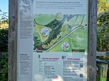
Los mejores recorridos (4)
![Excursión Senderismo Longny les Villages - Longny-au-Perche - Le Coteau de la Bandonnière - Photo](https://media.geolcdn.com/t/350/260/ext.jpg?maxdim=2&url=https%3A%2F%2Fmedia.geolcdn.com%2Ff%2F025440af-5b4b-458b-853d-275d198f0d8b.jpg)
![Senderismo Senderismo](https://static1.geolcdn.com/sitytour/trail-icons/101.png)
Km
#1 - Longny-au-Perche - Le Coteau de la Bandonnière
Senderismo
Fácil
Longny les Villages,
Normandía,
Orne,
France
![](/images/other/stat-length.png)
957 m | 1,4 km-effort
33min
![](https://static1.geolcdn.com/siteimages/upload/files/1508320355ic_sort_den_pos_24dp.png)
34 m
![](https://static1.geolcdn.com/siteimages/upload/files/1508320355ic_sort_den_neg_24dp.png)
32 m
![](https://static1.geolcdn.com/siteimages/upload/files/16400158638029165_repeat_loop_refresh_sync_direction_icon.png)
Sí
guydu41
![Excursión Senderismo Longny les Villages - [Itinéraire] Le coteau de la Bandonnière - Photo](https://media.geolcdn.com/t/350/260/ext.jpg?maxdim=2&url=https%3A%2F%2Fstatic1.geolcdn.com%2Fsiteimages%2Fupload%2Ffiles%2F1553511878bg_sport_marche.png)
![Senderismo Senderismo](https://static1.geolcdn.com/sitytour/trail-icons/101.png)
Km
#2 - [Itinéraire] Le coteau de la Bandonnière
Senderismo
Fácil
Longny les Villages,
Normandía,
Orne,
France
![](/images/other/stat-length.png)
827 m | 1,3 km-effort
18min
![](https://static1.geolcdn.com/siteimages/upload/files/1508320355ic_sort_den_pos_24dp.png)
37 m
![](https://static1.geolcdn.com/siteimages/upload/files/1508320355ic_sort_den_neg_24dp.png)
37 m
![](https://static1.geolcdn.com/siteimages/upload/files/16400158638029165_repeat_loop_refresh_sync_direction_icon.png)
Sí
ODDAD78
![Excursión Senderismo Longny les Villages - Longny 20,31 - Photo](https://media.geolcdn.com/t/350/260/ext.jpg?maxdim=2&url=https%3A%2F%2Fstatic1.geolcdn.com%2Fsiteimages%2Fupload%2Ffiles%2F1553511878bg_sport_marche.png)
![Senderismo Senderismo](https://static1.geolcdn.com/sitytour/trail-icons/101.png)
Km
#3 - Longny 20,31
Senderismo
Difícil
Longny les Villages,
Normandía,
Orne,
France
![](/images/other/stat-length.png)
20 km | 25 km-effort
5h 28min
![](https://static1.geolcdn.com/siteimages/upload/files/1508320355ic_sort_den_pos_24dp.png)
364 m
![](https://static1.geolcdn.com/siteimages/upload/files/1508320355ic_sort_den_neg_24dp.png)
355 m
![](https://static1.geolcdn.com/siteimages/upload/files/16400158638029165_repeat_loop_refresh_sync_direction_icon.png)
Sí
togolo28
![Excursión Senderismo Longny les Villages - Longny 18.1 - Photo](https://media.geolcdn.com/t/350/260/ext.jpg?maxdim=2&url=https%3A%2F%2Fstatic1.geolcdn.com%2Fsiteimages%2Fupload%2Ffiles%2F1553511878bg_sport_marche.png)
![Senderismo Senderismo](https://static1.geolcdn.com/sitytour/trail-icons/101.png)
Km
#4 - Longny 18.1
Senderismo
Muy difícil
Longny les Villages,
Normandía,
Orne,
France
![](/images/other/stat-length.png)
18 km | 23 km-effort
5h 8min
![](https://static1.geolcdn.com/siteimages/upload/files/1508320355ic_sort_den_pos_24dp.png)
349 m
![](https://static1.geolcdn.com/siteimages/upload/files/1508320355ic_sort_den_neg_24dp.png)
344 m
![](https://static1.geolcdn.com/siteimages/upload/files/16400158638029165_repeat_loop_refresh_sync_direction_icon.png)
Sí
togolo28
4 excursiones mostradas en 4
Aplicación GPS de excursión GRATIS