![](/images/other/stat-length.png)
- Excursiones
- A pie
- France
- Bretaña
- Morbihan
Morbihan, Bretaña, A pie: Los mejores itinerarios de excursión, recorridos, paseos y sendas
Morbihan: Descubra las mejores excursiones: 166 a pie, 3916 senderismo, 126 marcha nórdica, 85 carrera y 19 ruta. Todos estos circuitos, recorridos, itinerarios y actividades al aire libre están disponibles en nuestras aplicaciones SityTrail para smartphone y tablet.
Los mejores recorridos (4284)
![Excursión Marcha nórdica Plouhinec - D'Etel au Pont Laurois par les deux côtés de la Ria - Photo](https://media.geolcdn.com/t/350/260/ext.jpg?maxdim=2&url=https%3A%2F%2Fservices.sitytrail.com%2FGeolivesWS%2FDownloadMedia.ashx%3FTrailID%3D323717%26Media%3Dfix__20140713124707.jpg)
![Marcha nórdica Marcha nórdica](https://static1.geolcdn.com/sitytour/trail-icons/102.png)
Km
Marcha nórdica
![](/images/other/stat-length.png)
![](https://static1.geolcdn.com/siteimages/upload/files/1508320355ic_sort_den_pos_24dp.png)
![](https://static1.geolcdn.com/siteimages/upload/files/1508320355ic_sort_den_neg_24dp.png)
![](https://static1.geolcdn.com/siteimages/upload/files/16400158638029165_repeat_loop_refresh_sync_direction_icon.png)
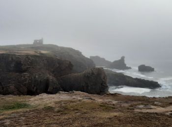
• A travers des couloirs de fougères ou des tunnels taillés dans la lande, on découvre à chaque virage un panorama diff...
![Senderismo Senderismo](https://static1.geolcdn.com/sitytour/trail-icons/101.png)
Km
Senderismo
![](/images/other/stat-length.png)
![](https://static1.geolcdn.com/siteimages/upload/files/1508320355ic_sort_den_pos_24dp.png)
![](https://static1.geolcdn.com/siteimages/upload/files/1508320355ic_sort_den_neg_24dp.png)
![](https://static1.geolcdn.com/siteimages/upload/files/16400158638029165_repeat_loop_refresh_sync_direction_icon.png)
![Excursión Senderismo Locmariaquer - PR_56_Locmariaquer_AA_01_Circuit1b_Entre-Golfe-Et-Ocean_20220217 - Photo](https://media.geolcdn.com/t/350/260/eee1e160-7ef6-4c8d-9c67-f23fbc97fcb6.jpg&format=jpg&maxdim=2)
![Senderismo Senderismo](https://static1.geolcdn.com/sitytour/trail-icons/101.png)
Km
Senderismo
![](/images/other/stat-length.png)
![](https://static1.geolcdn.com/siteimages/upload/files/1508320355ic_sort_den_pos_24dp.png)
![](https://static1.geolcdn.com/siteimages/upload/files/1508320355ic_sort_den_neg_24dp.png)
![](https://static1.geolcdn.com/siteimages/upload/files/16400158638029165_repeat_loop_refresh_sync_direction_icon.png)
![Excursión Senderismo Saint-Pierre-Quiberon - PR_56_St-Pierre-Quiberon_AA_01_Circuit1b_Kerhostin-Portivy-Cote-Sauvage_20220128 - Photo](https://media.geolcdn.com/t/350/260/d45e12b2-2e75-4861-a4a2-09f030be07c2.jpg&format=jpg&maxdim=2)
![Senderismo Senderismo](https://static1.geolcdn.com/sitytour/trail-icons/101.png)
Km
Senderismo
![](/images/other/stat-length.png)
![](https://static1.geolcdn.com/siteimages/upload/files/1508320355ic_sort_den_pos_24dp.png)
![](https://static1.geolcdn.com/siteimages/upload/files/1508320355ic_sort_den_neg_24dp.png)
![](https://static1.geolcdn.com/siteimages/upload/files/16400158638029165_repeat_loop_refresh_sync_direction_icon.png)
![Excursión Senderismo Plouhinec - PR_56_Plouhinec_AA_01_Circuit1b_La-Ria-Par-Les-Pinedes_20200712 - Photo](https://media.geolcdn.com/t/350/260/1d672734-99d3-43b8-9472-2acec23bab09.jpg&format=jpg&maxdim=2)
![Senderismo Senderismo](https://static1.geolcdn.com/sitytour/trail-icons/101.png)
Km
Senderismo
![](/images/other/stat-length.png)
![](https://static1.geolcdn.com/siteimages/upload/files/1508320355ic_sort_den_pos_24dp.png)
![](https://static1.geolcdn.com/siteimages/upload/files/1508320355ic_sort_den_neg_24dp.png)
![](https://static1.geolcdn.com/siteimages/upload/files/16400158638029165_repeat_loop_refresh_sync_direction_icon.png)
![Excursión Senderismo Questembert - PR_56_Questembert_AA_01_Circuit1b_Sentier-Des-Popinettes_20200521 - Photo](https://media.geolcdn.com/t/350/260/8a6cc9c1-1a36-4087-863e-60a39a6c581a.jpg&format=jpg&maxdim=2)
![Senderismo Senderismo](https://static1.geolcdn.com/sitytour/trail-icons/101.png)
Km
Senderismo
![](/images/other/stat-length.png)
![](https://static1.geolcdn.com/siteimages/upload/files/1508320355ic_sort_den_pos_24dp.png)
![](https://static1.geolcdn.com/siteimages/upload/files/1508320355ic_sort_den_neg_24dp.png)
![](https://static1.geolcdn.com/siteimages/upload/files/16400158638029165_repeat_loop_refresh_sync_direction_icon.png)
![Excursión Senderismo Pluvigner - PR_56_Pluvignier_AA_01_Circuit1b_St-Tremeur_20200512 - Photo](https://media.geolcdn.com/t/350/260/8f4a8d7d-c8a2-417f-b9fd-3f38305195a6.jpg&format=jpg&maxdim=2)
![Senderismo Senderismo](https://static1.geolcdn.com/sitytour/trail-icons/101.png)
Km
Senderismo
![](/images/other/stat-length.png)
![](https://static1.geolcdn.com/siteimages/upload/files/1508320355ic_sort_den_pos_24dp.png)
![](https://static1.geolcdn.com/siteimages/upload/files/1508320355ic_sort_den_neg_24dp.png)
![](https://static1.geolcdn.com/siteimages/upload/files/16400158638029165_repeat_loop_refresh_sync_direction_icon.png)
![Excursión Senderismo Carnac - ALA 08-10-18 CARNAC - Photo](https://media.geolcdn.com/t/350/260/ext.jpg?maxdim=2&url=https%3A%2F%2Fservices.sitytrail.com%2FGeolivesWS%2FDownloadMedia.ashx%3FTrailID%3D1053407%26Media%3Dfix__20181008155047.jpg)
![Senderismo Senderismo](https://static1.geolcdn.com/sitytour/trail-icons/101.png)
Km
Senderismo
![](/images/other/stat-length.png)
![](https://static1.geolcdn.com/siteimages/upload/files/1508320355ic_sort_den_pos_24dp.png)
![](https://static1.geolcdn.com/siteimages/upload/files/1508320355ic_sort_den_neg_24dp.png)
![](https://static1.geolcdn.com/siteimages/upload/files/16400158638029165_repeat_loop_refresh_sync_direction_icon.png)
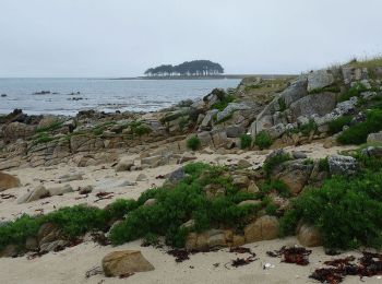
• certaines zones de rochers peuvent être contournées
![Excursión Senderismo Plouhinec - Rivière d'Etel - Photo](https://media.geolcdn.com/t/350/260/ext.jpg?maxdim=2&url=https%3A%2F%2Fservices.sitytrail.com%2FGeolivesWS%2FDownloadMedia.ashx%3FTrailID%3D691090%26Media%3Dfix__20170128155839.jpg)
![Senderismo Senderismo](https://static1.geolcdn.com/sitytour/trail-icons/101.png)
Km
Senderismo
![](/images/other/stat-length.png)
![](https://static1.geolcdn.com/siteimages/upload/files/1508320355ic_sort_den_pos_24dp.png)
![](https://static1.geolcdn.com/siteimages/upload/files/1508320355ic_sort_den_neg_24dp.png)
![](https://static1.geolcdn.com/siteimages/upload/files/16400158638029165_repeat_loop_refresh_sync_direction_icon.png)
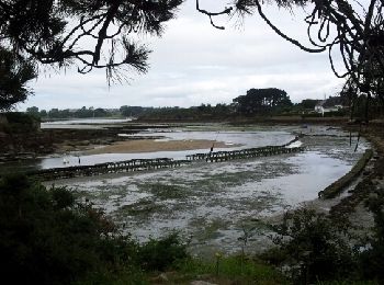
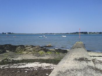
• Au nord de Pont-Lorois
![Excursión Senderismo Le Bono - Du Bono à la Chapelle de Saint-Avoye - Photo](https://media.geolcdn.com/t/350/260/ext.jpg?maxdim=2&url=https%3A%2F%2Fservices.sitytrail.com%2FGeolivesWS%2FDownloadMedia.ashx%3FTrailID%3D455675%26Media%3Dfix__20150807180035.jpg)
![Senderismo Senderismo](https://static1.geolcdn.com/sitytour/trail-icons/101.png)
Km
Senderismo
![](/images/other/stat-length.png)
![](https://static1.geolcdn.com/siteimages/upload/files/1508320355ic_sort_den_pos_24dp.png)
![](https://static1.geolcdn.com/siteimages/upload/files/1508320355ic_sort_den_neg_24dp.png)
![](https://static1.geolcdn.com/siteimages/upload/files/16400158638029165_repeat_loop_refresh_sync_direction_icon.png)
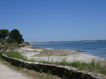
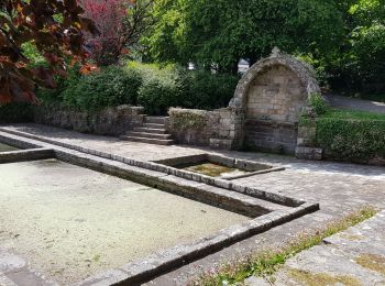
• Le parcours longe la rivière du Sal par un sentier côtier bordé de chênes têtards jusqu'à la Chapelle Renaissance du ...
![Excursión Senderismo Larmor-Baden - LARMOR-BADEN_PEN-EN-TOUL_BERDER - Photo](https://media.geolcdn.com/t/350/260/006d768a-8f9f-48de-b1ea-c2f886dc8e57.jpg&format=jpg&maxdim=2)
![Senderismo Senderismo](https://static1.geolcdn.com/sitytour/trail-icons/101.png)
Km
Senderismo
![](/images/other/stat-length.png)
![](https://static1.geolcdn.com/siteimages/upload/files/1508320355ic_sort_den_pos_24dp.png)
![](https://static1.geolcdn.com/siteimages/upload/files/1508320355ic_sort_den_neg_24dp.png)
![](https://static1.geolcdn.com/siteimages/upload/files/16400158638029165_repeat_loop_refresh_sync_direction_icon.png)
• Type: Circuit-56-Morbihan Départ : Pen En Toul
![Excursión Senderismo Locmariaquer - Locmariaquer et ses sites naturels - Photo](https://media.geolcdn.com/t/350/260/ext.jpg?maxdim=2&url=https%3A%2F%2Fservices.sitytrail.com%2FGeolivesWS%2FDownloadMedia.ashx%3FTrailID%3D316854%26Media%3D15924_5.jpg)
![Senderismo Senderismo](https://static1.geolcdn.com/sitytour/trail-icons/101.png)
Km
Senderismo
![](/images/other/stat-length.png)
![](https://static1.geolcdn.com/siteimages/upload/files/1508320355ic_sort_den_pos_24dp.png)
![](https://static1.geolcdn.com/siteimages/upload/files/1508320355ic_sort_den_neg_24dp.png)
![](https://static1.geolcdn.com/siteimages/upload/files/16400158638029165_repeat_loop_refresh_sync_direction_icon.png)
![Excursión Senderismo Locmariaquer - Le tour de Locmariaquer - Photo](https://media.geolcdn.com/t/350/260/ext.jpg?maxdim=2&url=https%3A%2F%2Fservices.sitytrail.com%2FGeolivesWS%2FDownloadMedia.ashx%3FTrailID%3D316851%26Media%3D15920_6.jpg)
![Senderismo Senderismo](https://static1.geolcdn.com/sitytour/trail-icons/101.png)
Km
Senderismo
![](/images/other/stat-length.png)
![](https://static1.geolcdn.com/siteimages/upload/files/1508320355ic_sort_den_pos_24dp.png)
![](https://static1.geolcdn.com/siteimages/upload/files/1508320355ic_sort_den_neg_24dp.png)
![](https://static1.geolcdn.com/siteimages/upload/files/16400158638029165_repeat_loop_refresh_sync_direction_icon.png)
![Excursión Senderismo Baden - Ile aux Moines - Photo](https://media.geolcdn.com/t/350/260/ext.jpg?maxdim=2&url=https%3A%2F%2Fservices.sitytrail.com%2FGeolivesWS%2FDownloadMedia.ashx%3FTrailID%3D204495%26Media%3Dfix__20130708163141.jpg)
![Senderismo Senderismo](https://static1.geolcdn.com/sitytour/trail-icons/101.png)
Km
Senderismo
![](/images/other/stat-length.png)
![](https://static1.geolcdn.com/siteimages/upload/files/1508320355ic_sort_den_pos_24dp.png)
![](https://static1.geolcdn.com/siteimages/upload/files/1508320355ic_sort_den_neg_24dp.png)
![](https://static1.geolcdn.com/siteimages/upload/files/16400158638029165_repeat_loop_refresh_sync_direction_icon.png)
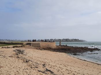
• Tour de l'île par le sentier douanier
![Excursión Senderismo Locmariaquer - locmariaquer - Photo](https://media.geolcdn.com/t/350/260/ext.jpg?maxdim=2&url=https%3A%2F%2Fservices.sitytrail.com%2FGeolivesWS%2FDownloadMedia.ashx%3FTrailID%3D156625%26Media%3D20121004110915.jpeg)
![Senderismo Senderismo](https://static1.geolcdn.com/sitytour/trail-icons/101.png)
Km
Senderismo
![](/images/other/stat-length.png)
![](https://static1.geolcdn.com/siteimages/upload/files/1508320355ic_sort_den_pos_24dp.png)
![](https://static1.geolcdn.com/siteimages/upload/files/1508320355ic_sort_den_neg_24dp.png)
![](https://static1.geolcdn.com/siteimages/upload/files/16400158638029165_repeat_loop_refresh_sync_direction_icon.png)
![Excursión Senderismo Étel - bignac - Photo](https://media.geolcdn.com/t/350/260/ext.jpg?maxdim=2&url=https%3A%2F%2Fservices.sitytrail.com%2FGeolivesWS%2FDownloadMedia.ashx%3FTrailID%3D153357%26Media%3D20120913152815.jpeg)
![Senderismo Senderismo](https://static1.geolcdn.com/sitytour/trail-icons/101.png)
Km
Senderismo
![](/images/other/stat-length.png)
![](https://static1.geolcdn.com/siteimages/upload/files/1508320355ic_sort_den_pos_24dp.png)
![](https://static1.geolcdn.com/siteimages/upload/files/1508320355ic_sort_den_neg_24dp.png)
![](https://static1.geolcdn.com/siteimages/upload/files/16400158638029165_repeat_loop_refresh_sync_direction_icon.png)
![Excursión Senderismo Locmariaquer - Raid du Golfe du Morbihan - Photo](https://media.geolcdn.com/t/350/260/ext.jpg?maxdim=2&url=https%3A%2F%2Fservices.sitytrail.com%2FGeolivesWS%2FDownloadMedia.ashx%3FTrailID%3D109057%26Media%3D3072_3.jpg)
![Senderismo Senderismo](https://static1.geolcdn.com/sitytour/trail-icons/101.png)
Km
Senderismo
![](/images/other/stat-length.png)
![](https://static1.geolcdn.com/siteimages/upload/files/1508320355ic_sort_den_pos_24dp.png)
![](https://static1.geolcdn.com/siteimages/upload/files/1508320355ic_sort_den_neg_24dp.png)
![](https://static1.geolcdn.com/siteimages/upload/files/16400158638029165_repeat_loop_refresh_sync_direction_icon.png)
![Excursión Senderismo Languidic - PR_56_Languidic_CA_03_Circuit1b_De-Lann-Veur_20220804 - Photo](https://media.geolcdn.com/t/350/260/6cee407d-a95a-4a08-ae5e-9d283a574aaf.jpg&format=jpg&maxdim=2)
![Senderismo Senderismo](https://static1.geolcdn.com/sitytour/trail-icons/101.png)
Km
Senderismo
![](/images/other/stat-length.png)
![](https://static1.geolcdn.com/siteimages/upload/files/1508320355ic_sort_den_pos_24dp.png)
![](https://static1.geolcdn.com/siteimages/upload/files/1508320355ic_sort_den_neg_24dp.png)
![](https://static1.geolcdn.com/siteimages/upload/files/16400158638029165_repeat_loop_refresh_sync_direction_icon.png)
![Excursión Senderismo Arzon - tour d'Arzon - Photo](https://media.geolcdn.com/t/350/260/8d2666dc-76b6-4531-82fb-267206fdbff7.jpg&format=jpg&maxdim=2)
![Senderismo Senderismo](https://static1.geolcdn.com/sitytour/trail-icons/101.png)
Km
Senderismo
![](/images/other/stat-length.png)
![](https://static1.geolcdn.com/siteimages/upload/files/1508320355ic_sort_den_pos_24dp.png)
![](https://static1.geolcdn.com/siteimages/upload/files/1508320355ic_sort_den_neg_24dp.png)
![](https://static1.geolcdn.com/siteimages/upload/files/16400158638029165_repeat_loop_refresh_sync_direction_icon.png)
20 excursiones mostradas en 4284
Aplicación GPS de excursión GRATIS
Actividades
Regiones próximas
- Allaire
- Ambon
- Arradon
- Arzal
- Arzon
- Augan
- Auray
- Baden
- Bangor
- Baud
- Béganne
- Beignon
- Belz
- Berné
- Berric
- Bignan
- Billiers
- Billio
- Bohal
- Brandérion
- Brandivy
- Brech
- Bréhan
- Brignac
- Bubry
- Caden
- Calan
- Camoël
- Camors
- Campénéac
- Carentoir
- Carnac
- Caro
- Caudan
- Cléguer
- Cléguérec
- Colpo
- Concoret
- Cournon
- Crac'h
- Crédin
- Croixanvec
- Cruguel
- Damgan
- Desconocido
- Elven
- Erdeven
- Étel
- Évellys
- Férel
- Forges-de-Lanouée
- Gâvres
- Gestel
- Gourin
- Grand-Champ
- Groix
- Guégon
- Guéhenno
- Gueltas
- Guémené-sur-Scorff
- Guénin
- Guer
- Guern
- Guidel
- Guillac
- Guilliers
- Guiscriff
- Helléan
- Hennebont
- Hœdic
- Île-aux-Moines
- Île-d'Arz
- Île-d'Houat
- Inguiniel
- Inzinzac-Lochrist
- Josselin
- Kergrist
- Kernascléden
- Kervignac
- La Chapelle-Neuve
- La Croix-Helléan
- La Gacilly
- La Roche-Bernard
- La Trinité-Porhoët
- La Trinité-Surzur
- La Trinité-sur-Mer
- La Vraie-Croix
- Landaul
- Landévant
- Lanester
- Langoëlan
- Langonnet
- Languidic
- Lanvaudan
- Lanvénégen
- Larmor-Baden
- Larmor-Plage
- Larré
- Lauzach
- Le Bono
- Le Cours
- Le Croisty
- Le Faouët
- Le Guerno
- Le Hézo
- Le Palais
- Le Saint
- Le Sourn
- Le Tour-du-Parc
- Les Fougerêts
- Lignol
- Limerzel
- Lizio
- Locmalo
- Locmaria
- Locmaria-Grand-Champ
- Locmariaquer
- Locminé
- Locmiquélic
- Locoal-Mendon
- Locqueltas
- Lorient
- Loyat
- Malansac
- Malestroit
- Malguénac
- Marzan
- Mauron
- Melrand
- Ménéac
- Merlevenez
- Meslan
- Meucon
- Missiriac
- Mohon
- Molac
- Monteneuf
- Monterblanc
- Montertelot
- Moréac
- Moustoir-Ac
- Muzillac
- Néant-sur-Yvel
- Neulliac
- Nivillac
- Nostang
- Noyal-Muzillac
- Noyal-Pontivy
- Péaule
- Peillac
- Pénestin
- Plaudren
- Plescop
- Pleucadeuc
- Pleugriffet
- Ploemel
- Ploërdut
- Ploeren
- Ploërmel
- Plouay
- Plougoumelen
- Plouharnel
- Plouhinec
- Plouray
- Pluherlin
- Plumelec
- Pluméliau-Bieuzy
- Plumelin
- Plumergat
- Pluneret
- Pluvigner
- Plœmeur
- Pont-Scorff
- Pontivy
- Porcaro
- Port-Louis
- Priziac
- Questembert
- Quéven
- Quiberon
- Quistinic
- Radenac
- Réguiny
- Réminiac
- Riantec
- Rieux
- Rochefort-en-Terre
- Rohan
- Roudouallec
- Ruffiac
- Saint-Aignan
- Saint-Allouestre
- Saint-Armel
- Saint-Avé
- Saint-Barthélemy
- Saint-Congard
- Saint-Dolay
- Saint-Gérand
- Saint-Gildas-de-Rhuys
- Saint-Gonnery
- Saint-Gorgon
- Saint-Gravé
- Saint-Guyomard
- Saint-Jacut-les-Pins
- Saint-Jean-Brévelay
- Saint-Jean-la-Poterie
- Saint-Laurent-sur-Oust
- Saint-Malo-de-Beignon
- Saint-Malo-des-Trois-Fontaines
- Saint-Marcel
- Saint-Martin-sur-Oust
- Saint-Nicolas-du-Tertre
- Saint-Nolff
- Saint-Perreux
- Saint-Philibert
- Saint-Pierre-Quiberon
- Saint-Servant
- Saint-Thuriau
- Saint-Tugdual
- Saint-Vincent-sur-Oust
- Sainte-Anne-d'Auray
- Sainte-Brigitte
- Sainte-Hélène
- Sarzeau
- Sauzon
- Séglien
- Séné
- Sérent
- Silfiac
- Sulniac
- Surzur
- Taupont
- Théhillac
- Theix-Noyalo
- Tréal
- Trédion
- Treffléan
- Tréhorenteuc
- Val d'Oust
- Vannes