La Souche, Ardecha, A pie: Los mejores itinerarios de excursión, recorridos, paseos y sendas

3 comentarios

La Souche: Descubra las mejores excursiones: 2 a pie y 29 senderismo. Todos estos circuitos, recorridos, itinerarios y actividades al aire libre están disponibles en nuestras aplicaciones SityTrail para smartphone y tablet.


Los mejores recorridos (31)
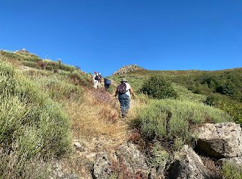
Excursión Senderismo La Souche - La Souche : de Montflat au Rocher du Midi avec un retour par les Rudils - Photo
Senderismo 6.772
Km

Senderismo

Difícil
La Souche, Auvergne-Rhône-Alpes, Ardecha, France
6,8 km | 12,8 km-effort
2h 53min
447 m
453 m
jeannine grandjean

Excursión Senderismo La Souche - Rocher d'Abraham par la Tour des Poignets - Photo
Senderismo 10.91
Km

Senderismo

Difícil
La Souche, Auvergne-Rhône-Alpes, Ardecha, France
10,9 km | 17,1 km-effort
5h 33min
463 m
463 m
bececoste

Excursión Senderismo La Souche - Bauzon station- Méjean-plateau du grand Tanargue - Photo
Senderismo 16.883
Km

Senderismo

Muy difícil
La Souche, Auvergne-Rhône-Alpes, Ardecha, France
16,9 km | 22 km-effort
4h 58min
376 m
376 m
coureursdecretes

Excursión Senderismo La Souche - Col de la Croix de Bauzon-La tour des poignets-Sommet Rocher d'Abraham  - Photo
Senderismo 11.181
Km

Senderismo

Difícil
La Souche, Auvergne-Rhône-Alpes, Ardecha, France
11,2 km | 17,1 km-effort
3h 36min
445 m
445 m
coureursdecretes

Excursión Senderismo La Souche - 2021-06-21_14h43m54_La Souche Mont Aigu 11km - Photo
Senderismo 9.989
Km

Senderismo

Muy difícil
La Souche, Auvergne-Rhône-Alpes, Ardecha, France
10 km | 22 km-effort
5h 7min
863 m
868 m
chancha

Excursión Senderismo La Souche - La Souche-La Lioure- Fontfreyde-Grand Val - Photo
Senderismo 9.92
Km

Senderismo

Difícil
La Souche, Auvergne-Rhône-Alpes, Ardecha, France
9,9 km | 17,1 km-effort
3h 13min
541 m
537 m
coureursdecretes

Excursión Senderismo La Souche - reco J1 BP - Photo
Senderismo 20.196
Km

Senderismo

Medio
La Souche, Auvergne-Rhône-Alpes, Ardecha, France
20 km | 28 km-effort
6h 54min
390 m
1318 m
No
loicthev

Excursión Senderismo La Souche - itinérance Jour 1  version finale - Photo
Senderismo 23.481
Km

Senderismo

Muy difícil
La Souche, Auvergne-Rhône-Alpes, Ardecha, France
23 km | 33 km-effort
7h 36min
552 m
1339 m
No
loicthev

Excursión Senderismo La Souche - Des Lioures aux  Roudils (boucle) - Photo
Senderismo 4.011
Km

Senderismo

Fácil
La Souche, Auvergne-Rhône-Alpes, Ardecha, France
4 km | 5,8 km-effort
1h 18min
131 m
133 m
Dile10

Excursión A pie La Souche - Rocher du Midi en partant des Lioures - Photo
A pie 7.348
Km

A pie

Fácil
La Souche, Auvergne-Rhône-Alpes, Ardecha, France
7,3 km | 13,8 km-effort
3h 8min
483 m
483 m
Dile10

Excursión Senderismo La Souche - Rocher du Isi - Photo
Senderismo 8.788
Km

Senderismo

Difícil
La Souche, Auvergne-Rhône-Alpes, Ardecha, France
8,8 km | 15,2 km-effort
2h 39min
478 m
479 m
Odile Guillot

Excursión Senderismo La Souche - Entre les Lioures et les Roudils - Photo
Senderismo 4.057
Km

Senderismo

Medio
La Souche, Auvergne-Rhône-Alpes, Ardecha, France
4,1 km | 5,8 km-effort
52min
127 m
134 m
Odile Guillot

Excursión Senderismo La Souche - Tour des Poignets 3 - Photo
Senderismo 12.621
Km

Senderismo

Difícil
La Souche, Auvergne-Rhône-Alpes, Ardecha, France
12,6 km | 18 km-effort
4h 47min
407 m
407 m
pb07

Excursión Senderismo La Souche - bauzon  - Photo
Senderismo 64.003
Km

Senderismo

Muy difícil
La Souche, Auvergne-Rhône-Alpes, Ardecha, France
64 km | 88 km-effort
7h 5min
1552 m
2553 m
No
Goran07

Excursión Senderismo La Souche - La lychere, la Souche, Jaujac, la Lychere - Photo
Senderismo 18.859
Km

Senderismo

Muy difícil
La Souche, Auvergne-Rhône-Alpes, Ardecha, France
18,9 km | 26 km-effort
5h 59min
560 m
561 m
marche vers l'Ardeche

Excursión Senderismo La Souche - Col de Bauzon - Rocher d'Abraham - Photo
Senderismo 11.634
Km

Senderismo

Difícil
La Souche, Auvergne-Rhône-Alpes, Ardecha, France
11,6 km | 17,8 km-effort
3h 30min
466 m
466 m
maupassant38

Excursión Senderismo La Souche - 2022-06-25_20h37m29_Tour des Poignets 18km.gpx.xml - Photo
Senderismo 17.123
Km

Senderismo

Difícil
La Souche, Auvergne-Rhône-Alpes, Ardecha, France
17,1 km | 25 km-effort
5h 42min
600 m
600 m
chancha

Excursión Senderismo La Souche - la souche - Photo
Senderismo 6.593
Km

Senderismo

Medio
(1)
La Souche, Auvergne-Rhône-Alpes, Ardecha, France
6,6 km | 9,5 km-effort
3h 24min
213 m
219 m
jeannine grandjean

Excursión Senderismo La Souche - Les Poignets  Valadous  - Photo
Senderismo 14.95
Km

Senderismo

Muy difícil
La Souche, Auvergne-Rhône-Alpes, Ardecha, France
14,9 km | 22 km-effort
5h 11min
514 m
514 m
pb07

Excursión Senderismo La Souche - LA SOUCHE LES ROUDILS - Photo
Senderismo 7.428
Km

Senderismo

Medio
La Souche, Auvergne-Rhône-Alpes, Ardecha, France
7,4 km | 9,8 km-effort
2h 14min
180 m
180 m
MORLE

20 excursiones mostradas en 31

Aplicación GPS de excursión GRATIS

Logo SityTrail SityTrail

IGN / Institutos geográficos

Descargar SityTrail en App Store Descargar SityTrail en Google Play

Logo SityTrail SityTrail World

El mundo es suyo

Descargar SityTrail en App Store Descargar SityTrail en Google Play Descargar SityTrail en Huawei AppGallery

Actividades

Cerrar
Mis suscripciones