![](/images/other/stat-length.png)
- Excursiones
- A pie
- Spain
- Andalucía
- Málaga
Málaga, Andalucía, A pie: Los mejores itinerarios de excursión, recorridos, paseos y sendas
Málaga: Descubra las mejores excursiones: 41 a pie y 92 senderismo. Todos estos circuitos, recorridos, itinerarios y actividades al aire libre están disponibles en nuestras aplicaciones SityTrail para smartphone y tablet.
Los mejores recorridos (133)
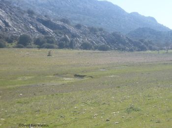
![Excursión Senderismo Sayalonga - Sayalonga Pico de la Rabita - Photo](https://media.geolcdn.com/t/350/260/6f11b6d2-45f7-4b69-9935-f3420b8de5af.jpg&format=jpg&maxdim=2)
![Senderismo Senderismo](https://static1.geolcdn.com/sitytour/trail-icons/101.png)
Km
Senderismo
![](/images/other/stat-length.png)
![](https://static1.geolcdn.com/siteimages/upload/files/1508320355ic_sort_den_pos_24dp.png)
![](https://static1.geolcdn.com/siteimages/upload/files/1508320355ic_sort_den_neg_24dp.png)
![](https://static1.geolcdn.com/siteimages/upload/files/16400158638029165_repeat_loop_refresh_sync_direction_icon.png)
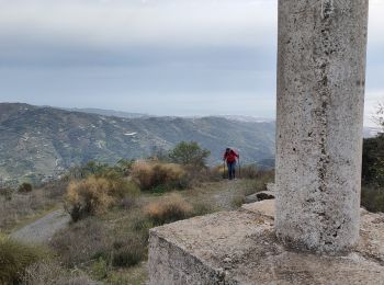
![Excursión A pie Montejaque - LOS LLANOS DE LÍBAR - Photo](https://media.geolcdn.com/t/350/260/c7314d68-8e4c-4812-8296-a697aa8a230d.jpeg&format=jpg&maxdim=2)
![A pie A pie](https://static1.geolcdn.com/sitytour/trail-icons/100.png)
Km
A pie
![](/images/other/stat-length.png)
![](https://static1.geolcdn.com/siteimages/upload/files/1508320355ic_sort_den_pos_24dp.png)
![](https://static1.geolcdn.com/siteimages/upload/files/1508320355ic_sort_den_neg_24dp.png)
![](https://static1.geolcdn.com/siteimages/upload/files/16400158638029165_repeat_loop_refresh_sync_direction_icon.png)
• Trail created by Junta de Andalucía. Symbol: -
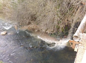
![Excursión A pie Benaoján - RÍO GUADIARO - Photo](https://media.geolcdn.com/t/350/260/141b47c0-2524-48e9-87d6-967db77aad06.jpeg&format=jpg&maxdim=2)
![A pie A pie](https://static1.geolcdn.com/sitytour/trail-icons/100.png)
Km
A pie
![](/images/other/stat-length.png)
![](https://static1.geolcdn.com/siteimages/upload/files/1508320355ic_sort_den_pos_24dp.png)
![](https://static1.geolcdn.com/siteimages/upload/files/1508320355ic_sort_den_neg_24dp.png)
![](https://static1.geolcdn.com/siteimages/upload/files/16400158638029165_repeat_loop_refresh_sync_direction_icon.png)
• Trail created by Junta de Andalucía. Symbol: -
![Excursión A pie Ronda - QUEJIGALES-TORRECILLA - Photo](https://media.geolcdn.com/t/350/260/0636dd76-d4a6-4b64-839b-143fb92e883b.jpeg&format=jpg&maxdim=2)
![A pie A pie](https://static1.geolcdn.com/sitytour/trail-icons/100.png)
Km
A pie
![](/images/other/stat-length.png)
![](https://static1.geolcdn.com/siteimages/upload/files/1508320355ic_sort_den_pos_24dp.png)
![](https://static1.geolcdn.com/siteimages/upload/files/1508320355ic_sort_den_neg_24dp.png)
![](https://static1.geolcdn.com/siteimages/upload/files/16400158638029165_repeat_loop_refresh_sync_direction_icon.png)
• Trail created by Junta de Andalucía. Symbol: -
![Excursión A pie Yunquera - PUERTO SAUCILLO-TORRECILLA - Photo](https://media.geolcdn.com/t/350/260/0636dd76-d4a6-4b64-839b-143fb92e883b.jpeg&format=jpg&maxdim=2)
![A pie A pie](https://static1.geolcdn.com/sitytour/trail-icons/100.png)
Km
A pie
![](/images/other/stat-length.png)
![](https://static1.geolcdn.com/siteimages/upload/files/1508320355ic_sort_den_pos_24dp.png)
![](https://static1.geolcdn.com/siteimages/upload/files/1508320355ic_sort_den_neg_24dp.png)
![](https://static1.geolcdn.com/siteimages/upload/files/16400158638029165_repeat_loop_refresh_sync_direction_icon.png)
• Trail created by Junta de Andalucía. Symbol: -
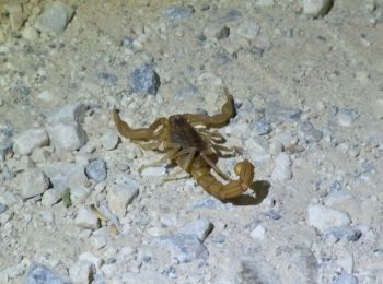
![Excursión A pie Yunquera - PUERTO SAUCILLO-PUERTO BELLINA - Photo](https://media.geolcdn.com/t/350/260/f78302e6-8df1-477f-9c49-43ce1dac983c.jpeg&format=jpg&maxdim=2)
![A pie A pie](https://static1.geolcdn.com/sitytour/trail-icons/100.png)
Km
A pie
![](/images/other/stat-length.png)
![](https://static1.geolcdn.com/siteimages/upload/files/1508320355ic_sort_den_pos_24dp.png)
![](https://static1.geolcdn.com/siteimages/upload/files/1508320355ic_sort_den_neg_24dp.png)
![](https://static1.geolcdn.com/siteimages/upload/files/16400158638029165_repeat_loop_refresh_sync_direction_icon.png)
• Trail created by Junta de Andalucía. Symbol: -
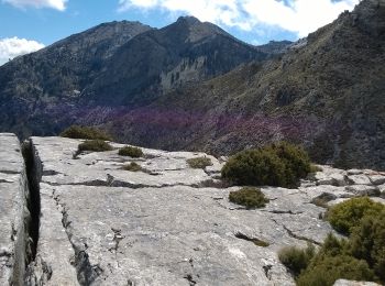
![Excursión A pie Yunquera - CAUCÓN-PEÑÓN DE LOS ENAMORADOS - Photo](https://media.geolcdn.com/t/350/260/b9ae0f6c-eee1-48fa-8066-543ef79c2757.jpeg&format=jpg&maxdim=2)
![A pie A pie](https://static1.geolcdn.com/sitytour/trail-icons/100.png)
Km
A pie
![](/images/other/stat-length.png)
![](https://static1.geolcdn.com/siteimages/upload/files/1508320355ic_sort_den_pos_24dp.png)
![](https://static1.geolcdn.com/siteimages/upload/files/1508320355ic_sort_den_neg_24dp.png)
![](https://static1.geolcdn.com/siteimages/upload/files/16400158638029165_repeat_loop_refresh_sync_direction_icon.png)
• Trail created by Junta de Andalucía. Symbol: -
![Excursión A pie Yunquera - CAUCÓN-TAJO DE LA CAÍNA - Photo](https://media.geolcdn.com/t/350/260/b9ae0f6c-eee1-48fa-8066-543ef79c2757.jpeg&format=jpg&maxdim=2)
![A pie A pie](https://static1.geolcdn.com/sitytour/trail-icons/100.png)
Km
A pie
![](/images/other/stat-length.png)
![](https://static1.geolcdn.com/siteimages/upload/files/1508320355ic_sort_den_pos_24dp.png)
![](https://static1.geolcdn.com/siteimages/upload/files/1508320355ic_sort_den_neg_24dp.png)
![](https://static1.geolcdn.com/siteimages/upload/files/16400158638029165_repeat_loop_refresh_sync_direction_icon.png)
• Trail created by Junta de Andalucía. Symbol: -
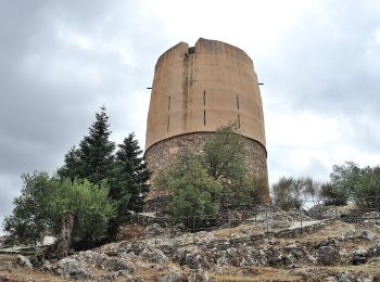
![Excursión A pie Yunquera - YUNQUERA-LOS SAUCES - Photo](https://media.geolcdn.com/t/350/260/be46c883-ade7-4355-b4a7-5cf70df91e46.jpeg&format=jpg&maxdim=2)
![A pie A pie](https://static1.geolcdn.com/sitytour/trail-icons/100.png)
Km
A pie
![](/images/other/stat-length.png)
![](https://static1.geolcdn.com/siteimages/upload/files/1508320355ic_sort_den_pos_24dp.png)
![](https://static1.geolcdn.com/siteimages/upload/files/1508320355ic_sort_den_neg_24dp.png)
![](https://static1.geolcdn.com/siteimages/upload/files/16400158638029165_repeat_loop_refresh_sync_direction_icon.png)
• Trail created by Junta de Andalucía. Symbol: -
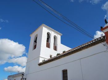
![Excursión A pie El Burgo - EL BURGO-PUERTO DE LA MUJER - Photo](https://media.geolcdn.com/t/350/260/df74605d-ff34-4047-a768-2172d4bd0328.jpeg&format=jpg&maxdim=2)
![A pie A pie](https://static1.geolcdn.com/sitytour/trail-icons/100.png)
Km
A pie
![](/images/other/stat-length.png)
![](https://static1.geolcdn.com/siteimages/upload/files/1508320355ic_sort_den_pos_24dp.png)
![](https://static1.geolcdn.com/siteimages/upload/files/1508320355ic_sort_den_neg_24dp.png)
![](https://static1.geolcdn.com/siteimages/upload/files/16400158638029165_repeat_loop_refresh_sync_direction_icon.png)
• Trail created by Junta de Andalucía. Symbol: -
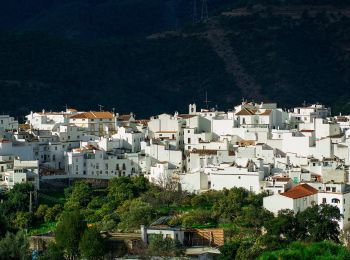
![Excursión A pie Istán - Ruta 2 Istán-Monda - Photo](https://media.geolcdn.com/t/350/260/129aef66-3e5c-4421-bc63-a806de50d54a.jpeg&format=jpg&maxdim=2)
![A pie A pie](https://static1.geolcdn.com/sitytour/trail-icons/100.png)
Km
A pie
![](/images/other/stat-length.png)
![](https://static1.geolcdn.com/siteimages/upload/files/1508320355ic_sort_den_pos_24dp.png)
![](https://static1.geolcdn.com/siteimages/upload/files/1508320355ic_sort_den_neg_24dp.png)
![](https://static1.geolcdn.com/siteimages/upload/files/16400158638029165_repeat_loop_refresh_sync_direction_icon.png)
• Sitio web: http://www.istan.es/es/2899/ruta-istan-monda
![Excursión A pie Pizarra - Sendero El Santo - Photo](https://media.geolcdn.com/t/350/260/01243dfd-ae0c-4030-bd2e-e647f9b6f8e8.jpeg&format=jpg&maxdim=2)
![A pie A pie](https://static1.geolcdn.com/sitytour/trail-icons/100.png)
Km
A pie
![](/images/other/stat-length.png)
![](https://static1.geolcdn.com/siteimages/upload/files/1508320355ic_sort_den_pos_24dp.png)
![](https://static1.geolcdn.com/siteimages/upload/files/1508320355ic_sort_den_neg_24dp.png)
![](https://static1.geolcdn.com/siteimages/upload/files/16400158638029165_repeat_loop_refresh_sync_direction_icon.png)
• Trail created by Federación Andaluza de Montañismo. Symbol: white strip on top of green strip
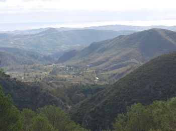
![Excursión A pie Coín - Sendero El Nacimiento - Cerro Alaminos - Photo](https://media.geolcdn.com/t/350/260/f58e2d3d-208a-4ded-8f2d-f6a802b6019b.jpeg&format=jpg&maxdim=2)
![A pie A pie](https://static1.geolcdn.com/sitytour/trail-icons/100.png)
Km
A pie
![](/images/other/stat-length.png)
![](https://static1.geolcdn.com/siteimages/upload/files/1508320355ic_sort_den_pos_24dp.png)
![](https://static1.geolcdn.com/siteimages/upload/files/1508320355ic_sort_den_neg_24dp.png)
![](https://static1.geolcdn.com/siteimages/upload/files/16400158638029165_repeat_loop_refresh_sync_direction_icon.png)
• Symbol: white strip on top of green strip
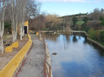
![Excursión A pie Coín - Sendero Camino de la Fuente - Photo](https://media.geolcdn.com/t/350/260/1e28f2df-3698-432c-acda-9bd1d840870d.jpeg&format=jpg&maxdim=2)
![A pie A pie](https://static1.geolcdn.com/sitytour/trail-icons/100.png)
Km
A pie
![](/images/other/stat-length.png)
![](https://static1.geolcdn.com/siteimages/upload/files/1508320355ic_sort_den_pos_24dp.png)
![](https://static1.geolcdn.com/siteimages/upload/files/1508320355ic_sort_den_neg_24dp.png)
![](https://static1.geolcdn.com/siteimages/upload/files/16400158638029165_repeat_loop_refresh_sync_direction_icon.png)
• Symbol: white strip on top of green strip
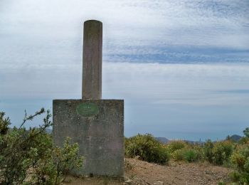
![Excursión A pie Málaga - Sendero Picapedrero-Boticario - Photo](https://media.geolcdn.com/t/350/260/505f7a7a-81c8-42d0-9243-a7ed7ac8f238.jpeg&format=jpg&maxdim=2)
![A pie A pie](https://static1.geolcdn.com/sitytour/trail-icons/100.png)
Km
A pie
![](/images/other/stat-length.png)
![](https://static1.geolcdn.com/siteimages/upload/files/1508320355ic_sort_den_pos_24dp.png)
![](https://static1.geolcdn.com/siteimages/upload/files/1508320355ic_sort_den_neg_24dp.png)
![](https://static1.geolcdn.com/siteimages/upload/files/16400158638029165_repeat_loop_refresh_sync_direction_icon.png)
• Sitio web: http://www.juntadeandalucia.es/medioambiente/servtc5/ventana/mostrarFicha.do?re=s&idEquipamiento=19593
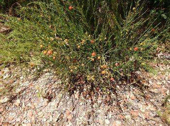
![Excursión A pie Benaoján - Sendero del Río Guadiaro - Photo](https://media.geolcdn.com/t/350/260/e76e3781-8933-4a61-97f6-a7a9d57c5653.jpeg&format=jpg&maxdim=2)
![A pie A pie](https://static1.geolcdn.com/sitytour/trail-icons/100.png)
Km
A pie
![](/images/other/stat-length.png)
![](https://static1.geolcdn.com/siteimages/upload/files/1508320355ic_sort_den_pos_24dp.png)
![](https://static1.geolcdn.com/siteimages/upload/files/1508320355ic_sort_den_neg_24dp.png)
![](https://static1.geolcdn.com/siteimages/upload/files/16400158638029165_repeat_loop_refresh_sync_direction_icon.png)
• Sitio web: http://www.juntadeandalucia.es/medioambiente/servtc5/ventana/mostrarFicha.do?idEquipamiento=19596
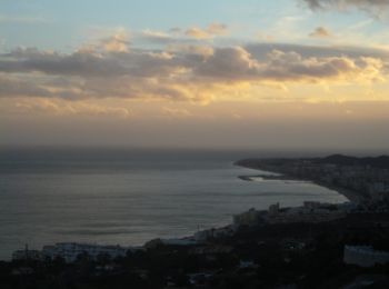
![Excursión A pie Mijas - Mina de la Trinidad - Photo](https://media.geolcdn.com/t/350/260/1e0af33e-8a09-466a-bc66-c0362222d276.jpeg&format=jpg&maxdim=2)
![A pie A pie](https://static1.geolcdn.com/sitytour/trail-icons/100.png)
Km
A pie
![](/images/other/stat-length.png)
![](https://static1.geolcdn.com/siteimages/upload/files/1508320355ic_sort_den_pos_24dp.png)
![](https://static1.geolcdn.com/siteimages/upload/files/1508320355ic_sort_den_neg_24dp.png)
![](https://static1.geolcdn.com/siteimages/upload/files/16400158638029165_repeat_loop_refresh_sync_direction_icon.png)
• Trail created by municipio Benalmadena.
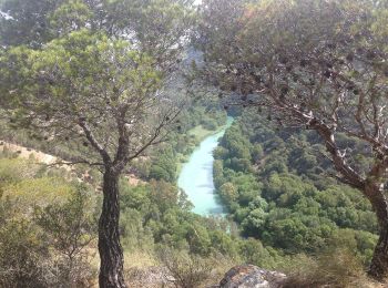
![Excursión A pie Ardales - Caminito del Rey - Photo](https://media.geolcdn.com/t/350/260/4a74a89a-4f7e-4dc7-801e-df752e3e2b78.jpeg&format=jpg&maxdim=2)
![A pie A pie](https://static1.geolcdn.com/sitytour/trail-icons/100.png)
Km
A pie
![](/images/other/stat-length.png)
![](https://static1.geolcdn.com/siteimages/upload/files/1508320355ic_sort_den_pos_24dp.png)
![](https://static1.geolcdn.com/siteimages/upload/files/1508320355ic_sort_den_neg_24dp.png)
![](https://static1.geolcdn.com/siteimages/upload/files/16400158638029165_repeat_loop_refresh_sync_direction_icon.png)
• Trail created by Diputación de Málaga y los Ayuntamientos de Ardales y Álora. Sitio web: http://www.caminitodelrey...
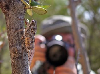
![Excursión A pie Benalmádena - Los Leñadores - Photo](https://media.geolcdn.com/t/350/260/133b459f-dde0-483b-a09a-f74a9313255a.jpeg&format=jpg&maxdim=2)
![A pie A pie](https://static1.geolcdn.com/sitytour/trail-icons/100.png)
Km
A pie
![](/images/other/stat-length.png)
![](https://static1.geolcdn.com/siteimages/upload/files/1508320355ic_sort_den_pos_24dp.png)
![](https://static1.geolcdn.com/siteimages/upload/files/1508320355ic_sort_den_neg_24dp.png)
![](https://static1.geolcdn.com/siteimages/upload/files/16400158638029165_repeat_loop_refresh_sync_direction_icon.png)
• Trail created by municipio Benalmadena.
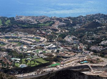
![Excursión A pie Alhaurín de la Torre - Los Cazadores - Photo](https://media.geolcdn.com/t/350/260/6c9567c9-b9d8-4bc4-a79f-af645f742f02.jpeg&format=jpg&maxdim=2)
![A pie A pie](https://static1.geolcdn.com/sitytour/trail-icons/100.png)
Km
A pie
![](/images/other/stat-length.png)
![](https://static1.geolcdn.com/siteimages/upload/files/1508320355ic_sort_den_pos_24dp.png)
![](https://static1.geolcdn.com/siteimages/upload/files/1508320355ic_sort_den_neg_24dp.png)
![](https://static1.geolcdn.com/siteimages/upload/files/16400158638029165_repeat_loop_refresh_sync_direction_icon.png)
• Trail created by municipio Benalmadena. Route not complete
20 excursiones mostradas en 133
Aplicación GPS de excursión GRATIS
Actividades
Regiones próximas
- Alameda
- Alcaucín
- Alfarnatejo
- Alhaurín de la Torre
- Alhaurín el Grande
- Álora
- Antequera
- Ardales
- Arenas
- Benahavís
- Benalauría
- Benalmádena
- Benaoján
- Campillos
- Canillas de Aceituno
- Canillas de Albaida
- Cártama
- Casares
- Coín
- Colmenar
- Comares
- Cómpeta
- Cortes de la Frontera
- El Burgo
- Estepona
- Frigiliana
- Fuengirola
- Fuente de Piedra
- Gaucín
- Genalguacil
- Guaro
- Humilladero
- Istán
- Júzcar
- Macharaviaya
- Málaga
- Manilva
- Marbella
- Mijas
- Mollina
- Monda
- Montejaque
- Nerja
- Ojén
- Parauta
- Periana
- Pizarra
- Rincón de la Victoria
- Ronda
- Salares
- Sayalonga
- Sedella
- Tolox
- Torremolinos
- Torrox
- Valle de Abdalajís
- Vélez-Málaga
- Villanueva de la Concepción
- Villanueva del Trabuco
- Viñuela
- Yunquera