![](/images/other/stat-length.png)
- Excursiones
- A pie
- Germany
- Hesse
- Odenwaldkreis
- Fränkisch-Crumbach
Fränkisch-Crumbach, Odenwaldkreis, A pie: Los mejores itinerarios de excursión, recorridos, paseos y sendas
Fränkisch-Crumbach: Descubra las mejores excursiones: 9 a pie. Todos estos circuitos, recorridos, itinerarios y actividades al aire libre están disponibles en nuestras aplicaciones SityTrail para smartphone y tablet.
Los mejores recorridos (9)
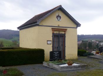
![Excursión A pie Fränkisch-Crumbach - Rundwanderweg Am Michelbacher Tal 5 : Rund um den Galgenbergweg - Photo](https://media.geolcdn.com/t/350/260/61f3a240-0d63-4e0e-bbfe-6da5694e8c0d.jpeg&format=jpg&maxdim=2)
![A pie A pie](https://static1.geolcdn.com/sitytour/trail-icons/100.png)
Km
A pie
![](/images/other/stat-length.png)
![](https://static1.geolcdn.com/siteimages/upload/files/1508320355ic_sort_den_pos_24dp.png)
![](https://static1.geolcdn.com/siteimages/upload/files/1508320355ic_sort_den_neg_24dp.png)
![](https://static1.geolcdn.com/siteimages/upload/files/16400158638029165_repeat_loop_refresh_sync_direction_icon.png)
• Trail created by Geo-Naturpark Bergstraße-Odenwald.
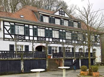
![Excursión A pie Fränkisch-Crumbach - Rundwanderweg Fränkisch-Crumbach Rodenstein 6: Rodenstein-Weg - Photo](https://media.geolcdn.com/t/350/260/f457ef47-44c7-4080-a530-8eee948e9e6e.jpeg&format=jpg&maxdim=2)
![A pie A pie](https://static1.geolcdn.com/sitytour/trail-icons/100.png)
Km
A pie
![](/images/other/stat-length.png)
![](https://static1.geolcdn.com/siteimages/upload/files/1508320355ic_sort_den_pos_24dp.png)
![](https://static1.geolcdn.com/siteimages/upload/files/1508320355ic_sort_den_neg_24dp.png)
![](https://static1.geolcdn.com/siteimages/upload/files/16400158638029165_repeat_loop_refresh_sync_direction_icon.png)
• Trail created by Geo-Naturpark Bergstraße-Odenwald.
![Excursión A pie Fränkisch-Crumbach - Rundwanderweg Fränkisch-Crumbach Rodenstein 3: Höllerheck-Weg - Photo](https://media.geolcdn.com/t/350/260/f457ef47-44c7-4080-a530-8eee948e9e6e.jpeg&format=jpg&maxdim=2)
![A pie A pie](https://static1.geolcdn.com/sitytour/trail-icons/100.png)
Km
A pie
![](/images/other/stat-length.png)
![](https://static1.geolcdn.com/siteimages/upload/files/1508320355ic_sort_den_pos_24dp.png)
![](https://static1.geolcdn.com/siteimages/upload/files/1508320355ic_sort_den_neg_24dp.png)
![](https://static1.geolcdn.com/siteimages/upload/files/16400158638029165_repeat_loop_refresh_sync_direction_icon.png)
• Trail created by Geo-Naturpark Bergstraße-Odenwald.
![Excursión A pie Fränkisch-Crumbach - Rundwanderweg Fränkisch-Crumbach Rodenstein 1: Rodenstein-Weg - Photo](https://media.geolcdn.com/t/350/260/f457ef47-44c7-4080-a530-8eee948e9e6e.jpeg&format=jpg&maxdim=2)
![A pie A pie](https://static1.geolcdn.com/sitytour/trail-icons/100.png)
Km
A pie
![](/images/other/stat-length.png)
![](https://static1.geolcdn.com/siteimages/upload/files/1508320355ic_sort_den_pos_24dp.png)
![](https://static1.geolcdn.com/siteimages/upload/files/1508320355ic_sort_den_neg_24dp.png)
![](https://static1.geolcdn.com/siteimages/upload/files/16400158638029165_repeat_loop_refresh_sync_direction_icon.png)
• Trail created by Geo-Naturpark Bergstraße-Odenwald.
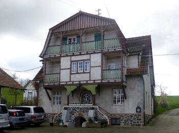
![Excursión A pie Fränkisch-Crumbach - Rundwanderweg Fränkisch-Crumbach Heilsruhe 3: Im-Röhr-Weg - Photo](https://media.geolcdn.com/t/350/260/91b5e72e-cb75-4a18-833d-4d408d0b6c55.jpeg&format=jpg&maxdim=2)
![A pie A pie](https://static1.geolcdn.com/sitytour/trail-icons/100.png)
Km
A pie
![](/images/other/stat-length.png)
![](https://static1.geolcdn.com/siteimages/upload/files/1508320355ic_sort_den_pos_24dp.png)
![](https://static1.geolcdn.com/siteimages/upload/files/1508320355ic_sort_den_neg_24dp.png)
![](https://static1.geolcdn.com/siteimages/upload/files/16400158638029165_repeat_loop_refresh_sync_direction_icon.png)
• Trail created by Geo-Naturpark Bergstraße-Odenwald.
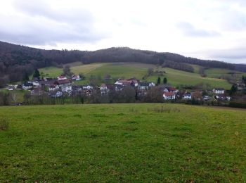
![Excursión A pie Fränkisch-Crumbach - Rundwanderweg Sparkasse-Odenwaldkreis S2 : Burg Rodenstein-Runde - Photo](https://media.geolcdn.com/t/350/260/4df93b57-3094-4bd6-9812-cf08e6c96c2c.jpeg&format=jpg&maxdim=2)
![A pie A pie](https://static1.geolcdn.com/sitytour/trail-icons/100.png)
Km
A pie
![](/images/other/stat-length.png)
![](https://static1.geolcdn.com/siteimages/upload/files/1508320355ic_sort_den_pos_24dp.png)
![](https://static1.geolcdn.com/siteimages/upload/files/1508320355ic_sort_den_neg_24dp.png)
![](https://static1.geolcdn.com/siteimages/upload/files/16400158638029165_repeat_loop_refresh_sync_direction_icon.png)
• Trail created by Geo-Naturpark Bergstraße-Odenwald.
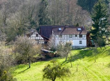
![Excursión A pie Fränkisch-Crumbach - Rundwanderweg Fränkisch-Crumbach 2 - Photo](https://media.geolcdn.com/t/350/260/eb7659e7-84e5-4942-b650-6b552438e747.jpeg&format=jpg&maxdim=2)
![A pie A pie](https://static1.geolcdn.com/sitytour/trail-icons/100.png)
Km
A pie
![](/images/other/stat-length.png)
![](https://static1.geolcdn.com/siteimages/upload/files/1508320355ic_sort_den_pos_24dp.png)
![](https://static1.geolcdn.com/siteimages/upload/files/1508320355ic_sort_den_neg_24dp.png)
![](https://static1.geolcdn.com/siteimages/upload/files/16400158638029165_repeat_loop_refresh_sync_direction_icon.png)
• Trail created by Geo-Naturpark Bergstraße-Odenwald. Symbol: white 2 in a white circle with FC in a break at the top ...
![Excursión A pie Fränkisch-Crumbach - Rundwanderweg Fränkisch-Crumbach Heilsruhe 5 : Nonroder-Höhe-Weg - Photo](https://media.geolcdn.com/t/350/260/91b5e72e-cb75-4a18-833d-4d408d0b6c55.jpeg&format=jpg&maxdim=2)
![A pie A pie](https://static1.geolcdn.com/sitytour/trail-icons/100.png)
Km
A pie
![](/images/other/stat-length.png)
![](https://static1.geolcdn.com/siteimages/upload/files/1508320355ic_sort_den_pos_24dp.png)
![](https://static1.geolcdn.com/siteimages/upload/files/1508320355ic_sort_den_neg_24dp.png)
![](https://static1.geolcdn.com/siteimages/upload/files/16400158638029165_repeat_loop_refresh_sync_direction_icon.png)
• Trail created by Geo-Naturpark Bergstraße-Odenwald.
![Excursión A pie Fränkisch-Crumbach - Rundwanderweg Fränkisch-Crumbach Heilsruhe 6 : Bierbachweg - Photo](https://media.geolcdn.com/t/350/260/91b5e72e-cb75-4a18-833d-4d408d0b6c55.jpeg&format=jpg&maxdim=2)
![A pie A pie](https://static1.geolcdn.com/sitytour/trail-icons/100.png)
Km
A pie
![](/images/other/stat-length.png)
![](https://static1.geolcdn.com/siteimages/upload/files/1508320355ic_sort_den_pos_24dp.png)
![](https://static1.geolcdn.com/siteimages/upload/files/1508320355ic_sort_den_neg_24dp.png)
![](https://static1.geolcdn.com/siteimages/upload/files/16400158638029165_repeat_loop_refresh_sync_direction_icon.png)
• Trail created by Geo-Naturpark Bergstraße-Odenwald.
9 excursiones mostradas en 9
Aplicación GPS de excursión GRATIS