![](/images/other/stat-length.png)
- Excursiones
- A pie
- Germany
- Hesse
- Wiesbaden
Wiesbaden, Hesse, A pie: Los mejores itinerarios de excursión, recorridos, paseos y sendas
Wiesbaden: Descubra las mejores excursiones: 28 a pie. Todos estos circuitos, recorridos, itinerarios y actividades al aire libre están disponibles en nuestras aplicaciones SityTrail para smartphone y tablet.
Los mejores recorridos (28)
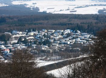
![Excursión A pie Desconocido - Kastanienallee - Photo](https://media.geolcdn.com/t/350/260/ad172078-591a-4e58-96e5-1369258ed669.jpeg&format=jpg&maxdim=2)
![A pie A pie](https://static1.geolcdn.com/sitytour/trail-icons/100.png)
Km
A pie
![](/images/other/stat-length.png)
![](https://static1.geolcdn.com/siteimages/upload/files/1508320355ic_sort_den_pos_24dp.png)
![](https://static1.geolcdn.com/siteimages/upload/files/1508320355ic_sort_den_neg_24dp.png)
![](https://static1.geolcdn.com/siteimages/upload/files/16400158638029165_repeat_loop_refresh_sync_direction_icon.png)
• Trail created by Förderverein Kelterhaus Heßloch. Symbol: Schwarze Haselnuß
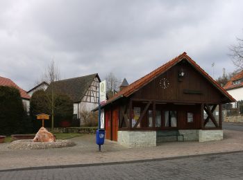
![Excursión A pie Desconocido - Achertsgräben - Photo](https://media.geolcdn.com/t/350/260/e703be52-82bd-4f63-96ba-eba985fadb75.jpeg&format=jpg&maxdim=2)
![A pie A pie](https://static1.geolcdn.com/sitytour/trail-icons/100.png)
Km
A pie
![](/images/other/stat-length.png)
![](https://static1.geolcdn.com/siteimages/upload/files/1508320355ic_sort_den_pos_24dp.png)
![](https://static1.geolcdn.com/siteimages/upload/files/1508320355ic_sort_den_neg_24dp.png)
![](https://static1.geolcdn.com/siteimages/upload/files/16400158638029165_repeat_loop_refresh_sync_direction_icon.png)
• Trail created by Förderverein Kelterhaus Heßloch. Symbol: Rote Haselnuß
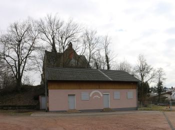
![Excursión A pie Desconocido - DE-WZM - Photo](https://media.geolcdn.com/t/350/260/ae51d730-0855-473a-a471-aa58236b690e.jpeg&format=jpg&maxdim=2)
![A pie A pie](https://static1.geolcdn.com/sitytour/trail-icons/100.png)
Km
A pie
![](/images/other/stat-length.png)
![](https://static1.geolcdn.com/siteimages/upload/files/1508320355ic_sort_den_pos_24dp.png)
![](https://static1.geolcdn.com/siteimages/upload/files/1508320355ic_sort_den_neg_24dp.png)
![](https://static1.geolcdn.com/siteimages/upload/files/16400158638029165_repeat_loop_refresh_sync_direction_icon.png)
• Trail created by DAV-Sektion Wiesbaden.
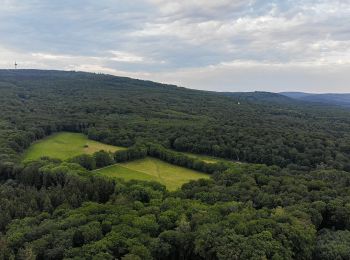
![Excursión A pie Desconocido - DE-WZW - Photo](https://media.geolcdn.com/t/350/260/7744ce21-6559-42a5-b047-76243d245733.jpeg&format=jpg&maxdim=2)
![A pie A pie](https://static1.geolcdn.com/sitytour/trail-icons/100.png)
Km
A pie
![](/images/other/stat-length.png)
![](https://static1.geolcdn.com/siteimages/upload/files/1508320355ic_sort_den_pos_24dp.png)
![](https://static1.geolcdn.com/siteimages/upload/files/1508320355ic_sort_den_neg_24dp.png)
![](https://static1.geolcdn.com/siteimages/upload/files/16400158638029165_repeat_loop_refresh_sync_direction_icon.png)
• Trail created by DAV-Sektion Wiesbaden.
![Excursión A pie Desconocido - DE-RUW - Photo](https://media.geolcdn.com/t/350/260/e13ed02b-76ca-4fcb-b565-e350b978c3e4.jpeg&format=jpg&maxdim=2)
![A pie A pie](https://static1.geolcdn.com/sitytour/trail-icons/100.png)
Km
A pie
![](/images/other/stat-length.png)
![](https://static1.geolcdn.com/siteimages/upload/files/1508320355ic_sort_den_pos_24dp.png)
![](https://static1.geolcdn.com/siteimages/upload/files/1508320355ic_sort_den_neg_24dp.png)
![](https://static1.geolcdn.com/siteimages/upload/files/16400158638029165_repeat_loop_refresh_sync_direction_icon.png)
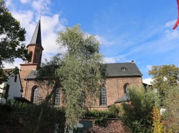
• Trail created by DAV-Sektion Wiesbaden.
![Excursión A pie Desconocido - DE-WZN - Photo](https://media.geolcdn.com/t/350/260/c7c1e036-904a-4684-957e-7f25e97d8cb9.jpeg&format=jpg&maxdim=2)
![A pie A pie](https://static1.geolcdn.com/sitytour/trail-icons/100.png)
Km
A pie
![](/images/other/stat-length.png)
![](https://static1.geolcdn.com/siteimages/upload/files/1508320355ic_sort_den_pos_24dp.png)
![](https://static1.geolcdn.com/siteimages/upload/files/1508320355ic_sort_den_neg_24dp.png)
![](https://static1.geolcdn.com/siteimages/upload/files/16400158638029165_repeat_loop_refresh_sync_direction_icon.png)
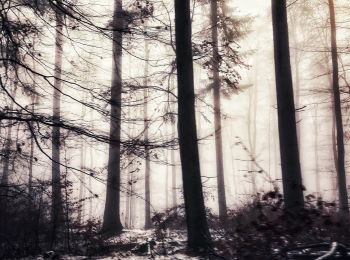
• Trail created by DAV-Sektion Wiesbaden.
![Excursión A pie Desconocido - Breckenheim: Rundwanderweg Kleeblatt - Photo](https://media.geolcdn.com/t/350/260/ffff52e9-4bd6-4933-85ee-2ac464f69e74.jpeg&format=jpg&maxdim=2)
![A pie A pie](https://static1.geolcdn.com/sitytour/trail-icons/100.png)
Km
A pie
![](/images/other/stat-length.png)
![](https://static1.geolcdn.com/siteimages/upload/files/1508320355ic_sort_den_pos_24dp.png)
![](https://static1.geolcdn.com/siteimages/upload/files/1508320355ic_sort_den_neg_24dp.png)
![](https://static1.geolcdn.com/siteimages/upload/files/16400158638029165_repeat_loop_refresh_sync_direction_icon.png)
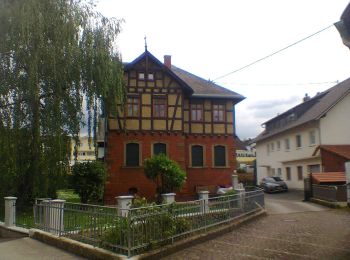
• Symbol: grünes Kleeblatt auf weißem Grund
![Excursión A pie Desconocido - Rehbockweg - Photo](https://media.geolcdn.com/t/350/260/3553ca79-b66b-4cf9-ab86-aebdf28c87fa.jpeg&format=jpg&maxdim=2)
![A pie A pie](https://static1.geolcdn.com/sitytour/trail-icons/100.png)
Km
A pie
![](/images/other/stat-length.png)
![](https://static1.geolcdn.com/siteimages/upload/files/1508320355ic_sort_den_pos_24dp.png)
![](https://static1.geolcdn.com/siteimages/upload/files/1508320355ic_sort_den_neg_24dp.png)
![](https://static1.geolcdn.com/siteimages/upload/files/16400158638029165_repeat_loop_refresh_sync_direction_icon.png)
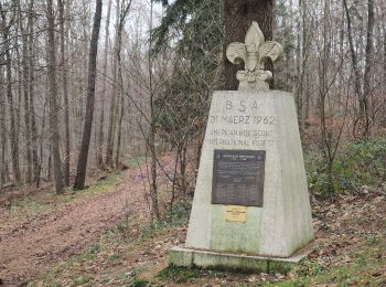
• Trail created by Landeshaupsstadt Wiesbaden. Symbol: rotes Reh auf weißem Grund
![Excursión A pie Desconocido - Hirschweg - Photo](https://media.geolcdn.com/t/350/260/3553ca79-b66b-4cf9-ab86-aebdf28c87fa.jpeg&format=jpg&maxdim=2)
![A pie A pie](https://static1.geolcdn.com/sitytour/trail-icons/100.png)
Km
A pie
![](/images/other/stat-length.png)
![](https://static1.geolcdn.com/siteimages/upload/files/1508320355ic_sort_den_pos_24dp.png)
![](https://static1.geolcdn.com/siteimages/upload/files/1508320355ic_sort_den_neg_24dp.png)
![](https://static1.geolcdn.com/siteimages/upload/files/16400158638029165_repeat_loop_refresh_sync_direction_icon.png)
• Trail created by Landeshauptstadt Wiesbaden. Symbol: schwarzes Geweih auf weißem Grund
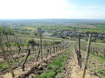
![Excursión A pie Desconocido - Rheinsteig-Zuweg Dotzheim - Photo](https://media.geolcdn.com/t/350/260/31beef47-d5a6-4c5c-b727-2ab898f7bcef.jpeg&format=jpg&maxdim=2)
![A pie A pie](https://static1.geolcdn.com/sitytour/trail-icons/100.png)
Km
A pie
![](/images/other/stat-length.png)
![](https://static1.geolcdn.com/siteimages/upload/files/1508320355ic_sort_den_pos_24dp.png)
![](https://static1.geolcdn.com/siteimages/upload/files/1508320355ic_sort_den_neg_24dp.png)
![](https://static1.geolcdn.com/siteimages/upload/files/16400158638029165_repeat_loop_refresh_sync_direction_icon.png)
• Trail created by Romantischer Rhein Tourismus GmbH. Symbol: Stilisiertes weißes R auf gelbem Grund
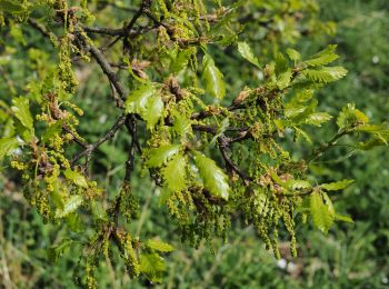
![Excursión A pie Desconocido - Rundwanderweg Parkplatz Goldsteintal: Birkenblatt - Photo](https://media.geolcdn.com/t/350/260/8da9c7ad-0df5-4bc5-8e53-b237fa1f9f8c.jpeg&format=jpg&maxdim=2)
![A pie A pie](https://static1.geolcdn.com/sitytour/trail-icons/100.png)
Km
A pie
![](/images/other/stat-length.png)
![](https://static1.geolcdn.com/siteimages/upload/files/1508320355ic_sort_den_pos_24dp.png)
![](https://static1.geolcdn.com/siteimages/upload/files/1508320355ic_sort_den_neg_24dp.png)
![](https://static1.geolcdn.com/siteimages/upload/files/16400158638029165_repeat_loop_refresh_sync_direction_icon.png)
• Symbol: braunes Birkenblatt auf weißem Grund
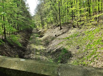
![Excursión A pie Desconocido - Rundwanderweg schwarze Flagge - Photo](https://media.geolcdn.com/t/350/260/fa7b56ed-e4cf-4290-b555-85cce3a47808.jpeg&format=jpg&maxdim=2)
![A pie A pie](https://static1.geolcdn.com/sitytour/trail-icons/100.png)
Km
A pie
![](/images/other/stat-length.png)
![](https://static1.geolcdn.com/siteimages/upload/files/1508320355ic_sort_den_pos_24dp.png)
![](https://static1.geolcdn.com/siteimages/upload/files/1508320355ic_sort_den_neg_24dp.png)
![](https://static1.geolcdn.com/siteimages/upload/files/16400158638029165_repeat_loop_refresh_sync_direction_icon.png)
• Trail created by Stadt Taunusstein. Symbol: schwarze Flagge auf weißem Grund
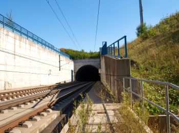
![Excursión A pie Desconocido - Auringer Rundwanderweg - Photo](https://media.geolcdn.com/t/350/260/87b4bf4a-1cc4-4446-804d-1f963e3da511.jpeg&format=jpg&maxdim=2)
![A pie A pie](https://static1.geolcdn.com/sitytour/trail-icons/100.png)
Km
A pie
![](/images/other/stat-length.png)
![](https://static1.geolcdn.com/siteimages/upload/files/1508320355ic_sort_den_pos_24dp.png)
![](https://static1.geolcdn.com/siteimages/upload/files/1508320355ic_sort_den_neg_24dp.png)
![](https://static1.geolcdn.com/siteimages/upload/files/16400158638029165_repeat_loop_refresh_sync_direction_icon.png)
• Trail created by SPD Auringen. Symbol: aufgehende Sonne oberhalb ein Wappen mit einem grünen Baum
![Excursión A pie Desconocido - Rundwanderweg Fuchs - Photo](https://media.geolcdn.com/t/350/260/95729a3c-d906-4c38-8925-a2081945e3f9.jpeg&format=jpg&maxdim=2)
![A pie A pie](https://static1.geolcdn.com/sitytour/trail-icons/100.png)
Km
A pie
![](/images/other/stat-length.png)
![](https://static1.geolcdn.com/siteimages/upload/files/1508320355ic_sort_den_pos_24dp.png)
![](https://static1.geolcdn.com/siteimages/upload/files/1508320355ic_sort_den_neg_24dp.png)
![](https://static1.geolcdn.com/siteimages/upload/files/16400158638029165_repeat_loop_refresh_sync_direction_icon.png)
• Trail created by Kommunaler Zweckverband Naturpark Rhein-Taunus. Symbol: roter Fuchs auf weißem Grund Sitio web: h...
![Excursión A pie Desconocido - Rundwanderweg Vogel - Photo](https://media.geolcdn.com/t/350/260/c7c1e036-904a-4684-957e-7f25e97d8cb9.jpeg&format=jpg&maxdim=2)
![A pie A pie](https://static1.geolcdn.com/sitytour/trail-icons/100.png)
Km
A pie
![](/images/other/stat-length.png)
![](https://static1.geolcdn.com/siteimages/upload/files/1508320355ic_sort_den_pos_24dp.png)
![](https://static1.geolcdn.com/siteimages/upload/files/1508320355ic_sort_den_neg_24dp.png)
![](https://static1.geolcdn.com/siteimages/upload/files/16400158638029165_repeat_loop_refresh_sync_direction_icon.png)
• Symbol: roter Vogel auf weißem Grund
![Excursión A pie Desconocido - Rundwanderweg Schmetterling - Photo](https://media.geolcdn.com/t/350/260/c7c1e036-904a-4684-957e-7f25e97d8cb9.jpeg&format=jpg&maxdim=2)
![A pie A pie](https://static1.geolcdn.com/sitytour/trail-icons/100.png)
Km
A pie
![](/images/other/stat-length.png)
![](https://static1.geolcdn.com/siteimages/upload/files/1508320355ic_sort_den_pos_24dp.png)
![](https://static1.geolcdn.com/siteimages/upload/files/1508320355ic_sort_den_neg_24dp.png)
![](https://static1.geolcdn.com/siteimages/upload/files/16400158638029165_repeat_loop_refresh_sync_direction_icon.png)
• Symbol: blauer Schmetterling auf weißem Grund
![Excursión A pie Desconocido - Rundwanderweg Fuchs - Photo](https://media.geolcdn.com/t/350/260/4f67ef4e-bd3d-4468-9590-d53f9733cbb1.jpeg&format=jpg&maxdim=2)
![A pie A pie](https://static1.geolcdn.com/sitytour/trail-icons/100.png)
Km
A pie
![](/images/other/stat-length.png)
![](https://static1.geolcdn.com/siteimages/upload/files/1508320355ic_sort_den_pos_24dp.png)
![](https://static1.geolcdn.com/siteimages/upload/files/1508320355ic_sort_den_neg_24dp.png)
![](https://static1.geolcdn.com/siteimages/upload/files/16400158638029165_repeat_loop_refresh_sync_direction_icon.png)
• Trail created by Naturpark Rhein-Taunus. Symbol: roter Fuchs auf weißem Grund
![Excursión A pie Desconocido - Rundwanderweg Libelle - Photo](https://media.geolcdn.com/t/350/260/4f67ef4e-bd3d-4468-9590-d53f9733cbb1.jpeg&format=jpg&maxdim=2)
![A pie A pie](https://static1.geolcdn.com/sitytour/trail-icons/100.png)
Km
A pie
![](/images/other/stat-length.png)
![](https://static1.geolcdn.com/siteimages/upload/files/1508320355ic_sort_den_pos_24dp.png)
![](https://static1.geolcdn.com/siteimages/upload/files/1508320355ic_sort_den_neg_24dp.png)
![](https://static1.geolcdn.com/siteimages/upload/files/16400158638029165_repeat_loop_refresh_sync_direction_icon.png)
• Trail created by Naturpark Rhein-Taunus. Symbol: blaue Libelle auf weißem Grund
![Excursión A pie Desconocido - Rundwanderweg Pilz - Photo](https://media.geolcdn.com/t/350/260/fab62fa6-f9f5-47ac-8078-1a28b9303946.jpeg&format=jpg&maxdim=2)
![A pie A pie](https://static1.geolcdn.com/sitytour/trail-icons/100.png)
Km
A pie
![](/images/other/stat-length.png)
![](https://static1.geolcdn.com/siteimages/upload/files/1508320355ic_sort_den_pos_24dp.png)
![](https://static1.geolcdn.com/siteimages/upload/files/1508320355ic_sort_den_neg_24dp.png)
![](https://static1.geolcdn.com/siteimages/upload/files/16400158638029165_repeat_loop_refresh_sync_direction_icon.png)
• Trail created by Naturpark Rhein Taunus. Symbol: roter Pilz auf weißem Grund
![Excursión A pie Desconocido - Rundwanderweg Hase - Photo](https://media.geolcdn.com/t/350/260/fab62fa6-f9f5-47ac-8078-1a28b9303946.jpeg&format=jpg&maxdim=2)
![A pie A pie](https://static1.geolcdn.com/sitytour/trail-icons/100.png)
Km
A pie
![](/images/other/stat-length.png)
![](https://static1.geolcdn.com/siteimages/upload/files/1508320355ic_sort_den_pos_24dp.png)
![](https://static1.geolcdn.com/siteimages/upload/files/1508320355ic_sort_den_neg_24dp.png)
![](https://static1.geolcdn.com/siteimages/upload/files/16400158638029165_repeat_loop_refresh_sync_direction_icon.png)
• Trail created by Naturpark Rhein Taunus. Symbol: brauner Hase auf weißem Grund
20 excursiones mostradas en 28
Aplicación GPS de excursión GRATIS