![](/images/other/stat-length.png)
- Excursiones
- A pie
- Germany
- Renania-Palatinado
- Südwestpfalz
- Busenberg
Busenberg, Südwestpfalz, A pie: Los mejores itinerarios de excursión, recorridos, paseos y sendas
Busenberg: Descubra las mejores excursiones: 5 a pie. Todos estos circuitos, recorridos, itinerarios y actividades al aire libre están disponibles en nuestras aplicaciones SityTrail para smartphone y tablet.
Los mejores recorridos (5)
![Excursión A pie Busenberg - Eichelberg-Tour - Photo](https://media.geolcdn.com/t/350/260/431a5290-0948-4f72-a036-2dc71abf60a5.jpeg&format=jpg&maxdim=2)
![A pie A pie](https://static1.geolcdn.com/sitytour/trail-icons/100.png)
Km
A pie
![](/images/other/stat-length.png)
![](https://static1.geolcdn.com/siteimages/upload/files/1508320355ic_sort_den_pos_24dp.png)
![](https://static1.geolcdn.com/siteimages/upload/files/1508320355ic_sort_den_neg_24dp.png)
![](https://static1.geolcdn.com/siteimages/upload/files/16400158638029165_repeat_loop_refresh_sync_direction_icon.png)
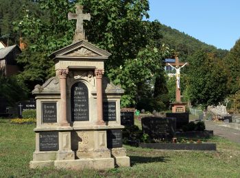
• Trail created by Tourist Information Dahner Felsenland. Symbol: Stilisierter weißer Felsen mit Gipfelkreuz über weiß...
![Excursión A pie Busenberg - Rundwanderweg Busenberg 4 - Photo](https://media.geolcdn.com/t/350/260/c8b5074f-c3fa-4c9d-98b3-e3917fb695ae.jpeg&format=jpg&maxdim=2)
![A pie A pie](https://static1.geolcdn.com/sitytour/trail-icons/100.png)
Km
A pie
![](/images/other/stat-length.png)
![](https://static1.geolcdn.com/siteimages/upload/files/1508320355ic_sort_den_pos_24dp.png)
![](https://static1.geolcdn.com/siteimages/upload/files/1508320355ic_sort_den_neg_24dp.png)
![](https://static1.geolcdn.com/siteimages/upload/files/16400158638029165_repeat_loop_refresh_sync_direction_icon.png)
• Trail created by Tourist Information Dahner Felsenland. Symbol: schwarze 4 auf weißem Kreis, oben steht halbrund "RW...
![Excursión A pie Busenberg - Puhlstein-Tour - Photo](https://media.geolcdn.com/t/350/260/431a5290-0948-4f72-a036-2dc71abf60a5.jpeg&format=jpg&maxdim=2)
![A pie A pie](https://static1.geolcdn.com/sitytour/trail-icons/100.png)
Km
A pie
![](/images/other/stat-length.png)
![](https://static1.geolcdn.com/siteimages/upload/files/1508320355ic_sort_den_pos_24dp.png)
![](https://static1.geolcdn.com/siteimages/upload/files/1508320355ic_sort_den_neg_24dp.png)
![](https://static1.geolcdn.com/siteimages/upload/files/16400158638029165_repeat_loop_refresh_sync_direction_icon.png)
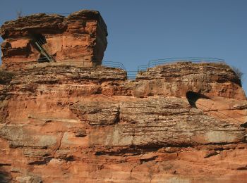
• Trail created by Tourist Information Dahner Felsenland. Symbol: Stilisierte weiße Bergsilhouette mit Felsen auf blau...
![Excursión A pie Busenberg - Drachenfels-Tour - Photo](https://media.geolcdn.com/t/350/260/431a5290-0948-4f72-a036-2dc71abf60a5.jpeg&format=jpg&maxdim=2)
![A pie A pie](https://static1.geolcdn.com/sitytour/trail-icons/100.png)
Km
A pie
![](/images/other/stat-length.png)
![](https://static1.geolcdn.com/siteimages/upload/files/1508320355ic_sort_den_pos_24dp.png)
![](https://static1.geolcdn.com/siteimages/upload/files/1508320355ic_sort_den_neg_24dp.png)
![](https://static1.geolcdn.com/siteimages/upload/files/16400158638029165_repeat_loop_refresh_sync_direction_icon.png)
• Trail created by Tourist Information Dahner Felsenland. Symbol: Stilisierte weiße Burg auf Hügel (Drachenfels) auf r...
![Excursión A pie Busenberg - Busenberger Holzschuhpfad - Photo](https://media.geolcdn.com/t/350/260/1b792a14-9ea6-46a6-88f4-8146abb3ff6d.jpeg&format=jpg&maxdim=2)
![A pie A pie](https://static1.geolcdn.com/sitytour/trail-icons/100.png)
Km
A pie
![](/images/other/stat-length.png)
![](https://static1.geolcdn.com/siteimages/upload/files/1508320355ic_sort_den_pos_24dp.png)
![](https://static1.geolcdn.com/siteimages/upload/files/1508320355ic_sort_den_neg_24dp.png)
![](https://static1.geolcdn.com/siteimages/upload/files/16400158638029165_repeat_loop_refresh_sync_direction_icon.png)
• Trail created by Tourist Information Dahner Felsenland. Symbol: Stilisierter schwarzer Holzschuh auf weißem Fünfeck ...
5 excursiones mostradas en 5
Aplicación GPS de excursión GRATIS