![](/images/other/stat-length.png)
- Excursiones
- A pie
- Germany
- Renania del Norte-Westfalia
- Rheinisch-Bergischer Kreis
Rheinisch-Bergischer Kreis, Renania del Norte-Westfalia, A pie: Los mejores itinerarios de excursión, recorridos, paseos y sendas
Rheinisch-Bergischer Kreis: Descubra las mejores excursiones: 105 a pie y 1 senderismo. Todos estos circuitos, recorridos, itinerarios y actividades al aire libre están disponibles en nuestras aplicaciones SityTrail para smartphone y tablet.
Los mejores recorridos (106)
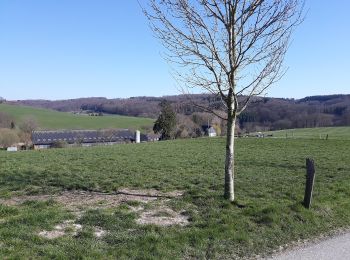
![Excursión A pie Kürten - Denkmalweg Olpe - Photo](https://media.geolcdn.com/t/350/260/9fda76c1-b983-4153-a9bf-2c3584f6c9ac.jpeg&format=jpg&maxdim=2)
![A pie A pie](https://static1.geolcdn.com/sitytour/trail-icons/100.png)
Km
A pie
![](/images/other/stat-length.png)
![](https://static1.geolcdn.com/siteimages/upload/files/1508320355ic_sort_den_pos_24dp.png)
![](https://static1.geolcdn.com/siteimages/upload/files/1508320355ic_sort_den_neg_24dp.png)
![](https://static1.geolcdn.com/siteimages/upload/files/16400158638029165_repeat_loop_refresh_sync_direction_icon.png)
• Symbol: Weißes D auf schwarzem Viereck
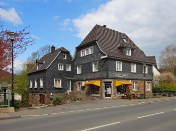
![Excursión A pie Odenthal - Odenthal Rundweg A3 - Photo](https://media.geolcdn.com/t/350/260/5c0c5eda-d0de-4bc8-b3c6-93c221a26070.jpeg&format=jpg&maxdim=2)
![A pie A pie](https://static1.geolcdn.com/sitytour/trail-icons/100.png)
Km
A pie
![](/images/other/stat-length.png)
![](https://static1.geolcdn.com/siteimages/upload/files/1508320355ic_sort_den_pos_24dp.png)
![](https://static1.geolcdn.com/siteimages/upload/files/1508320355ic_sort_den_neg_24dp.png)
![](https://static1.geolcdn.com/siteimages/upload/files/16400158638029165_repeat_loop_refresh_sync_direction_icon.png)
• Trail created by Sauerländischer Gebirgsverein, Bezirk Bergisches Land. Symbol: Weißes A3 auf schwarzem Grund Siti...
![Excursión A pie Odenthal - Odenthal Rundweg A2 - Photo](https://media.geolcdn.com/t/350/260/5c0c5eda-d0de-4bc8-b3c6-93c221a26070.jpeg&format=jpg&maxdim=2)
![A pie A pie](https://static1.geolcdn.com/sitytour/trail-icons/100.png)
Km
A pie
![](/images/other/stat-length.png)
![](https://static1.geolcdn.com/siteimages/upload/files/1508320355ic_sort_den_pos_24dp.png)
![](https://static1.geolcdn.com/siteimages/upload/files/1508320355ic_sort_den_neg_24dp.png)
![](https://static1.geolcdn.com/siteimages/upload/files/16400158638029165_repeat_loop_refresh_sync_direction_icon.png)
• Trail created by Sauerländischer Gebirgsverein, Bezirk Bergisches Land. Symbol: Weißes A2 auf schwarzem Grund Siti...
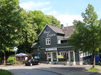
![Excursión A pie Wermelskirchen - E1 - Vom Park ins Tal - Photo](https://media.geolcdn.com/t/350/260/b440e6fc-79bf-41f0-96e2-f578bda2ef8b.jpeg&format=jpg&maxdim=2)
![A pie A pie](https://static1.geolcdn.com/sitytour/trail-icons/100.png)
Km
A pie
![](/images/other/stat-length.png)
![](https://static1.geolcdn.com/siteimages/upload/files/1508320355ic_sort_den_pos_24dp.png)
![](https://static1.geolcdn.com/siteimages/upload/files/1508320355ic_sort_den_neg_24dp.png)
![](https://static1.geolcdn.com/siteimages/upload/files/16400158638029165_repeat_loop_refresh_sync_direction_icon.png)
• Trail created by Sauerländischer Gebirgsverein Bergisches Land. Symbol: Weißes "E1" auf schwarzem Grund Sitio web:...
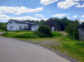
![Excursión A pie Odenthal - D8 - Über den Bömberg - Photo](https://media.geolcdn.com/t/350/260/3b32deb4-e024-444d-9e76-b5a340d75832.jpeg&format=jpg&maxdim=2)
![A pie A pie](https://static1.geolcdn.com/sitytour/trail-icons/100.png)
Km
A pie
![](/images/other/stat-length.png)
![](https://static1.geolcdn.com/siteimages/upload/files/1508320355ic_sort_den_pos_24dp.png)
![](https://static1.geolcdn.com/siteimages/upload/files/1508320355ic_sort_den_neg_24dp.png)
![](https://static1.geolcdn.com/siteimages/upload/files/16400158638029165_repeat_loop_refresh_sync_direction_icon.png)
• Trail created by Sauerländischer Gebirgsverein. Symbol: Weißes "D8" auf scharzem Grund Sitio web: https://www.werm...
![Excursión A pie Odenthal - Hüttchen Rundweg A2 - Photo](https://media.geolcdn.com/t/350/260/3b32deb4-e024-444d-9e76-b5a340d75832.jpeg&format=jpg&maxdim=2)
![A pie A pie](https://static1.geolcdn.com/sitytour/trail-icons/100.png)
Km
A pie
![](/images/other/stat-length.png)
![](https://static1.geolcdn.com/siteimages/upload/files/1508320355ic_sort_den_pos_24dp.png)
![](https://static1.geolcdn.com/siteimages/upload/files/1508320355ic_sort_den_neg_24dp.png)
![](https://static1.geolcdn.com/siteimages/upload/files/16400158638029165_repeat_loop_refresh_sync_direction_icon.png)
• Trail created by Sauerländischer Gebirgsverein. Symbol: Weißes A2 auf scharzem Grund
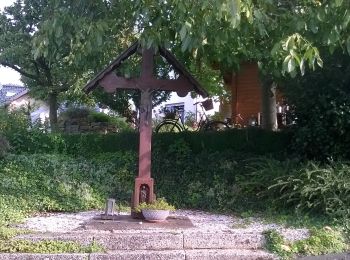
![Excursión A pie Overath - Overath-Vilkerath Rundweg A4 - Photo](https://media.geolcdn.com/t/350/260/bf3472f4-7cc8-469d-939d-293284566ae4.jpeg&format=jpg&maxdim=2)
![A pie A pie](https://static1.geolcdn.com/sitytour/trail-icons/100.png)
Km
A pie
![](/images/other/stat-length.png)
![](https://static1.geolcdn.com/siteimages/upload/files/1508320355ic_sort_den_pos_24dp.png)
![](https://static1.geolcdn.com/siteimages/upload/files/1508320355ic_sort_den_neg_24dp.png)
![](https://static1.geolcdn.com/siteimages/upload/files/16400158638029165_repeat_loop_refresh_sync_direction_icon.png)
• Trail created by Sauerländischer Gebirgsverein.
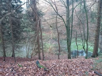
![Excursión A pie Overath - Overath Rundwanderweg Nord - Photo](https://media.geolcdn.com/t/350/260/99b575e3-aed9-48d3-b159-37df23505ed6.jpeg&format=jpg&maxdim=2)
![A pie A pie](https://static1.geolcdn.com/sitytour/trail-icons/100.png)
Km
A pie
![](/images/other/stat-length.png)
![](https://static1.geolcdn.com/siteimages/upload/files/1508320355ic_sort_den_pos_24dp.png)
![](https://static1.geolcdn.com/siteimages/upload/files/1508320355ic_sort_den_neg_24dp.png)
![](https://static1.geolcdn.com/siteimages/upload/files/16400158638029165_repeat_loop_refresh_sync_direction_icon.png)
• Trail created by Heimat- und Bürgerverein Overath. Symbol: Schwarzes "N" in weißer Raute
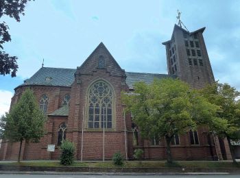
![Excursión A pie Burscheid - Rundweg Burscheid - Benninghausen - Burscheid - Photo](https://media.geolcdn.com/t/350/260/fae1b87f-ded6-4b8b-821d-395fcdf8bba1.jpeg&format=jpg&maxdim=2)
![A pie A pie](https://static1.geolcdn.com/sitytour/trail-icons/100.png)
Km
A pie
![](/images/other/stat-length.png)
![](https://static1.geolcdn.com/siteimages/upload/files/1508320355ic_sort_den_pos_24dp.png)
![](https://static1.geolcdn.com/siteimages/upload/files/1508320355ic_sort_den_neg_24dp.png)
![](https://static1.geolcdn.com/siteimages/upload/files/16400158638029165_repeat_loop_refresh_sync_direction_icon.png)
• Trail created by Sauerländischer Gebirgsverein. Symbol: Umgekehrtes weißes T auf schwarzem Grund Sitio web: http:/...
![Excursión A pie Burscheid - Rundweg Burscheid - Grünscheid - Burscheid - Photo](https://media.geolcdn.com/t/350/260/ab53fe57-0b5d-44ae-b1ff-e67c9feb0d63.jpeg&format=jpg&maxdim=2)
![A pie A pie](https://static1.geolcdn.com/sitytour/trail-icons/100.png)
Km
A pie
![](/images/other/stat-length.png)
![](https://static1.geolcdn.com/siteimages/upload/files/1508320355ic_sort_den_pos_24dp.png)
![](https://static1.geolcdn.com/siteimages/upload/files/1508320355ic_sort_den_neg_24dp.png)
![](https://static1.geolcdn.com/siteimages/upload/files/16400158638029165_repeat_loop_refresh_sync_direction_icon.png)
• Trail created by Sauerländischer Gebirgsverein. Symbol: Delta Sitio web: http://www.sgv-bergischesland.de/wanderwe...
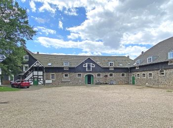
![Excursión A pie Odenthal - Eifgenbachtalweg - Photo](https://media.geolcdn.com/t/350/260/8fd76f57-39d8-47a1-aa22-55c2f9ae7f18.jpeg&format=jpg&maxdim=2)
![A pie A pie](https://static1.geolcdn.com/sitytour/trail-icons/100.png)
Km
A pie
![](/images/other/stat-length.png)
![](https://static1.geolcdn.com/siteimages/upload/files/1508320355ic_sort_den_pos_24dp.png)
![](https://static1.geolcdn.com/siteimages/upload/files/1508320355ic_sort_den_neg_24dp.png)
![](https://static1.geolcdn.com/siteimages/upload/files/16400158638029165_repeat_loop_refresh_sync_direction_icon.png)
• Trail created by Das Bergische gGmbH. Auch mit Symbol "Weißer Wasserlauf auf grünem Grund und Schriftzug Eifgen Sym...
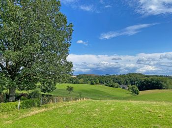
![Excursión A pie Wermelskirchen - D4 - Naturwelten - Photo](https://media.geolcdn.com/t/350/260/bc106ab4-d620-4949-9c9e-f02c29880e90.jpeg&format=jpg&maxdim=2)
![A pie A pie](https://static1.geolcdn.com/sitytour/trail-icons/100.png)
Km
A pie
![](/images/other/stat-length.png)
![](https://static1.geolcdn.com/siteimages/upload/files/1508320355ic_sort_den_pos_24dp.png)
![](https://static1.geolcdn.com/siteimages/upload/files/1508320355ic_sort_den_neg_24dp.png)
![](https://static1.geolcdn.com/siteimages/upload/files/16400158638029165_repeat_loop_refresh_sync_direction_icon.png)
• Trail created by Sauerländischer Gebirgsverein Bergisches Land. Symbol: Weißes “D4” auf schwarzem Grund Sitio web:...
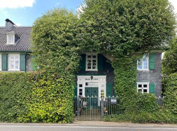
![Excursión A pie Wermelskirchen - D3 - Kirchweg - Photo](https://media.geolcdn.com/t/350/260/c61ce69e-f6ea-482e-a162-ed313189b52f.jpeg&format=jpg&maxdim=2)
![A pie A pie](https://static1.geolcdn.com/sitytour/trail-icons/100.png)
Km
A pie
![](/images/other/stat-length.png)
![](https://static1.geolcdn.com/siteimages/upload/files/1508320355ic_sort_den_pos_24dp.png)
![](https://static1.geolcdn.com/siteimages/upload/files/1508320355ic_sort_den_neg_24dp.png)
![](https://static1.geolcdn.com/siteimages/upload/files/16400158638029165_repeat_loop_refresh_sync_direction_icon.png)
• Trail created by Sauerländischer Gebirgsverein Bergisches Land. Symbol: Weißes "D3” auf schwarzem Grund Sitio web:...
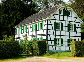
![Excursión A pie Burscheid - E3 - Täler und Höhen - Photo](https://media.geolcdn.com/t/350/260/061b268b-ec5f-4237-8ca1-c669372ea049.jpeg&format=jpg&maxdim=2)
![A pie A pie](https://static1.geolcdn.com/sitytour/trail-icons/100.png)
Km
A pie
![](/images/other/stat-length.png)
![](https://static1.geolcdn.com/siteimages/upload/files/1508320355ic_sort_den_pos_24dp.png)
![](https://static1.geolcdn.com/siteimages/upload/files/1508320355ic_sort_den_neg_24dp.png)
![](https://static1.geolcdn.com/siteimages/upload/files/16400158638029165_repeat_loop_refresh_sync_direction_icon.png)
• Trail created by Sauerländischer Gebirgsverein. Symbol: Weißes "E3" auf scharzem Grund
![Excursión A pie Odenthal - Hüttchen Rundweg A1 - Photo](https://media.geolcdn.com/t/350/260/061b268b-ec5f-4237-8ca1-c669372ea049.jpeg&format=jpg&maxdim=2)
![A pie A pie](https://static1.geolcdn.com/sitytour/trail-icons/100.png)
Km
A pie
![](/images/other/stat-length.png)
![](https://static1.geolcdn.com/siteimages/upload/files/1508320355ic_sort_den_pos_24dp.png)
![](https://static1.geolcdn.com/siteimages/upload/files/1508320355ic_sort_den_neg_24dp.png)
![](https://static1.geolcdn.com/siteimages/upload/files/16400158638029165_repeat_loop_refresh_sync_direction_icon.png)
• Trail created by Sauerländischer Gebirgsverein. Symbol: Weißes A1 auf scharzem Grund Sitio web: http://www.sgv-ber...
![Excursión A pie Odenthal - Wasserroute - Photo](https://media.geolcdn.com/t/350/260/061b268b-ec5f-4237-8ca1-c669372ea049.jpeg&format=jpg&maxdim=2)
![A pie A pie](https://static1.geolcdn.com/sitytour/trail-icons/100.png)
Km
A pie
![](/images/other/stat-length.png)
![](https://static1.geolcdn.com/siteimages/upload/files/1508320355ic_sort_den_pos_24dp.png)
![](https://static1.geolcdn.com/siteimages/upload/files/1508320355ic_sort_den_neg_24dp.png)
![](https://static1.geolcdn.com/siteimages/upload/files/16400158638029165_repeat_loop_refresh_sync_direction_icon.png)
• Trail created by Gemeinde Odenthal. Symbol: Weißes leeres Rechteck auf schwarzem Grund
![Excursión A pie Odenthal - Schwarzpulverroute - Photo](https://media.geolcdn.com/t/350/260/061b268b-ec5f-4237-8ca1-c669372ea049.jpeg&format=jpg&maxdim=2)
![A pie A pie](https://static1.geolcdn.com/sitytour/trail-icons/100.png)
Km
A pie
![](/images/other/stat-length.png)
![](https://static1.geolcdn.com/siteimages/upload/files/1508320355ic_sort_den_pos_24dp.png)
![](https://static1.geolcdn.com/siteimages/upload/files/1508320355ic_sort_den_neg_24dp.png)
![](https://static1.geolcdn.com/siteimages/upload/files/16400158638029165_repeat_loop_refresh_sync_direction_icon.png)
• Trail created by Gemeinde Odenthal. Symbol: Weißes P auf schwarzem Grund
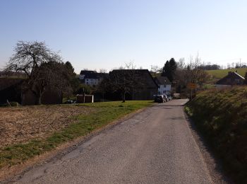
![Excursión A pie Kürten - Eichhof Rundweg A2 - Photo](https://media.geolcdn.com/t/350/260/209b023c-9702-4c60-a65d-8e28f2d3a5be.jpeg&format=jpg&maxdim=2)
![A pie A pie](https://static1.geolcdn.com/sitytour/trail-icons/100.png)
Km
A pie
![](/images/other/stat-length.png)
![](https://static1.geolcdn.com/siteimages/upload/files/1508320355ic_sort_den_pos_24dp.png)
![](https://static1.geolcdn.com/siteimages/upload/files/1508320355ic_sort_den_neg_24dp.png)
![](https://static1.geolcdn.com/siteimages/upload/files/16400158638029165_repeat_loop_refresh_sync_direction_icon.png)
• Trail created by Sauerländischer Gebirgsverein. Symbol: Weißes A2 auf schwarzem Grund
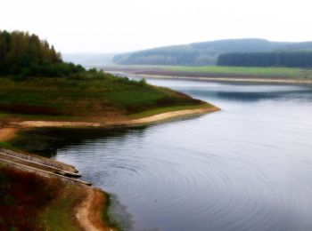
![Excursión A pie Kürten - D5 - Dunkle Wälder, sonnige Höhen - Photo](https://media.geolcdn.com/t/350/260/afedf003-f0de-49af-aba5-3a40fcc4185c.jpeg&format=jpg&maxdim=2)
![A pie A pie](https://static1.geolcdn.com/sitytour/trail-icons/100.png)
Km
A pie
![](/images/other/stat-length.png)
![](https://static1.geolcdn.com/siteimages/upload/files/1508320355ic_sort_den_pos_24dp.png)
![](https://static1.geolcdn.com/siteimages/upload/files/1508320355ic_sort_den_neg_24dp.png)
![](https://static1.geolcdn.com/siteimages/upload/files/16400158638029165_repeat_loop_refresh_sync_direction_icon.png)
• Trail created by Sauerländischer Gebirgsverein Bergisches Land. Symbol: Weißes “D5” auf schwarzem Grund Sitio web:...
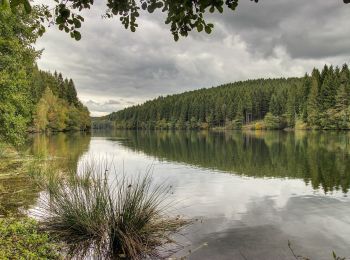
![Excursión A pie Wermelskirchen - Talsperrenweg - Photo](https://media.geolcdn.com/t/350/260/415aa66f-2a7f-4fe9-8982-55bc16d229a9.jpeg&format=jpg&maxdim=2)
![A pie A pie](https://static1.geolcdn.com/sitytour/trail-icons/100.png)
Km
A pie
![](/images/other/stat-length.png)
![](https://static1.geolcdn.com/siteimages/upload/files/1508320355ic_sort_den_pos_24dp.png)
![](https://static1.geolcdn.com/siteimages/upload/files/1508320355ic_sort_den_neg_24dp.png)
![](https://static1.geolcdn.com/siteimages/upload/files/16400158638029165_repeat_loop_refresh_sync_direction_icon.png)
• Trail created by Sauerländischer Gebirgsverein Bergisches Land. Symbol: Stilisierter weißer Bogen und Schriftzug “dh...
20 excursiones mostradas en 106
Aplicación GPS de excursión GRATIS