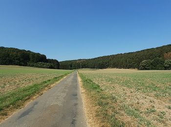
![](/images/other/stat-length.png)
- Excursiones
- A pie
- Germany
- Renania del Norte-Westfalia
- Kreis Minden-Lübbecke
Kreis Minden-Lübbecke, Renania del Norte-Westfalia, A pie: Los mejores itinerarios de excursión, recorridos, paseos y sendas
Kreis Minden-Lübbecke: Descubra las mejores excursiones: 62 a pie. Todos estos circuitos, recorridos, itinerarios y actividades al aire libre están disponibles en nuestras aplicaciones SityTrail para smartphone y tablet.
Los mejores recorridos (62)
![Excursión A pie Bad Oeynhausen - Zuweg von Bad Oeynhausen zum Wittekingsweg - Photo](https://media.geolcdn.com/t/350/260/37b0db09-f180-4847-9422-fae21a8b2693.jpeg&format=jpg&maxdim=2)
![A pie A pie](https://static1.geolcdn.com/sitytour/trail-icons/100.png)
Km
A pie
![](/images/other/stat-length.png)
![](https://static1.geolcdn.com/siteimages/upload/files/1508320355ic_sort_den_pos_24dp.png)
![](https://static1.geolcdn.com/siteimages/upload/files/1508320355ic_sort_den_neg_24dp.png)
![](https://static1.geolcdn.com/siteimages/upload/files/16400158638029165_repeat_loop_refresh_sync_direction_icon.png)
• Symbol: liegender weiss-rot-gelber Dreifachstrich auf weissem Grund
![Excursión A pie Lübbecke - Nikolausweg - Alternativroute](https://media.geolcdn.com/t/350/260/6667e3c2-796d-4c63-b4e8-c438d993be8c.jpeg&format=jpg&maxdim=2)
![A pie A pie](https://static1.geolcdn.com/sitytour/trail-icons/100.png)
Km
A pie
![](/images/other/stat-length.png)
![](https://static1.geolcdn.com/siteimages/upload/files/1508320355ic_sort_den_pos_24dp.png)
![](https://static1.geolcdn.com/siteimages/upload/files/1508320355ic_sort_den_neg_24dp.png)
![](https://static1.geolcdn.com/siteimages/upload/files/16400158638029165_repeat_loop_refresh_sync_direction_icon.png)
• Trail created by Ev.-Luth. Kirchengemeinde Gehlenbeck. Symbol: Gelbe Bischofsmütze auf rotem Grund Sitio web: http...
![Excursión A pie Lübbecke - Nikolausweg - Photo](https://media.geolcdn.com/t/350/260/60e6984e-4ab4-410b-abec-52f37900380b.jpeg&format=jpg&maxdim=2)
![A pie A pie](https://static1.geolcdn.com/sitytour/trail-icons/100.png)
Km
A pie
![](/images/other/stat-length.png)
![](https://static1.geolcdn.com/siteimages/upload/files/1508320355ic_sort_den_pos_24dp.png)
![](https://static1.geolcdn.com/siteimages/upload/files/1508320355ic_sort_den_neg_24dp.png)
![](https://static1.geolcdn.com/siteimages/upload/files/16400158638029165_repeat_loop_refresh_sync_direction_icon.png)
• Trail created by Ev.-Luth. Kirchengemeinde Gehlenbeck. Symbol: Gelbe Bischofsmütze auf rotem Grund Sitio web: http...
![Excursión A pie Preußisch Oldendorf - Eggetaler Panorama Rundwanderweg - Photo](https://media.geolcdn.com/t/350/260/e1f85307-e4d0-4558-93df-ffb80182a55e.jpeg&format=jpg&maxdim=2)
![A pie A pie](https://static1.geolcdn.com/sitytour/trail-icons/100.png)
Km
A pie
![](/images/other/stat-length.png)
![](https://static1.geolcdn.com/siteimages/upload/files/1508320355ic_sort_den_pos_24dp.png)
![](https://static1.geolcdn.com/siteimages/upload/files/1508320355ic_sort_den_neg_24dp.png)
![](https://static1.geolcdn.com/siteimages/upload/files/16400158638029165_repeat_loop_refresh_sync_direction_icon.png)
• Trail created by Heimatverein Eggetal e.V..
![Excursión A pie Bad Oeynhausen - Pilgerweg Kirchengemeinde Eidinghausen-Dehme - Photo](https://media.geolcdn.com/t/350/260/37b0db09-f180-4847-9422-fae21a8b2693.jpeg&format=jpg&maxdim=2)
![A pie A pie](https://static1.geolcdn.com/sitytour/trail-icons/100.png)
Km
A pie
![](/images/other/stat-length.png)
![](https://static1.geolcdn.com/siteimages/upload/files/1508320355ic_sort_den_pos_24dp.png)
![](https://static1.geolcdn.com/siteimages/upload/files/1508320355ic_sort_den_neg_24dp.png)
![](https://static1.geolcdn.com/siteimages/upload/files/16400158638029165_repeat_loop_refresh_sync_direction_icon.png)
• Trail created by Kirchengemeinde Eidinghausen-Dehme. nur Richtung Eidinghausen ausgeschildert Symbol: Grünes Radkreuz
![Excursión A pie Stemwede - Stemweder Berg - Photo](https://media.geolcdn.com/t/350/260/1f6ed8a4-760e-4d09-ae14-4e46e78a4120.jpeg&format=jpg&maxdim=2)
![A pie A pie](https://static1.geolcdn.com/sitytour/trail-icons/100.png)
Km
A pie
![](/images/other/stat-length.png)
![](https://static1.geolcdn.com/siteimages/upload/files/1508320355ic_sort_den_pos_24dp.png)
![](https://static1.geolcdn.com/siteimages/upload/files/1508320355ic_sort_den_neg_24dp.png)
![](https://static1.geolcdn.com/siteimages/upload/files/16400158638029165_repeat_loop_refresh_sync_direction_icon.png)
• Symbol: Rote Balken / Red Bars
![Excursión A pie Stemwede - Blau gestrichelte Route - Stemweder Berg - Photo](https://media.geolcdn.com/t/350/260/1f6ed8a4-760e-4d09-ae14-4e46e78a4120.jpeg&format=jpg&maxdim=2)
![A pie A pie](https://static1.geolcdn.com/sitytour/trail-icons/100.png)
Km
A pie
![](/images/other/stat-length.png)
![](https://static1.geolcdn.com/siteimages/upload/files/1508320355ic_sort_den_pos_24dp.png)
![](https://static1.geolcdn.com/siteimages/upload/files/1508320355ic_sort_den_neg_24dp.png)
![](https://static1.geolcdn.com/siteimages/upload/files/16400158638029165_repeat_loop_refresh_sync_direction_icon.png)
• Symbol: Blau gestrichelt / Blue bars
![Excursión A pie Bad Oeynhausen - A2 Bad Oeynhausen-Sielpark - Photo](https://media.geolcdn.com/t/350/260/a8fcea73-dd1b-4249-9180-1c4d47e71556.jpeg&format=jpg&maxdim=2)
![A pie A pie](https://static1.geolcdn.com/sitytour/trail-icons/100.png)
Km
A pie
![](/images/other/stat-length.png)
![](https://static1.geolcdn.com/siteimages/upload/files/1508320355ic_sort_den_pos_24dp.png)
![](https://static1.geolcdn.com/siteimages/upload/files/1508320355ic_sort_den_neg_24dp.png)
![](https://static1.geolcdn.com/siteimages/upload/files/16400158638029165_repeat_loop_refresh_sync_direction_icon.png)
• Trail created by Stadt Bad Oeynhausen.
![Excursión A pie Hille - A2 Hille-Torfmoor - Photo](https://media.geolcdn.com/t/350/260/d97d4654-4399-467b-9f8d-e2462366fd1d.jpeg&format=jpg&maxdim=2)
![A pie A pie](https://static1.geolcdn.com/sitytour/trail-icons/100.png)
Km
A pie
![](/images/other/stat-length.png)
![](https://static1.geolcdn.com/siteimages/upload/files/1508320355ic_sort_den_pos_24dp.png)
![](https://static1.geolcdn.com/siteimages/upload/files/1508320355ic_sort_den_neg_24dp.png)
![](https://static1.geolcdn.com/siteimages/upload/files/16400158638029165_repeat_loop_refresh_sync_direction_icon.png)
• Trail created by Gemeinde Hille.
![Excursión A pie Hüllhorst - A1 Hüllhorst-Schnathorst - Photo](https://media.geolcdn.com/t/350/260/17e438d4-7b0a-4ff0-89e5-c7c2a4d87065.jpeg&format=jpg&maxdim=2)
![A pie A pie](https://static1.geolcdn.com/sitytour/trail-icons/100.png)
Km
A pie
![](/images/other/stat-length.png)
![](https://static1.geolcdn.com/siteimages/upload/files/1508320355ic_sort_den_pos_24dp.png)
![](https://static1.geolcdn.com/siteimages/upload/files/1508320355ic_sort_den_neg_24dp.png)
![](https://static1.geolcdn.com/siteimages/upload/files/16400158638029165_repeat_loop_refresh_sync_direction_icon.png)
• Trail created by Gemeinde Hülhorst.
![Excursión A pie Hüllhorst - A3 Hüllhorst-Schnathorst - Photo](https://media.geolcdn.com/t/350/260/17e438d4-7b0a-4ff0-89e5-c7c2a4d87065.jpeg&format=jpg&maxdim=2)
![A pie A pie](https://static1.geolcdn.com/sitytour/trail-icons/100.png)
Km
A pie
![](/images/other/stat-length.png)
![](https://static1.geolcdn.com/siteimages/upload/files/1508320355ic_sort_den_pos_24dp.png)
![](https://static1.geolcdn.com/siteimages/upload/files/1508320355ic_sort_den_neg_24dp.png)
![](https://static1.geolcdn.com/siteimages/upload/files/16400158638029165_repeat_loop_refresh_sync_direction_icon.png)
• Trail created by Gemeinde Hüllhorst.
![Excursión A pie Hüllhorst - A2 Hüllhorst-Schnathorst - Photo](https://media.geolcdn.com/t/350/260/17e438d4-7b0a-4ff0-89e5-c7c2a4d87065.jpeg&format=jpg&maxdim=2)
![A pie A pie](https://static1.geolcdn.com/sitytour/trail-icons/100.png)
Km
A pie
![](/images/other/stat-length.png)
![](https://static1.geolcdn.com/siteimages/upload/files/1508320355ic_sort_den_pos_24dp.png)
![](https://static1.geolcdn.com/siteimages/upload/files/1508320355ic_sort_den_neg_24dp.png)
![](https://static1.geolcdn.com/siteimages/upload/files/16400158638029165_repeat_loop_refresh_sync_direction_icon.png)
• Trail created by Gemeinde Hüllhorst.
![Excursión A pie Hille - A4 Hille-Rothenuffeln - Photo](https://media.geolcdn.com/t/350/260/9f26329b-1862-4877-96d6-9aebd160f2fa.jpeg&format=jpg&maxdim=2)
![A pie A pie](https://static1.geolcdn.com/sitytour/trail-icons/100.png)
Km
A pie
![](/images/other/stat-length.png)
![](https://static1.geolcdn.com/siteimages/upload/files/1508320355ic_sort_den_pos_24dp.png)
![](https://static1.geolcdn.com/siteimages/upload/files/1508320355ic_sort_den_neg_24dp.png)
![](https://static1.geolcdn.com/siteimages/upload/files/16400158638029165_repeat_loop_refresh_sync_direction_icon.png)
• Trail created by Gemeinde Hille.
![Excursión A pie Hille - A10 Hille-Rothenuffeln - Photo](https://media.geolcdn.com/t/350/260/6ff1b0e6-2df2-4fed-a9b9-128976fdb974.jpeg&format=jpg&maxdim=2)
![A pie A pie](https://static1.geolcdn.com/sitytour/trail-icons/100.png)
Km
A pie
![](/images/other/stat-length.png)
![](https://static1.geolcdn.com/siteimages/upload/files/1508320355ic_sort_den_pos_24dp.png)
![](https://static1.geolcdn.com/siteimages/upload/files/1508320355ic_sort_den_neg_24dp.png)
![](https://static1.geolcdn.com/siteimages/upload/files/16400158638029165_repeat_loop_refresh_sync_direction_icon.png)
• Trail created by Gemeinde Hille.
![Excursión A pie Preußisch Oldendorf - A3 Preußisch Oldendorf - Photo](https://media.geolcdn.com/t/350/260/edb7723f-a92e-47bb-b741-c80cba19f11a.jpeg&format=jpg&maxdim=2)
![A pie A pie](https://static1.geolcdn.com/sitytour/trail-icons/100.png)
Km
A pie
![](/images/other/stat-length.png)
![](https://static1.geolcdn.com/siteimages/upload/files/1508320355ic_sort_den_pos_24dp.png)
![](https://static1.geolcdn.com/siteimages/upload/files/1508320355ic_sort_den_neg_24dp.png)
![](https://static1.geolcdn.com/siteimages/upload/files/16400158638029165_repeat_loop_refresh_sync_direction_icon.png)
• Trail created by Stadt Preußisch Oldendorf.
![Excursión A pie Preußisch Oldendorf - A4 Preußisch Oldendorf - Photo](https://media.geolcdn.com/t/350/260/f64b6046-f9bf-4c02-ad92-8cad76c834ed.jpeg&format=jpg&maxdim=2)
![A pie A pie](https://static1.geolcdn.com/sitytour/trail-icons/100.png)
Km
A pie
![](/images/other/stat-length.png)
![](https://static1.geolcdn.com/siteimages/upload/files/1508320355ic_sort_den_pos_24dp.png)
![](https://static1.geolcdn.com/siteimages/upload/files/1508320355ic_sort_den_neg_24dp.png)
![](https://static1.geolcdn.com/siteimages/upload/files/16400158638029165_repeat_loop_refresh_sync_direction_icon.png)
• Trail created by Stadt Preußisch Oldendorf.
![Excursión A pie Preußisch Oldendorf - A8 Preußisch Oldendorf-Eininghausen - Photo](https://media.geolcdn.com/t/350/260/8079baee-c56a-4b92-8b49-96db9d2cae54.jpeg&format=jpg&maxdim=2)
![A pie A pie](https://static1.geolcdn.com/sitytour/trail-icons/100.png)
Km
A pie
![](/images/other/stat-length.png)
![](https://static1.geolcdn.com/siteimages/upload/files/1508320355ic_sort_den_pos_24dp.png)
![](https://static1.geolcdn.com/siteimages/upload/files/1508320355ic_sort_den_neg_24dp.png)
![](https://static1.geolcdn.com/siteimages/upload/files/16400158638029165_repeat_loop_refresh_sync_direction_icon.png)
• Trail created by Stadt Preußisch Oldendorf.
![Excursión A pie Preußisch Oldendorf - A9 Preußisch Oldendorf-Eininghausen - Photo](https://media.geolcdn.com/t/350/260/e1f85307-e4d0-4558-93df-ffb80182a55e.jpeg&format=jpg&maxdim=2)
![A pie A pie](https://static1.geolcdn.com/sitytour/trail-icons/100.png)
Km
A pie
![](/images/other/stat-length.png)
![](https://static1.geolcdn.com/siteimages/upload/files/1508320355ic_sort_den_pos_24dp.png)
![](https://static1.geolcdn.com/siteimages/upload/files/1508320355ic_sort_den_neg_24dp.png)
![](https://static1.geolcdn.com/siteimages/upload/files/16400158638029165_repeat_loop_refresh_sync_direction_icon.png)
• Trail created by Stadt Preußisch Oldendorf.
![Excursión A pie Preußisch Oldendorf - A2 Preußisch Oldendorf-Eininghausen - Photo](https://media.geolcdn.com/t/350/260/0315526e-89dc-41fd-8224-806aae64ddbc.jpeg&format=jpg&maxdim=2)
![A pie A pie](https://static1.geolcdn.com/sitytour/trail-icons/100.png)
Km
A pie
![](/images/other/stat-length.png)
![](https://static1.geolcdn.com/siteimages/upload/files/1508320355ic_sort_den_pos_24dp.png)
![](https://static1.geolcdn.com/siteimages/upload/files/1508320355ic_sort_den_neg_24dp.png)
![](https://static1.geolcdn.com/siteimages/upload/files/16400158638029165_repeat_loop_refresh_sync_direction_icon.png)
• Trail created by Stadt Preußisch Oldendorf.
![Excursión A pie Preußisch Oldendorf - A6 Preußisch Oldendorf-Holzhausen - Photo](https://media.geolcdn.com/t/350/260/68f10557-1c20-4463-8df7-7c7374f9483c.jpeg&format=jpg&maxdim=2)
![A pie A pie](https://static1.geolcdn.com/sitytour/trail-icons/100.png)
Km
A pie
![](/images/other/stat-length.png)
![](https://static1.geolcdn.com/siteimages/upload/files/1508320355ic_sort_den_pos_24dp.png)
![](https://static1.geolcdn.com/siteimages/upload/files/1508320355ic_sort_den_neg_24dp.png)
![](https://static1.geolcdn.com/siteimages/upload/files/16400158638029165_repeat_loop_refresh_sync_direction_icon.png)
• Trail created by Stadt Preußisch Oldendorf.
20 excursiones mostradas en 62
Aplicación GPS de excursión GRATIS