![](/images/other/stat-length.png)
- Excursiones
- A pie
- Germany
- Brandemburgo
- Potsdam-Mittelmark
- Treuenbrietzen
Treuenbrietzen, Potsdam-Mittelmark, A pie: Los mejores itinerarios de excursión, recorridos, paseos y sendas
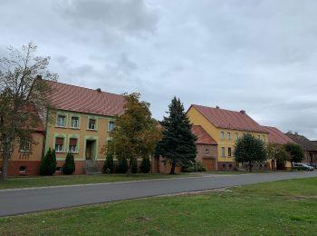
Treuenbrietzen: Descubra las mejores excursiones: 3 a pie. Todos estos circuitos, recorridos, itinerarios y actividades al aire libre están disponibles en nuestras aplicaciones SityTrail para smartphone y tablet.
Los mejores recorridos (3)
![Excursión A pie Treuenbrietzen - Tour04 Landschaftstour - Photo](https://media.geolcdn.com/t/350/260/82927095-deff-46f9-84c0-d63d1ae846c1.jpeg&format=jpg&maxdim=2)
![A pie A pie](https://static1.geolcdn.com/sitytour/trail-icons/100.png)
Km
A pie
![](/images/other/stat-length.png)
![](https://static1.geolcdn.com/siteimages/upload/files/1508320355ic_sort_den_pos_24dp.png)
![](https://static1.geolcdn.com/siteimages/upload/files/1508320355ic_sort_den_neg_24dp.png)
![](https://static1.geolcdn.com/siteimages/upload/files/16400158638029165_repeat_loop_refresh_sync_direction_icon.png)
• Trail created by http://www.treuenbrietzen.de.
![Excursión A pie Treuenbrietzen - Tour03 Steintour - Photo](https://media.geolcdn.com/t/350/260/37392b35-cf43-4e80-a4b4-9c20cced2e9d.jpeg&format=jpg&maxdim=2)
![A pie A pie](https://static1.geolcdn.com/sitytour/trail-icons/100.png)
Km
A pie
![](/images/other/stat-length.png)
![](https://static1.geolcdn.com/siteimages/upload/files/1508320355ic_sort_den_pos_24dp.png)
![](https://static1.geolcdn.com/siteimages/upload/files/1508320355ic_sort_den_neg_24dp.png)
![](https://static1.geolcdn.com/siteimages/upload/files/16400158638029165_repeat_loop_refresh_sync_direction_icon.png)
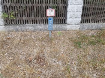
• Trail created by http://www.treuenbrietzen.de. Symbol: gelber Punkt auf grün mit Text: Steintour
![Excursión A pie Treuenbrietzen - Rundwanderweg Keilbergaussicht - Photo](https://media.geolcdn.com/t/350/260/ext.jpg?maxdim=2&url=https%3A%2F%2Fstatic1.geolcdn.com%2Fsiteimages%2Fupload%2Ffiles%2F1545311037marcheuse_200dpi.jpg)
![A pie A pie](https://static1.geolcdn.com/sitytour/trail-icons/100.png)
Km
A pie
![](/images/other/stat-length.png)
![](https://static1.geolcdn.com/siteimages/upload/files/1508320355ic_sort_den_pos_24dp.png)
![](https://static1.geolcdn.com/siteimages/upload/files/1508320355ic_sort_den_neg_24dp.png)
![](https://static1.geolcdn.com/siteimages/upload/files/16400158638029165_repeat_loop_refresh_sync_direction_icon.png)
• Trail created by Stiftung Naturlandschaften Brandenburg. Symbol: gelber Kreis auf weißem Grund
3 excursiones mostradas en 3
Aplicación GPS de excursión GRATIS