![](/images/other/stat-length.png)
- Excursiones
- A pie
- Germany
- Baviera
- Landkreis Ansbach
- Rothenburg ob der Tauber
Rothenburg ob der Tauber, Landkreis Ansbach, A pie: Los mejores itinerarios de excursión, recorridos, paseos y sendas
Rothenburg ob der Tauber: Descubra las mejores excursiones: 12 a pie. Todos estos circuitos, recorridos, itinerarios y actividades al aire libre están disponibles en nuestras aplicaciones SityTrail para smartphone y tablet.
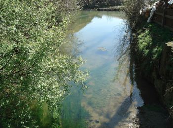
Los mejores recorridos (12)
![Excursión A pie Rothenburg ob der Tauber - Rothenburger W4 - Natursteig - Photo](https://media.geolcdn.com/t/350/260/d569b6e8-20ae-4c7f-9f17-9f200af7a901.jpeg&format=jpg&maxdim=2)
![A pie A pie](https://static1.geolcdn.com/sitytour/trail-icons/100.png)
Km
A pie
![](/images/other/stat-length.png)
![](https://static1.geolcdn.com/siteimages/upload/files/1508320355ic_sort_den_pos_24dp.png)
![](https://static1.geolcdn.com/siteimages/upload/files/1508320355ic_sort_den_neg_24dp.png)
![](https://static1.geolcdn.com/siteimages/upload/files/16400158638029165_repeat_loop_refresh_sync_direction_icon.png)
• Trail created by Verkehrsverein Rothenburg ob der Tauber e.V..
![Excursión A pie Rothenburg ob der Tauber - Rothenburger W3 - Kleiner Taubertalweg - Photo](https://media.geolcdn.com/t/350/260/2d219dd4-d118-4615-825c-f1e0ab382514.jpeg&format=jpg&maxdim=2)
![A pie A pie](https://static1.geolcdn.com/sitytour/trail-icons/100.png)
Km
A pie
![](/images/other/stat-length.png)
![](https://static1.geolcdn.com/siteimages/upload/files/1508320355ic_sort_den_pos_24dp.png)
![](https://static1.geolcdn.com/siteimages/upload/files/1508320355ic_sort_den_neg_24dp.png)
![](https://static1.geolcdn.com/siteimages/upload/files/16400158638029165_repeat_loop_refresh_sync_direction_icon.png)
• Trail created by Verkehrsverein Rothenburg ob der Tauber e.V..
![Excursión A pie Rothenburg ob der Tauber - Rothenburger W1 - Detwanger Weg - Photo](https://media.geolcdn.com/t/350/260/3855134a-1211-4ce0-bb69-11a7db59eccd.jpeg&format=jpg&maxdim=2)
![A pie A pie](https://static1.geolcdn.com/sitytour/trail-icons/100.png)
Km
A pie
![](/images/other/stat-length.png)
![](https://static1.geolcdn.com/siteimages/upload/files/1508320355ic_sort_den_pos_24dp.png)
![](https://static1.geolcdn.com/siteimages/upload/files/1508320355ic_sort_den_neg_24dp.png)
![](https://static1.geolcdn.com/siteimages/upload/files/16400158638029165_repeat_loop_refresh_sync_direction_icon.png)
• Trail created by Verkehrsverein Rothenburg ob der Tauber e.V..
![Excursión A pie Rothenburg ob der Tauber - Rothenburger W2 - Zu den Rothenburger Mühlen - Photo](https://media.geolcdn.com/t/350/260/fd08601b-fa2a-4d50-9433-292f77fe7f6e.jpeg&format=jpg&maxdim=2)
![A pie A pie](https://static1.geolcdn.com/sitytour/trail-icons/100.png)
Km
A pie
![](/images/other/stat-length.png)
![](https://static1.geolcdn.com/siteimages/upload/files/1508320355ic_sort_den_pos_24dp.png)
![](https://static1.geolcdn.com/siteimages/upload/files/1508320355ic_sort_den_neg_24dp.png)
![](https://static1.geolcdn.com/siteimages/upload/files/16400158638029165_repeat_loop_refresh_sync_direction_icon.png)
• Trail created by Verkehrsverein Rothenburg ob der Tauber e.V..
![Excursión A pie Rothenburg ob der Tauber - DE-NW blau - Photo](https://media.geolcdn.com/t/350/260/fd08601b-fa2a-4d50-9433-292f77fe7f6e.jpeg&format=jpg&maxdim=2)
![A pie A pie](https://static1.geolcdn.com/sitytour/trail-icons/100.png)
Km
A pie
![](/images/other/stat-length.png)
![](https://static1.geolcdn.com/siteimages/upload/files/1508320355ic_sort_den_pos_24dp.png)
![](https://static1.geolcdn.com/siteimages/upload/files/1508320355ic_sort_den_neg_24dp.png)
![](https://static1.geolcdn.com/siteimages/upload/files/16400158638029165_repeat_loop_refresh_sync_direction_icon.png)
• Trail created by Stadt Rothenburg ob der Tauber. Symbol: Nordic Walking + blauer Punkt
![Excursión A pie Rothenburg ob der Tauber - DE-NW rot - Photo](https://media.geolcdn.com/t/350/260/ad83b47e-3323-4ea1-8fe2-a79eaf813dd4.jpeg&format=jpg&maxdim=2)
![A pie A pie](https://static1.geolcdn.com/sitytour/trail-icons/100.png)
Km
A pie
![](/images/other/stat-length.png)
![](https://static1.geolcdn.com/siteimages/upload/files/1508320355ic_sort_den_pos_24dp.png)
![](https://static1.geolcdn.com/siteimages/upload/files/1508320355ic_sort_den_neg_24dp.png)
![](https://static1.geolcdn.com/siteimages/upload/files/16400158638029165_repeat_loop_refresh_sync_direction_icon.png)
• Trail created by Stadt Rothenburg ob der Tauber. Symbol: Nordic Walking + roter Punkt
![Excursión A pie Rothenburg ob der Tauber - Rothenburger W10 - Lindleinsee - Photo](https://media.geolcdn.com/t/350/260/1193c70e-1492-40c9-a8f0-1f45d7068679.jpeg&format=jpg&maxdim=2)
![A pie A pie](https://static1.geolcdn.com/sitytour/trail-icons/100.png)
Km
A pie
![](/images/other/stat-length.png)
![](https://static1.geolcdn.com/siteimages/upload/files/1508320355ic_sort_den_pos_24dp.png)
![](https://static1.geolcdn.com/siteimages/upload/files/1508320355ic_sort_den_neg_24dp.png)
![](https://static1.geolcdn.com/siteimages/upload/files/16400158638029165_repeat_loop_refresh_sync_direction_icon.png)
• Trail created by Verkehrsverein Rothenburg ob der Tauber e.V.. Symbol: Weiße 10 auf rotem Schild
![Excursión A pie Rothenburg ob der Tauber - Rothenburger W9 - Bettwar - Photo](https://media.geolcdn.com/t/350/260/a5789f1d-48b7-4b9b-bea2-01de53df7d3e.jpeg&format=jpg&maxdim=2)
![A pie A pie](https://static1.geolcdn.com/sitytour/trail-icons/100.png)
Km
A pie
![](/images/other/stat-length.png)
![](https://static1.geolcdn.com/siteimages/upload/files/1508320355ic_sort_den_pos_24dp.png)
![](https://static1.geolcdn.com/siteimages/upload/files/1508320355ic_sort_den_neg_24dp.png)
![](https://static1.geolcdn.com/siteimages/upload/files/16400158638029165_repeat_loop_refresh_sync_direction_icon.png)
• Trail created by Verkehrsverein Rothenburg ob der Tauber e.V.. Symbol: Weiße 9, 9a und 9b auf rotem Schild
![Excursión A pie Rothenburg ob der Tauber - Rothenburger W7 - Leuzenbronn - Photo](https://media.geolcdn.com/t/350/260/0ec789b7-e956-4789-a3dd-ed9aa16ea7c2.jpeg&format=jpg&maxdim=2)
![A pie A pie](https://static1.geolcdn.com/sitytour/trail-icons/100.png)
Km
A pie
![](/images/other/stat-length.png)
![](https://static1.geolcdn.com/siteimages/upload/files/1508320355ic_sort_den_pos_24dp.png)
![](https://static1.geolcdn.com/siteimages/upload/files/1508320355ic_sort_den_neg_24dp.png)
![](https://static1.geolcdn.com/siteimages/upload/files/16400158638029165_repeat_loop_refresh_sync_direction_icon.png)
• Trail created by Verkehrsverein Rothenburg ob der Tauber e.V.. Symbol: Weiße 7 und 7a auf rotem Grund
![Excursión A pie Rothenburg ob der Tauber - Rothenburger W13 - Kirnberger Weg - Photo](https://media.geolcdn.com/t/350/260/d569b6e8-20ae-4c7f-9f17-9f200af7a901.jpeg&format=jpg&maxdim=2)
![A pie A pie](https://static1.geolcdn.com/sitytour/trail-icons/100.png)
Km
A pie
![](/images/other/stat-length.png)
![](https://static1.geolcdn.com/siteimages/upload/files/1508320355ic_sort_den_pos_24dp.png)
![](https://static1.geolcdn.com/siteimages/upload/files/1508320355ic_sort_den_neg_24dp.png)
![](https://static1.geolcdn.com/siteimages/upload/files/16400158638029165_repeat_loop_refresh_sync_direction_icon.png)
• Trail created by Verkehrsverein Rothenburg ob der Tauber e.V.. Symbol: Weiße 13, 13a und 13b auf rotem Schild
![Excursión A pie Rothenburg ob der Tauber - Rothenburger W12 - Gebsattel - Photo](https://media.geolcdn.com/t/350/260/d569b6e8-20ae-4c7f-9f17-9f200af7a901.jpeg&format=jpg&maxdim=2)
![A pie A pie](https://static1.geolcdn.com/sitytour/trail-icons/100.png)
Km
A pie
![](/images/other/stat-length.png)
![](https://static1.geolcdn.com/siteimages/upload/files/1508320355ic_sort_den_pos_24dp.png)
![](https://static1.geolcdn.com/siteimages/upload/files/1508320355ic_sort_den_neg_24dp.png)
![](https://static1.geolcdn.com/siteimages/upload/files/16400158638029165_repeat_loop_refresh_sync_direction_icon.png)
• Trail created by Verkehrsverein Rothenburg ob der Tauber e.V.. Symbol: Weiße 12 auf rotem Schild
![Excursión A pie Rothenburg ob der Tauber - Rothenburger W5 - Jakobsweg - Photo](https://media.geolcdn.com/t/350/260/a8b308fa-f049-4072-b777-6b814278d9c2.jpeg&format=jpg&maxdim=2)
![A pie A pie](https://static1.geolcdn.com/sitytour/trail-icons/100.png)
Km
A pie
![](/images/other/stat-length.png)
![](https://static1.geolcdn.com/siteimages/upload/files/1508320355ic_sort_den_pos_24dp.png)
![](https://static1.geolcdn.com/siteimages/upload/files/1508320355ic_sort_den_neg_24dp.png)
![](https://static1.geolcdn.com/siteimages/upload/files/16400158638029165_repeat_loop_refresh_sync_direction_icon.png)
• Trail created by Verkehrsverein Rothenburg ob der Tauber e.V.. Symbol: Weiße 5 und 5a auf rotem Schild
12 excursiones mostradas en 12
Aplicación GPS de excursión GRATIS