![](/images/other/stat-length.png)
- Excursiones
- A pie
- Germany
- Baviera
- Landkreis Forchheim
- Wiesenttal
Wiesenttal, Landkreis Forchheim, A pie: Los mejores itinerarios de excursión, recorridos, paseos y sendas
Wiesenttal: Descubra las mejores excursiones: 8 a pie. Todos estos circuitos, recorridos, itinerarios y actividades al aire libre están disponibles en nuestras aplicaciones SityTrail para smartphone y tablet.
Los mejores recorridos (8)
![Excursión A pie Wiesenttal - Gebürgsweg - Photo](https://media.geolcdn.com/t/350/260/4b3fc851-c600-47ea-b4d8-49568b0b3e58.jpeg&format=jpg&maxdim=2)
![A pie A pie](https://static1.geolcdn.com/sitytour/trail-icons/100.png)
Km
A pie
![](/images/other/stat-length.png)
![](https://static1.geolcdn.com/siteimages/upload/files/1508320355ic_sort_den_pos_24dp.png)
![](https://static1.geolcdn.com/siteimages/upload/files/1508320355ic_sort_den_neg_24dp.png)
![](https://static1.geolcdn.com/siteimages/upload/files/16400158638029165_repeat_loop_refresh_sync_direction_icon.png)
• Verlauf in Engelhardsberg und Muggendorf unklar Symbol: Grüner Ring auf weißem Grund
![Excursión A pie Wiesenttal - Ebermannnstadt-Birkenreuth - Photo](https://media.geolcdn.com/t/350/260/43b853a2-7942-4d17-8916-9d0067953ca7.jpeg&format=jpg&maxdim=2)
![A pie A pie](https://static1.geolcdn.com/sitytour/trail-icons/100.png)
Km
A pie
![](/images/other/stat-length.png)
![](https://static1.geolcdn.com/siteimages/upload/files/1508320355ic_sort_den_pos_24dp.png)
![](https://static1.geolcdn.com/siteimages/upload/files/1508320355ic_sort_den_neg_24dp.png)
![](https://static1.geolcdn.com/siteimages/upload/files/16400158638029165_repeat_loop_refresh_sync_direction_icon.png)
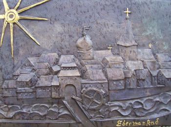
• Trail created by Stadt Ebermannstadt. abgeschlossen (Mai 2013 by cycling_zno) Symbol: Roter Punkt auf weißem Grund
![Excursión A pie Wiesenttal - Muggendorf-Oswaldhöhe-Hohes Kreuz-Engelhardsberg - Photo](https://media.geolcdn.com/t/350/260/c6feccf9-d570-43c5-b244-7b0ee69b5fc1.jpeg&format=jpg&maxdim=2)
![A pie A pie](https://static1.geolcdn.com/sitytour/trail-icons/100.png)
Km
A pie
![](/images/other/stat-length.png)
![](https://static1.geolcdn.com/siteimages/upload/files/1508320355ic_sort_den_pos_24dp.png)
![](https://static1.geolcdn.com/siteimages/upload/files/1508320355ic_sort_den_neg_24dp.png)
![](https://static1.geolcdn.com/siteimages/upload/files/16400158638029165_repeat_loop_refresh_sync_direction_icon.png)
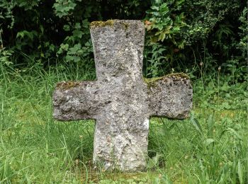
• Trail created by Gemeinde Wiesenttal. Symbol: Braunes Kreuz auf weißem Grund
![Excursión A pie Wiesenttal - Rundwanderweg Birkenreuth-Wohlmannsgesees-Kanndorf - Photo](https://media.geolcdn.com/t/350/260/9524cfbe-7ba4-409d-9d55-5ae743756cf6.jpeg&format=jpg&maxdim=2)
![A pie A pie](https://static1.geolcdn.com/sitytour/trail-icons/100.png)
Km
A pie
![](/images/other/stat-length.png)
![](https://static1.geolcdn.com/siteimages/upload/files/1508320355ic_sort_den_pos_24dp.png)
![](https://static1.geolcdn.com/siteimages/upload/files/1508320355ic_sort_den_neg_24dp.png)
![](https://static1.geolcdn.com/siteimages/upload/files/16400158638029165_repeat_loop_refresh_sync_direction_icon.png)
• Trail created by Gemeinde Wiesenttal. abgeschlossen (Mai 2013 by cycling_zno) Symbol: Gelber Ring auf weißem Grund
![Excursión A pie Wiesenttal - Rundweg durch die Felsenschlucht - Photo](https://media.geolcdn.com/t/350/260/82aa8b63-dbdf-43c8-bd54-053a3419f496.jpeg&format=jpg&maxdim=2)
![A pie A pie](https://static1.geolcdn.com/sitytour/trail-icons/100.png)
Km
A pie
![](/images/other/stat-length.png)
![](https://static1.geolcdn.com/siteimages/upload/files/1508320355ic_sort_den_pos_24dp.png)
![](https://static1.geolcdn.com/siteimages/upload/files/1508320355ic_sort_den_neg_24dp.png)
![](https://static1.geolcdn.com/siteimages/upload/files/16400158638029165_repeat_loop_refresh_sync_direction_icon.png)
• Trail created by Gemeinde Wiesenttal. abgeschlossen (Mai 2013 by cycling_zno) Symbol: Schwarzer Ring auf weißem Grund
![Excursión A pie Wiesenttal - Rundwanderweg Wüstenstein - Draisendorf - Photo](https://media.geolcdn.com/t/350/260/bee08269-e64f-43ce-b44d-7b73c847c494.jpeg&format=jpg&maxdim=2)
![A pie A pie](https://static1.geolcdn.com/sitytour/trail-icons/100.png)
Km
A pie
![](/images/other/stat-length.png)
![](https://static1.geolcdn.com/siteimages/upload/files/1508320355ic_sort_den_pos_24dp.png)
![](https://static1.geolcdn.com/siteimages/upload/files/1508320355ic_sort_den_neg_24dp.png)
![](https://static1.geolcdn.com/siteimages/upload/files/16400158638029165_repeat_loop_refresh_sync_direction_icon.png)
• Trail created by Fränkische Schweiz - Verein. abgeschlossen (Mai 2013 by cycling_zno) Symbol: Schwarzer Kreis auf w...
![Excursión A pie Wiesenttal - Rund um den Schwingbogen - Photo](https://media.geolcdn.com/t/350/260/70dbaae3-e348-4adb-821a-4958d4e0e983.jpeg&format=jpg&maxdim=2)
![A pie A pie](https://static1.geolcdn.com/sitytour/trail-icons/100.png)
Km
A pie
![](/images/other/stat-length.png)
![](https://static1.geolcdn.com/siteimages/upload/files/1508320355ic_sort_den_pos_24dp.png)
![](https://static1.geolcdn.com/siteimages/upload/files/1508320355ic_sort_den_neg_24dp.png)
![](https://static1.geolcdn.com/siteimages/upload/files/16400158638029165_repeat_loop_refresh_sync_direction_icon.png)
• Trail created by Gemeinde Wiesenttal. abgeschlossen (Mai 2013 by cycling_zno) Symbol: Blauer Ring auf weißem Grund
![Excursión A pie Wiesenttal - Rundwanderweg Romantischer Weg Muggendorf - Photo](https://media.geolcdn.com/t/350/260/9026c9bf-e4ff-4912-8707-a173ca42ee81.jpeg&format=jpg&maxdim=2)
![A pie A pie](https://static1.geolcdn.com/sitytour/trail-icons/100.png)
Km
A pie
![](/images/other/stat-length.png)
![](https://static1.geolcdn.com/siteimages/upload/files/1508320355ic_sort_den_pos_24dp.png)
![](https://static1.geolcdn.com/siteimages/upload/files/1508320355ic_sort_den_neg_24dp.png)
![](https://static1.geolcdn.com/siteimages/upload/files/16400158638029165_repeat_loop_refresh_sync_direction_icon.png)
• Trail created by Gemeinde Wiesenttal. abgeschlossen (Mai 2013 by cycling_zno) Symbol: Gelber Ring auf weißem Grund
8 excursiones mostradas en 8
Aplicación GPS de excursión GRATIS