![](/images/other/stat-length.png)
- Excursiones
- A pie
- Czech Republic
- Severovýchod
- Pardubický kraj
Pardubický kraj, Severovýchod, A pie: Los mejores itinerarios de excursión, recorridos, paseos y sendas
Pardubický kraj: Descubra las mejores excursiones: 64 a pie. Todos estos circuitos, recorridos, itinerarios y actividades al aire libre están disponibles en nuestras aplicaciones SityTrail para smartphone y tablet.
Los mejores recorridos (64)
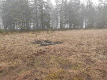
![Excursión A pie Třemošnice - [Ž] Údolím Doubravy (Pařížov - Třemošnice) - Photo](https://media.geolcdn.com/t/350/260/128e315c-4870-4181-9cde-93bc9f6c90c5.jpeg&format=jpg&maxdim=2)
![A pie A pie](https://static1.geolcdn.com/sitytour/trail-icons/100.png)
Km
A pie
![](/images/other/stat-length.png)
![](https://static1.geolcdn.com/siteimages/upload/files/1508320355ic_sort_den_pos_24dp.png)
![](https://static1.geolcdn.com/siteimages/upload/files/1508320355ic_sort_den_neg_24dp.png)
![](https://static1.geolcdn.com/siteimages/upload/files/16400158638029165_repeat_loop_refresh_sync_direction_icon.png)
• Ruta creada por cz:KČT.
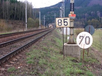
![Excursión A pie Pustá Kamenice - [M] Pustá Kamenice - Pustá Rybná - Photo](https://media.geolcdn.com/t/350/260/b3405cc6-7ad6-46df-8907-c57a73873ec8.jpeg&format=jpg&maxdim=2)
![A pie A pie](https://static1.geolcdn.com/sitytour/trail-icons/100.png)
Km
A pie
![](/images/other/stat-length.png)
![](https://static1.geolcdn.com/siteimages/upload/files/1508320355ic_sort_den_pos_24dp.png)
![](https://static1.geolcdn.com/siteimages/upload/files/1508320355ic_sort_den_neg_24dp.png)
![](https://static1.geolcdn.com/siteimages/upload/files/16400158638029165_repeat_loop_refresh_sync_direction_icon.png)
• Ruta creada por cz:KČT.
![Excursión A pie Veliny - Naučná stezka rytíře Velingera - Photo](https://media.geolcdn.com/t/350/260/b2a4504b-4d31-41bf-ab67-463221cb32b7.jpeg&format=jpg&maxdim=2)
![A pie A pie](https://static1.geolcdn.com/sitytour/trail-icons/100.png)
Km
A pie
![](/images/other/stat-length.png)
![](https://static1.geolcdn.com/siteimages/upload/files/1508320355ic_sort_den_pos_24dp.png)
![](https://static1.geolcdn.com/siteimages/upload/files/1508320355ic_sort_den_neg_24dp.png)
![](https://static1.geolcdn.com/siteimages/upload/files/16400158638029165_repeat_loop_refresh_sync_direction_icon.png)
• Ruta creada por obec Veliny. Sitio web: https://veliny.cz/turista/naucna-stezka-rytire-velingera/
![Excursión A pie Holice - CZ-4243 - Photo](https://media.geolcdn.com/t/350/260/44aaae75-ea87-4e90-8e7c-5cfea5f7e555.jpeg&format=jpg&maxdim=2)
![A pie A pie](https://static1.geolcdn.com/sitytour/trail-icons/100.png)
Km
A pie
![](/images/other/stat-length.png)
![](https://static1.geolcdn.com/siteimages/upload/files/1508320355ic_sort_den_pos_24dp.png)
![](https://static1.geolcdn.com/siteimages/upload/files/1508320355ic_sort_den_neg_24dp.png)
![](https://static1.geolcdn.com/siteimages/upload/files/16400158638029165_repeat_loop_refresh_sync_direction_icon.png)
• Ruta creada por cz:KČT.
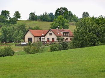
![Excursión A pie Záchlumí - [M] Litice nad Orlicí - Žamberk - Photo](https://media.geolcdn.com/t/350/260/06e32d5b-ad68-47cd-bbfd-bb17859dd844.jpeg&format=jpg&maxdim=2)
![A pie A pie](https://static1.geolcdn.com/sitytour/trail-icons/100.png)
Km
A pie
![](/images/other/stat-length.png)
![](https://static1.geolcdn.com/siteimages/upload/files/1508320355ic_sort_den_pos_24dp.png)
![](https://static1.geolcdn.com/siteimages/upload/files/1508320355ic_sort_den_neg_24dp.png)
![](https://static1.geolcdn.com/siteimages/upload/files/16400158638029165_repeat_loop_refresh_sync_direction_icon.png)
• Ruta creada por cz:KČT.
![Excursión A pie Jevíčko - Muřinohova literární stezka - Photo](https://media.geolcdn.com/t/350/260/79e06201-790c-4819-8c49-34b6d1203107.jpeg&format=jpg&maxdim=2)
![A pie A pie](https://static1.geolcdn.com/sitytour/trail-icons/100.png)
Km
A pie
![](/images/other/stat-length.png)
![](https://static1.geolcdn.com/siteimages/upload/files/1508320355ic_sort_den_pos_24dp.png)
![](https://static1.geolcdn.com/siteimages/upload/files/1508320355ic_sort_den_neg_24dp.png)
![](https://static1.geolcdn.com/siteimages/upload/files/16400158638029165_repeat_loop_refresh_sync_direction_icon.png)
• Ruta creada por Město Jevíčko.
![Excursión A pie Choceň - NS Dívčí doly - Photo](https://media.geolcdn.com/t/350/260/0bcec713-5f83-4b6a-aab0-8a056fd60769.jpeg&format=jpg&maxdim=2)
![A pie A pie](https://static1.geolcdn.com/sitytour/trail-icons/100.png)
Km
A pie
![](/images/other/stat-length.png)
![](https://static1.geolcdn.com/siteimages/upload/files/1508320355ic_sort_den_pos_24dp.png)
![](https://static1.geolcdn.com/siteimages/upload/files/1508320355ic_sort_den_neg_24dp.png)
![](https://static1.geolcdn.com/siteimages/upload/files/16400158638029165_repeat_loop_refresh_sync_direction_icon.png)
• Ruta creada por cz:KČT.
![Excursión A pie Dolní Morava - NS Králický Sněžník - Photo](https://media.geolcdn.com/t/350/260/448cd04e-44c3-43ba-a6bf-9fbf78816dd1.jpeg&format=jpg&maxdim=2)
![A pie A pie](https://static1.geolcdn.com/sitytour/trail-icons/100.png)
Km
A pie
![](/images/other/stat-length.png)
![](https://static1.geolcdn.com/siteimages/upload/files/1508320355ic_sort_den_pos_24dp.png)
![](https://static1.geolcdn.com/siteimages/upload/files/1508320355ic_sort_den_neg_24dp.png)
![](https://static1.geolcdn.com/siteimages/upload/files/16400158638029165_repeat_loop_refresh_sync_direction_icon.png)
• Ruta creada por cz:KČT.
![Excursión A pie Orlické Podhůří - NS po stopách živé vody - Photo](https://media.geolcdn.com/t/350/260/5194f7cf-b48e-4736-965d-7f4bcd64f7bf.jpeg&format=jpg&maxdim=2)
![A pie A pie](https://static1.geolcdn.com/sitytour/trail-icons/100.png)
Km
A pie
![](/images/other/stat-length.png)
![](https://static1.geolcdn.com/siteimages/upload/files/1508320355ic_sort_den_pos_24dp.png)
![](https://static1.geolcdn.com/siteimages/upload/files/1508320355ic_sort_den_neg_24dp.png)
![](https://static1.geolcdn.com/siteimages/upload/files/16400158638029165_repeat_loop_refresh_sync_direction_icon.png)
• Ruta creada por cz:KČT.
![Excursión A pie Albrechtice - NS Údolí Moravské Sázavy - Photo](https://media.geolcdn.com/t/350/260/0cf5a210-49e2-493d-bbbe-fcefafd35a27.jpeg&format=jpg&maxdim=2)
![A pie A pie](https://static1.geolcdn.com/sitytour/trail-icons/100.png)
Km
A pie
![](/images/other/stat-length.png)
![](https://static1.geolcdn.com/siteimages/upload/files/1508320355ic_sort_den_pos_24dp.png)
![](https://static1.geolcdn.com/siteimages/upload/files/1508320355ic_sort_den_neg_24dp.png)
![](https://static1.geolcdn.com/siteimages/upload/files/16400158638029165_repeat_loop_refresh_sync_direction_icon.png)
• Ruta creada por cz:KČT.
![Excursión A pie Klášterec nad Orlicí - NS Zemská brána - Photo](https://media.geolcdn.com/t/350/260/76d7b68f-266d-4730-b8fd-522f5f5acae1.jpeg&format=jpg&maxdim=2)
![A pie A pie](https://static1.geolcdn.com/sitytour/trail-icons/100.png)
Km
A pie
![](/images/other/stat-length.png)
![](https://static1.geolcdn.com/siteimages/upload/files/1508320355ic_sort_den_pos_24dp.png)
![](https://static1.geolcdn.com/siteimages/upload/files/1508320355ic_sort_den_neg_24dp.png)
![](https://static1.geolcdn.com/siteimages/upload/files/16400158638029165_repeat_loop_refresh_sync_direction_icon.png)
• Ruta creada por cz:KČT.
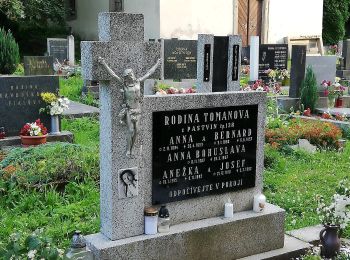
![Excursión A pie Králíky - [Ž] Mladkov - Bouda - Photo](https://media.geolcdn.com/t/350/260/aabd9832-44ad-4471-bdf5-4f6c9c9260f0.jpeg&format=jpg&maxdim=2)
![A pie A pie](https://static1.geolcdn.com/sitytour/trail-icons/100.png)
Km
A pie
![](/images/other/stat-length.png)
![](https://static1.geolcdn.com/siteimages/upload/files/1508320355ic_sort_den_pos_24dp.png)
![](https://static1.geolcdn.com/siteimages/upload/files/1508320355ic_sort_den_neg_24dp.png)
![](https://static1.geolcdn.com/siteimages/upload/files/16400158638029165_repeat_loop_refresh_sync_direction_icon.png)
• Ruta creada por cz:KČT.
![Excursión A pie Žamberk - Výletní okruh městem - Photo](https://media.geolcdn.com/t/350/260/6acd1579-fe43-4d48-b6dd-b843c1fe193b.jpeg&format=jpg&maxdim=2)
![A pie A pie](https://static1.geolcdn.com/sitytour/trail-icons/100.png)
Km
A pie
![](/images/other/stat-length.png)
![](https://static1.geolcdn.com/siteimages/upload/files/1508320355ic_sort_den_pos_24dp.png)
![](https://static1.geolcdn.com/siteimages/upload/files/1508320355ic_sort_den_neg_24dp.png)
![](https://static1.geolcdn.com/siteimages/upload/files/16400158638029165_repeat_loop_refresh_sync_direction_icon.png)
• Ruta creada por cz:KČT.
![Excursión A pie Tatenice - [M] Cukrová bouda - Tatenice - Photo](https://media.geolcdn.com/t/350/260/d7936ed9-d5a8-4f9e-8f62-c7c3895a88ed.jpeg&format=jpg&maxdim=2)
![A pie A pie](https://static1.geolcdn.com/sitytour/trail-icons/100.png)
Km
A pie
![](/images/other/stat-length.png)
![](https://static1.geolcdn.com/siteimages/upload/files/1508320355ic_sort_den_pos_24dp.png)
![](https://static1.geolcdn.com/siteimages/upload/files/1508320355ic_sort_den_neg_24dp.png)
![](https://static1.geolcdn.com/siteimages/upload/files/16400158638029165_repeat_loop_refresh_sync_direction_icon.png)
• Ruta creada por cz:KČT.
![Excursión A pie Rybník - NS Údolím Skuhrovského potoka - Photo](https://media.geolcdn.com/t/350/260/981a0e31-bd99-4924-ad4c-fb3778b5ba20.jpeg&format=jpg&maxdim=2)
![A pie A pie](https://static1.geolcdn.com/sitytour/trail-icons/100.png)
Km
A pie
![](/images/other/stat-length.png)
![](https://static1.geolcdn.com/siteimages/upload/files/1508320355ic_sort_den_pos_24dp.png)
![](https://static1.geolcdn.com/siteimages/upload/files/1508320355ic_sort_den_neg_24dp.png)
![](https://static1.geolcdn.com/siteimages/upload/files/16400158638029165_repeat_loop_refresh_sync_direction_icon.png)
• Ruta creada por cz:KČT.
![Excursión A pie Moravská Třebová - NS Boršovský les - Photo](https://media.geolcdn.com/t/350/260/31d03399-d7ff-4a12-b8e8-b76b75ab25ac.jpeg&format=jpg&maxdim=2)
![A pie A pie](https://static1.geolcdn.com/sitytour/trail-icons/100.png)
Km
A pie
![](/images/other/stat-length.png)
![](https://static1.geolcdn.com/siteimages/upload/files/1508320355ic_sort_den_pos_24dp.png)
![](https://static1.geolcdn.com/siteimages/upload/files/1508320355ic_sort_den_neg_24dp.png)
![](https://static1.geolcdn.com/siteimages/upload/files/16400158638029165_repeat_loop_refresh_sync_direction_icon.png)
• Ruta creada por cz:KČT.
![Excursión A pie Kukle - [Č] Vozíčkářský okruh nad Rosničkou - Photo](https://media.geolcdn.com/t/350/260/a09e8f9b-db43-4592-b8eb-0648f5280109.jpeg&format=jpg&maxdim=2)
![A pie A pie](https://static1.geolcdn.com/sitytour/trail-icons/100.png)
Km
A pie
![](/images/other/stat-length.png)
![](https://static1.geolcdn.com/siteimages/upload/files/1508320355ic_sort_den_pos_24dp.png)
![](https://static1.geolcdn.com/siteimages/upload/files/1508320355ic_sort_den_neg_24dp.png)
![](https://static1.geolcdn.com/siteimages/upload/files/16400158638029165_repeat_loop_refresh_sync_direction_icon.png)
• Ruta creada por cz:KČT.
![Excursión A pie Libchavy - NS Údolím Sejfů - Photo](https://media.geolcdn.com/t/350/260/99be47a7-1707-4bb6-a2ff-8c904a045a11.jpeg&format=jpg&maxdim=2)
![A pie A pie](https://static1.geolcdn.com/sitytour/trail-icons/100.png)
Km
A pie
![](/images/other/stat-length.png)
![](https://static1.geolcdn.com/siteimages/upload/files/1508320355ic_sort_den_pos_24dp.png)
![](https://static1.geolcdn.com/siteimages/upload/files/1508320355ic_sort_den_neg_24dp.png)
![](https://static1.geolcdn.com/siteimages/upload/files/16400158638029165_repeat_loop_refresh_sync_direction_icon.png)
• Ruta creada por cz:KČT.
![Excursión A pie Řetová - NS Okolo Řetové - Photo](https://media.geolcdn.com/t/350/260/e9cbc577-d7db-4570-967f-fbb8bd2a6e49.jpeg&format=jpg&maxdim=2)
![A pie A pie](https://static1.geolcdn.com/sitytour/trail-icons/100.png)
Km
A pie
![](/images/other/stat-length.png)
![](https://static1.geolcdn.com/siteimages/upload/files/1508320355ic_sort_den_pos_24dp.png)
![](https://static1.geolcdn.com/siteimages/upload/files/1508320355ic_sort_den_neg_24dp.png)
![](https://static1.geolcdn.com/siteimages/upload/files/16400158638029165_repeat_loop_refresh_sync_direction_icon.png)
• Ruta creada por cz:KČT.
![Excursión A pie Česká Třebová - [Ž] Pod Kozlovcem - Pod Skuhrovem - Photo](https://media.geolcdn.com/t/350/260/e10c881f-a244-44ac-b766-3afd8215abfb.jpeg&format=jpg&maxdim=2)
![A pie A pie](https://static1.geolcdn.com/sitytour/trail-icons/100.png)
Km
A pie
![](/images/other/stat-length.png)
![](https://static1.geolcdn.com/siteimages/upload/files/1508320355ic_sort_den_pos_24dp.png)
![](https://static1.geolcdn.com/siteimages/upload/files/1508320355ic_sort_den_neg_24dp.png)
![](https://static1.geolcdn.com/siteimages/upload/files/16400158638029165_repeat_loop_refresh_sync_direction_icon.png)
• Ruta creada por cz:KČT.
20 excursiones mostradas en 64
Aplicación GPS de excursión GRATIS
Actividades
Regiones próximas
- Albrechtice
- Běstvina
- Bojanov
- Borová
- Brandýs nad Orlicí
- Břehy
- Bukovka
- Býšť
- Červená Voda
- Česká Třebová
- České Lhotice
- Choceň
- Chvaletice
- Cotkytle
- Dolní Morava
- Holetín
- Holice
- Horní Čermná
- Javorník
- Jevíčko
- Kladruby nad Labem
- Klášterec nad Orlicí
- Koclířov
- Králíky
- Kukle
- Kunčina
- Lanškroun
- Lázně Bohdaneč
- Libchavy
- Mladkov
- Moravská Třebová
- Oldřiš
- Orlické Podhůří
- Polička
- Poříčí u Litomyšle
- Přívrat
- Proseč
- Pustá Kamenice
- Rabštejnská Lhota
- Řetová
- Rybník
- Semanín
- Skuteč
- Staré Město
- Svitavy
- Tatenice
- Třemošnice
- Ústí nad Orlicí
- Valy
- Vápenný Podol
- Veliny
- Vysoké Mýto
- Záchlumí
- Žamberk
- Zdechovice