![](/images/other/stat-length.png)
- Excursiones
- A pie
- Czech Republic
- Severovýchod
- Liberecký kraj
Liberecký kraj, Severovýchod, A pie: Los mejores itinerarios de excursión, recorridos, paseos y sendas
Liberecký kraj: Descubra las mejores excursiones: 107 a pie. Todos estos circuitos, recorridos, itinerarios y actividades al aire libre están disponibles en nuestras aplicaciones SityTrail para smartphone y tablet.
Los mejores recorridos (107)
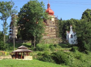
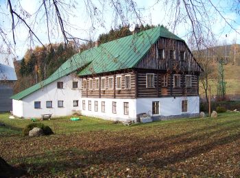
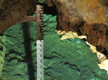
![Excursión A pie Polevsko - NS Za polevskými obry - Photo](https://media.geolcdn.com/t/350/260/b947cb3d-a05e-4825-b7c3-ef8eb4b315f0.jpeg&format=jpg&maxdim=2)
![A pie A pie](https://static1.geolcdn.com/sitytour/trail-icons/100.png)
Km
A pie
![](/images/other/stat-length.png)
![](https://static1.geolcdn.com/siteimages/upload/files/1508320355ic_sort_den_pos_24dp.png)
![](https://static1.geolcdn.com/siteimages/upload/files/1508320355ic_sort_den_neg_24dp.png)
![](https://static1.geolcdn.com/siteimages/upload/files/16400158638029165_repeat_loop_refresh_sync_direction_icon.png)
• Ruta creada por cz:Polevsko.
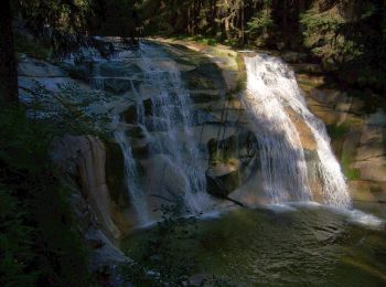
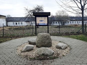
![Excursión A pie Rokytnice nad Jizerou - NS Krakonoš a lyžníci - Photo](https://media.geolcdn.com/t/350/260/bf2b38d6-7981-4f47-9364-dc060e81e0cc.jpeg&format=jpg&maxdim=2)
![A pie A pie](https://static1.geolcdn.com/sitytour/trail-icons/100.png)
Km
A pie
![](/images/other/stat-length.png)
![](https://static1.geolcdn.com/siteimages/upload/files/1508320355ic_sort_den_pos_24dp.png)
![](https://static1.geolcdn.com/siteimages/upload/files/1508320355ic_sort_den_neg_24dp.png)
![](https://static1.geolcdn.com/siteimages/upload/files/16400158638029165_repeat_loop_refresh_sync_direction_icon.png)
• Ruta creada por cz:KČT.
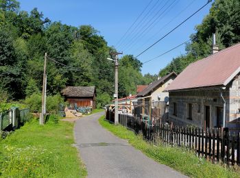
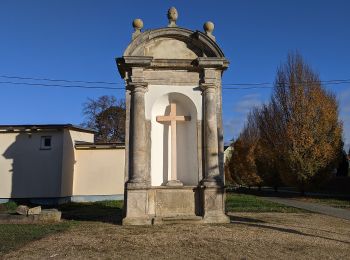
![Excursión A pie Rokytnice nad Jizerou - NS Živá mrtvá Mumlava - Photo](https://media.geolcdn.com/t/350/260/69be2469-06c5-4969-88fd-b7337a12fe66.jpeg&format=jpg&maxdim=2)
![A pie A pie](https://static1.geolcdn.com/sitytour/trail-icons/100.png)
Km
A pie
![](/images/other/stat-length.png)
![](https://static1.geolcdn.com/siteimages/upload/files/1508320355ic_sort_den_pos_24dp.png)
![](https://static1.geolcdn.com/siteimages/upload/files/1508320355ic_sort_den_neg_24dp.png)
![](https://static1.geolcdn.com/siteimages/upload/files/16400158638029165_repeat_loop_refresh_sync_direction_icon.png)
• Ruta creada por cz:KČT.
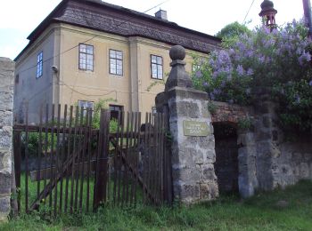
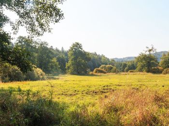
![Excursión A pie Dubá - [Z] Dubá - místní okruh - Photo](https://media.geolcdn.com/t/350/260/34bbea99-b172-428f-985b-ab1f4428ddc7.jpeg&format=jpg&maxdim=2)
![A pie A pie](https://static1.geolcdn.com/sitytour/trail-icons/100.png)
Km
A pie
![](/images/other/stat-length.png)
![](https://static1.geolcdn.com/siteimages/upload/files/1508320355ic_sort_den_pos_24dp.png)
![](https://static1.geolcdn.com/siteimages/upload/files/1508320355ic_sort_den_neg_24dp.png)
![](https://static1.geolcdn.com/siteimages/upload/files/16400158638029165_repeat_loop_refresh_sync_direction_icon.png)
• Ruta creada por cz:KČT.
![Excursión A pie Hrubá Skála - naučná stezka Podtrosecká údolí - Photo](https://media.geolcdn.com/t/350/260/4bd8416f-19f5-4ad6-a8b3-e7b658796d45.jpeg&format=jpg&maxdim=2)
![A pie A pie](https://static1.geolcdn.com/sitytour/trail-icons/100.png)
Km
A pie
![](/images/other/stat-length.png)
![](https://static1.geolcdn.com/siteimages/upload/files/1508320355ic_sort_den_pos_24dp.png)
![](https://static1.geolcdn.com/siteimages/upload/files/1508320355ic_sort_den_neg_24dp.png)
![](https://static1.geolcdn.com/siteimages/upload/files/16400158638029165_repeat_loop_refresh_sync_direction_icon.png)
• Ruta creada por cz:KČT.
![Excursión A pie Okna - CZ-3955 - Photo](https://media.geolcdn.com/t/350/260/ef3f6ad6-5c16-42c0-a05d-38e66d8df5a6.jpeg&format=jpg&maxdim=2)
![A pie A pie](https://static1.geolcdn.com/sitytour/trail-icons/100.png)
Km
A pie
![](/images/other/stat-length.png)
![](https://static1.geolcdn.com/siteimages/upload/files/1508320355ic_sort_den_pos_24dp.png)
![](https://static1.geolcdn.com/siteimages/upload/files/1508320355ic_sort_den_neg_24dp.png)
![](https://static1.geolcdn.com/siteimages/upload/files/16400158638029165_repeat_loop_refresh_sync_direction_icon.png)
• Ruta creada por cz:KČT. zelená:Bezděz - Staré Splavy
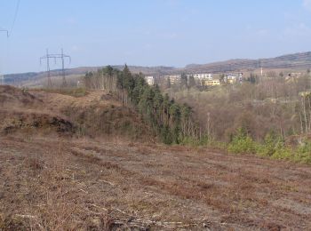
![Excursión A pie Zákupy - NS Zákupy - Photo](https://media.geolcdn.com/t/350/260/73c27391-a204-4590-805c-e915504c9179.jpeg&format=jpg&maxdim=2)
![A pie A pie](https://static1.geolcdn.com/sitytour/trail-icons/100.png)
Km
A pie
![](/images/other/stat-length.png)
![](https://static1.geolcdn.com/siteimages/upload/files/1508320355ic_sort_den_pos_24dp.png)
![](https://static1.geolcdn.com/siteimages/upload/files/1508320355ic_sort_den_neg_24dp.png)
![](https://static1.geolcdn.com/siteimages/upload/files/16400158638029165_repeat_loop_refresh_sync_direction_icon.png)
• Ruta creada por cz:KČT.
![Excursión A pie Frýdštejn - NS manželů Scheybalových 2. část - Photo](https://media.geolcdn.com/t/350/260/045c8d07-5395-40bc-80ac-bd7470fe0be2.jpeg&format=jpg&maxdim=2)
![A pie A pie](https://static1.geolcdn.com/sitytour/trail-icons/100.png)
Km
A pie
![](/images/other/stat-length.png)
![](https://static1.geolcdn.com/siteimages/upload/files/1508320355ic_sort_den_pos_24dp.png)
![](https://static1.geolcdn.com/siteimages/upload/files/1508320355ic_sort_den_neg_24dp.png)
![](https://static1.geolcdn.com/siteimages/upload/files/16400158638029165_repeat_loop_refresh_sync_direction_icon.png)
• Ruta creada por cz:KČT.
![Excursión A pie Rychnov u Jablonce nad Nisou - NS manželů Scheybalových 1. část - Photo](https://media.geolcdn.com/t/350/260/20c24816-e22e-43ee-bd40-11c6a6522ec7.jpeg&format=jpg&maxdim=2)
![A pie A pie](https://static1.geolcdn.com/sitytour/trail-icons/100.png)
Km
A pie
![](/images/other/stat-length.png)
![](https://static1.geolcdn.com/siteimages/upload/files/1508320355ic_sort_den_pos_24dp.png)
![](https://static1.geolcdn.com/siteimages/upload/files/1508320355ic_sort_den_neg_24dp.png)
![](https://static1.geolcdn.com/siteimages/upload/files/16400158638029165_repeat_loop_refresh_sync_direction_icon.png)
• Ruta creada por cz:KČT.
![Excursión A pie Chuchelna - [Ž] Tatobity (vodojem) - Kozákov - Photo](https://media.geolcdn.com/t/350/260/60a9145e-607c-4ea0-a933-69a7b1a00525.jpeg&format=jpg&maxdim=2)
![A pie A pie](https://static1.geolcdn.com/sitytour/trail-icons/100.png)
Km
A pie
![](/images/other/stat-length.png)
![](https://static1.geolcdn.com/siteimages/upload/files/1508320355ic_sort_den_pos_24dp.png)
![](https://static1.geolcdn.com/siteimages/upload/files/1508320355ic_sort_den_neg_24dp.png)
![](https://static1.geolcdn.com/siteimages/upload/files/16400158638029165_repeat_loop_refresh_sync_direction_icon.png)
• Ruta creada por cz:KČT.
![Excursión A pie Mírová pod Kozákovem - NS Kozákov - Photo](https://media.geolcdn.com/t/350/260/30988289-477c-4312-8db4-29e06a5522c0.jpeg&format=jpg&maxdim=2)
![A pie A pie](https://static1.geolcdn.com/sitytour/trail-icons/100.png)
Km
A pie
![](/images/other/stat-length.png)
![](https://static1.geolcdn.com/siteimages/upload/files/1508320355ic_sort_den_pos_24dp.png)
![](https://static1.geolcdn.com/siteimages/upload/files/1508320355ic_sort_den_neg_24dp.png)
![](https://static1.geolcdn.com/siteimages/upload/files/16400158638029165_repeat_loop_refresh_sync_direction_icon.png)
• Ruta creada por cz:KČT.
![Excursión A pie Zásada - NS K mokřadu Zásada - Photo](https://media.geolcdn.com/t/350/260/cd70b0cf-2c7b-4176-bc27-eab898bccdfd.jpeg&format=jpg&maxdim=2)
![A pie A pie](https://static1.geolcdn.com/sitytour/trail-icons/100.png)
Km
A pie
![](/images/other/stat-length.png)
![](https://static1.geolcdn.com/siteimages/upload/files/1508320355ic_sort_den_pos_24dp.png)
![](https://static1.geolcdn.com/siteimages/upload/files/1508320355ic_sort_den_neg_24dp.png)
![](https://static1.geolcdn.com/siteimages/upload/files/16400158638029165_repeat_loop_refresh_sync_direction_icon.png)
• Ruta creada por cz:KČT.
![Excursión A pie Semily - [Ž] Semily - Sejkorská kaple - Bitouchov - Photo](https://media.geolcdn.com/t/350/260/ad273ffb-8712-4976-94a1-7a2514a4e8d8.jpeg&format=jpg&maxdim=2)
![A pie A pie](https://static1.geolcdn.com/sitytour/trail-icons/100.png)
Km
A pie
![](/images/other/stat-length.png)
![](https://static1.geolcdn.com/siteimages/upload/files/1508320355ic_sort_den_pos_24dp.png)
![](https://static1.geolcdn.com/siteimages/upload/files/1508320355ic_sort_den_neg_24dp.png)
![](https://static1.geolcdn.com/siteimages/upload/files/16400158638029165_repeat_loop_refresh_sync_direction_icon.png)
• Ruta creada por cz:KČT.
![Excursión A pie Semily - [M] Semily - Nouzov - Photo](https://media.geolcdn.com/t/350/260/ad273ffb-8712-4976-94a1-7a2514a4e8d8.jpeg&format=jpg&maxdim=2)
![A pie A pie](https://static1.geolcdn.com/sitytour/trail-icons/100.png)
Km
A pie
![](/images/other/stat-length.png)
![](https://static1.geolcdn.com/siteimages/upload/files/1508320355ic_sort_den_pos_24dp.png)
![](https://static1.geolcdn.com/siteimages/upload/files/1508320355ic_sort_den_neg_24dp.png)
![](https://static1.geolcdn.com/siteimages/upload/files/16400158638029165_repeat_loop_refresh_sync_direction_icon.png)
• Ruta creada por cz:KČT.
![Excursión A pie Bozkov - NS Údolím Vošmendy - Photo](https://media.geolcdn.com/t/350/260/b95f7973-14a9-4ebe-8f71-115789124244.jpeg&format=jpg&maxdim=2)
![A pie A pie](https://static1.geolcdn.com/sitytour/trail-icons/100.png)
Km
A pie
![](/images/other/stat-length.png)
![](https://static1.geolcdn.com/siteimages/upload/files/1508320355ic_sort_den_pos_24dp.png)
![](https://static1.geolcdn.com/siteimages/upload/files/1508320355ic_sort_den_neg_24dp.png)
![](https://static1.geolcdn.com/siteimages/upload/files/16400158638029165_repeat_loop_refresh_sync_direction_icon.png)
• Ruta creada por cz:KČT.
![Excursión A pie Dlouhý Most - [Ž] Jeřmanice - Vesecký rybník - Photo](https://media.geolcdn.com/t/350/260/ff65f4ef-fc4b-4afc-94c8-b3aecddcea25.jpeg&format=jpg&maxdim=2)
![A pie A pie](https://static1.geolcdn.com/sitytour/trail-icons/100.png)
Km
A pie
![](/images/other/stat-length.png)
![](https://static1.geolcdn.com/siteimages/upload/files/1508320355ic_sort_den_pos_24dp.png)
![](https://static1.geolcdn.com/siteimages/upload/files/1508320355ic_sort_den_neg_24dp.png)
![](https://static1.geolcdn.com/siteimages/upload/files/16400158638029165_repeat_loop_refresh_sync_direction_icon.png)
• Ruta creada por cz:KČT.
![Excursión A pie Hrádek nad Nisou - NS Pašerácká stezka - Photo](https://media.geolcdn.com/t/350/260/33e0b3d7-a061-4075-ad06-68f770b3455c.jpeg&format=jpg&maxdim=2)
![A pie A pie](https://static1.geolcdn.com/sitytour/trail-icons/100.png)
Km
A pie
![](/images/other/stat-length.png)
![](https://static1.geolcdn.com/siteimages/upload/files/1508320355ic_sort_den_pos_24dp.png)
![](https://static1.geolcdn.com/siteimages/upload/files/1508320355ic_sort_den_neg_24dp.png)
![](https://static1.geolcdn.com/siteimages/upload/files/16400158638029165_repeat_loop_refresh_sync_direction_icon.png)
• Ruta creada por cz:KČT.
![Excursión A pie Hrádek nad Nisou - NS Stezka stromů - Photo](https://media.geolcdn.com/t/350/260/06a5c462-d3f3-4f6f-8c94-d426dae5c68c.jpeg&format=jpg&maxdim=2)
![A pie A pie](https://static1.geolcdn.com/sitytour/trail-icons/100.png)
Km
A pie
![](/images/other/stat-length.png)
![](https://static1.geolcdn.com/siteimages/upload/files/1508320355ic_sort_den_pos_24dp.png)
![](https://static1.geolcdn.com/siteimages/upload/files/1508320355ic_sort_den_neg_24dp.png)
![](https://static1.geolcdn.com/siteimages/upload/files/16400158638029165_repeat_loop_refresh_sync_direction_icon.png)
• Ruta creada por cz:KČT.
![Excursión A pie Ralsko - naučná stezka Jeřáb - Photo](https://media.geolcdn.com/t/350/260/117fe431-d1ec-4e00-89fe-5287e3f96880.jpeg&format=jpg&maxdim=2)
![A pie A pie](https://static1.geolcdn.com/sitytour/trail-icons/100.png)
Km
A pie
![](/images/other/stat-length.png)
![](https://static1.geolcdn.com/siteimages/upload/files/1508320355ic_sort_den_pos_24dp.png)
![](https://static1.geolcdn.com/siteimages/upload/files/1508320355ic_sort_den_neg_24dp.png)
![](https://static1.geolcdn.com/siteimages/upload/files/16400158638029165_repeat_loop_refresh_sync_direction_icon.png)
• Ruta creada por cz:KČT.
![Excursión A pie Prysk - Pryskovský okruh - Photo](https://media.geolcdn.com/t/350/260/03f91b88-2c0b-454a-8b5d-5645fc041a33.jpeg&format=jpg&maxdim=2)
![A pie A pie](https://static1.geolcdn.com/sitytour/trail-icons/100.png)
Km
A pie
![](/images/other/stat-length.png)
![](https://static1.geolcdn.com/siteimages/upload/files/1508320355ic_sort_den_pos_24dp.png)
![](https://static1.geolcdn.com/siteimages/upload/files/1508320355ic_sort_den_neg_24dp.png)
![](https://static1.geolcdn.com/siteimages/upload/files/16400158638029165_repeat_loop_refresh_sync_direction_icon.png)
• Ruta creada por cz:obec Prysk.
20 excursiones mostradas en 107
Aplicación GPS de excursión GRATIS
Actividades
Regiones próximas
- Bedřichov
- Bozkov
- Česká Lípa
- Chrastava
- Chuchelna
- Cvikov
- Dlouhý Most
- Doksy
- Dubá
- Frýdlant
- Frýdštejn
- Hamr na Jezeře
- Harrachov
- Hejnice
- Hodkovice nad Mohelkou
- Hrádek nad Nisou
- Hrubá Skála
- Jablonec nad Jizerou
- Jablonec nad Nisou
- Jablonné v Podještědí
- Janov nad Nisou
- Jenišovice
- Jilemnice
- Jiřetín pod Bukovou
- Kamenický Šenov
- Karlovice
- Koberovy
- Kořenov
- Křižany
- Kryštofovo Údolí
- Liberec
- Lomnice nad Popelkou
- Malá Skála
- Mimoň
- Mírová pod Kozákovem
- Nové Město pod Smrkem
- Nový Bor
- Okna
- Osečná
- Paseky nad Jizerou
- Polevsko
- Prysk
- Pulečný
- Ralsko
- Raspenava
- Rokytnice nad Jizerou
- Roztoky u Semil
- Rychnov u Jablonce nad Nisou
- Rynoltice
- Semily
- Sloup v Čechách
- Světlá pod Ještědem
- Svor
- Tanvald
- Turnov
- Vítkovice
- Vysoké nad Jizerou
- Zahrádky
- Zákupy
- Zásada
- Zdislava
- Železný Brod
- Zlatá Olešnice