![](/images/other/stat-length.png)
- Excursiones
- A pie
- Austria
- Alta Austria
- Bezirk Freistadt
- Sankt Oswald bei Freistadt
Sankt Oswald bei Freistadt, Bezirk Freistadt, A pie: Los mejores itinerarios de excursión, recorridos, paseos y sendas
Sankt Oswald bei Freistadt: Descubra las mejores excursiones: 3 a pie. Todos estos circuitos, recorridos, itinerarios y actividades al aire libre están disponibles en nuestras aplicaciones SityTrail para smartphone y tablet.
Los mejores recorridos (3)
![Excursión A pie Sankt Oswald bei Freistadt - Panoramaweg - Mitterbach - Photo](https://media.geolcdn.com/t/350/260/d7243e97-9a42-45d3-9620-9027b8a406e1.jpeg&format=jpg&maxdim=2)
![A pie A pie](https://static1.geolcdn.com/sitytour/trail-icons/100.png)
Km
A pie
![](/images/other/stat-length.png)
![](https://static1.geolcdn.com/siteimages/upload/files/1508320355ic_sort_den_pos_24dp.png)
![](https://static1.geolcdn.com/siteimages/upload/files/1508320355ic_sort_den_neg_24dp.png)
![](https://static1.geolcdn.com/siteimages/upload/files/16400158638029165_repeat_loop_refresh_sync_direction_icon.png)
• Trail created by Mühlviertler Kernland. Symbol: Schilder mit Symbol Panorama & G4
![Excursión A pie Sankt Oswald bei Freistadt - Sankt Oswalder Höhenweg - Photo](https://media.geolcdn.com/t/350/260/b687d49e-e8e4-4989-b2be-9d8fa580ee3a.jpeg&format=jpg&maxdim=2)
![A pie A pie](https://static1.geolcdn.com/sitytour/trail-icons/100.png)
Km
A pie
![](/images/other/stat-length.png)
![](https://static1.geolcdn.com/siteimages/upload/files/1508320355ic_sort_den_pos_24dp.png)
![](https://static1.geolcdn.com/siteimages/upload/files/1508320355ic_sort_den_neg_24dp.png)
![](https://static1.geolcdn.com/siteimages/upload/files/16400158638029165_repeat_loop_refresh_sync_direction_icon.png)
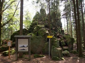
• Trail created by Gemeinde Sankt Oswald. Symbol: gelber Hinweispfeil mit schwarzem Text "O6 Höhenweg"
![Excursión A pie Sankt Oswald bei Freistadt - Hochplateauweg - Photo](https://media.geolcdn.com/t/350/260/ext.jpg?maxdim=2&url=https%3A%2F%2Fstatic1.geolcdn.com%2Fsiteimages%2Fupload%2Ffiles%2F1545311037marcheuse_200dpi.jpg)
![A pie A pie](https://static1.geolcdn.com/sitytour/trail-icons/100.png)
Km
A pie
![](/images/other/stat-length.png)
![](https://static1.geolcdn.com/siteimages/upload/files/1508320355ic_sort_den_pos_24dp.png)
![](https://static1.geolcdn.com/siteimages/upload/files/1508320355ic_sort_den_neg_24dp.png)
![](https://static1.geolcdn.com/siteimages/upload/files/16400158638029165_repeat_loop_refresh_sync_direction_icon.png)
• Trail created by Gemeinde Sankt Oswald. Symbol: gelber Hinweispfeil mit schwarzem Text "O7 Hochplateuaweg"
3 excursiones mostradas en 3
Aplicación GPS de excursión GRATIS