![](/images/other/stat-length.png)
- Excursiones
- A pie
- Austria
- Estiria
- Bezirk Hartberg-Fürstenfeld
Bezirk Hartberg-Fürstenfeld, Estiria, A pie: Los mejores itinerarios de excursión, recorridos, paseos y sendas
Bezirk Hartberg-Fürstenfeld: Descubra las mejores excursiones: 153 a pie. Todos estos circuitos, recorridos, itinerarios y actividades al aire libre están disponibles en nuestras aplicaciones SityTrail para smartphone y tablet.
Los mejores recorridos (153)
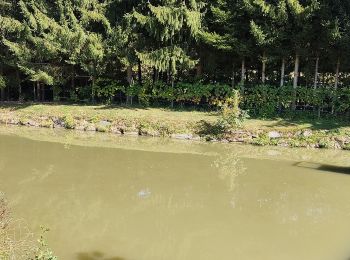
![Excursión A pie Bad Waltersdorf - S1 Berg- und Tal Rundwanderweg - Photo](https://media.geolcdn.com/t/350/260/44c06e8c-23ab-4301-b184-4ac3b204ecd2.jpeg&format=jpg&maxdim=2)
![A pie A pie](https://static1.geolcdn.com/sitytour/trail-icons/100.png)
Km
A pie
![](/images/other/stat-length.png)
![](https://static1.geolcdn.com/siteimages/upload/files/1508320355ic_sort_den_pos_24dp.png)
![](https://static1.geolcdn.com/siteimages/upload/files/1508320355ic_sort_den_neg_24dp.png)
![](https://static1.geolcdn.com/siteimages/upload/files/16400158638029165_repeat_loop_refresh_sync_direction_icon.png)
• Trail created by 2-Thermenregion Bad Waltersdorf.
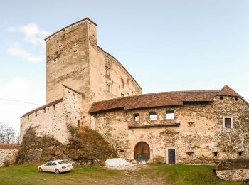
![Excursión A pie Stubenberg - Klammrunde - Photo](https://media.geolcdn.com/t/350/260/da81cdef-c26a-4882-b4e5-36b56d66709a.jpeg&format=jpg&maxdim=2)
![A pie A pie](https://static1.geolcdn.com/sitytour/trail-icons/100.png)
Km
A pie
![](/images/other/stat-length.png)
![](https://static1.geolcdn.com/siteimages/upload/files/1508320355ic_sort_den_pos_24dp.png)
![](https://static1.geolcdn.com/siteimages/upload/files/1508320355ic_sort_den_neg_24dp.png)
![](https://static1.geolcdn.com/siteimages/upload/files/16400158638029165_repeat_loop_refresh_sync_direction_icon.png)
• Trail created by Gemeinde Stubenberg. http://wiki.openstreetmap.org/wiki/WikiProject_Austria/Wanderwege Symbol: rot...
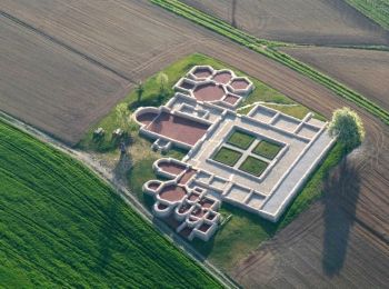
![Excursión A pie Hartberg Umgebung - Löffelbach - Villa Rustica - Burg Neuberg - Sportplatz Schildbach - Löffenbach (II) - Photo](https://media.geolcdn.com/t/350/260/435820f5-6204-4c3d-a056-0ebf7fea6b43.jpeg&format=jpg&maxdim=2)
![A pie A pie](https://static1.geolcdn.com/sitytour/trail-icons/100.png)
Km
A pie
![](/images/other/stat-length.png)
![](https://static1.geolcdn.com/siteimages/upload/files/1508320355ic_sort_den_pos_24dp.png)
![](https://static1.geolcdn.com/siteimages/upload/files/1508320355ic_sort_den_neg_24dp.png)
![](https://static1.geolcdn.com/siteimages/upload/files/16400158638029165_repeat_loop_refresh_sync_direction_icon.png)
• Symbol: braunes Kleeblatt mit röm. Zahl II
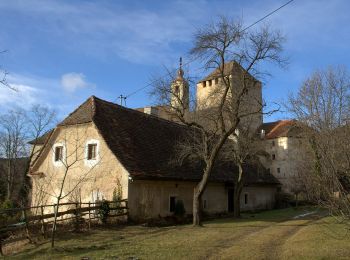
![Excursión A pie Hartberg Umgebung - Löffelbach - Villa Rustica - Burg Neuberg - Löffenbach (I) - Photo](https://media.geolcdn.com/t/350/260/7662d677-9ccc-4427-a9eb-a8c9a1c8776e.jpeg&format=jpg&maxdim=2)
![A pie A pie](https://static1.geolcdn.com/sitytour/trail-icons/100.png)
Km
A pie
![](/images/other/stat-length.png)
![](https://static1.geolcdn.com/siteimages/upload/files/1508320355ic_sort_den_pos_24dp.png)
![](https://static1.geolcdn.com/siteimages/upload/files/1508320355ic_sort_den_neg_24dp.png)
![](https://static1.geolcdn.com/siteimages/upload/files/16400158638029165_repeat_loop_refresh_sync_direction_icon.png)
• Symbol: blaues Kleeblatt mit röm. Zahl I
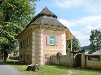
![Excursión A pie Vorau - Erzherzog Johann Weg - Photo](https://media.geolcdn.com/t/350/260/5ef2163b-ce61-4812-9ce7-385b1d87875c.jpeg&format=jpg&maxdim=2)
![A pie A pie](https://static1.geolcdn.com/sitytour/trail-icons/100.png)
Km
A pie
![](/images/other/stat-length.png)
![](https://static1.geolcdn.com/siteimages/upload/files/1508320355ic_sort_den_pos_24dp.png)
![](https://static1.geolcdn.com/siteimages/upload/files/1508320355ic_sort_den_neg_24dp.png)
![](https://static1.geolcdn.com/siteimages/upload/files/16400158638029165_repeat_loop_refresh_sync_direction_icon.png)
• http://wiki.openstreetmap.org/wiki/WikiProject_Austria/Wanderwege Symbol: Schilder Sitio web: http://www.vorau.at/...
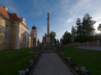
![Excursión A pie Vorau - Strassbauerwirtweg - Photo](https://media.geolcdn.com/t/350/260/39b1ec05-1d4b-4e5b-8282-41b074b4b4c6.jpeg&format=jpg&maxdim=2)
![A pie A pie](https://static1.geolcdn.com/sitytour/trail-icons/100.png)
Km
A pie
![](/images/other/stat-length.png)
![](https://static1.geolcdn.com/siteimages/upload/files/1508320355ic_sort_den_pos_24dp.png)
![](https://static1.geolcdn.com/siteimages/upload/files/1508320355ic_sort_den_neg_24dp.png)
![](https://static1.geolcdn.com/siteimages/upload/files/16400158638029165_repeat_loop_refresh_sync_direction_icon.png)
• http://wiki.openstreetmap.org/wiki/WikiProject_Austria/Wanderwege Symbol: Schilder Sitio web: http://www.vorau.at/...
![Excursión A pie Hartberg Umgebung - Löffelbach - Häckerberg - Flattendorf-Aue - St. Anna - Löffelbach (IV) - Photo](https://media.geolcdn.com/t/350/260/435820f5-6204-4c3d-a056-0ebf7fea6b43.jpeg&format=jpg&maxdim=2)
![A pie A pie](https://static1.geolcdn.com/sitytour/trail-icons/100.png)
Km
A pie
![](/images/other/stat-length.png)
![](https://static1.geolcdn.com/siteimages/upload/files/1508320355ic_sort_den_pos_24dp.png)
![](https://static1.geolcdn.com/siteimages/upload/files/1508320355ic_sort_den_neg_24dp.png)
![](https://static1.geolcdn.com/siteimages/upload/files/16400158638029165_repeat_loop_refresh_sync_direction_icon.png)
• Einige Streckenabschnitte nicht markiert Symbol: gelbes Kleeblatt mit röm. Zahl IV bzw. gelb-weiß
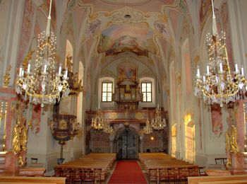
![Excursión A pie Hartberg Umgebung - Kurweg (V) - Photo](https://media.geolcdn.com/t/350/260/7a813856-0bc8-49ef-8b6f-334a63796daa.jpeg&format=jpg&maxdim=2)
![A pie A pie](https://static1.geolcdn.com/sitytour/trail-icons/100.png)
Km
A pie
![](/images/other/stat-length.png)
![](https://static1.geolcdn.com/siteimages/upload/files/1508320355ic_sort_den_pos_24dp.png)
![](https://static1.geolcdn.com/siteimages/upload/files/1508320355ic_sort_den_neg_24dp.png)
![](https://static1.geolcdn.com/siteimages/upload/files/16400158638029165_repeat_loop_refresh_sync_direction_icon.png)
• Symbol: grünes Kleeblatt mit röm. Zahl V
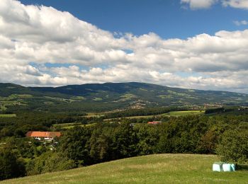
![Excursión A pie Pöllau - Wanderweg 14 - Photo](https://media.geolcdn.com/t/350/260/9e79a128-0d28-445b-953d-5d47722ad071.jpeg&format=jpg&maxdim=2)
![A pie A pie](https://static1.geolcdn.com/sitytour/trail-icons/100.png)
Km
A pie
![](/images/other/stat-length.png)
![](https://static1.geolcdn.com/siteimages/upload/files/1508320355ic_sort_den_pos_24dp.png)
![](https://static1.geolcdn.com/siteimages/upload/files/1508320355ic_sort_den_neg_24dp.png)
![](https://static1.geolcdn.com/siteimages/upload/files/16400158638029165_repeat_loop_refresh_sync_direction_icon.png)
• Trail created by ?. http://wiki.openstreetmap.org/w/index.php?title=WikiProject_Austria/Wanderwege Symbol: Weiss Ge...
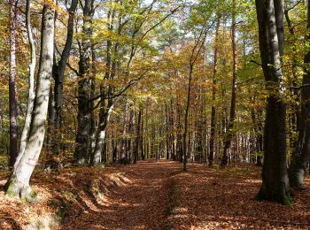
![Excursión A pie Bad Loipersdorf - Lautenberg/Schaufelberg Runde (Weg 7) - Photo](https://media.geolcdn.com/t/350/260/0ef68ff7-d780-4303-9d12-c45fbc4d8f49.jpeg&format=jpg&maxdim=2)
![A pie A pie](https://static1.geolcdn.com/sitytour/trail-icons/100.png)
Km
A pie
![](/images/other/stat-length.png)
![](https://static1.geolcdn.com/siteimages/upload/files/1508320355ic_sort_den_pos_24dp.png)
![](https://static1.geolcdn.com/siteimages/upload/files/1508320355ic_sort_den_neg_24dp.png)
![](https://static1.geolcdn.com/siteimages/upload/files/16400158638029165_repeat_loop_refresh_sync_direction_icon.png)
• Symbol: blau-gelb Schilder mit grüner 7
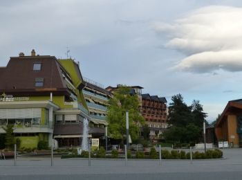
![Excursión A pie Bad Loipersdorf - Au & Uferweg, kurze Variante (Weg 8) - Photo](https://media.geolcdn.com/t/350/260/9d6ff6f2-489d-4087-935b-672a1098ffaf.jpeg&format=jpg&maxdim=2)
![A pie A pie](https://static1.geolcdn.com/sitytour/trail-icons/100.png)
Km
A pie
![](/images/other/stat-length.png)
![](https://static1.geolcdn.com/siteimages/upload/files/1508320355ic_sort_den_pos_24dp.png)
![](https://static1.geolcdn.com/siteimages/upload/files/1508320355ic_sort_den_neg_24dp.png)
![](https://static1.geolcdn.com/siteimages/upload/files/16400158638029165_repeat_loop_refresh_sync_direction_icon.png)
• Symbol: blau-gelb Schilder mit grüner 8
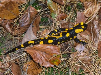
![Excursión A pie Bad Loipersdorf - Für](https://media.geolcdn.com/t/350/260/b03ffa49-a331-44da-890d-7d84c3bb7a91.jpeg&format=jpg&maxdim=2)
![A pie A pie](https://static1.geolcdn.com/sitytour/trail-icons/100.png)
Km
A pie
![](/images/other/stat-length.png)
![](https://static1.geolcdn.com/siteimages/upload/files/1508320355ic_sort_den_pos_24dp.png)
![](https://static1.geolcdn.com/siteimages/upload/files/1508320355ic_sort_den_neg_24dp.png)
![](https://static1.geolcdn.com/siteimages/upload/files/16400158638029165_repeat_loop_refresh_sync_direction_icon.png)
• Symbol: blau-gelb Schilder mit grüner 2
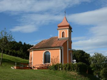
![Excursión A pie Bad Loipersdorf - Kleiner Höhenrundweg (Weg 5) - Photo](https://media.geolcdn.com/t/350/260/999e08bb-955b-4635-a0ba-e7dd5ecae701.jpeg&format=jpg&maxdim=2)
![A pie A pie](https://static1.geolcdn.com/sitytour/trail-icons/100.png)
Km
A pie
![](/images/other/stat-length.png)
![](https://static1.geolcdn.com/siteimages/upload/files/1508320355ic_sort_den_pos_24dp.png)
![](https://static1.geolcdn.com/siteimages/upload/files/1508320355ic_sort_den_neg_24dp.png)
![](https://static1.geolcdn.com/siteimages/upload/files/16400158638029165_repeat_loop_refresh_sync_direction_icon.png)
• Symbol: blau-gelb Schilder mit grüner 5
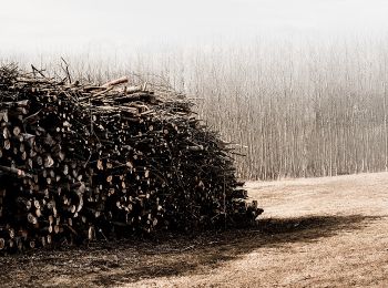
![Excursión A pie Bad Waltersdorf - Herrschaftswaldweg (W7) - Photo](https://media.geolcdn.com/t/350/260/a53dbc2d-f6e3-46d6-a11b-08b69fe5948f.jpeg&format=jpg&maxdim=2)
![A pie A pie](https://static1.geolcdn.com/sitytour/trail-icons/100.png)
Km
A pie
![](/images/other/stat-length.png)
![](https://static1.geolcdn.com/siteimages/upload/files/1508320355ic_sort_den_pos_24dp.png)
![](https://static1.geolcdn.com/siteimages/upload/files/1508320355ic_sort_den_neg_24dp.png)
![](https://static1.geolcdn.com/siteimages/upload/files/16400158638029165_repeat_loop_refresh_sync_direction_icon.png)
• Symbol: rechteckiges Schild, grün-gelb senkrecht geteilt, W7 auf grünem Grund
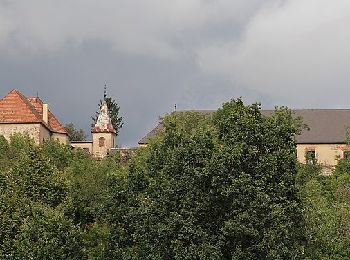
![Excursión A pie Dechantskirchen - Waldviertelweg (Weg D, 3,7 km) - Photo](https://media.geolcdn.com/t/350/260/1eb4ba67-9f60-407f-928c-c84654249f62.jpeg&format=jpg&maxdim=2)
![A pie A pie](https://static1.geolcdn.com/sitytour/trail-icons/100.png)
Km
A pie
![](/images/other/stat-length.png)
![](https://static1.geolcdn.com/siteimages/upload/files/1508320355ic_sort_den_pos_24dp.png)
![](https://static1.geolcdn.com/siteimages/upload/files/1508320355ic_sort_den_neg_24dp.png)
![](https://static1.geolcdn.com/siteimages/upload/files/16400158638029165_repeat_loop_refresh_sync_direction_icon.png)
• Trail created by Gemeinde Dechantskirchen. Symbol: weiß-braun
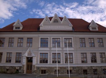
![Excursión A pie Dechantskirchen - Weidenweg (Weg C, 5,0 km) - Photo](https://media.geolcdn.com/t/350/260/82af6aea-b32b-4521-97fd-e11183b51558.jpeg&format=jpg&maxdim=2)
![A pie A pie](https://static1.geolcdn.com/sitytour/trail-icons/100.png)
Km
A pie
![](/images/other/stat-length.png)
![](https://static1.geolcdn.com/siteimages/upload/files/1508320355ic_sort_den_pos_24dp.png)
![](https://static1.geolcdn.com/siteimages/upload/files/1508320355ic_sort_den_neg_24dp.png)
![](https://static1.geolcdn.com/siteimages/upload/files/16400158638029165_repeat_loop_refresh_sync_direction_icon.png)
• Trail created by Gemeinde Dechantskirchen. Symbol: weiß-braun
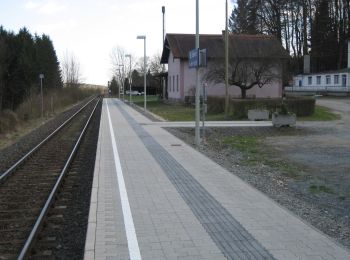
![Excursión A pie Sankt Johann in der Haide - St. Johann i.d. Haide - Unterlungitz Rundewanderweg - Photo](https://media.geolcdn.com/t/350/260/11b7653b-2966-47f5-bae3-e1fb34a8f601.jpeg&format=jpg&maxdim=2)
![A pie A pie](https://static1.geolcdn.com/sitytour/trail-icons/100.png)
Km
A pie
![](/images/other/stat-length.png)
![](https://static1.geolcdn.com/siteimages/upload/files/1508320355ic_sort_den_pos_24dp.png)
![](https://static1.geolcdn.com/siteimages/upload/files/1508320355ic_sort_den_neg_24dp.png)
![](https://static1.geolcdn.com/siteimages/upload/files/16400158638029165_repeat_loop_refresh_sync_direction_icon.png)
• Symbol: weiß-grün-weiß
![Excursión A pie Sankt Johann in der Haide - Fischteich Rundwanderweg - Photo](https://media.geolcdn.com/t/350/260/11b7653b-2966-47f5-bae3-e1fb34a8f601.jpeg&format=jpg&maxdim=2)
![A pie A pie](https://static1.geolcdn.com/sitytour/trail-icons/100.png)
Km
A pie
![](/images/other/stat-length.png)
![](https://static1.geolcdn.com/siteimages/upload/files/1508320355ic_sort_den_pos_24dp.png)
![](https://static1.geolcdn.com/siteimages/upload/files/1508320355ic_sort_den_neg_24dp.png)
![](https://static1.geolcdn.com/siteimages/upload/files/16400158638029165_repeat_loop_refresh_sync_direction_icon.png)
• Wegbezeichnung 14a, 14b Symbol: weiß-rot-weiß
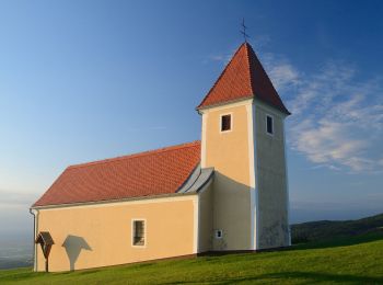
![Excursión A pie Grafendorf bei Hartberg - Stambach Weg 1 - Photo](https://media.geolcdn.com/t/350/260/c62fbda3-1413-4d24-97ed-ac34e183a5b7.jpeg&format=jpg&maxdim=2)
![A pie A pie](https://static1.geolcdn.com/sitytour/trail-icons/100.png)
Km
A pie
![](/images/other/stat-length.png)
![](https://static1.geolcdn.com/siteimages/upload/files/1508320355ic_sort_den_pos_24dp.png)
![](https://static1.geolcdn.com/siteimages/upload/files/1508320355ic_sort_den_neg_24dp.png)
![](https://static1.geolcdn.com/siteimages/upload/files/16400158638029165_repeat_loop_refresh_sync_direction_icon.png)
• Trail created by Gemeinde Grafendorf.
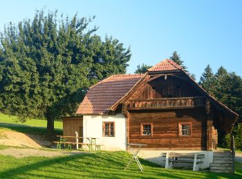
![Excursión A pie Grafendorf bei Hartberg - Stambach Weg 4 - Photo](https://media.geolcdn.com/t/350/260/6cd60473-fc2c-43f7-8f1a-26a1b64a16ff.jpeg&format=jpg&maxdim=2)
![A pie A pie](https://static1.geolcdn.com/sitytour/trail-icons/100.png)
Km
A pie
![](/images/other/stat-length.png)
![](https://static1.geolcdn.com/siteimages/upload/files/1508320355ic_sort_den_pos_24dp.png)
![](https://static1.geolcdn.com/siteimages/upload/files/1508320355ic_sort_den_neg_24dp.png)
![](https://static1.geolcdn.com/siteimages/upload/files/16400158638029165_repeat_loop_refresh_sync_direction_icon.png)
• Trail created by Gemeinde Grafendorf.
20 excursiones mostradas en 153
Aplicación GPS de excursión GRATIS
Actividades
Regiones próximas
- Bad Blumau
- Bad Loipersdorf
- Bad Waltersdorf
- Buch-Sankt Magdalena
- Dechantskirchen
- Feistritztal
- Friedberg
- Grafendorf bei Hartberg
- Greinbach
- Hartberg
- Hartberg Umgebung
- Hartl
- Ilz
- Kaindorf
- Lafnitz
- Pinggau
- Pöllau
- Pöllauberg
- Rohr bei Hartberg
- Rohrbach an der Lafnitz
- Sankt Johann in der Haide
- Schäffern
- Söchau
- St. Lorenzen
- Stubenberg
- Vorau
- Waldbach-Mönichwald
- Wenigzell