![](/images/other/stat-length.png)
- Excursiones
- A pie
- Austria
- Baja Austria
- Bezirk Lilienfeld
- Gemeinde St. Veit an der Gölsen
Gemeinde St. Veit an der Gölsen, Bezirk Lilienfeld, A pie: Los mejores itinerarios de excursión, recorridos, paseos y sendas
Gemeinde St. Veit an der Gölsen: Descubra las mejores excursiones: 16 a pie. Todos estos circuitos, recorridos, itinerarios y actividades al aire libre están disponibles en nuestras aplicaciones SityTrail para smartphone y tablet.
Los mejores recorridos (16)
![Excursión A pie Gemeinde St. Veit an der Gölsen - Innerfahrafeld - Kleinzeller Hinteralm -Wiesenfeld - Schwarzenbach (Bahnhof) - Photo](https://media.geolcdn.com/t/350/260/0ad14150-f5a4-45b5-bae0-ffd1958467f1.jpeg&format=jpg&maxdim=2)
![A pie A pie](https://static1.geolcdn.com/sitytour/trail-icons/100.png)
Km
A pie
![](/images/other/stat-length.png)
![](https://static1.geolcdn.com/siteimages/upload/files/1508320355ic_sort_den_pos_24dp.png)
![](https://static1.geolcdn.com/siteimages/upload/files/1508320355ic_sort_den_neg_24dp.png)
![](https://static1.geolcdn.com/siteimages/upload/files/16400158638029165_repeat_loop_refresh_sync_direction_icon.png)
• Trail created by ÖTK Österreichischer Touristenklub.
![Excursión A pie Gemeinde St. Veit an der Gölsen - tut gut Route 3 - Photo](https://media.geolcdn.com/t/350/260/66eb8f98-f27d-4724-8fc9-42757a9864ca.jpeg&format=jpg&maxdim=2)
![A pie A pie](https://static1.geolcdn.com/sitytour/trail-icons/100.png)
Km
A pie
![](/images/other/stat-length.png)
![](https://static1.geolcdn.com/siteimages/upload/files/1508320355ic_sort_den_pos_24dp.png)
![](https://static1.geolcdn.com/siteimages/upload/files/1508320355ic_sort_den_neg_24dp.png)
![](https://static1.geolcdn.com/siteimages/upload/files/16400158638029165_repeat_loop_refresh_sync_direction_icon.png)
• Trail created by Niederösterreichische Familienwanderwege. Symbol: gelbes Schild, weiße Schrift "Route 3"
![Excursión A pie Gemeinde St. Veit an der Gölsen - tut gut Route 4 - Photo](https://media.geolcdn.com/t/350/260/66eb8f98-f27d-4724-8fc9-42757a9864ca.jpeg&format=jpg&maxdim=2)
![A pie A pie](https://static1.geolcdn.com/sitytour/trail-icons/100.png)
Km
A pie
![](/images/other/stat-length.png)
![](https://static1.geolcdn.com/siteimages/upload/files/1508320355ic_sort_den_pos_24dp.png)
![](https://static1.geolcdn.com/siteimages/upload/files/1508320355ic_sort_den_neg_24dp.png)
![](https://static1.geolcdn.com/siteimages/upload/files/16400158638029165_repeat_loop_refresh_sync_direction_icon.png)
• Trail created by Niederösterreichische Familienwanderwege. Symbol: gelbes Schild, weiße Schrift "Route 4"
![Excursión A pie Gemeinde St. Veit an der Gölsen - tut gut Route 1 - Photo](https://media.geolcdn.com/t/350/260/d81c6288-d15b-432a-83b2-a23664615158.jpeg&format=jpg&maxdim=2)
![A pie A pie](https://static1.geolcdn.com/sitytour/trail-icons/100.png)
Km
A pie
![](/images/other/stat-length.png)
![](https://static1.geolcdn.com/siteimages/upload/files/1508320355ic_sort_den_pos_24dp.png)
![](https://static1.geolcdn.com/siteimages/upload/files/1508320355ic_sort_den_neg_24dp.png)
![](https://static1.geolcdn.com/siteimages/upload/files/16400158638029165_repeat_loop_refresh_sync_direction_icon.png)
• Trail created by Niederösterreichische Familienwanderwege. Symbol: gelbes Schild, weiße Schrift "Route 1"
![Excursión A pie Gemeinde St. Veit an der Gölsen - tut gut Route 2 - Photo](https://media.geolcdn.com/t/350/260/d81c6288-d15b-432a-83b2-a23664615158.jpeg&format=jpg&maxdim=2)
![A pie A pie](https://static1.geolcdn.com/sitytour/trail-icons/100.png)
Km
A pie
![](/images/other/stat-length.png)
![](https://static1.geolcdn.com/siteimages/upload/files/1508320355ic_sort_den_pos_24dp.png)
![](https://static1.geolcdn.com/siteimages/upload/files/1508320355ic_sort_den_neg_24dp.png)
![](https://static1.geolcdn.com/siteimages/upload/files/16400158638029165_repeat_loop_refresh_sync_direction_icon.png)
• Trail created by Niederösterreichische Familienwanderwege. Symbol: gelbes Schild, weiße Schrift "Route 2"
![Excursión A pie Gemeinde St. Veit an der Gölsen - Schwarzenbach - Stockerhütte - Photo](https://media.geolcdn.com/t/350/260/d81c6288-d15b-432a-83b2-a23664615158.jpeg&format=jpg&maxdim=2)
![A pie A pie](https://static1.geolcdn.com/sitytour/trail-icons/100.png)
Km
A pie
![](/images/other/stat-length.png)
![](https://static1.geolcdn.com/siteimages/upload/files/1508320355ic_sort_den_pos_24dp.png)
![](https://static1.geolcdn.com/siteimages/upload/files/1508320355ic_sort_den_neg_24dp.png)
![](https://static1.geolcdn.com/siteimages/upload/files/16400158638029165_repeat_loop_refresh_sync_direction_icon.png)
• Trail created by Touristenverein "Die Naturfreunde", Ortsgruppe St. Veit a.d. Gölsen. Symbol: weiß-blau-weiß
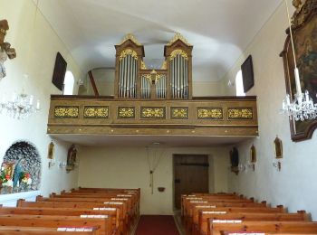
![Excursión A pie Gemeinde St. Veit an der Gölsen - St. Veit a.d. Gölsen - Schwarzenbach - Photo](https://media.geolcdn.com/t/350/260/7321cb7b-b480-46d2-992f-028f2426aaa2.jpeg&format=jpg&maxdim=2)
![A pie A pie](https://static1.geolcdn.com/sitytour/trail-icons/100.png)
Km
A pie
![](/images/other/stat-length.png)
![](https://static1.geolcdn.com/siteimages/upload/files/1508320355ic_sort_den_pos_24dp.png)
![](https://static1.geolcdn.com/siteimages/upload/files/1508320355ic_sort_den_neg_24dp.png)
![](https://static1.geolcdn.com/siteimages/upload/files/16400158638029165_repeat_loop_refresh_sync_direction_icon.png)
• Trail created by Touristenverein "Die Naturfreunde", Ortsgruppe St. Veit a.d. Gölsen. Symbol: weiß-blau-weiß
![Excursión A pie Gemeinde St. Veit an der Gölsen - Schwarzenbacher Rundwanderweg 03 - Photo](https://media.geolcdn.com/t/350/260/d81c6288-d15b-432a-83b2-a23664615158.jpeg&format=jpg&maxdim=2)
![A pie A pie](https://static1.geolcdn.com/sitytour/trail-icons/100.png)
Km
A pie
![](/images/other/stat-length.png)
![](https://static1.geolcdn.com/siteimages/upload/files/1508320355ic_sort_den_pos_24dp.png)
![](https://static1.geolcdn.com/siteimages/upload/files/1508320355ic_sort_den_neg_24dp.png)
![](https://static1.geolcdn.com/siteimages/upload/files/16400158638029165_repeat_loop_refresh_sync_direction_icon.png)
• Trail created by Touristenverein "Die Naturfreunde", Ortsgruppe St. Veit a.d. Gölsen. Symbol: gelb-rot
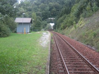
![Excursión A pie Gemeinde St. Veit an der Gölsen - Schwarzenbacher Rundwanderweg 01 - Photo](https://media.geolcdn.com/t/350/260/a7240c66-6791-4953-9cd7-82d6ec6f9edf.jpeg&format=jpg&maxdim=2)
![A pie A pie](https://static1.geolcdn.com/sitytour/trail-icons/100.png)
Km
A pie
![](/images/other/stat-length.png)
![](https://static1.geolcdn.com/siteimages/upload/files/1508320355ic_sort_den_pos_24dp.png)
![](https://static1.geolcdn.com/siteimages/upload/files/1508320355ic_sort_den_neg_24dp.png)
![](https://static1.geolcdn.com/siteimages/upload/files/16400158638029165_repeat_loop_refresh_sync_direction_icon.png)
• fertig stellen Symbol: gelb-rot
![Excursión A pie Gemeinde St. Veit an der Gölsen - St. Veit a.d. Gölsen - Ebenwald - Kleinzeller Hinteralm - Photo](https://media.geolcdn.com/t/350/260/018fafab-f5c5-46f3-a42f-7932738893d4.jpeg&format=jpg&maxdim=2)
![A pie A pie](https://static1.geolcdn.com/sitytour/trail-icons/100.png)
Km
A pie
![](/images/other/stat-length.png)
![](https://static1.geolcdn.com/siteimages/upload/files/1508320355ic_sort_den_pos_24dp.png)
![](https://static1.geolcdn.com/siteimages/upload/files/1508320355ic_sort_den_neg_24dp.png)
![](https://static1.geolcdn.com/siteimages/upload/files/16400158638029165_repeat_loop_refresh_sync_direction_icon.png)
• Trail created by Österreichischer Touristenklub. Symbol: roter, waagrechter Balken
![Excursión A pie Gemeinde St. Veit an der Gölsen - St. Veit an der Gölsen - Staffhütte - Oberhauser - Photo](https://media.geolcdn.com/t/350/260/66eb8f98-f27d-4724-8fc9-42757a9864ca.jpeg&format=jpg&maxdim=2)
![A pie A pie](https://static1.geolcdn.com/sitytour/trail-icons/100.png)
Km
A pie
![](/images/other/stat-length.png)
![](https://static1.geolcdn.com/siteimages/upload/files/1508320355ic_sort_den_pos_24dp.png)
![](https://static1.geolcdn.com/siteimages/upload/files/1508320355ic_sort_den_neg_24dp.png)
![](https://static1.geolcdn.com/siteimages/upload/files/16400158638029165_repeat_loop_refresh_sync_direction_icon.png)
• Trail created by Touristenverein Naturfreunde Österreich Ortsgruppe St. Veit/Gölsen. Symbol: roter, waagrechter Balken
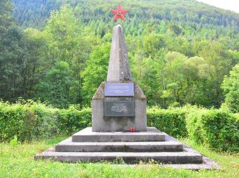
![Excursión A pie Gemeinde St. Veit an der Gölsen - St. Veit an der Gölsen - Lilienfeld - Photo](https://media.geolcdn.com/t/350/260/938ad371-ff44-4581-9625-551b006b71b0.jpeg&format=jpg&maxdim=2)
![A pie A pie](https://static1.geolcdn.com/sitytour/trail-icons/100.png)
Km
A pie
![](/images/other/stat-length.png)
![](https://static1.geolcdn.com/siteimages/upload/files/1508320355ic_sort_den_pos_24dp.png)
![](https://static1.geolcdn.com/siteimages/upload/files/1508320355ic_sort_den_neg_24dp.png)
![](https://static1.geolcdn.com/siteimages/upload/files/16400158638029165_repeat_loop_refresh_sync_direction_icon.png)
• Trail created by Touristenverein Naturfreunde Österreich Ortsgruppe St. Veit/Gölsen. Symbol: blauer, waagrechter Bal...
![Excursión A pie Gemeinde St. Veit an der Gölsen - Bibelweg St. Veit - Schwarzenbach - Photo](https://media.geolcdn.com/t/350/260/d81c6288-d15b-432a-83b2-a23664615158.jpeg&format=jpg&maxdim=2)
![A pie A pie](https://static1.geolcdn.com/sitytour/trail-icons/100.png)
Km
A pie
![](/images/other/stat-length.png)
![](https://static1.geolcdn.com/siteimages/upload/files/1508320355ic_sort_den_pos_24dp.png)
![](https://static1.geolcdn.com/siteimages/upload/files/1508320355ic_sort_den_neg_24dp.png)
![](https://static1.geolcdn.com/siteimages/upload/files/16400158638029165_repeat_loop_refresh_sync_direction_icon.png)
![Excursión A pie Gemeinde St. Veit an der Gölsen - Bhf Wiesenfeld-Schwarzenbach - Stockerhütte - Photo](https://media.geolcdn.com/t/350/260/a7240c66-6791-4953-9cd7-82d6ec6f9edf.jpeg&format=jpg&maxdim=2)
![A pie A pie](https://static1.geolcdn.com/sitytour/trail-icons/100.png)
Km
A pie
![](/images/other/stat-length.png)
![](https://static1.geolcdn.com/siteimages/upload/files/1508320355ic_sort_den_pos_24dp.png)
![](https://static1.geolcdn.com/siteimages/upload/files/1508320355ic_sort_den_neg_24dp.png)
![](https://static1.geolcdn.com/siteimages/upload/files/16400158638029165_repeat_loop_refresh_sync_direction_icon.png)
• Trail created by Touristenverein "Die Naturfreunde", Ortsgruppe St. Veit a.d. Gölsen. Symbol: rot-weiss-rot
![Excursión A pie Gemeinde St. Veit an der Gölsen - St. Veit a.d. Gölsen - Anna Rast Kapelle - Photo](https://media.geolcdn.com/t/350/260/ext.jpg?maxdim=2&url=https%3A%2F%2Fstatic1.geolcdn.com%2Fsiteimages%2Fupload%2Ffiles%2F1545311037marcheuse_200dpi.jpg)
![A pie A pie](https://static1.geolcdn.com/sitytour/trail-icons/100.png)
Km
A pie
![](/images/other/stat-length.png)
![](https://static1.geolcdn.com/siteimages/upload/files/1508320355ic_sort_den_pos_24dp.png)
![](https://static1.geolcdn.com/siteimages/upload/files/1508320355ic_sort_den_neg_24dp.png)
![](https://static1.geolcdn.com/siteimages/upload/files/16400158638029165_repeat_loop_refresh_sync_direction_icon.png)
• Trail created by Touristenverein "Die Naturfreunde", Ortsgruppe St. Veit a.d. Gölsen. Symbol: grüner Balken auf weiß...
![Excursión A pie Gemeinde St. Veit an der Gölsen - St. Veit a.d. Gölsen - Kukubauerhütte - Photo](https://media.geolcdn.com/t/350/260/ext.jpg?maxdim=2&url=https%3A%2F%2Fstatic1.geolcdn.com%2Fsiteimages%2Fupload%2Ffiles%2F1545311037marcheuse_200dpi.jpg)
![A pie A pie](https://static1.geolcdn.com/sitytour/trail-icons/100.png)
Km
A pie
![](/images/other/stat-length.png)
![](https://static1.geolcdn.com/siteimages/upload/files/1508320355ic_sort_den_pos_24dp.png)
![](https://static1.geolcdn.com/siteimages/upload/files/1508320355ic_sort_den_neg_24dp.png)
![](https://static1.geolcdn.com/siteimages/upload/files/16400158638029165_repeat_loop_refresh_sync_direction_icon.png)
• Trail created by Touristenverein "Die Naturfreunde", Ortsgruppe St. Veit a.d. Gölsen. Symbol: weiß-gelb-weiß
16 excursiones mostradas en 16
Aplicación GPS de excursión GRATIS